

BCCL Hill
General information
-
Ideal Duration:
1 to 2 HoursPlace Type:
Industrial TourismSpecial Events:
Best Photo Spots:
Coal Pit Backdrop: A shot showing the depth of the mines behind you.
Industrial Sunset: The orange sun over the mining smoke.
Greenery vs Black: The contrast of the new plantations against the coal. ...Coal Pit Backdrop: A shot showing the depth of the mines behind you.
Industrial Sunset: The orange sun over the mining smoke.
Greenery vs Black: The contrast of the new plantations against the coal.Photo Gallery
Things To Do
-
Panoramic Viewing: See the vastness of the coal pits.
Evening Walk: Enjoy the breeze at the hilltop.
Photography: Industrial photography at its best.
Learning: Observe mining machinery like draglines from afar.
Fitness: A good spot for a light uphill trek.
Stargazing: View the mining lights and the sky.
Sunset Watching: Witness the sun dipping behind the mining horizon. ...
Information
-
Why Famous:
Mining Panoramas: Famous for offering the best aerial view of the active Jharia mines.
Technological Feat: A symbol of successful land reclamation and stabilization. ...Mining Panoramas: Famous for offering the best aerial view of the active Jharia mines.
Technological Feat: A symbol of successful land reclamation and stabilization. -
Architecture:
Terraced Structure: The hill is built in terraces to ensure slope stability.
Altitude: It rises approximately 150 feet above the surrounding plains.
Reclamation Area: The top surface is flat and covers sever...Terraced Structure: The hill is built in terraces to ensure slope stability.
Altitude: It rises approximately 150 feet above the surrounding plains.
Reclamation Area: The top surface is flat and covers several acres for public gathering. -
How To Reach:
By Air: Ranchi Airport is the most reliable major hub.
By Train: Dhanbad Railway Station is 9 KM away.
By Road: Take the Kendua-Jharia main road.
By Local Transport: Shared ... -
Near Tourist Places:
Bhutgadiya More (8 KM), Bhatinda Waterfall (18 KM), Jharia King Fort (9 KM), Shakti Mandir (10 KM), Birsa Munda Park (15 KM), Amtal Forest (10 KM), Topchanchi Lake (30 KM), Maithon Dam (45 KM), Panchet Dam (42 KM), Lal Bangla (11 KM).
Tourism Tips
-
Health & Safety: Stay away from the steep edges of the hill.
Packing: Wear sturdy shoes for the rocky climb.
Accommodation: Numerous budget hotels near Dhanbad station.
Cash & C...
Reviews
Jharia Itineray And Cost:-
Information about New and Updated Locations() of Jharkhand Has Been Added :-
Card subtitle
Note:-
Information provided here in good Faith and for reference only.
All information and pictures will be updated soon, please keep visiting.
Near Places

Alauddin Home
Some quick example text to build on the card title and make up the bulk of the card's content.
Go somewhere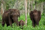
Amtal Forest Patch
Some quick example text to build on the card title and make up the bulk of the card's content.
Go somewhere
BCCL Hill
Some quick example text to build on the card title and make up the bulk of the card's content.
Go somewhere
Bhatinda Waterfall
Some quick example text to build on the card title and make up the bulk of the card's content.
Go somewhere
Bhutgadiya More
Some quick example text to build on the card title and make up the bulk of the card's content.
Go somewhere
Bit Sindri Birsa Chowk
Some quick example text to build on the card title and make up the bulk of the card's content.
Go somewhere
Chasnala Indra Chowk
Some quick example text to build on the card title and make up the bulk of the card's content.
Go somewhere
Dhangi Palash Forest
Some quick example text to build on the card title and make up the bulk of the card's content.
Go somewhere
Dolabar Hill
Some quick example text to build on the card title and make up the bulk of the card's content.
Go somewhere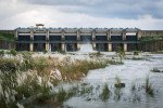
Gorangdih Dam
Some quick example text to build on the card title and make up the bulk of the card's content.
Go somewherein Other Cities