

How To Reach Mainpat Sunset Point
How to Reach
By Train: The closest railhead is Ambikapur Railway Station (ABKP), approximately 60-65 KMS away. From Ambikapur, hire a direct taxi to Parpatiya/Mainpat Sunset Point.
By Road: Parpatiya is accessed via the road from the main Mainpat village area, a journey of about 45 minutes to 1 hour. Hiring a private cab or a local shared jeep is the best option for a comfortable ride and to ensure you reach on time for the sunset. The roads are generally decent up to the final few meters to the point.
By Local Transport: From the main Tibetan settlement area, you must hire a dedicated local taxi (Winger/Bolero). Since the location is remote, it is crucial to negotiate a waiting time/return trip fare with the driver before starting, as you will likely leave after dark.
Mainpat Itineray And Cost:-
Mainpat Sunset Point Tourism:-
Information about New and Updated Locations() of Chhattisgarh Has Been Added :-
Card subtitle
Note:-
Information provided here in good Faith and for reference only.
All information and pictures will be updated soon, please keep visiting.
Near Places

Aam Gaon Water Fall
Some quick example text to build on the card title and make up the bulk of the card's content.
Go somewhere
Biodiversity Park Mainpat
Some quick example text to build on the card title and make up the bulk of the card's content.
Go somewhere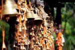
Budha Temple, Mainpat
Some quick example text to build on the card title and make up the bulk of the card's content.
Go somewhere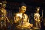
Dhakpo Shedupling Monastery
Some quick example text to build on the card title and make up the bulk of the card's content.
Go somewhere
Ex. Army Litchi Farm
Some quick example text to build on the card title and make up the bulk of the card's content.
Go somewhere
Fish Point Waterfall
Some quick example text to build on the card title and make up the bulk of the card's content.
Go somewhere
Jaljali
Some quick example text to build on the card title and make up the bulk of the card's content.
Go somewhere
Jaljali Mainpat
Some quick example text to build on the card title and make up the bulk of the card's content.
Go somewhere
Jalpari Waterfall / Point & Kayaking/Rafting Point
Some quick example text to build on the card title and make up the bulk of the card's content.
Go somewhere
Jalpari Waterfall / Point
Some quick example text to build on the card title and make up the bulk of the card's content.
Go somewhere