

How To Reach Vartek Tlang
How to Reach
Taxi to the Trailhead: From Lengpui Airport (AIZ), take the long-distance taxi to Saiha town, then hire a local taxi or auto-rickshaw to the Zosaplui Veng area or the known trailhead for Vartek Tlang. Ensure the local driver is familiar with the starting point.
By Train:
Local Guidance Required: Arrive in Saiha from Silchar Railway Station (SCL). The trek trailhead is not easily signposted. You must hire a local guide or get very precise directions from your hotel/local contact to reach the starting point, likely via a local auto-rickshaw ride.
By Road:
Specific Drop-off Point: If traveling by private vehicle, you will need to drive towards the outskirts of Saiha in the direction of Tuipang, looking for the unpaved road or trail leading up the hill. The most reliable method is still to use a local taxi to point out the exact trailhead.
By Local Transport:
Auto-Rickshaw to Base: Hire an auto-rickshaw or a bike taxi from Saiha Bazar for a short ride (15-20 minutes) to the base of the hill near Zosaplui Veng. This is where the actual trekking begins. The vehicle will likely not be able to proceed further.
Saiha Itineray And Cost:-
Information about New and Updated Locations() of Mizoram Has Been Added :-
Card subtitle
Note:-
Information provided here in good Faith and for reference only.
All information and pictures will be updated soon, please keep visiting.
Near Places

Chhimtuipui River Bank
Some quick example text to build on the card title and make up the bulk of the card's content.
Go somewhere
Lakuar Aoh
Some quick example text to build on the card title and make up the bulk of the card's content.
Go somewhere
Mara Autonomous District Council Office Building
Some quick example text to build on the card title and make up the bulk of the card's content.
Go somewhere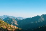
Mara Hills Viewpoint
Some quick example text to build on the card title and make up the bulk of the card's content.
Go somewhere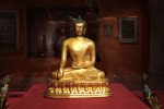
Mara Traditional House Museum
Some quick example text to build on the card title and make up the bulk of the card's content.
Go somewhere
Maraland Mission Cemetery
Some quick example text to build on the card title and make up the bulk of the card's content.
Go somewhere
Mount Mawma
Some quick example text to build on the card title and make up the bulk of the card's content.
Go somewhere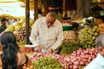
New Saiha Market
Some quick example text to build on the card title and make up the bulk of the card's content.
Go somewhere
Pala Tipo
Some quick example text to build on the card title and make up the bulk of the card's content.
Go somewhere
Palak Wildlife Sanctuary
Some quick example text to build on the card title and make up the bulk of the card's content.
Go somewhere