

Vartek Tlang
General information
-
Ideal Duration:
3-4 hours (Including the trek)Place Type:
Trekking & Nature: Hiking, Panoramic Views, FiEntry Fees:
No Entry Fee, Just Trekking Effort: There is generally No Entry Fee to trek up Vartek Tlang, as it is a natural, open hillside. The cost is the physical effort and the required expense of hiring a local guide.
Guided Trekking Fee:No Entry Fee, Just Trekking Effort: There is generally No Entry Fee to trek up Vartek Tlang, as it is a natural, open hillside. The cost is the physical effort and the required expense of hiring a local guide.
Guided Trekking Fee:
Local Guide Cost: While Free to enter, hiring a local guide is highly recommended for safety and for enriching the experience with local knowledge. A guide's fee might range from Rs.500 to Rs.1500 for a half-day trek, depending on negotiation and group size.
Permit Check:
Contingent: Since it is a remote area, you should check with the local police or your accommodation if a local-area trekking permit is required, though this is rare for non-reserved forest areas near the town.Timing:
Regular Timings:
Daylight Hours Only: The trek must be undertaken during Daylight Hours only, typically starting after 6:00 AM and completing the descent before 4:00 PM for safety. The summit itself is not a place for late-night viewing due ...Regular Timings:
Daylight Hours Only: The trek must be undertaken during Daylight Hours only, typically starting after 6:00 AM and completing the descent before 4:00 PM for safety. The summit itself is not a place for late-night viewing due to isolation.
Ideal Visit Time:
Early Morning Start: The Ideal Visit Time is an early morning start (6:00 AM to 7:00 AM) to complete the ascent before the midday heat and to catch the best, clearest views before the afternoon haze builds up.
Best Season Timings:
Dry and Solid Trails: The absolute best time is the Cool, Dry Winter season (November to February) when the trails are solid, non-slippery, and the air is crisp, providing optimal visibility.Special Events:
Annual Endurance Trek: Local sports or youth clubs often organize an Annual Endurance Trek up Vartek Tlang, typically in late December or early January, as a New Year's fitness challenge. This competitive, celebratory event draws a large crowd of participants.Annual Endurance Trek: Local sports or youth clubs often organize an Annual Endurance Trek up Vartek Tlang, typically in late December or early January, as a New Year's fitness challenge. This competitive, celebratory event draws a large crowd of participants.
Transmission Tower Maintenance: Periodically, technical teams visit the summit for maintenance, which can sometimes involve special helicopter landings or organized treks, offering an unusual sight for those who happen to be visiting at the time.Best Photo Spots:
The Winding Ascent Trail: A photo taken from a low angle on the winding, forest-covered trail, emphasizing the sense of depth and the scale of the climb, especially if the morning light filters through the trees.
The Distant Saiha Town: A te...The Winding Ascent Trail: A photo taken from a low angle on the winding, forest-covered trail, emphasizing the sense of depth and the scale of the climb, especially if the morning light filters through the trees.
The Distant Saiha Town: A telephoto shot taken from the summit, zooming in on the clustered houses of Saiha town in the distant valley, showing the immense height difference.
The Tower's Base: A dramatic, low-angle shot of the massive steel communication tower base against the backdrop of the sky, emphasizing the technology in the remote wilderness.Photo Gallery
Things To Do
-
Undertake the Summit Trek:
Things to Do include the main activity: a challenging but rewarding Trek to the Vartek Tlang summit. This requires good stamina and appropriate footwear.
Panoramic Photography: Use the summit to capture a vast, 360-degree panoramic photograph of the entire mountain range and the distant, winding river valleys. The sheer scale of the landscape is immense.
Bird and Butterfly Watching: The dense forest along the trekking path is rich in biodiversity, offering excellent opportunities for spotting local bird species and colorful butterflies, especially in the early morning.
Guided Nature Walk: Hire a local guide to take you on a slower, interpretive nature walk on the lower slopes, learning about the medici...Undertake the Summit Trek:
Things to Do include the main activity: a challenging but rewarding Trek to the Vartek Tlang summit. This requires good stamina and appropriate footwear.
Panoramic Photography: Use the summit to capture a vast, 360-degree panoramic photograph of the entire mountain range and the distant, winding river valleys. The sheer scale of the landscape is immense.
Bird and Butterfly Watching: The dense forest along the trekking path is rich in biodiversity, offering excellent opportunities for spotting local bird species and colorful butterflies, especially in the early morning.
Guided Nature Walk: Hire a local guide to take you on a slower, interpretive nature walk on the lower slopes, learning about the medicinal plants and forest ecology of the region.
Fitness Challenge: Time your ascent and descent for a personal fitness challenge, using the steep terrain to test your endurance. The clean hill air makes for an excellent workout.
Meditation and Reflection: Find a quiet, safe spot near the summit (away from the towers) for a moment of quiet meditation and reflection, utilizing the immense natural silence.
Capture the Communication Towers: Take a dramatic photograph of the imposing communication towers, using a wide-angle lens to emphasize their height and their utilitarian contrast against the pristine natural backdrop.
Information
-
Why Famous:
Saiha's Highest Accessible Vantage: It is Famous among locals and serious trekkers for being the highest and most challenging peak that can be reached in a short, half-day excursion from the town center, offering the most expansive, 360-degree view of the remote landscape. <...Saiha's Highest Accessible Vantage: It is Famous among locals and serious trekkers for being the highest and most challenging peak that can be reached in a short, half-day excursion from the town center, offering the most expansive, 360-degree view of the remote landscape.
Strategic Communication Hub: The presence of the major communication towers at the summit makes it a vital, Famous functional landmark in the district, essential for television and mobile connectivity across the region.
Local Fitness Challenge: It is a key part of the local fitness and endurance culture, a celebrated local challenge that residents take pride in conquering regularly. -
Architecture:
The Architecture of Utility: The architecture on Vartek Tlang is purely utilitarian, dedicated to supporting communication and broadcasting infrastructure on a difficult terrain.
Structures and Dimension: The main architectural features are ...The Architecture of Utility: The architecture on Vartek Tlang is purely utilitarian, dedicated to supporting communication and broadcasting infrastructure on a difficult terrain.
Structures and Dimension: The main architectural features are the tall, lattice-steel Communication Towers, likely soaring to a Dimension of 50-70 meters in height, with a base footprint of approximately 10x10 meters. The summit may also feature a small, fenced-off, single-story, reinforced concrete Transmitter/Control Room building (approx. 10 meters by 6 meters) for housing sensitive electronic equipment. The path leading to the summit is the most significant human-made structure, a compacted earth or rough-cut stone trail that winds up the steep slopes. The viewing area itself is often an informal, naturally cleared space near the base of the towers, devoid of formal platforms or railings, emphasizing its wild nature. The structures are painted in standard institutional colors (grey, white, or red/white striped) to maximize visibility and resist weathering. -
How To Reach:
By Air:
Taxi to the Trailhead: From Lengpui Airport (AIZ), take the long-distance taxi to Saiha town, then hire a local taxi or auto-rickshaw to the Zosaplui Veng area or the known trailhead for Vartek Tlang. Ensure the local driver is famil...By Air:
Taxi to the Trailhead: From Lengpui Airport (AIZ), take the long-distance taxi to Saiha town, then hire a local taxi or auto-rickshaw to the Zosaplui Veng area or the known trailhead for Vartek Tlang. Ensure the local driver is familiar with the starting point.
By Train:
Local Guidance Required: Arrive in Saiha from Silchar Railway Station (SCL). The trek trailhead is not easily signposted. You must hire a local guide or get very precise directions from your hotel/local contact to reach the starting point, likely via a local auto-rickshaw ride.
By Road:
Specific Drop-off Point: If traveling by private vehicle, you will need to drive towards the outskirts of Saiha in the direction of Tuipang, looking for the unpaved road or trail leading up the hill. The most reliable method is still to use a local taxi to point out the exact trailhead.
By Local Transport:
Auto-Rickshaw to Base: Hire an auto-rickshaw or a bike taxi from Saiha Bazar for a short ride (15-20 minutes) to the base of the hill near Zosaplui Veng. This is where the actual trekking begins. The vehicle will likely not be able to proceed further. -
Weather and Best Time to Visit:
Cool, Crisp Air:
November to February: The Best Time to Visit is during the Winter (November to February). The cool, dry weather is perfect for strenuous trekking, and the skies are at their clearest, maximizing the value of the panoramic vi...Cool, Crisp Air:
November to February: The Best Time to Visit is during the Winter (November to February). The cool, dry weather is perfect for strenuous trekking, and the skies are at their clearest, maximizing the value of the panoramic view.
Best Part of the Day:
Golden Hour Ascent: The Ideal Part of the Day is a very early morning start (6:00 AM), allowing you to reach the summit around 8:00 AM to 9:00 AM to experience the sun rising over the distant, layered hills. -
Near Tourist Places:
1. Palak Dil (Palak Lake)-(50 KMs) 2. Tokalo Wildlife Sanctuary-60KMs 3. Phawngpui (Blue Mountain) Peak-80KMs 4. Saikao Village-25KMs 5. Tuipang Town-60KMs 6. Kaochao-70KMs 7. Rengtlang Village-10KMs 8. Beinô River Valley-35KMs 9. MADC Secretariat Building-1KMs 10. Lunglei Town-90KMs
Tourism Tips
-
Health & Safety:
Local Guide is Mandatory: Given the un-signposted and rugged nature of the trail, hiring a local guide is crucial for safety and navigation. Carry a fully charged mobile phone.
Packing Essential...Health & Safety:
Local Guide is Mandatory: Given the un-signposted and rugged nature of the trail, hiring a local guide is crucial for safety and navigation. Carry a fully charged mobile phone.
Packing Essentials:
Hydration and Trail Gear: Carry at least 2 liters of water per person, energy bars, sun protection, and a basic first-aid kit. Wear sturdy, ankle-supporting trekking boots as the path is rocky and uneven.
Accommodation and Booking:
Early Start Convenience: Stay in a location that facilitates an easy and early morning departure. Arrange the local transport and guide the night before.
Respect Local Customs:
Leave No Trace: Practice a strict 'Leave No Trace' policy. Carry out all trash, do not disturb the natural environment, and respect any small agricultural fields on the lower slopes.
Other Tips:
Wear Bright Colors: Wear bright-colored clothing if trekking alone or in a small group to ensure visibility on the remote trail for safety purposes.
Reviews
FAQs
Saiha Itineray And Cost:-
Other Places In Saiha :-
Other States In India :-
Information about New and Updated Locations() of Mizoram Has Been Added :-
Card subtitle
Note:-
Information provided here in good Faith and for reference only.
Near Places

Chhimtuipui River Bank
Some quick example text to build on the card title and make up the bulk of the card's content.
Go somewhere
Lakuar Aoh
Some quick example text to build on the card title and make up the bulk of the card's content.
Go somewhere
Mara Autonomous District Council Office Building
Some quick example text to build on the card title and make up the bulk of the card's content.
Go somewhere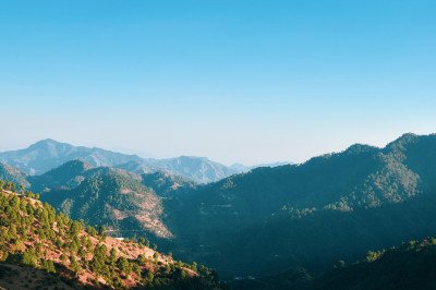
Mara Hills Viewpoint
Some quick example text to build on the card title and make up the bulk of the card's content.
Go somewhere
Mara Traditional House Museum
Some quick example text to build on the card title and make up the bulk of the card's content.
Go somewhere
Maraland Mission Cemetery
Some quick example text to build on the card title and make up the bulk of the card's content.
Go somewhere
Mount Mawma
Some quick example text to build on the card title and make up the bulk of the card's content.
Go somewhere
New Saiha Market
Some quick example text to build on the card title and make up the bulk of the card's content.
Go somewhere
Pala Tipo
Some quick example text to build on the card title and make up the bulk of the card's content.
Go somewhere
Palak Wildlife Sanctuary
Some quick example text to build on the card title and make up the bulk of the card's content.
Go somewhere
Phawngpui National Park
Some quick example text to build on the card title and make up the bulk of the card's content.
Go somewhere
Phawngpui
Some quick example text to build on the card title and make up the bulk of the card's content.
Go somewhere
Phura Village Cultural Site
Some quick example text to build on the card title and make up the bulk of the card's content.
Go somewhere
Saiha Cultural Centre
Some quick example text to build on the card title and make up the bulk of the card's content.
Go somewhere
Saiha Sports Stadium
Some quick example text to build on the card title and make up the bulk of the card's content.
Go somewhere
Saiha Town Viewpoint
Some quick example text to build on the card title and make up the bulk of the card's content.
Go somewherein Other Cities