

Mehta Point
General information
-
Ideal Duration:
1. 5 to 2 HoursPlace Type:
Viewpoint, Scenic, Photography, AdventureEntry Fees:
No Entry Fee for Viewpoint: There is No Official Entry Fee to access Mehta Point, which is a public nature viewing spot.
Parking and Local Services Fee: A small, nominal fee (usually Rs.10-Rs.30 per vehicle) may be collected for vehicle Parking ...No Entry Fee for Viewpoint: There is No Official Entry Fee to access Mehta Point, which is a public nature viewing spot.
Parking and Local Services Fee: A small, nominal fee (usually Rs.10-Rs.30 per vehicle) may be collected for vehicle Parking management and basic amenities (e. g. , use of toilet facilities if available). This contributes to the local upkeep of the point.
Adventure Activity Charges: The main cost for this location would be for optional adventure sports. Paragliding tandem flights, if available, can cost significantly more (ranging from Rs.2,000-Rs.5,000) and are run by independent operators.
Local Vendor Support: A few small vendors sell tea, coffee, and basic snacks. Support them by purchasing refreshments.Timing:
Regular Timings: The point is officially Open 24 Hrs, but the recommended safe visiting time is from 5:30 AM (for sunrise) to 6:30 PM (after sunset). Access after dark is highly discouraged due to the remote location and potential wildlife.
Ide...Regular Timings: The point is officially Open 24 Hrs, but the recommended safe visiting time is from 5:30 AM (for sunrise) to 6:30 PM (after sunset). Access after dark is highly discouraged due to the remote location and potential wildlife.
Ideal Visit Time: The Ideal Visit Time is during the Early Morning (5:30 AM to 8:00 AM) for the iconic sunrise view and the 'cloud-walking' experience. The weather is cool, and the light is soft for photography. The best season is the Winter (October to February) for the clearest skies and most dramatic mist.
Afternoon Alternative: A visit in the Late Afternoon (3:00 PM to 5:00 PM) is pleasant for a relaxing view, but the sun's position might make photography difficult before it sets behind the hills.Special Events:
The Mainpat Adventure Sports Camp: The point often hosts a special, temporary Adventure Sports Camp during the peak winter season (usually December to January). This involves professional setup for paragliding, rock climbing (on nearby formations), and camping, turning the ...The Mainpat Adventure Sports Camp: The point often hosts a special, temporary Adventure Sports Camp during the peak winter season (usually December to January). This involves professional setup for paragliding, rock climbing (on nearby formations), and camping, turning the point into a festive adventure hub.
The Kesara Village Fair (Mela): The nearby village of Kesara sometimes hosts a local harvest or religious fair (Mela). While not directly at the viewpoint, the point becomes crowded with villagers who visit the temple/fair and stop at Mehta Point for the view, creating a vibrant, localized event.
Annual Bauxite Mining Observation: Historically, the Mainpat plateau is rich in bauxite. Local geology enthusiasts sometimes organize annual field trips here to observe the geological formations and the impact of responsible bauxite mining in the region.Best Photo Spots:
The Cloud Carpet Effect: The signature photo is taken early morning, capturing the misty valley floor looking like a dense white carpet of clouds with only the peaks of distant hills visible, creating a surreal, high-altitude vista. (Approx. ).The Cloud Carpet Effect: The signature photo is taken early morning, capturing the misty valley floor looking like a dense white carpet of clouds with only the peaks of distant hills visible, creating a surreal, high-altitude vista. (Approx. ).
The Sunrise Silhouettes: Capture a portrait or a silhouette of a person standing on the platform with the golden sunrise as the background. Use the railings as a leading line into the vast view. (Approx. ).
The Winding Road Perspective: Use a zoom lens to capture the winding ghat road that snakes up the plateau, visible from the point. The road is a symbol of the journey and the connectivity of the region. (Approx. ).
The 'Point of Triumph' Selfie: Take a selfie from the viewpoint that clearly captures the vast, deep valley behind you, giving the feeling of standing atop the world and having conquered the plateau. (Approx. ).Photo Gallery
Things To Do
-
Witness the Breathtaking Sunrise: Plan to arrive at least 30 minutes before the official sunrise time. Watch the light change and the mist slowly dissipate from the valleys, capturing the day's first golden light. (Approx. ).
Panoramic Photography and Landscape Capture: Use a wide-angle lens to capture the enormous, sweeping panorama of the valleys and forests. The morning light provides the best contrast and clarity for landscape shots. Focus on capturing the depth and layering of the distant hills. (Approx. ).
Cloud Gazing and Mist Observation: If visiting on a misty or cloudy day, enjoy the surreal experience of the clouds swirling around the point. Try taking slow-motion videos to capture the movement of the fog and the 'walking among the clouds' feeling. (Approx. ).
Information
-
Why Famous:
The 'Walking in Clouds' Experience: Its unique fame comes from its altitude and location, often allowing visitors to literally stand above the clouds or within a dense mist, creating a magical, ethereal experience perfect for photography.
Paragl...The 'Walking in Clouds' Experience: Its unique fame comes from its altitude and location, often allowing visitors to literally stand above the clouds or within a dense mist, creating a magical, ethereal experience perfect for photography.
Paragliding Launch Site: It is one of the few places in Mainpat where paragliding and zorbing activities are sometimes organized, attracting adventure tourists and making it a hub for adrenaline sports.
The Sunrise Panorama: Mehta Point is the most popular spot for sunrise viewing, offering an unobstructed vista of the sun rising over the distant plains and illuminating the winding roads below.
Vast Valley View: The point is renowned for its sheer vastness of view, allowing tourists to see a huge expanse of the Surguja district's forests and valleys, giving a true sense of the plateau's altitude. -
Architecture:
Functional Viewpoint Architecture: Mehta Point is a natural plateau feature with minimal, functional man-made architecture. The infrastructure focuses on creating a safe viewing space.
Safety Railings and Boundary: The viewing area is a rel...Functional Viewpoint Architecture: Mehta Point is a natural plateau feature with minimal, functional man-made architecture. The infrastructure focuses on creating a safe viewing space.
Safety Railings and Boundary: The viewing area is a relatively flat natural clearing. Key architectural additions include robust safety railings or a protective wall, typically constructed from steel or rock masonry, running along the cliff edge. This railing is generally about 1. 2-1. 5 meters high to ensure visitor safety on the steep drop.
Pavilion and Seating: A simple, open-air pavilion or a small, circular seating area built from local stone or concrete often marks the best spot for viewing. These seating blocks are typically low-profile, keeping the focus on the natural view. The main clearing is approximately 80-100 sq meters.
Paragliding Launch Pad (Unformal): While not formally 'architectural,' a cleared, gently sloping section of the ridge nearby is sometimes used as a natural Paragliding Launch Pad, involving minor ground leveling and clearing of obstacles, but no major structures. The dimensions are about 20 meters by 15 meters for the run-up. The simplicity of the structures preserves the raw beauty of the forest view. -
How To Reach:
By Air: The nearest airport is Swami Vivekananda Airport, Raipur (RPR), approximately 360 KMS away. Take a taxi or bus to Ambikapur. The closer, developing Maa Mahamaya Airport, Ambikapur is about 60 KMS away.
By Train: The closest railhea... -
Near Tourist Places:
1. Tiger Point Waterfall (Approx. 7 KMS) 2. Dhakpo Shedupling Monastery (Approx. 8 KMS) 3. Jaljali (Bouncing Land) (Approx. 12 KMS) 4. Fish Point Waterfall (Approx. 20 KMS) 5. Magnetic Hill (Ulta Pani) (Approx. 16 KMS) 6. Mainpat Sunset Point (Parpatiya) (Approx. 18 KMS) 7. Jalpari Waterfall (Approx. 14 KMS) 8. Mercury Falls (Approx. 20 KMS) 9. Ex. Army Litchi Farm (Approx. 15 KMS) 10. Tatapani Hot Water Spring (Approx. 55 KMS)
Tourism Tips
-
Health & Safety: Prioritize Safety on the Cliff. Be aware of the steep drops and use the safety railings. If paragliding is available, only use licensed and certified operators and ensure all safety checks are performed. Carry a small, portable seat/blanket for sitting co...
Reviews
Mainpat Itineray And Cost:-
Information about New and Updated Locations() of Chhattisgarh Has Been Added :-
Card subtitle
Note:-
Information provided here in good Faith and for reference only.
All information and pictures will be updated soon, please keep visiting.
Near Places

Aam Gaon Water Fall
Some quick example text to build on the card title and make up the bulk of the card's content.
Go somewhere
Biodiversity Park Mainpat
Some quick example text to build on the card title and make up the bulk of the card's content.
Go somewhere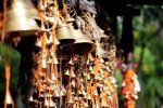
Budha Temple, Mainpat
Some quick example text to build on the card title and make up the bulk of the card's content.
Go somewhere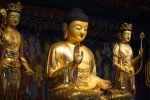
Dhakpo Shedupling Monastery
Some quick example text to build on the card title and make up the bulk of the card's content.
Go somewhere
Ex. Army Litchi Farm
Some quick example text to build on the card title and make up the bulk of the card's content.
Go somewhere
Fish Point Waterfall
Some quick example text to build on the card title and make up the bulk of the card's content.
Go somewhere
Jaljali
Some quick example text to build on the card title and make up the bulk of the card's content.
Go somewhere
Jaljali Mainpat
Some quick example text to build on the card title and make up the bulk of the card's content.
Go somewhere
Jalpari Waterfall / Point & Kayaking/Rafting Point
Some quick example text to build on the card title and make up the bulk of the card's content.
Go somewhere
Jalpari Waterfall / Point
Some quick example text to build on the card title and make up the bulk of the card's content.
Go somewherein Other Cities