Tarik Viewpoint
General information
-
Ideal Duration:
30 minutes to 1 hour, plus travel time, for photography and enjoying the view. :Place Type:
Scenic Viewpoint, Nature, Photography, ContemplatiEntry Fees:
Access to the Viewpoint: There is typically No Entry Fee to access Tarik Viewpoint. : Like most natural, scenic spots in the region, it is considered a public natural resource, freely accessible to all who make the effort to reach it. This ensures that the natural beauty re...Access to the Viewpoint: There is typically No Entry Fee to access Tarik Viewpoint. : Like most natural, scenic spots in the region, it is considered a public natural resource, freely accessible to all who make the effort to reach it. This ensures that the natural beauty remains open for all to enjoy.
Platform and Maintenance Contribution: Occasionally, a local community organization or youth club may request a small, voluntary donation or contribution (e. g. , INR 10 or INR 20 per person) at the entrance to the main viewing area for its upkeep, maintenance, and cleanliness. : This is generally voluntary and not a mandatory fee, meant to encourage responsible tourism.
Trekking/Guide Fees: If you hire a local person as a guide to take you to the viewpoint or to explore the surrounding trails, a negotiated fee will apply. : This fee, typically around INR 500 to INR 1000 for a half-day, is for the guide's service, not the viewpoint itself, and is highly recommended for safety and local insights.
Parking Charges: Given its remote location, designated parking areas are rare, and therefore, No Formal Parking Fees are usually levied. : However, if you park in a way that blocks local access, you may be asked to move by locals. :Timing:
Regular Viewing Hours: As a natural viewpoint, Tarik Viewpoint is technically Open 24 Hours a day, seven days a week. : There are no gates or official closure times. However, visitors are strongly advised only to visit during daylight hours for safety, generally between 5:0...Regular Viewing Hours: As a natural viewpoint, Tarik Viewpoint is technically Open 24 Hours a day, seven days a week. : There are no gates or official closure times. However, visitors are strongly advised only to visit during daylight hours for safety, generally between 5:00 AM and 6:00 PM. Night visits are only recommended with a local guide and with clear knowledge of the area due to potential wildlife and poor visibility.
Ideal Visit Time for Scenic Beauty (Golden Hour): The single best time to visit is for the sunrise (typically between 5:00 AM and 6:00 AM) or the sunset (typically between 4:30 PM and 5:30 PM), depending on the season. : These 'golden hours' offer the most spectacular lighting, mist, and color displays over the hills, providing the quintessential Tarik Viewpoint experience.
Ideal Visit Time for Clear Views: For the clearest, sharpest panoramic views, plan your visit for the mid-morning (around 9:00 AM to 12:00 PM) on a clear, post-monsoon or winter day. : At this time, morning mist often has burned off, and the air is at its clearest, offering the maximum visibility of distant peaks and valleys. :Special Events:
Local Community Prayer Meets: While not a mainstream festival, the viewpoint is occasionally used for local community prayer meets, nature-worship ceremonies, or spiritual retreats. : These small, solemn gatherings leverage the tranquil, elevated setting for religious or tra...Local Community Prayer Meets: While not a mainstream festival, the viewpoint is occasionally used for local community prayer meets, nature-worship ceremonies, or spiritual retreats. : These small, solemn gatherings leverage the tranquil, elevated setting for religious or traditional purposes, offering a unique glimpse into the spiritual life of the local tribes. Visitors should maintain respectful distance if one is occurring.
Photography Meetups and Nature Camps: The Viewpoint is a frequent, if informal, site for small groups of local and regional photographers or nature enthusiasts to hold weekend meetups and camps. : These gatherings focus on capturing the landscape, observing birds, or simply sharing a love for the natural beauty of Tamenglong, representing a modern, yet respectful, appreciation of the site.
New Year's Sunrise Viewing: The most anticipated informal special event is the early morning rush on January 1st. : Locals and visitors flock to the viewpoint to witness and welcome the first sunrise of the New Year, a moment of communal hope and breathtaking natural beauty. :Best Photo Spots:
The Sunrise/Sunset Edge: The absolute best photo spot is at the eastern edge for sunrise and the western edge for sunset. : This positioning captures the sun dipping or rising over the multiple layers of hills, often shrouded in dramatic mist or fog. Use a telephoto lens to...The Sunrise/Sunset Edge: The absolute best photo spot is at the eastern edge for sunrise and the western edge for sunset. : This positioning captures the sun dipping or rising over the multiple layers of hills, often shrouded in dramatic mist or fog. Use a telephoto lens to compress the layers of hills for a stunning perspective shot. The colors at these times are vivid and constantly changing.
The Viewpoint Platform Vista: From the main, elevated platform, capture the wide, sweeping panoramic shot that includes the distant river valleys and the entire horizon. : This requires a wide-angle lens and is perfect for capturing the sheer scale of the landscape. Use a foreground element (like a safety railing or a solitary tree) to add depth and context to the massive vista.
Foreground Flora and Silhouette: Use the uniquely shaped trees, rocks, or any local flowers near the viewpoint's edge as a foreground silhouette against the bright sky during golden hour. : This technique adds artistic flair and a sense of place to the landscape shot. Focus on the sharp outline of the foreground object contrasted with the soft, colorful background.
View of the Town: Locate the small patch where Tamenglong Town is visible in the distance, nestled amidst the green hills. : Zoom in to capture the contrast between the small cluster of human settlement and the vast, surrounding wilderness, highlighting the isolation and natural setting of the district headquarters. :Photo Gallery
Things To Do
-
Enjoy the Panoramic View and Photography: The main activity is taking in the breathtaking, expansive views of the Tamenglong landscape. : Use the elevation to capture wide-angle shots of the valley, the winding Barak and Irang rivers in the distance, and the layers of distant hills. Time your visit for the 'golden hours'—sunrise or sunset—for the most dramatic lighting. Bring a tripod for stability, especially for low-light photography.
Birdwatching and Nature Spotting: Bring binoculars and spend time scanning the distant trees and forests, especially for the elusive Great Indian Hornbill and other regional endemic birds. : The viewpoint's location, overlooking a vast, undisturbed forest canopy, makes it an excellent, passive birdwatching spot. Keep an eye out for interesting flora, including unique mosses and orchids, in ...Enjoy the Panoramic View and Photography: The main activity is taking in the breathtaking, expansive views of the Tamenglong landscape. : Use the elevation to capture wide-angle shots of the valley, the winding Barak and Irang rivers in the distance, and the layers of distant hills. Time your visit for the 'golden hours'—sunrise or sunset—for the most dramatic lighting. Bring a tripod for stability, especially for low-light photography.
Birdwatching and Nature Spotting: Bring binoculars and spend time scanning the distant trees and forests, especially for the elusive Great Indian Hornbill and other regional endemic birds. : The viewpoint's location, overlooking a vast, undisturbed forest canopy, makes it an excellent, passive birdwatching spot. Keep an eye out for interesting flora, including unique mosses and orchids, in the immediate vicinity.
Meditation and Contemplation: The peace and quiet of the viewpoint, away from the town's noise, make it an ideal spot for quiet reflection, meditation, or reading. : Carry a book or simply sit and enjoy the solitude, letting the vastness of the natural environment clear your mind. This is a perfect escape for wellness tourism.
Short Nature Walk: Explore the short, undeveloped trails that lead away from the main viewing area (with caution, and not alone) to experience the forest edge and discover smaller flora and fauna. : These walks are typically gentle and short, focusing on sensory engagement with the forest environment. Ensure you stay on known paths and avoid venturing into dense jungle.
Picnicking with a View: Bring a simple, packed lunch and enjoy an open-air meal with an unparalleled scenic backdrop. : Carry all trash back with you to maintain the spot's pristine condition. A simple meal enjoyed here enhances the feeling of being one with nature.
Drawing and Sketching: For artists, the varied landscape offers an incredible subject. : Carry a sketchbook and pencils to capture the natural contours of the hills, the cloud movements, and the unique forest textures, creating a personal artistic memory of the vista.
Star Gazing (If feasible and safe): On a clear night, the low light pollution in this remote area makes it an excellent spot for stargazing. : This requires careful planning for transport and safety, but the reward is a view of the unpolluted night sky. Ensure you have local company and clearance before attempting a late-night visit. :
Information
-
Why Famous:
Unparalleled Panoramic Vistas: Tarik Viewpoint is famous for offering the most spectacular and unobstructed 360-degree views of the hill-valley topography of Tamenglong. : Its height and location provide a majestic perspective on the region's vast, untouched natural beauty, ...Unparalleled Panoramic Vistas: Tarik Viewpoint is famous for offering the most spectacular and unobstructed 360-degree views of the hill-valley topography of Tamenglong. : Its height and location provide a majestic perspective on the region's vast, untouched natural beauty, making it a mandatory stop for nature lovers and photographers. The view extends over dense forests and distant mountain ranges.
Gateway to the 'Land of the Hornbill': The viewpoint provides a perfect vantage point to appreciate why Tamenglong is nicknamed the 'Land of the Hornbill', offering sightings of the area's rich avian life, including the Great Indian Hornbill, if one is lucky and patient. : The sheer biodiversity visible from this height contributes significantly to its reputation.
A Sunrise and Sunset Haven: Its fame is cemented by its status as one of the best locations near the town for witnessing truly memorable sunrises and sunsets. : The way the light interacts with the layers of hills and mist at these times creates a visual spectacle that is widely celebrated and shared, solidifying its reputation as a must-visit scenic spot in Manipur. : -
Architecture:
Natural and Minimalist Design: Tarik Viewpoint itself is characterized by an absence of elaborate architecture, with the main 'structure' being the natural landscape itself. : The area is designed to highlight the panoramic view, focusing on minimal human intervention. Ther...Natural and Minimalist Design: Tarik Viewpoint itself is characterized by an absence of elaborate architecture, with the main 'structure' being the natural landscape itself. : The area is designed to highlight the panoramic view, focusing on minimal human intervention. There may be simple, functional structures like a small viewing platform, a railing for safety, and perhaps a small hut or shelter for rest, constructed using local materials like stone and wood.
Viewing Platform Dimension and Layout: If a platform exists, it is likely a small, flat, concrete or stone-paved area designed for a group of 10-20 people. : An estimated dimension for a typical viewing area might be around 10×10 meters, strategically positioned to offer a 180 to 270-degree vista. Railings, if present, are functional metal or wooden barriers, approximately 1. 2 meters high, following the contour of the hill's edge.
Geological Foundation: The true architecture is the geological structure of the hill, composed of the region's characteristic sandstone, schist, and shale. : The viewpoint rests upon a high ridge or cliff, which is the natural backbone of the structure. The surrounding valleys and the distant peaks form the visual 'walls' and 'ceiling' of this natural amphitheater, showcasing the raw, unadulterated engineering of nature. Its design is for passive enjoyment, blending seamlessly with the environment. : -
How To Reach:
By Air: The nearest major airport is Imphal International Airport (IMF), approximately 150-160 KMS from Tamenglong. : The first step is to follow the same procedure as the Tamenglong Bazaar; reaching Tamenglong Town via a pre-booked taxi or shared jeep from IMF. The full j...By Air: The nearest major airport is Imphal International Airport (IMF), approximately 150-160 KMS from Tamenglong. : The first step is to follow the same procedure as the Tamenglong Bazaar; reaching Tamenglong Town via a pre-booked taxi or shared jeep from IMF. The full journey from the airport to the viewpoint itself involves an intercity leg followed by local transport.
By Train: The nearest railhead is Dimapur Railway Station (DMV) in Nagaland, approximately 230 KMS away. : The initial journey involves a long road trip from Dimapur to Tamenglong Town via a taxi or bus. Once you reach the town, the journey is completed via local transport.
By Road (Inter-City): The first and most substantial part of the journey is reaching Tamenglong Town from Imphal (via NH-137) or other neighboring districts by shared or private taxi. : The viewpoint is accessible from the main town road.
By Local Transport (Within Tamenglong): Tarik Viewpoint is located about 5 KMS from the Tamenglong Town Center and requires a vehicle to reach. : You can hire a local taxi (usually a Maruti Alto or similar local jeep) from the main market or taxi stand. Negotiate a return fare, including waiting time, as public transport is non-existent to the viewpoint. The road is unpaved and steep in parts, making the hire of a local, experienced driver essential. Alternatively, for the fit and adventurous, the viewpoint can be reached via a trek of approximately 1. 5 to 2 hours from the town center, following local trails, but a local guide is mandatory for the trek. : -
Weather and Best Time to Visit:
Seasonal Headings:
Winter (October to March): This is the Best Time to Visit. : The weather is cool and dry, providing the clearest visibility for the panoramic views. The distant peaks are often visible, and the crisp, cold air enhances the...Seasonal Headings:
Winter (October to March): This is the Best Time to Visit. : The weather is cool and dry, providing the clearest visibility for the panoramic views. The distant peaks are often visible, and the crisp, cold air enhances the experience. This season offers the best conditions for both photography and trekking to the viewpoint.
Summer (April to June): This season is warmer, but the views can still be good, though the visibility might be slightly hazy due to the heat. : An early morning visit is highly recommended to catch the cooler temperatures and beat the haze. The surrounding flora is often in bloom.
Monsoon (July to September): This is the Least Ideal Time to Visit. : Heavy rains often bring thick clouds and fog, completely obscuring the views. The paths leading to the viewpoint become extremely slippery and dangerous. Views can be spectacular immediately after a heavy shower clears, but this is unpredictable.
Part of the Day Headings: Sunrise (5:00 AM to 6:00 AM) This is the Ultimate Ideal Time to Visit. : The spectacular rising sun, the mist in the valleys, and the dramatic colors create a truly unforgettable and visually stunning experience. Requires an extremely early start. Mid-Morning (9:00 AM to 12:00 PM) A good time for clear, unobstructed views and comfortable temperatures for a walk or drive. : The sunlight is bright, perfect for seeing the details of the distant landscape. Sunset (4:30 PM to 5:30 PM) The second-best time for a dramatic sky and warm, golden light across the hills. : Ensure you have arranged transport for the return journey before it gets completely dark. : -
Near Tourist Places:
1: Zeilad Lake (Approx. 25 KMS) 2: Tharon Cave (Approx. 22 KMS) 3: Buning (N-Piulong) Meadow (Approx. 18 KMS) 4: Barak Waterfalls (Approx. 38 KMS) 5: Dailong Village (Approx. 12 KMS) 6: Tamenglong District Museum (Approx. 6 KMS) 7: Khoupum Dam (Approx. 86 KMS) 8: Kisha Khou (Cliff) (Approx. 33 KMS) 9: Irang River Bridge (Approx. 35 KMS) 10: Zoujam Waterfall (Approx.
45 KMS):
Tourism Tips
-
Health & Safety Tips: Since the viewpoint is remote, never visit alone; always go with a local guide or in a group. Be cautious near the edge of the viewpoint, as there are no strong barricades, and the ground can be slippery. : If trekking, be aware of small wildlife and ...Health & Safety Tips: Since the viewpoint is remote, never visit alone; always go with a local guide or in a group. Be cautious near the edge of the viewpoint, as there are no strong barricades, and the ground can be slippery. : If trekking, be aware of small wildlife and ensure you wear appropriate gear. Carry a charged power bank, as you will likely be relying on your phone for navigation and photography in an area with potentially poor mobile signal.
Packing Essentials: Pack warm layers even for a daytime visit, as the elevation makes it colder and windier than the town. : A good pair of hiking or sturdy walking shoes is essential for the drive and potential short walk to the main platform. Bring a camera with a wide-angle lens for the panoramic shots. Carry a small flask of hot tea/coffee and some snacks, as there are no shops nearby.
Accommodation: Stay in a homestay in Tamenglong Town. : From there, you can arrange the early morning/late afternoon transport to the viewpoint. Confirm the readiness of your transport for the challenging roads before booking a late-night or early morning trip.
Other Important Tips: Leave No Trace; carry all your garbage (even fruit peels) back with you to maintain the site's pristine natural condition. Go with a mindset of appreciation for nature's quiet beauty. Be prepared for a bumpy ride to the viewpoint, as the roads can be rough. Check the weather forecast before planning your visit; clear skies are essential for the view. :
Reviews
FAQs
Tamenglong Itineray And Cost:-
Other Places In Tamenglong :-
Other States In India :-
Information about New and Updated Locations() of Manipur Has Been Added :-
Card subtitle
Note:-
Information provided here in good Faith and for reference only.
Near Places
Akham Khou
Some quick example text to build on the card title and make up the bulk of the card's content.
Go somewhere
Azuram Community Reserves
Some quick example text to build on the card title and make up the bulk of the card's content.
Go somewhere
Barak Waterfalls
Some quick example text to build on the card title and make up the bulk of the card's content.
Go somewhere
Buning Meadow
Some quick example text to build on the card title and make up the bulk of the card's content.
Go somewhere
Dailong Village
Some quick example text to build on the card title and make up the bulk of the card's content.
Go somewhere
Devpriya Hill
Some quick example text to build on the card title and make up the bulk of the card's content.
Go somewhere
Dilji Waterfall
Some quick example text to build on the card title and make up the bulk of the card's content.
Go somewhere
Duithailong Village
Some quick example text to build on the card title and make up the bulk of the card's content.
Go somewhere
Gailong Village
Some quick example text to build on the card title and make up the bulk of the card's content.
Go somewhere
Jiri Makru Wildlife Sanctuary
Some quick example text to build on the card title and make up the bulk of the card's content.
Go somewhere
Kambiron Village
Some quick example text to build on the card title and make up the bulk of the card's content.
Go somewhere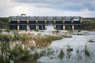
Khoupum Dam
Some quick example text to build on the card title and make up the bulk of the card's content.
Go somewhere
Khoupum Waterfall
Some quick example text to build on the card title and make up the bulk of the card's content.
Go somewhere
Kisha Khou
Some quick example text to build on the card title and make up the bulk of the card's content.
Go somewhere
Kuilong Waterfall
Some quick example text to build on the card title and make up the bulk of the card's content.
Go somewhere
Naga River
Some quick example text to build on the card title and make up the bulk of the card's content.
Go somewherein Other Cities