

Hatu View Point
General information
-
Ideal Duration:
1 hour (Quick Stop) to 2. 5 hours (Relaxed Visit/Picnic)Place Type:
Viewpoint, Photography Spot, Rest StopEntry Fees:
General Entry Fees: There are no entry fees to visit the Hatu View Point itself, as it is a point on a public road within the forest area. It is a natural, open access site.
Vehicle Road Fee: As it is on the road to the main peak, the small...General Entry Fees: There are no entry fees to visit the Hatu View Point itself, as it is a point on a public road within the forest area. It is a natural, open access site.
Vehicle Road Fee: As it is on the road to the main peak, the small, occasional road maintenance fee (typically Rs.10 to Rs.50 per vehicle) that may be collected near the forest barrier is the only cost potentially incurred.
Local Vendors' Costs: Any cost here would be limited to purchasing snacks, tea, or water from seasonal vendors, which is entirely optional.
Guide Costs: If the visitor has hired a local guide for the Hatu Peak trek, the guide's fee covers this stop as part of the overall journey. The main cost for a visit is purely the vehicle fuel or taxi fare required to reach the location from Narkanda. The absence of a formal gate or ticket booth emphasizes the site's natural and open character.
Timing:
Regular Timings: Accessible 24 hours a day, 7 days a week, as it is an open point on the road. However, due to the steep terrain and winding road, a visit is highly recommended only during daylight hours (Sunrise to Sunset) for safety.
Ideal Vi...Regular Timings: Accessible 24 hours a day, 7 days a week, as it is an open point on the road. However, due to the steep terrain and winding road, a visit is highly recommended only during daylight hours (Sunrise to Sunset) for safety.
Ideal Visit Time:
Mid-Morning: Visiting between 9:00 AM and 11:00 AM is often the best time. The light is good, and it’s typically less busy than the peak itself, making it perfect for a peaceful stop.
Sunset: The viewpoint offers a beautiful sight during sunset (approx. 5:30 PM to 7:30 PM in summer) as the golden light washes over the valley and distant peaks.
Winter Timings: In snow season, the visit is dictated by road accessibility. It is best to visit after 10:00 AM when the road is slightly warmer and any fresh snow is less icy, and to leave by 4:00 PM to ensure a safe descent before the temperature drops.
Special Events:
The Himalayan Winter Photo Opportunity: The peak receives significant snow, but unlike the summit, the View Point is often accessible enough in late December and January to serve as a hub for photographers seeking pristine snow landscape shots that are otherwise too difficul...The Himalayan Winter Photo Opportunity: The peak receives significant snow, but unlike the summit, the View Point is often accessible enough in late December and January to serve as a hub for photographers seeking pristine snow landscape shots that are otherwise too difficult to reach.
Local Tea/Snack Vendors (Seasonal): During the peak summer tourist season (May to June), local vendors may set up temporary stalls selling tea, corn on the cob (Bhutta), and snacks, turning a simple stop into a social event.
New Year's Eve Gatherings (Informal): Given its high altitude and relative accessibility, groups sometimes informally gather here on New Year's Eve to witness the spectacle of the night sky and the first sunrise of the year, though this is not an official event.
Best Photo Spots:
The Framed Valley View: Position yourself slightly off-road at the edge of the clearing to capture the deep valley, with the towering deodar and spruce trees framing the shot, lending a beautiful sense of depth.
Mountain Range Telephoto: Sin...The Framed Valley View: Position yourself slightly off-road at the edge of the clearing to capture the deep valley, with the towering deodar and spruce trees framing the shot, lending a beautiful sense of depth.
Mountain Range Telephoto: Since the air is often clear here, this is a prime spot for using a telephoto lens to isolate and magnify the distant, snow-capped peaks that form the horizon.
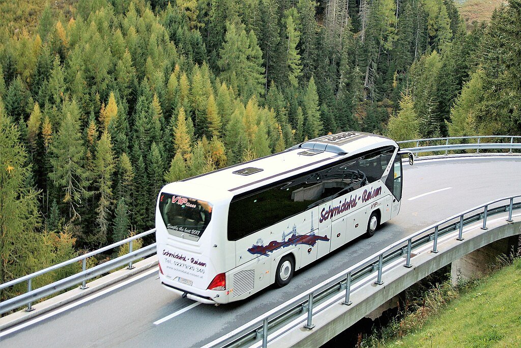
Road Perspective: The winding road itself, either curving up towards the peak or down towards Narkanda, makes for a dynamic subject, symbolizing the journey and the scale of the landscape.
Snow Landscape Shots: In winter, the viewpoint offers vast, undisturbed fields of snow on the upper slopes, perfect for minimalist, white landscape photography.
Car/Jeep Shots: The dramatic background makes this a great spot for taking photos of the vehicles that made the climb, adding an adventurous element to the travel photos.
Photo Gallery
Things To Do
-
Panoramic Photography: The main activity is to set up a camera and capture the spectacular, framed views of the valley and the distant mountains. It's a prime location for telephoto shots of the peaks.
Relaxation and Picnicking: The cleared area provides a perfect, safe spot for a relaxing stopover. Unpack a thermos of tea or coffee and some snacks and simply enjoy the peaceful, high-altitude air.
Short Nature Walks: Engage in a brief, gentle stroll along the main road stretch or a short distance into the less-dense forest nearby, focusing on the fresh scent of pine and deodar.
Witnessing Snowfall (in Season): During the winter months, simply being at this accessible height when snow is falling or has freshly fallen is an experience in itself, allowing for easy...Panoramic Photography: The main activity is to set up a camera and capture the spectacular, framed views of the valley and the distant mountains. It's a prime location for telephoto shots of the peaks.
Relaxation and Picnicking: The cleared area provides a perfect, safe spot for a relaxing stopover. Unpack a thermos of tea or coffee and some snacks and simply enjoy the peaceful, high-altitude air.
Short Nature Walks: Engage in a brief, gentle stroll along the main road stretch or a short distance into the less-dense forest nearby, focusing on the fresh scent of pine and deodar.
Witnessing Snowfall (in Season): During the winter months, simply being at this accessible height when snow is falling or has freshly fallen is an experience in itself, allowing for easy snow play and photography near the road.
Observing Valley Life: Use binoculars to spot the distant villages and terraced fields in the deep valley below, gaining a perspective on the scale of human settlement in the rugged terrain.
Hatu Peak Trek Start/End: For trekkers, this spot is either the final push or the first major rest/reward point, making the activity of starting or successfully completing a section of the trek a major focal point.
Meditation and Quiet Contemplation: The relative quiet and stunning natural backdrop make it an ideal place for a few minutes of quiet, undisturbed meditation or mindful appreciation of nature.
Information
-
Why Famous:
Spectacular Valley Drop: It offers a more dramatic, close-up view of the deep valley and the forested slopes below, contrasting with the distant snow peaks seen from the summit.
Accessible Views: For visitors unable to complete the final, mo...Spectacular Valley Drop: It offers a more dramatic, close-up view of the deep valley and the forested slopes below, contrasting with the distant snow peaks seen from the summit.
Accessible Views: For visitors unable to complete the final, most challenging trek or drive to the very summit of Hatu Peak, this viewpoint serves as a much more accessible and equally rewarding location for great Himalayan vistas.
Winter Photography: It is often the highest easily accessible point during the heavy snow season, making it famous as a safe, snow-covered photographic location when the road to the temple itself is fully blocked.
The Roadside Rest: Its location as a convenient and breathtaking rest stop along the arduous uphill journey makes it a famous pause point for both trekkers and drivers to catch their breath and appreciate the landscape.
-
Architecture:
Geographical Positioning and Slope Dynamics: The Hatu View Point is strategically located on a relatively gentle spur or shoulder of the main Hatu Peak ridge, which is what allows for the small, safe pull-off area for vehicles and pedestrians. The point's geography offers a...Geographical Positioning and Slope Dynamics: The Hatu View Point is strategically located on a relatively gentle spur or shoulder of the main Hatu Peak ridge, which is what allows for the small, safe pull-off area for vehicles and pedestrians. The point's geography offers a direct, uninterrupted line of sight down the major slopes and deep into the valley, giving a strong sense of elevation. The slopes around the viewpoint are extremely steep, showcasing the dramatic erosional dynamics of the Himalayan foothills. The land is stabilized by a dense network of coniferous tree roots, including the dominant Deodar and Spruce trees, which form a rich, protective forest cover right up to the edge of the viewing platform.
Ecological Framing:
The Coniferous Canopy: The View Point is effectively framed by a towering, old-growth coniferous canopy. The trees act as a natural frame for the distant views, enhancing the visual depth of the panorama. The local flora includes mosses and ferns that thrive in the perpetually moist, shaded environment of the higher temperate forest, adding to the point's raw, natural beauty.
Man-Made Infrastructure:
Simplicity and Safety: The man-made infrastructure here is intentionally minimal, designed to not detract from the natural view. It typically consists of a simple cleared parking space (often just a widening of the road) and sometimes a low stone or wooden railing for safety, especially considering the steep drop-offs. There are generally no formal buildings or complex structures, maintaining the spot's rugged, unspoiled character, allowing nature's scale to be the dominant architectural element.
-
How To Reach:
By Air:
The Nearest Air Route: The nearest airport is Jubbarhatti Airport (SLV) near Shimla (85 KMS away). From the airport, travelers hire a taxi to Narkanda town. The viewpoint is on the road a few kilometers above Narkanda.By Air:
The Nearest Air Route: The nearest airport is Jubbarhatti Airport (SLV) near Shimla (85 KMS away). From the airport, travelers hire a taxi to Narkanda town. The viewpoint is on the road a few kilometers above Narkanda.
By Train:
Rail Access: The broad-gauge railhead is Kalka (KLK), followed by the Kalka-Shimla Toy Train to Shimla Railway Station (SML) (65 KMS from Narkanda). From Shimla, buses or shared/private taxis ply the NH-5 route to Narkanda.
By Road:
Direct Motorable Access: The viewpoint is located on the motorable road that leads to Hatu Peak from Narkanda. From the main market of Narkanda, it is a 5-6 KM drive. Vehicles (private cars, taxis, or 4x4s) can easily reach this spot.
By Local Transport:
Trekking Path: For trekkers, the road to the viewpoint is part of the scenic Hatu Peak Trek route, offering a rewarding uphill walk. Local taxis hired in Narkanda for the Hatu Peak journey will naturally pass and often stop at this point. The distance is too short and steep for local shared vehicles.
-
Weather and Best Time to Visit:
Different Types of Seasons:
April to June (Summer/Spring): Excellent period with pleasant weather and clear skies, ideal for all-day viewing and photography. The rhododendrons are in bloom in the surrounding forests.
Read MoreDifferent Types of Seasons:
April to June (Summer/Spring): Excellent period with pleasant weather and clear skies, ideal for all-day viewing and photography. The rhododendrons are in bloom in the surrounding forests.
September to October (Autumn): Offers the clearest, post-monsoon views of the distant Himalayas, with cool, crisp air, which is perfect for extended stays.
December to March (Winter): Best for snow scenery, as the viewpoint is often the highest easily accessible point when the summit road is closed.
Different Parts of the Day:
Early Morning: Recommended for the crispest views and softest light for photography, especially of the snow-capped horizon.
Mid-day: A convenient and warm time for a relaxed picnic and enjoying the immediate forest environment.
Late Afternoon: Great for witnessing the dramatic sunset as the sun dips below the Western ranges, painting the sky with intense colors.
Near Tourist Places:
Hatu Peak (Summit, 3-4 KMS), Jau Baug (Jor Bagh) (Near the peak, 3 KMS), Hatu Mata Temple (3-4 KMS), Tannu Jubbar Lake (12 KMS), Narkanda Skiing Slopes (2 KMS, downhill), Mahamaya Temple, Kacheri (7 KMS), Stokes Farm (18 KMS), Kotgarh Church (19 KMS), Fagu (25 KMS), Sutlej View Point, Kingal (20 KMS), Theog (30 KMS)Tourism Tips
-
Health & safety:
Roadside Caution: Be extremely cautious near the edges of the viewpoint, especially with children, as there are steep, unprotected drop-offs.
Watch for Traffic: The viewpoint is on a narrow, ...Health & safety:
Roadside Caution: Be extremely cautious near the edges of the viewpoint, especially with children, as there are steep, unprotected drop-offs.
Watch for Traffic: The viewpoint is on a narrow, winding road, so be aware of vehicles maneuvering, particularly local taxis.
Packing:
Binoculars: Highly useful for spotting and identifying the distant peaks and geographical features of the valley.
Seat Cover/Mat: Carry a small, portable mat or sheet if you plan to sit on the ground or a rock for a picnic.
Accommodation:
Day Trip Focus: This spot is mainly a day-trip or stop-over attraction. Ensure your accommodation is booked back in Narkanda or Thanedhar well before nightfall.
Other Different Topics heading:
Forest Etiquette: Stick to the main cleared area and avoid venturing deep into the surrounding forest without a guide to prevent getting lost or encountering wildlife.
Local Interaction: If seasonal vendors are present, be polite and support the local economy by purchasing a cup of tea or a local snack.
Reviews
FAQs
Narkanda Itineray And Cost:-
Information about New and Updated Locations() of Himachal Pradesh Has Been Added :-
Card subtitle
Note:-
Information provided here in good Faith and for reference only.
All information and pictures will be updated soon, please keep visiting.
Near Places
Dhumri Ski Slopes
Some quick example text to build on the card title and make up the bulk of the card's content.
Go somewhere
Hatu Mata Temple
Some quick example text to build on the card title and make up the bulk of the card's content.
Go somewhere
Hatu Peak
Some quick example text to build on the card title and make up the bulk of the card's content.
Go somewhere
Hatu View Point
Some quick example text to build on the card title and make up the bulk of the card's content.
Go somewhere
Jau Baug
Some quick example text to build on the card title and make up the bulk of the card's content.
Go somewhere
Kingal Sunset Point
Some quick example text to build on the card title and make up the bulk of the card's content.
Go somewhere
Kotgarh & Thanedhar
Some quick example text to build on the card title and make up the bulk of the card's content.
Go somewhere
Mahamaya Temple
Some quick example text to build on the card title and make up the bulk of the card's content.
Go somewhere
Matiana Selfie Point
Some quick example text to build on the card title and make up the bulk of the card's content.
Go somewhere
Narkanda
Some quick example text to build on the card title and make up the bulk of the card's content.
Go somewherein Other Cities