


How To Reach Mullayanagiri Peak
How to Reach
By Train to Mullayanagiri Peak: The nearest railway station is Chikmagalur Railway Station (CMGR), located roughly 35 KMS from the peak's base. The station is relatively new and connects primarily to Bangalore via a weekly service. A more convenient, well-connected railway head is Kadur (KDU), about 70 KMS away, or Hassan (HAS), around 100 KMS away. From the station, hiring a private taxi or cab directly to the peak (or up to Seethalayyanagiri where local jeeps take over) is necessary.
By Road to Mullayanagiri Peak: The road is the primary mode of transport. From Chikmagalur city, the peak is about 20 to 22 KMS and takes around 1 to 1. 5 hours. The road is steep, narrow, and winding, particularly the final 5 KMS stretch, which is only motorable by small cars, SUVs, or hired 4x4 jeeps. Large vehicles are generally not allowed or cannot navigate the final road. The main route is via SH 57 and the Mullayanagiri Road, passing through Seethalayyanagiri.
By Local Transport: Specialized local 4x4 jeeps operate from the Seethalayyanagiri parking area or the check post to ferry tourists the last 4 KMS to the final stepping point of Mullayanagiri. This is the recommended option for those unfamiliar with steep mountain driving. Shared taxis also run from Chikmagalur to Seethalayyanagiri during the peak season.
Chikmagalur Itineray And Cost:-
Mullayanagiri Peak Tourism:-
Information about New and Updated Locations() of Karnataka Has Been Added :-
Card subtitle
Note:-
Information provided here in good Faith and for reference only.
All information and pictures will be updated soon, please keep visiting.
Near Places
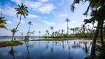
Ayyanakere Lake
Some quick example text to build on the card title and make up the bulk of the card's content.
Go somewhere
Baba Budangiri/Dattatreya Peetha
Some quick example text to build on the card title and make up the bulk of the card's content.
Go somewhere
Ballalarayana Durga Fort
Some quick example text to build on the card title and make up the bulk of the card's content.
Go somewhere
Bhadra Wildlife Sanctuary
Some quick example text to build on the card title and make up the bulk of the card's content.
Go somewhere
Coffee Museum Chikmagalur
Some quick example text to build on the card title and make up the bulk of the card's content.
Go somewhere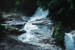
Dabdabe Falls
Some quick example text to build on the card title and make up the bulk of the card's content.
Go somewhere
Dantaramakki Lake
Some quick example text to build on the card title and make up the bulk of the card's content.
Go somewhere
Gadaikallu View Point
Some quick example text to build on the card title and make up the bulk of the card's content.
Go somewhere
Hebbe Falls
Some quick example text to build on the card title and make up the bulk of the card's content.
Go somewhere
Hirekolale Lake
Some quick example text to build on the card title and make up the bulk of the card's content.
Go somewhere