


Kaas Lake
General information
-
Ideal Duration:
1-2 hoursPlace Type:
Lake/Reservoir/Nature SpotEntry Fees:
Ticket Pricing: The lake area is often included in the entry pass for the Kaas Plateau during the peak flowering season (around Rs.150 per person). Otherwise, No Direct Entry Fee. :
Parking Fees: There is a separate charge for vehicle parking ...Ticket Pricing: The lake area is often included in the entry pass for the Kaas Plateau during the peak flowering season (around Rs.150 per person). Otherwise, No Direct Entry Fee. :
Parking Fees: There is a separate charge for vehicle parking near the lake/plateau entry point (typically Rs.50-Rs.100 per vehicle). :
Photography Fees: No separate fees for mobile or amateur photography. :
Boating Fees: If boating is permitted, charges will be separate, depending on the boat type and duration. :
Guide Charges: No local guide is usually required for the lake itself. :Timing:
Regular Timings: Generally accessible from 9:00 AM to 7:00 PM. The main road is open 24/7. :
Ideal Visit Time: Early Morning (8:00 AM - 10:00 AM) or Late Afternoon (4:00 PM - 6:00 PM) for the best views and to avoid crowds heading to the pla...Regular Timings: Generally accessible from 9:00 AM to 7:00 PM. The main road is open 24/7. :
Ideal Visit Time: Early Morning (8:00 AM - 10:00 AM) or Late Afternoon (4:00 PM - 6:00 PM) for the best views and to avoid crowds heading to the plateau. :
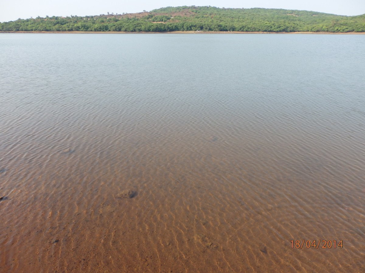
Water Level: The lake is fullest and most beautiful from August to November. :
Peak Season: Visit during September to combine with the Kaas Plateau flower viewing, but expect heavy traffic. :Special Events:
Monsoon Viewpoint: The lake is most full and visually dramatic during and immediately after the Monsoon (August to October), attracting a higher number of visitors. :
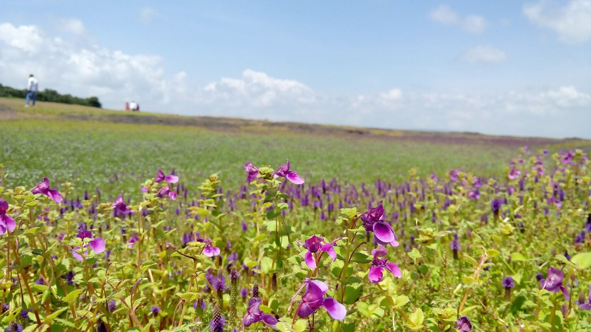
Kaas Plateau Flower Season: It becomes a major thoroughfare during the Kaas...Monsoon Viewpoint: The lake is most full and visually dramatic during and immediately after the Monsoon (August to October), attracting a higher number of visitors. :
Kaas Plateau Flower Season: It becomes a major thoroughfare during the Kaas Plateau flower blooming season (September), seeing peak tourist activity. :
Local Kasaidevi Temple Festival: The nearby Kasaidevi Temple has an annual local festival that draws devotees to the area. :
Environmental Awareness Programs: Occasional events focusing on water conservation and the Kaas ecosystem are held here. :Best Photo Spots:
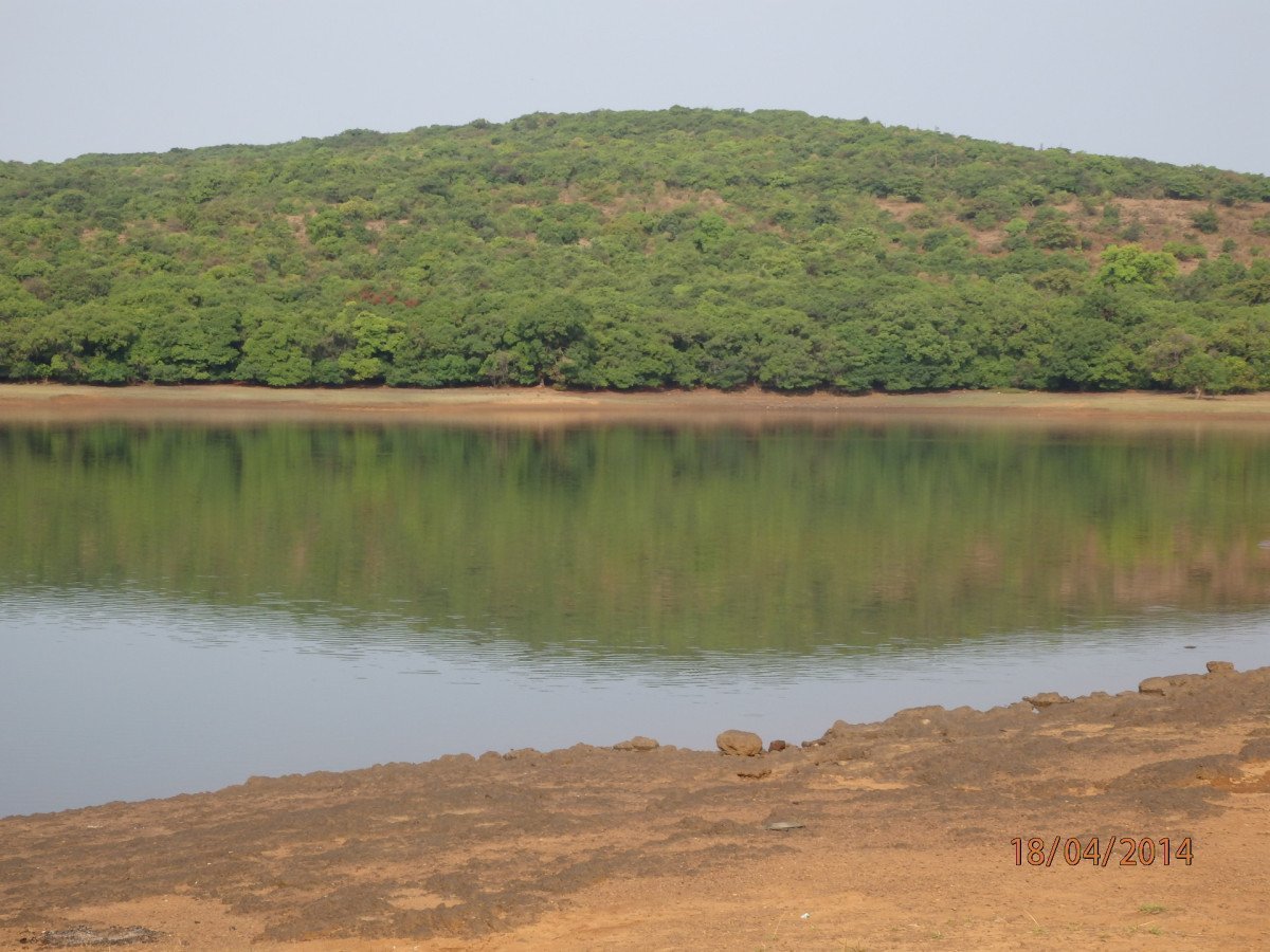
The Water Reflection: The lake's surface, particularly when the water is calm, provides a perfect mirror image of the surrounding hills and sky. :
The Dam Wall Texture: The old stone masonry of the dam wall offers great opportunities for text...The Water Reflection: The lake's surface, particularly when the water is calm, provides a perfect mirror image of the surrounding hills and sky. :
The Dam Wall Texture: The old stone masonry of the dam wall offers great opportunities for textured, black-and-white, or historical-themed photographs. :
The Lone Tree/Rock: Look for single, interesting natural elements (like a lone tree or rock) on the water's edge to use as a focal point. :
Misty Morning Shots: Capture the ethereal atmosphere of the mist hanging over the water in the Early Morning. :
Panoramic Landscape: Use a wide-angle lens to capture the entire expanse of the lake and the forest on the far shore. :Photo Gallery

Things To Do
-
Photography: Capture the stunning reflections in the water, the scenic landscape, and the historic dam structure. :
Relaxation: Sit on the banks or designated viewing points to enjoy the tranquility and cool breeze. :
Bird Watching: The lake is a good spot for observing water birds and local avifauna, especially in the early morning. :
Light Trekking: Take a short, gentle walk along the lake's perimeter (where permitted) to explore the forest edge. :
Boating (Seasonal/Permitted): If permitted by local authorities (often restricted due to it being a water source), enjoy a relaxing rowboat ride. :
Picnicking: Find a safe, clean spot on the edge of the forest for a quick, refreshing picnic (remember to c...
Information
-
Why Famous:
Water Source to Satara: Famous for its historic role as a crucial water source for Satara city, a testament to 19th-century engineering. :
Scenic Beauty: Highly regarded for its tranquil beauty, the calm blue waters, and the reflection of the...Water Source to Satara: Famous for its historic role as a crucial water source for Satara city, a testament to 19th-century engineering. :
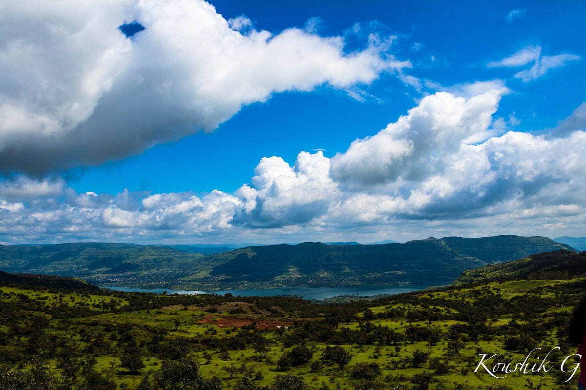
Scenic Beauty: Highly regarded for its tranquil beauty, the calm blue waters, and the reflection of the surrounding green hills. :
Gateway to the Plateau: It is the first major scenic stop for tourists heading towards the Kaas Plateau (Kaas Pathar), located just before the main flower valley. :
Natural Habitat: Provides a vital watering hole and habitat for local birds and animals, especially during dry seasons. : -
Architecture:
Functional Architecture: The architecture is that of a man-made reservoir with a simple, functional stone masonry dam and embankments constructed during the British colonial era. :
Dimension & Layout: The lake is moderate in size for a local ...Functional Architecture: The architecture is that of a man-made reservoir with a simple, functional stone masonry dam and embankments constructed during the British colonial era. :
Dimension & Layout: The lake is moderate in size for a local reservoir, designed to capture runoff rainwater and perennial stream flow. The dam structure itself is a straightforward earth-fill and gravity design, creating a bowl-shaped catchment area. :
Construction Material: The main structure of the dam uses local stone and earth, typical of 19th-century reservoir construction in the region. :
Surrounding Embankments: The surrounding area features simple embankments and pathways for water management, blending into the forest landscape. : -
How To Reach:
By Air: Nearest airport is Pune International Airport (PNQ) (approx. 145 km). Hire a taxi to Satara and then to Kaas. :
By Train: Nearest major station is Satara Railway Station (STR). From Satara, hire a private taxi, which takes about an... -
Near Tourist Places:
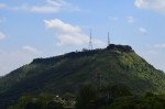
Kaas Plateau (3 km):
Bamnoli (Koyana Backwater) (15 km):
Thoseghar Waterfall (30 km):
Kanher Dam (20 km):
Sajjangad Fort (38 km):
Ajinkyatara Fort (32 km):
Natraj Mandir (26 km):
Tapola (Mini Kashmir) (Boat ride from Bamnoli):
Chalkewadi Windmill Farms (35 km):
Yavateshwar Temple (22 km):
Tourism Tips
-
Health & Safety: Do not attempt to swim or wade in the lake as it is a deep water source. Be cautious near the dam structure and embankments. :
Packing: Carry a water bottle, snacks, and a cap. Wear comfortable shoes for walking on uneven t...
Reviews
Information about New and Updated Locations(608+) of Maharashtra Has Been Added :-
Card subtitle
Note:-
Information provided here in good Faith and for reference only.
All information and pictures will be updated soon, please keep visiting.
Near Places
Ajinkyatara Fort
Some quick example text to build on the card title and make up the bulk of the card's content.
Go somewhere
Aundh
Some quick example text to build on the card title and make up the bulk of the card's content.
Go somewhere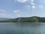
Bamnoli
Some quick example text to build on the card title and make up the bulk of the card's content.
Go somewhere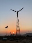
Chalkewadi Windmill Farms
Some quick example text to build on the card title and make up the bulk of the card's content.
Go somewhere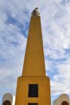
Char Bhinti Hutatma Smarak
Some quick example text to build on the card title and make up the bulk of the card's content.
Go somewhere
Kaas Lake
Some quick example text to build on the card title and make up the bulk of the card's content.
Go somewhere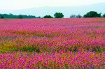
Kaas Plateau
Some quick example text to build on the card title and make up the bulk of the card's content.
Go somewhere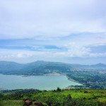
Kanher Dam
Some quick example text to build on the card title and make up the bulk of the card's content.
Go somewhere
Koyna Dam
Some quick example text to build on the card title and make up the bulk of the card's content.
Go somewhere
Mayani Bird Sanctuary
Some quick example text to build on the card title and make up the bulk of the card's content.
Go somewherein Other Cities