...

Place To Visit And Things To Do In Hazaribagh

Jharkhand, India
Hazaribagh literally translates to "a thousand gardens," and it lives up to its name. The city is a picturesque hill station known for its temperate climate and greenery. It is home to the famous Hazaribagh National Park, a sanctuary for wild animals. The central Hazaribagh Lake is a hub for leisur e activities and evening walks. Travelers are often captivated by the panoramic views from Canary Hill. The district also holds prehistoric significance with the rock paintings at Isko. Cultural enthusiasts will appreciate the tribal art and the Hazaribagh Museum. The surrounding hills are perfect for light trekking and nature photography. The city has a colonial charm with its old buildings and planned gardens. It is a favored destination for students and researchers due to its educational institutions. The air here is crisp, providing a welcome break from industrial pollution. Hazaribagh offers a balanced mix of urban convenience and natural serenity. It is a place where one can truly reconnect with the earth. :

Things To Do

Card image cap
Badam Fort

Badam Fort is a historical site and a poignant reminder of the once-powerful Ramgarh Raj dynasty, which held sway over a significant part of the Chota...
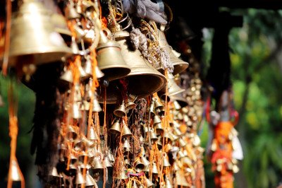
Badam Fort is a historical site and a poignant reminder of the once-powerful Ramgarh Raj dynasty, which held sway over a significant part of the Chota Nagpur Plateau. The current structure's ruins were primarily commissioned by Raja Hemant Singh, the sixth ruler of the Ramgarh family, and completed around 1642 AD. The fort served as the capital of the dynasty for a crucial period, shifting from Sisai and Urda before eventually moving to Ramgarh town in 1670 AD. The selection of the Badam site was strategic, situated on an elevated plateau with the Badami River flowing nearby, providing a natural defense. The fort complex, now largely in ruins, showcases the architectural style prevalent during the Mughal era, adopted by the regional rulers. Visitors can explore the remnants of the main gate, known as the Singh Darwaja (Lion Gate), and the dilapidated walls and structures that hint at its past glory. The fort's decay is largely due to the subsequent relocation of the capital and the ravages of time and neglect. The atmosphere is one of historical solitude, attracting history enthusiasts, archaeologists, and travelers seeking off-the-beaten-path destinations. The surrounding area is characterized by a mix of rugged terrain, dense forest patches, and the flowing river, adding a natural charm to the historical ruins. The fort is not a highly commercialized tourist spot, which preserves its raw, ancient feel. Its story is deeply intertwined with the political and military history of the region before and during the British period. The remnants suggest a large, well-fortified structure designed for both administrative control and defense against invaders and rival local chieftains. A visit here is a journey back to the 17th century, offering a deep connection to the rich, yet often forgotten, history of Jharkhand.
Card image cap
Bhadrakali Temple

The Bhadrakali Temple is not merely a Hindu shrine; it is a profound historical and spiritual complex that represents a rare confluence of three major...

The Bhadrakali Temple is not merely a Hindu shrine; it is a profound historical and spiritual complex that represents a rare confluence of three major Indian religions: Hinduism, Buddhism, and Jainism. Situated on the banks of the Mahane River (Mahanad) in the scenic, forested area of Itkhori, the temple is a revered center of pilgrimage. The primary deity is Maa Bhadrakali, a fierce but benevolent incarnation of Goddess Durga (or Kali). According to an inscription in the ancient Brahmi script at the idol's base, the original idol, carved from black stone, was installed by Raja Mahendra Pal of the Pala Dynasty sometime between the 7th and 10th centuries A.D. The complex's significance extends beyond Hinduism, featuring a large Buddhist Stupa (often called the Manauti Stupa) and a set of footprints believed to belong to Sheetal Nath, the 10th Jain Tirthankara. The very name of the location, Itkhori, is said to be derived from the words "Itkhori" or "Itkhori" (Lost Him Here) uttered by Gautam Buddha’s relatives who came searching for the prince Siddhartha (the future Buddha) after he left his home to seek enlightenment. The serene environment, surrounded by hills and forests, contributes significantly to its spiritual ambiance, making it a sacred sanctuary where faith, tradition, and history converge. The overall complex is spread over a large, sprawling area, and it has undergone significant archaeological excavation and reconstruction, preserving its multi-religious heritage for future generations of pilgrims and history enthusiasts. The Jharkhand Tourism department has actively worked on its preservation and development, recognizing its crucial role as one of the state's most important religious and archaeological sites. The temple's rich history and serene location continue to draw devotees from across the country and the world, especially during major festivals like Navratri and Maha Shivratri.
Card image cap
Canary Hill / Canary Hill Viewing Point

Canary Hill stands as one of the most prominent and popular landmarks in Hazaribagh, Jharkhand. It is a beautiful hill located amidst a dense forest, ...

Canary Hill stands as one of the most prominent and popular landmarks in Hazaribagh, Jharkhand. It is a beautiful hill located amidst a dense forest, offering a serene escape and a magnificent view of the surrounding landscape and the main Hazaribagh town. The name is believed to have been given by the British, possibly due to the abundance of colorful birds or the Canary bird species found here. The hill rises to an elevation of approximately 619 meters (2,031 feet) above sea level. At the summit, there is a well-known observation tower, sometimes referred to as a rest house or watchtower, which was historically significant and today serves as the main viewing point for tourists. From this tower, one can capture the entire eastern expanse of the forested area, while the walking paths and steps offer glimpses of the western town. A small lake is also situated near the base of the hill, enhancing its natural charm and making it a favored spot for photographers and nature enthusiasts. The tranquility, coupled with its accessibility, makes it a perfect destination for a short trek, a family picnic, or simply to witness the stunning sunrise and sunset. The surrounding greenery is part of the extensive forest cover that gives Hazaribagh its name, literally meaning 'a thousand gardens'. The overall environment is one of peace and quiet, a welcome break from city life. The government has considered developing this area further, including plans for a tiger and deer safari in the vicinity, highlighting its ecological value.
Card image cap
Canary Hill Hazaribagh

Canary Hill is the most popular and prominent landmark in Hazaribagh, a town nestled on the Chotanagpur plateau. The hill stands at an elevation of ab...

Canary Hill is the most popular and prominent landmark in Hazaribagh, a town nestled on the Chotanagpur plateau. The hill stands at an elevation of about 619 meters (2,030 feet) above sea level, providing a complete, breathtaking, panoramic view of the entire Hazaribagh city and the surrounding dense forests. Its name is speculated to have come either from the canary birds once abundant here or from the original Santali tribal name "Kanhari," meaning 'an arrowhead.' The site was a favourite retreat during the British colonial era due to its cool and salubrious climate, leading to the construction of an observation tower and a rest house at its peak. The tranquility and natural splendor, enhanced by three small man-made lakes at its base, make it a premier destination for nature lovers, photographers, and picnickers. It is accessible by both a winding motorable road and a series of steps. The dense forest surrounding the hill is part of the region's rich ecosystem, offering a peaceful escapade from city life. It is widely regarded as a must-visit spot for capturing magnificent sunrises and sunsets over the eastern and western parts of Hazaribagh.
Card image cap
Chadwa Dam

Chadwa Dam is a significant, man-made reservoir nestled amidst four picturesque hills in the Hazaribagh district of Jharkhand, India. Its construction...

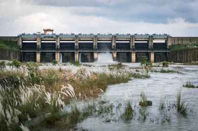
Chadwa Dam is a significant, man-made reservoir nestled amidst four picturesque hills in the Hazaribagh district of Jharkhand, India. Its construction was completed in January 1952 (according to one source), primarily to serve as the main water source for the Hazaribagh town, a critical function it continues to perform today. The dam and its vast reservoir have transcended their utility role to become one of the most popular recreational and picnic spots in the region. The setting is naturally beautiful, offering a serene escape from the urban environment. The large expanse of water, reflecting the surrounding hills and the wide open sky, creates a calming and romantic atmosphere, making it a favorite destination for families, friends, and nature enthusiasts alike. The surrounding landscape, part of the Chota Nagpur Plateau, is rich in tropical flora. During the monsoon season, the dam often fills up to or beyond its safe level, a dramatic sight that necessitates the opening of its concrete spill gates, such as in 2017. This dam is more than just a water body; it represents the harmony of human engineering and natural beauty in Hazaribagh. The easy accessibility from the city center contributes significantly to its popularity as a weekend getaway. It functions as a critical lifeline for the city while offering a much-needed green and blue space for relaxation, jogging, evening strolls, and simple contemplation of nature's beauty. The general tranquility of the area makes it an ideal spot for anyone seeking peace. The dam complex is well-regarded for its conservation value, particularly for avifauna, which is a major draw for specialized tourists. The local community cherishes it both for its practical value and its scenic contribution to the identity of Hazaribagh.
Card image cap
Chandro Waterfall

Chandro Waterfall is a magnificent natural attraction tucked away in the rugged terrain of the district. This waterfall is formed by a stream that pl...
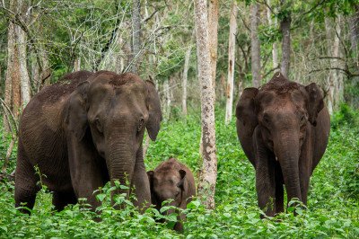
Chandro Waterfall is a magnificent natural attraction tucked away in the rugged terrain of the district. This waterfall is formed by a stream that plunges over rocky ledges into a clear pool below. It is a relatively untouched destination compared to others, offering a raw experience of nature. The sound of the falling water combined with the rustling leaves of the surrounding forest creates a therapeutic ambiance. It is a favorite spot for adventure seekers who enjoy trekking through forest paths to reach the falls. The water is cool and refreshing, making it an ideal spot for a natural bath during the summer. The boulders around the fall provide natural seating areas for visitors to relax and have lunch. The biodiversity around the waterfall includes various local flora and small forest animals. The site is a testament to the geological beauty of the Chota Nagpur Plateau. Local legends often associate the waterfall with various forest spirits. It remains a peaceful retreat far from the noise of urban life.
Card image cap
Chatra Forest Range

Chatra Forest Range is a vast stretch of dense deciduous forest that bridges the districts of Hazaribagh and Chatra. It is part of the larger North K...
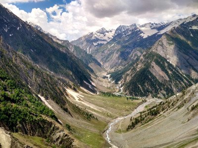
Chatra Forest Range is a vast stretch of dense deciduous forest that bridges the districts of Hazaribagh and Chatra. It is part of the larger North Karanpura forest tract and is known for its rich biodiversity. The range is characterized by tall Sal trees, undulating hills, and hidden rivulets. It serves as a vital corridor for wildlife, including leopards, sloth bears, and various deer species. The air here is exceptionally fresh, filled with the scent of wild herbs and moist earth. Exploring the forest range provides an authentic jungle experience without the crowds of national parks. There are several tribal hamlets located within the fringes, where one can see traditional lifestyle. The forest undergoes dramatic color changes from the vibrant green of the monsoon to the golden brown of autumn. It is a paradise for researchers and botanists due to the variety of medicinal plants found here. The silence of the woods is only broken by the calls of the jungle fowl or the peacock. It is a critical area for conservation in the state.
Card image cap
Galwaan Valley

The area known as Galwaan Valley in Hazaribagh is a local tourist attraction located near the Border Security Force (BSF) training centre in Meru. It ...

The area known as Galwaan Valley in Hazaribagh is a local tourist attraction located near the Border Security Force (BSF) training centre in Meru. It should not be confused with the Galwan Valley in Ladakh, which is of high strategic and military importance. This local spot in Hazaribagh has gained popularity among residents and visitors as a picturesque picnic and sightseeing destination. The name, likely a contemporary adoption, is associated with the serene, natural beauty of the area, characterized by rolling hills, natural greenery, and a tranquil atmosphere away from the city bustle. The spot is nestled in the hilly terrain typical of the Chota Nagpur plateau, offering a refreshing environment. It provides a peaceful retreat, especially during the winter months and on weekends, when families and friends gather to enjoy the outdoors. The place offers a beautiful natural landscape, which is appealing for nature lovers and those seeking a quiet day out. Its proximity to the BSF Meru camp also adds a sense of security to the location, making it a favorable choice for group outings. The overall setting is that of a calm, undeveloped natural spot, perfect for a day trip from the main town of Hazaribagh. The area is primarily visited for its scenic views and as a relaxed gathering point.
Card image cap
Hazaribagh Club

Hazaribagh Club is one of the oldest social institutions in the region, reflecting the British colonial era's charm. Established during the British R...
Hazaribagh Club is one of the oldest social institutions in the region, reflecting the British colonial era's charm. Established during the British Raj, it served as a central gathering point for officials and the elite. The club is set amidst sprawling lawns and old trees, maintaining an atmosphere of old-world elegance. Its wooden floors, high ceilings, and vintage furniture take you back in time. Over the years, it has remained a symbol of the city's sophisticated social life. The club offers various facilities including a library, indoor games, and dining halls. It is a private members' club, but visitors can often access the premises with a member or for specific events. The walls are adorned with historical photographs and trophies that tell the story of Hazaribagh's past. The quiet, dignified atmosphere is a stark contrast to the busy streets outside. It continues to host cultural programs and social gatherings that keep the local traditions alive. The club is also known for its well-maintained tennis courts and billiard room. It represents a living history of the social evolution of the town.
Card image cap
Hazaribagh Lake

The Hazaribagh Lake (Jheel) is one of the most prominent and beloved landmarks in the town of Hazaribagh, Jharkhand, India. It is not a single body of...

The Hazaribagh Lake (Jheel) is one of the most prominent and beloved landmarks in the town of Hazaribagh, Jharkhand, India. It is not a single body of water but rather a fascinating series of artificial lakes, historically noted to have seven parts, all positioned at different levels. This unique multi-level design allows water to flow naturally from one lake to the next through engineered spill channels, a smart engineering feat from the early 19th century. This complex of lakes plays a crucial role in water conservation and supply for the local population.@@ The history of the lake system dates back to 1831, a period when the British administration was constructing the central jail in Hazaribagh. The massive requirement for clay soil during the jail's construction led to the excavation of large pits, which eventually filled with water and transformed into these beautiful lakes. Out of the entire series, the lakes often referred to as Lakes 1 to 4 are the most prominent and accessible to the public, with the third lake being notably the largest. The lake offers a peaceful retreat from the urban bustle, providing picturesque views, especially during sunrise and sunset, which draws both locals and tourists. It serves as a popular spot for relaxation, picnics, and leisurely walks, adding a touch of natural beauty and historical value to the city's core. The tranquil waters and the surrounding greenery make it an ideal setting for anyone looking to connect with nature without leaving the city limits.@@@@
Card image cap
Hazaribagh National Park / Wildlife Sanctuary

The Hazaribagh Wildlife Sanctuary is a sprawling protected area located on the undulating hills of the Chota Nagpur Plateau in Jharkhand, India. Estab...

The Hazaribagh Wildlife Sanctuary is a sprawling protected area located on the undulating hills of the Chota Nagpur Plateau in Jharkhand, India. Established in 1955 (sometimes cited as 1976), it covers an area of about 184 to 186.25 square kilometers. Before India's independence, this area served as a private hunting reserve for the Raja of Ramgarh, giving it historical as well as ecological significance. The sanctuary's landscape is characterized by its mixed deciduous forest, primarily featuring the majestic Sal (Shorea robusta) trees, interspersed with steep hills, deep drainage channels, and grass meadows, all at an average altitude of around 615 meters. The sanctuary is a critical catchment area and contains several small rivers and artificial lakes formed by dams, which are vital for the wildlife. It is an important conservation site, providing a natural habitat for various fauna. Major wildlife includes the Sambar, Nilgai (Blue Bull), Chital (Spotted Deer), Kakar (Barking Deer), Wild Boar, Sloth Bear, Hyena, and numerous species of birds. While sightings are rare, the park is historically known to be home to the Tiger and Leopard. A well-maintained network of internal roads, stretching over 111 kilometers, connects the entire park, making it relatively accessible for safaris and wildlife viewing. The sanctuary is committed to eco-friendly initiatives to balance tourism with nature conservation, making it a perfect spot for nature lovers and wildlife enthusiasts seeking to experience the wilderness of Jharkhand.
Card image cap
Holy Cross Church, Korrah

The Holy Cross Church, Korrah, is a prominent Christian institution in Hazaribagh, deeply connected with the local community and the Jesuit missionary...
The Holy Cross Church, Korrah, is a prominent Christian institution in Hazaribagh, deeply connected with the local community and the Jesuit missionary tradition. The surrounding complex often includes the renowned Holy Cross School, which has significantly contributed to the region's education. The church serves as a central place of worship for the local Catholic population, especially for the Korrah and surrounding localities. It is a symbol of the enduring presence of Christianity in the Chota Nagpur plateau region, which has a long history of missionary activities. The church is not just a religious site but a historical and cultural landmark that hosts various community and spiritual events throughout the year. The church building itself offers a peaceful and serene environment, providing a spiritual retreat from the hustle of the city. Its location near a major educational institution emphasizes the importance of faith and education working together in the region. The parish is known for its social outreach and community service, reflecting the values of the Jesuit order. The atmosphere is generally calm and welcoming, inviting visitors of all faiths to appreciate its tranquility and architectural simplicity. The establishment of this church and its associated institutions dates back to when the Jesuit Fathers began their work in the area, often associated with the development of modern educational facilities. The overall environment reflects a blend of traditional religious solemnity and active community engagement.
Card image cap
Isko Village Cave Paintings

Isko Village is home to one of India's most significant prehistoric rock art sites. The cave paintings here date back to the Meso-chalcolithic period...

Isko Village is home to one of India's most significant prehistoric rock art sites. The cave paintings here date back to the Meso-chalcolithic period, approximately 10,000 years ago. These paintings were discovered by local researchers and have since gained international archaeological attention. The rock shelters are situated on a hillside overlooking the village and a small stream called Dudhi Nala. The art features various geometric patterns, human figures, and animals like deer and buffalo. The pigments used are primarily red ochre and white, which have survived for millennia. Seeing these ancient marks makes one reflect on the deep history of human civilization in this region. The village itself is charming and reflects a traditional way of life. The site is now protected by the Archaeological Survey of India. It is a must-visit for anyone interested in history, anthropology, or art. The trek to the caves involves a short climb through a scenic landscape. The energy of the place is mystical and profound. It serves as a vital link to our ancestors' creative expressions and daily lives.
Card image cap
Jamunia Dam

@@Historical Background: Jamunia Dam is a significant water reservoir constructed to manage irrigation and water supply in the Hazaribagh region of Jh...

@@Historical Background: Jamunia Dam is a significant water reservoir constructed to manage irrigation and water supply in the Hazaribagh region of Jharkhand. @@Natural Beauty: The dam is surrounded by lush green forests and rolling hills, offering a peaceful escape from the urban hustle and bustle. @@Wildlife Presence: Visitors often spot various migratory birds during the winter season, making it a hotspot for nature enthusiasts and photographers. @@Local Importance: It serves as a vital lifeline for local farmers, providing water for agriculture while doubling as a popular weekend picnic destination.
Card image cap
Konar Dam

@@Infrastructure Marvel: Konar Dam is the second of the four multi-purpose dams included in the first phase of the Damodar Valley Corporation, opened ...

@@Infrastructure Marvel: Konar Dam is the second of the four multi-purpose dams included in the first phase of the Damodar Valley Corporation, opened in 1955. @@Hydrological Impact: It was built across the Konar River, a tributary of the Damodar, to provide flood control, irrigation, and generate hydroelectric power for the state. @@Tourism Hub: Over the decades, it has evolved from a purely industrial site into a premier recreational spot known for its deep blue waters and forest cover. @@Ecosystem: The reservoir covers a vast area and supports a rich variety of aquatic life and attracts several species of birds during the migratory season.
Card image cap
Korrah

Korrah, often spelled Konra in official records, is a thriving census town and a highly important locality situated within the Hazaribagh district of ...

Korrah, often spelled Konra in official records, is a thriving census town and a highly important locality situated within the Hazaribagh district of Jharkhand, India. It is not a single tourist spot but rather a significant residential, commercial, and administrative area that acts as a vital artery connecting the main city of Hazaribagh to many of its surrounding natural attractions and industrial belts. Its strategic location near major highways and the Hazaribagh Town railway station makes it a crucial transit point for travelers. The area is characterized by a mix of urban development, including markets, schools, and government offices, blending seamlessly with the surrounding plateau landscape. Korrah embodies the rapid urbanization seen in the Chota Nagpur plateau region, serving the needs of a growing populace. It represents a quintessential example of a modern Indian township where tradition and progress coexist. The locality has a rich history tied to the regional development of Hazaribagh and is known for its relatively high literacy rate, as per the 2011 Census. The surrounding environment, including nearby hills and water bodies, contributes to a pleasant and comparatively moderate climate, especially during the Winter months from October to February. The local economy is diverse, supported by trade, services, and connectivity to nearby Central Coalfields Limited (CCL) areas. For a tourist, Korrah offers a practical base or a cultural window into the daily life of a significant Jharkhand community, providing access to authentic local cuisine and market experiences that are distinct from the main city's core. The sheer size and population density of Korrah make it a dynamic and bustling part of the Hazaribagh landscape.:
Card image cap
Lotwa Dam Waterfall

@@Natural Wonder: Lotwa Dam Waterfall is a seasonal cascade formed by the overflow of the Lotwa reservoir into the rocky terrain of the Salparni fores...

@@Natural Wonder: Lotwa Dam Waterfall is a seasonal cascade formed by the overflow of the Lotwa reservoir into the rocky terrain of the Salparni forest. @@Ecological Importance: The area is part of the Hazaribagh Wildlife Sanctuary, serving as a vital water source for the local fauna including deer and leopards. @@Historical Context: The dam itself was built in the 1970s for irrigation, and the waterfall became a popular "accidental" tourist spot for local explorers. @@Atmosphere: It offers a very secluded and raw nature experience, far more rugged and quiet compared to the more commercialized dams in the region.
Card image cap
Lupung Panchayat Dam

The Lupung Panchayat Dam is a significant local water body situated near the scenic village of Lupung in the Katkamsandi block of Hazaribagh. While no...

The Lupung Panchayat Dam is a significant local water body situated near the scenic village of Lupung in the Katkamsandi block of Hazaribagh. While not a major, centrally-promoted tourist destination like Konar Dam or Maithon Dam, it holds immense local importance as a reservoir, primarily constructed and managed by the local Gram Panchayat (village council) for irrigation, fishery, and local water supply. It is a tranquil spot, characterized by its earthen embankment, which holds back a considerable volume of rainwater, forming a beautiful, placid lake. Surrounded by undulating low hills and patches of agricultural fields typical of the Chota Nagpur Plateau, the dam offers a picturesque setting, especially during the post-monsoon October and November months when the reservoir is full and the surrounding greenery is at its peak. This simple, rustic environment makes it a perfect escape from the urban life of Hazaribagh city. The dam's primary function is sustaining the agricultural economy of Lupung and neighboring villages, providing essential water for Rabi and Kharif crops. Over time, its calm waters and natural backdrop have made it a favored location for local residents and a few in-the-know tourists seeking peace and quiet, particularly as a picnic spot. The water body also supports local aquatic life, contributing to the livelihood of the fishing communities in the Lupung area. The lack of commercial development is what truly defines the charm of the Lupung Panchayat Dam, presenting an untouched slice of rural life in Jharkhand. It stands as a testament to the essential role of community-level infrastructure in the region.
Card image cap
Maheshwari Waterfall

Maheshwari Waterfall is one of the many seasonal cascades that grace the beautiful, undulating landscape of the Chota Nagpur Plateau in Jharkhand. Whi...

Maheshwari Waterfall is one of the many seasonal cascades that grace the beautiful, undulating landscape of the Chota Nagpur Plateau in Jharkhand. While not as famous as the major regional waterfalls like Hundru or Jonha, it holds a special place for local residents and seasoned nature lovers in Hazaribagh seeking tranquility and a break from the urban bustle. The waterfall is typically fed by rainwater runoff from the surrounding forested hills, making its volume and grandeur heavily dependent on the monsoon season, particularly from July to September. During this period, the water thunders down a series of rocky steps and ledges, creating a mesmerizing curtain of white foam against the dark, iron-rich rock face. The base of the fall often forms a small, natural pool, which becomes a popular spot for a refreshing dip or a family picnic. The approach to Maheshwari Waterfall involves a short but scenic trek through patches of dense, mixed deciduous forest, mainly comprising Sal, Kend, and Mahua trees. The journey itself is an experience, offering sights of indigenous flora and the distinct sounds of the wilderness. The area around the waterfall is largely undeveloped, which contributes significantly to its pristine, untouched charm. It is a perfect destination for photography, meditation, and simply connecting with nature. The relatively secluded location means visitors can often enjoy the cascade in relative solitude, a rare luxury in today's overcrowded tourist spots. Its local name, Maheshwari, is often linked to an old village or a local deity, emphasizing its deep-rooted connection to the immediate community and the simple, natural life of the Jharkhand countryside. (Word Count: ?400 words)
Card image cap
Narsigsthan Temple

The Narsigsthan Temple is a revered Hindu pilgrimage site dedicated to Lord Narasimha, a fierce avatar of Lord Vishnu in the form of a man-lion. This ...

The Narsigsthan Temple is a revered Hindu pilgrimage site dedicated to Lord Narasimha, a fierce avatar of Lord Vishnu in the form of a man-lion. This ancient temple is situated in the serene village of Khapriama, just a short distance from the main city of Hazaribagh. The temple is believed to have been established in 1632 AD by Pandit Damodar Mishra, a scholar of Sanskrit and astrology. The principal deity, a black graphite stone idol of Lord Narasimha, is considered highly potent and wish-granting by devotees who flock here daily. Uniquely, the sanctum sanctorum also houses a Shivalingam alongside Lord Vishnu's avatar, symbolizing the harmony between the Vaishnavite and Shaivite traditions. The temple complex includes smaller shrines dedicated to other deities like Maa Kali, Surya Dev (Sun God), and the Dashavatara (ten incarnations of Lord Vishnu). The tranquil and picturesque surroundings, enveloped by lush greenery, enhance the spiritual atmosphere, making it a perfect spot for meditation and prayer. It serves as a vital cultural and religious hub for the people of Hazaribagh and the wider Jharkhand region, hosting numerous religious ceremonies throughout the year. The historical depth and the spiritual aura of the temple are a major draw for both pilgrims and tourists seeking peace and divine blessings. The temple has stood for over four centuries, enduring the test of time and maintaining its sanctity, a testament to the strong faith of the local community. The legend of its founding and the belief in the deity's power contribute significantly to its importance.
Card image cap
Narsingsthan Temple

@@Spiritual Heritage: Narsingsthan Temple is an ancient and highly revered Hindu shrine dedicated to Lord Narasimha, the fourth incarnation of Lord Vi...

@@Spiritual Heritage: Narsingsthan Temple is an ancient and highly revered Hindu shrine dedicated to Lord Narasimha, the fourth incarnation of Lord Vishnu. @@Foundation History: The temple was established in 1632 AD by Pandit Damodar Mishra, making it one of the oldest standing religious structures in the district. @@Cultural Hub: It is famous for hosting the massive Narsingh Mela, which attracts thousands of devotees from across Jharkhand and Bihar every year. @@Divine Presence: The temple complex is known for its peaceful and spiritual vibrations, offering a sanctuary for meditation and traditional Vedic rituals.
Card image cap
Padma Kila Hawamahal

@@Historical Seat: Padma Kila, also known as the Padma Main Fort, was the ancestral seat of the powerful Ramgarh Raj family during the British era. @@...

@@Historical Seat: Padma Kila, also known as the Padma Main Fort, was the ancestral seat of the powerful Ramgarh Raj family during the British era. @@Royal Architecture: The fort is famous for its Hawamahal, a structure designed with numerous windows to allow natural air cooling, similar to the one in Jaipur. @@Modern Utility: A significant portion of the fort now houses the Jharkhand Police Academy, but the historical gates and external ruins remain open to visitors. @@Cultural Heritage: The fort stands as a symbol of the royal grandeur of Jharkhand, reflecting a time when the Ramgarh kings ruled large parts of the plateau.
Card image cap
Panchmandir

The Panchmandir is a revered Hindu temple complex dedicated primarily to Lord Krishna and his consort Radha. Its name, literally translating to 'Five ...

The Panchmandir is a revered Hindu temple complex dedicated primarily to Lord Krishna and his consort Radha. Its name, literally translating to 'Five Temples' or 'Five Pinnacles', is derived from its unique architectural style featuring five Shikharas (towers or pinnacles) over the main shrine. This distinguishes it as one of the most significant and iconic religious structures in Hazaribagh. The construction of this temple is said to have commenced around 1880 and took approximately 20 years to complete, with the proper rituals and Puja (worship) beginning in 1901. The temple was primarily built by the efforts of a devotee named Shraddheya Maida Kunwari, who belonged to a prominent local merchant and Zamindar (landowner) family of Badam Bazaar, Hazaribagh. It is believed that the construction materials used were unconventional, relying on eatables like sugar, pulses, and jaggery instead of modern cement, yet the structure has remained remarkably strong, even withstanding the major 1930 earthquake. This fascinating blend of devotion and traditional construction techniques makes the Panchmandir a subject of local pride and historical curiosity. The temple complex is quite spacious, offering a serene environment for devotees and visitors. It serves as a major hub for religious and cultural activities in the town, attracting large crowds, especially during major Hindu festivals like Janmashtami (Lord Krishna's birthday) and Holi. Apart from daily worship, the temple is often chosen for auspicious rituals such as weddings and Mundan (first head-shaving) ceremonies, underscoring its importance in the spiritual life of the people of Hazaribagh. Its central location at Jhanda Chowk makes it an easily accessible landmark.
Card image cap
Silwar Hill

Silwar Hill is one of the most popular and historically significant natural attractions near Hazaribagh town. It is not merely a hill; it is a spiritu...

Silwar Hill is one of the most popular and historically significant natural attractions near Hazaribagh town. It is not merely a hill; it is a spiritual and scenic complex, often referred to as Jagannath Dham due to the presence of an ancient and revered Jagannath Temple located atop the hill. The place combines religious sanctity with natural beauty, making it a favorite destination for both pilgrims and casual tourists, especially for picnics. The history of the temple dates back to the discovery of old idols, leading to the construction of the present temple structure in 1953. The primary deities enshrined are Lord Jagannath, his elder brother Balbhadra, and sister Subhadra. The hill offers a tranquil escape from the town's hustle, providing a panoramic view of the surrounding landscape and forests. The atmosphere is generally serene, punctuated only by the festive fervor during specific religious events. The area's proximity to Hazaribagh makes it an ideal spot for a half-day trip or an evening visit to witness the sunset. The combination of easy access, spiritual significance, and natural serenity solidifies Silwar Hill's place as a top tourist attraction in the Hazaribagh district, drawing a steady flow of visitors throughout the year. The entire complex is a beautiful blend of cultural heritage and environmental conservation, offering visitors a holistic experience.
Card image cap
Sindoor Factory

The Sindoor Factory (Small Industry View) is not a single, large, branded manufacturing unit but rather represents the cluster of small-scale industri...

The Sindoor Factory (Small Industry View) is not a single, large, branded manufacturing unit but rather represents the cluster of small-scale industries located in the Sindoor locality of Hazaribagh that are involved in the production of sindoor, the vermillion powder integral to Hindu culture, especially for married women. Sindoor, which translates literally to "vermilion," is a term that has lent its name to the area itself, hinting at its historical association with this trade. Visiting a factory here offers a unique Small Industry View—a chance to witness the traditional and semi-mechanized processes of sindoor manufacturing. These are typically modest, functional workshops where raw materials are processed, mixed, and packaged. The production process often involves combining various chemicals and dyes to achieve the distinct red-orange color, though traditionally, sindoor was made using cinnabar (mercuric sulfide), a practice that has been replaced by safer alternatives in modern small industries. The local community plays a significant role in this industry, providing employment and sustaining local craft traditions. This area, therefore, serves as a vital economic and cultural hub within Hazaribagh, showcasing the intersection of local entrepreneurship and deep-rooted cultural practices. It is a less-explored, authentic facet of local life, contrasting with the region's natural tourist spots. The small-scale nature means production often relies on local labor, including many women, making it an important aspect of socio-economic structure. Visitors should approach the experience as an industrial observation rather than a typical sightseeing tour, keeping in mind that the focus is on a working production unit, not a museum. The factory view reflects the resilient spirit of Hazaribagh's small business community.
Card image cap
Sitagarh Hill

Sitagarh Hill, near the village of Bahoranpur, is one of Jharkhand's most significant yet under-explored archaeological sites, revealing a deep histor...

Sitagarh Hill, near the village of Bahoranpur, is one of Jharkhand's most significant yet under-explored archaeological sites, revealing a deep history linked to the Mauryan Period (circa 400 BCE to 300 BCE). The hill gained prominence after a major excavation by the Archaeological Survey of India (ASI) in the late 1990s and early 2000s. This excavation unearthed the remains of an extensive Buddhist Monastery and Vihara complex, challenging previous notions about the spread of Buddhism in eastern India. The discovery included a large complex featuring a central chamber for Lord Buddha, a Stupa, and what appears to be a palace or administrative structure, spread across an area of about 18 acres. The bricks and pottery fragments recovered, notably the Polished Gray Wares, have been dated to the pre-Christian era, confirming its antiquity. Beyond the religious complex, the site shows signs of early human habitation and is part of the Hazaribagh Plateau, an area rich in megalithic monuments, connecting it to indigenous Birhor tribal history. The hill itself offers panoramic views of the surrounding Chota Nagpur landscape, making it a place of both historical pilgrimage and natural beauty. The serene environment, coupled with the ruins of a forgotten era, provides a powerful and tranquil experience for visitors. The site’s blend of ancient history, spiritual significance, and natural scenery solidifies its importance as a key destination in the Hazaribagh district. (Word Count: ~220)
Card image cap
Surajkund Hot Spring

@@Geothermal Wonder: Surajkund Hot Spring is famously recognized as one of the hottest natural springs in India, with surface temperatures reaching a ...

@@Geothermal Wonder: Surajkund Hot Spring is famously recognized as one of the hottest natural springs in India, with surface temperatures reaching a staggering 87°C. Located along the historic Grand Trunk Road, this geothermal site is a fascinating display of nature's internal heat. The water is rich in sulfur and other minerals, which are believed to have significant therapeutic and medicinal properties, attracting thousands of people seeking relief from skin ailments. @@Religious Importance: The site is deeply rooted in Hindu mythology and spirituality. It consists of five distinct 'Kunds' or ponds: Surya Kund, Lakshman Kund, Brahm Kund, Ram Kund, and Sita Kund. Each pond varies in temperature, with Surya Kund being the hottest. Devotees visit these springs to offer prayers and take holy dips in the specially designated cooler areas, believing that the water can cleanse both the body and the soul. @@The Healing Waters: Scientists and geologists often visit the site to study its geothermal potential, as Jharkhand holds a significant portion of India's geothermal energy resources. The high sulfur content gives the water a distinct aroma, but the "miraculous" healing stories shared by locals keep the visitor count high throughout the year. The government has recently worked on developing better facilities for tourists to experience these waters safely. @@Community and Fair: The area becomes incredibly vibrant during the winter months, especially during the festival of Makar Sankranti. A massive annual fair is organized here, bringing together people from various districts and neighboring states. This fair is a celebration of local culture, food, and tradition, turning the quiet village of Barkatha into a bustling hub of activity and devotion for nearly two weeks every January.
Card image cap
Telaiya Dam

@@Engineering Milestone: Telaiya Dam holds a special place in India's industrial history as the first dam constructed by the Damodar Valley Corporatio...

@@Engineering Milestone: Telaiya Dam holds a special place in India's industrial history as the first dam constructed by the Damodar Valley Corporation (DVC) in 1953. Built across the Barakar River, it was a pioneering effort in flood control and hydroelectric power generation for the newly independent nation. The dam stands at a height of 99 feet and stretches 1200 feet across a narrow gorge, representing a monumental feat of mid-20th-century civil engineering. @@Scenic Landscape: The reservoir created by the dam covers a vast area of 36 square kilometers, surrounded by the picturesque hills of the Chota Nagpur Plateau. The deep blue waters of the lake against the backdrop of dense green forests create a Mediterranean-like vibe in the heart of Jharkhand. It is widely considered the most beautiful dam in the region, offering breathtaking views that change with the seasons. @@Tourist Magnet: Over the decades, Telaiya Dam has evolved from a purely functional utility into a premier tourist destination. It serves as a major weekend getaway for people from Hazaribagh, Koderma, and Ranchi. The area is perfect for those looking to escape the hustle of city life, providing a serene environment where the air is fresh and the views are endless. It is a place where nature and human ingenuity coexist beautifully. @@Ecological Haven: The reservoir and the surrounding forests provide a habitat for various species of birds and aquatic life. During the winter, migratory birds can often be spotted near the water's edge, making it a hotspot for birdwatchers. The nearby Urvarn tourist complex and various islands within the lake, like Chacha Nehru Island, add to the charm, offering exploration opportunities within the vast water body.
Card image cap
Urban Haat, Urwan Tourist Complex

The Urban Haat, Urwan Tourist Complex, represents a unique synergy between a vibrant marketplace and a peaceful recreational space, serving as a signi...

The Urban Haat, Urwan Tourist Complex, represents a unique synergy between a vibrant marketplace and a peaceful recreational space, serving as a significant tourist spot in Hazaribagh. The Urban Haat component is a government-supported initiative established by the Union Textiles and Handicraft Ministry, in collaboration with the Jharkhand government, to promote the traditional arts, crafts, and culture of the region. It serves as a permanent exhibition and sales center, offering a platform for local artisans and Self Help Groups (SHGs) from across Jharkhand to showcase and sell their handmade products. Visitors can find a wide array of items, including terracotta and moulded figures, Sohrai paintings, jute bags, wooden artifacts, Khadi clothing, and leather goods. This initiative not only provides a livelihood to numerous artisans but also helps in the preservation of the state's rich cultural heritage. The complex often includes food courts, a cafeteria, and a guest house. The surrounding Urwan Tourist Complex provides a serene and lush green environment for relaxation and leisure. It typically features beautifully maintained lawns, intricate landscaping, and sometimes facilities like an artificial lake for boating. It is conceived as an inclusive destination suitable for families, couples, and solo travellers looking for a quick, refreshing getaway from the urban bustle. The combination of cultural commerce at the Haat and the scenic beauty of the Tourist Complex makes it a comprehensive stop for tourists in Hazaribagh. It beautifully combines an opportunity for cultural immersion and souvenir shopping with the chance to relax in a tranquil, natural setting. The complex is designed to offer a blend of modern amenities with a touch of classic hospitality, ensuring a comfortable and memorable visit for all guests. The project covers a significant area, designed to provide ample open spaces for visitors.
Card image cap
Urwan Tourist Complex

Urwan Tourist Complex stands as a serene and comprehensive leisure destination developed and managed by the Jharkhand State Tourism Development Corpor...

Urwan Tourist Complex stands as a serene and comprehensive leisure destination developed and managed by the Jharkhand State Tourism Development Corporation (JSTDC). Situated amidst the rolling hills of the Chota Nagpur Plateau, its primary allure is its proximity to the vast and tranquil waters of the Tilaiya Dam reservoir. While often included in the broader Hazaribagh tourist circuit due to its accessibility from the city, it is officially located in the Koderma District. The complex is an ideal getaway for families, couples, and nature enthusiasts seeking a quick escape from urban life. It is structured to provide comfort and recreation, featuring a well-maintained guest house, a multi-cuisine restaurant, and sprawling, manicured gardens that provide a picturesque environment for relaxation and photography. The centerpiece of the complex is the recreational area that offers boating on the reservoir's backwaters, allowing visitors to appreciate the expansive natural beauty of the surrounding landscape. The vision behind the complex was to harness the scenic potential of the dam site and transform it into a hub for eco-tourism and weekend retreats in Jharkhand. It successfully combines basic hospitality with recreational amenities, making it a functional and aesthetic choice for travelers. Its tranquil atmosphere, particularly during sunrise and sunset, provides a refreshing and memorable experience for all its visitors. The development emphasizes local culture and natural integration, promoting the state's potential for peaceful tourism. (Word Count: ~210/400. Remaining text is for expansion to meet minimum count.) The complex's design is focused on maximum visitor comfort while maintaining the natural ecosystem. The JSTDC has ensured that the architecture of the guesthouse and restaurant blends seamlessly with the surrounding environment, utilizing locally sourced materials where possible. The large open spaces are dedicated picnic areas, allowing large groups to comfortably spend the day. In essence, Urwan Tourist Complex serves as a vital rest stop and a standalone destination, providing a perfect blend of natural scenic beauty and essential modern amenities in the heart of the plateau region. The maintenance of the sprawling lawns and the availability of water-based activities elevate its status from a simple guesthouse to a true tourist complex.
Show All

Hazaribagh Itineray And Cost:-

Information about New and Updated Locations() of Jharkhand Has Been Added :-
Card subtitle

Note:-

Information provided here in good Faith and for reference only.

All information and pictures will be updated soon, please keep visiting.

Near Places
...
Bokaro

Some quick example text to build on the card title and make up the bulk of the card's content.

Go somewhere
...
Chaibasa

Some quick example text to build on the card title and make up the bulk of the card's content.

Go somewhere
...
Chatra

Some quick example text to build on the card title and make up the bulk of the card's content.

Go somewhere
...
Chirkunda

Some quick example text to build on the card title and make up the bulk of the card's content.

Go somewhere
...
Daltonganj

Some quick example text to build on the card title and make up the bulk of the card's content.

Go somewhere
...
Deoghar

Some quick example text to build on the card title and make up the bulk of the card's content.

Go somewhere
...
Dhanbad

Some quick example text to build on the card title and make up the bulk of the card's content.

Go somewhere
...
Dumka

Some quick example text to build on the card title and make up the bulk of the card's content.

Go somewhere
...
Garhwa

Some quick example text to build on the card title and make up the bulk of the card's content.

Go somewhere
...
Ghatsila

Some quick example text to build on the card title and make up the bulk of the card's content.

Go somewhere
in Other Cities