Chinta Valley
General information
-
Ideal Duration:
2-3 Hours for a quick visit;
1-2 Days for camping/trekking:Place Type:
Nature/Adventure:
Meadow:
Trekking:
Camping:Entry Fees:
Access and Parking Fees: Unlike major, developed tourist sites, Chinta Valley generally does not have a formal entry fee for access to the public meadow area. However, the private or designated parking areas operated by local bodies or the BDA might charge a nominal fee ran...Access and Parking Fees: Unlike major, developed tourist sites, Chinta Valley generally does not have a formal entry fee for access to the public meadow area. However, the private or designated parking areas operated by local bodies or the BDA might charge a nominal fee ranging from Rs.50 to Rs.100 per vehicle for the day. This is a standard local administration fee to manage traffic and basic sanitation in the tourist area.
Paragliding Activity Charges: The main cost will be for organized adventure activities. A tandem paragliding jump typically costs between Rs.3,500 and Rs.5,000 per person, depending on the season, duration, and the operator. It is essential to choose a licensed operator for safety. This fee usually includes gear, a certified pilot, and a short training session.
Camping and Accommodation Charges: If opting for overnight stay, the charges apply. Renting a tent at a designated campsite can cost from Rs.800 to Rs.1,500 per night, including basic meals (dinner and breakfast). Staying in a nearby private resort or guesthouse will range from Rs.2,000 to Rs.5,000 per night.
Guide Fees and Local Support: For long-distance treks to Subarnag or through the wilderness, hiring a certified local guide is recommended for safety and can cost between Rs.1,000 and Rs.2,000 per day. This fee supports the local economy and ensures a safe, informed experience. :Timing:
Regular Timings: The valley is an open natural area and does not have official closure timings. It is accessible 24 hours a day, seven days a week. However, local administration typically advises tourists to visit between Sunrise (6:00 AM in summer) and Sunset (7:00 PM in ...Regular Timings: The valley is an open natural area and does not have official closure timings. It is accessible 24 hours a day, seven days a week. However, local administration typically advises tourists to visit between Sunrise (6:00 AM in summer) and Sunset (7:00 PM in summer) for safety, especially if not staying in organized accommodation or camping. The Chinta Nallah area is best visited during daylight hours.
Ideal Visit Time: The ideal time for a casual visit, picnic, and photography is the late morning (9:00 AM to 11:00 AM) or the late afternoon (3:00 PM to 5:00 PM) when the heat is minimal and the light is soft. For serious trekkers, starting the Subarnag trek early (5:00 AM) is crucial to complete the round trip before nightfall.
Seasonal Timings Considerations: During Winter (December to March), road accessibility can be unpredictable due to heavy snow. The safe visit time is restricted to only a few hours in the midday (11:00 AM to 3:00 PM), assuming the road is cleared. In Monsoon (July to September), visits are limited by rainfall, with clear periods in the midday being the most opportune time. Always check local forecasts.
Festival Timings: During the Bhaderwah Festival in autumn, cultural programs in the valley might extend into the late evening (8:00 PM to 10:00 PM). :Special Events:
Bhaderwah Festival Celebrations: The most significant local event is the Bhaderwah Festival, an annual cultural extravaganza that starts around Raksha Bandhan (typically August) and culminates around the full moon day of November. Chinta Valley is one of the key venues for ...Bhaderwah Festival Celebrations: The most significant local event is the Bhaderwah Festival, an annual cultural extravaganza that starts around Raksha Bandhan (typically August) and culminates around the full moon day of November. Chinta Valley is one of the key venues for the outdoor activities of this festival, hosting local folk dances, music performances (like the Kud dance), and showcasing local crafts and cuisine. The festive atmosphere is infectious and provides a deep dive into the region's Dogra-Pahari culture.
Subarnag Temple Yatra: The pilgrimage to the Subarnag Temple, for which Chinta Valley is the base, sees a massive turnout of devotees, particularly around the Baisakhi festival (mid-April) and other Hindu auspicious days. The valley is filled with temporary shelters and stalls for the pilgrims, creating a vibrant, communal, and deeply religious atmosphere that contrasts with its usual quietude.
Youth Adventure Camps: The Bhaderwah Development Authority (BDA) and private agencies frequently organize adventure camps in the valley, particularly for paragliding and trekking, throughout the summer and autumn. These multi-day events bring a lively, youthful energy to the area, featuring training, competitions, and evening cultural programs for participants. :Best Photo Spots:
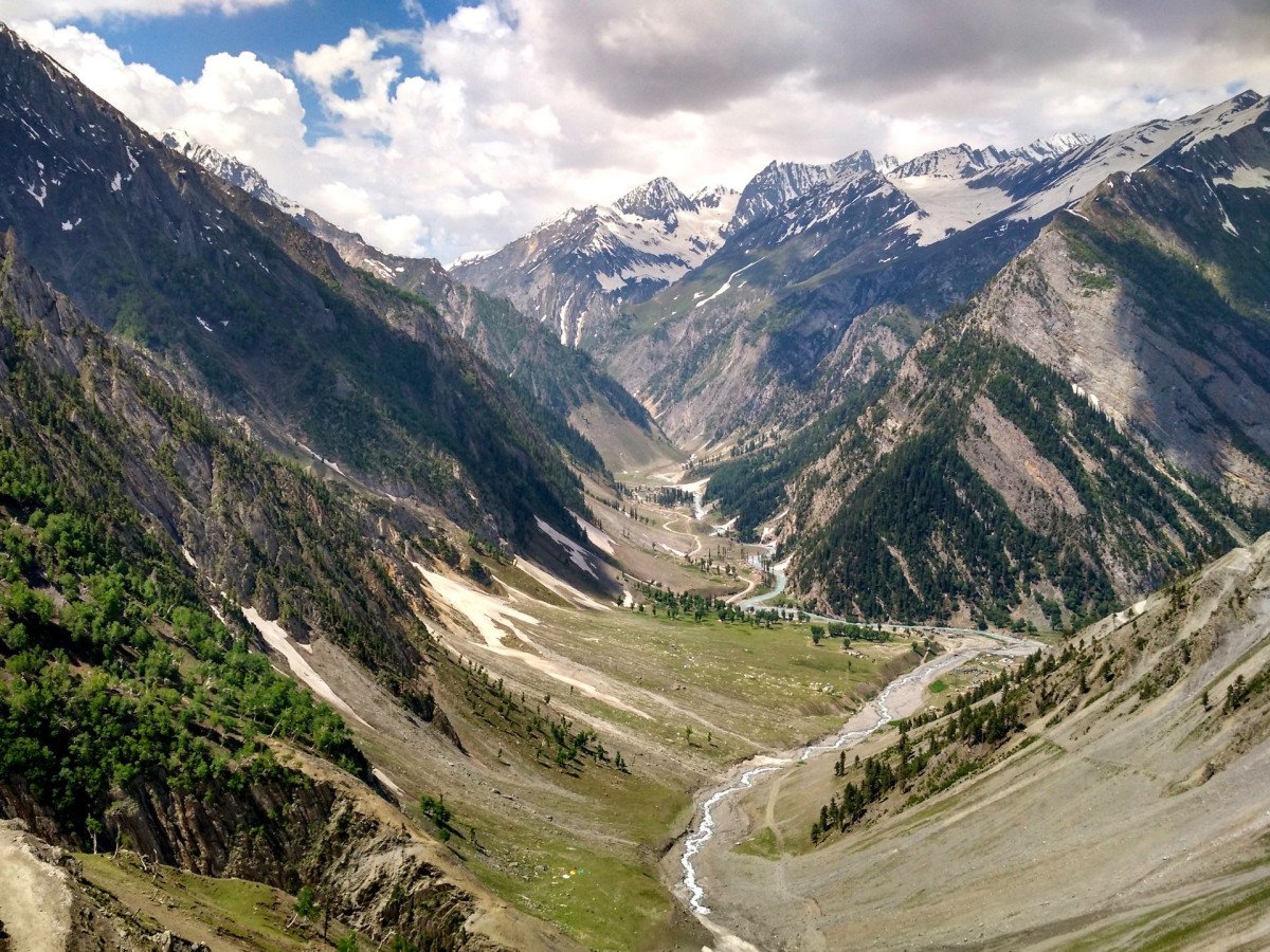
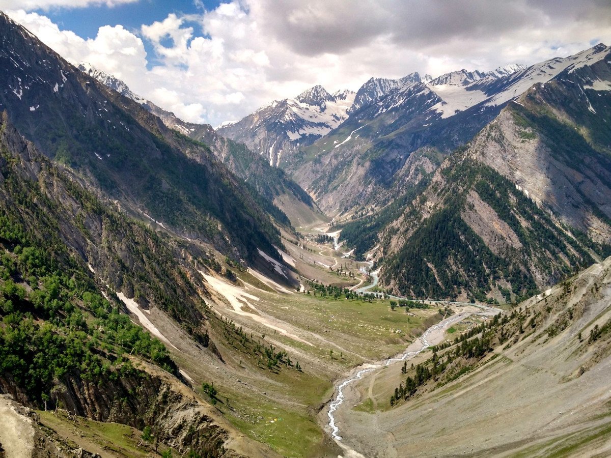
The Meadow Panorama near the Chinta Nallah: The best spot for wide-angle landscape photography is the central meadow, capturing the stream winding toward the distant horizon with the dense coniferous forests and the soaring mountain peaks (like Subarnag) forming a dramatic b...The Meadow Panorama near the Chinta Nallah: The best spot for wide-angle landscape photography is the central meadow, capturing the stream winding toward the distant horizon with the dense coniferous forests and the soaring mountain peaks (like Subarnag) forming a dramatic backdrop. This is a perfect spot for capturing the Mini Kashmir essence. The light is best during the Golden Hours.
Forest Fringe Deodar Shots: For detailed and atmospheric photographs, the edges of the deodar forest offer deep contrasts between the dark, textured wood and the bright green meadows. Look for pockets where the sunlight filters through the dense canopy to create stunning light rays (god rays). This is ideal for moody, high-contrast black-and-white photography.
The Thuba Valley Turnoff View: The curve in the road near Thuba Village, approximately 5 KMS before the valley, provides a high-altitude vantage point. From here, you can photograph the entire valley floor and the serpentine road leading into it. It’s excellent for capturing the scale and isolation of the valley, especially during the monsoon when the clouds hang low over the pines.
Winter Snowscapes (if accessible): During January and February, the valley is transformed into a pure-white snowfield. Capturing the snow-covered pines and the frozen stream provides highly dramatic, monochromatic winter scenery. A telephoto lens can isolate patterns and textures in the snow and ice. :Photo Gallery
Things To Do
-
Paragliding at Khanni Top: Take an exhilarating tandem paragliding flight from Khanni Top, offering stunning aerial views of the Chinta and Jai Valleys. This is a must-do for adrenaline junkies. The flights are generally available during the pleasant summer and autumn months, depending on wind conditions and are a core adventure activity.
Trekking to Subarnag Peak and Temple: Embark on a challenging but rewarding 6-kilometer bridle path trek to the Subarnag Temple (10,200 ft). This full-day activity offers incredible mountain vistas and a visit to an important ancient shrine. Proper hiking gear and a local guide are highly recommended for safety and navigation.
Chinta Nallah Riverside Picnicking: Spend a relaxing day by the Chinta Nallah. The banks of the stream are perfect for setting up a pi...Paragliding at Khanni Top: Take an exhilarating tandem paragliding flight from Khanni Top, offering stunning aerial views of the Chinta and Jai Valleys. This is a must-do for adrenaline junkies. The flights are generally available during the pleasant summer and autumn months, depending on wind conditions and are a core adventure activity.
Trekking to Subarnag Peak and Temple: Embark on a challenging but rewarding 6-kilometer bridle path trek to the Subarnag Temple (10,200 ft). This full-day activity offers incredible mountain vistas and a visit to an important ancient shrine. Proper hiking gear and a local guide are highly recommended for safety and navigation.
Chinta Nallah Riverside Picnicking: Spend a relaxing day by the Chinta Nallah. The banks of the stream are perfect for setting up a picnic, enjoying the cool mountain air, and listening to the gentle flow of the water. Children can safely play by the shallow edges. Carry back all waste to maintain the cleanliness.
Forest Bathing and Nature Walks: Engage in 'Forest Bathing' (Shinrin-yoku), taking a slow, mindful walk through the dense coniferous forests. Focus on the smell of deodar, the textures of the pine needles, and the sounds of the forest birds. This therapeutic activity helps reduce stress and connect with nature. This is a great activity during the early morning or late afternoon when the sunlight filters beautifully through the trees.
Photography and Landscape Sketching: The picturesque landscape, with its interplay of green meadows and dark forests, provides endless subjects for photography. Capture the dramatic cloud formations, the meandering stream, and the vernacular architecture. Artists can bring their sketching pads to capture the valley’s tranquility.
Camping and Stargazing: Chinta Valley is an excellent site for organized camping. Clear mountain nights offer spectacular opportunities for stargazing and astrophotography, far from any light pollution. Ensure you have permission and proper cold-weather gear, even in summer, as nights can be chilly. Enjoy an evening campfire (where permitted) with local stories.
Local Cuisine and Tea: Stop at a small local eatery or roadside stall to savor authentic local dishes like Rajmash Chawal with pure desi ghee and traditional Pahari tea. Experiencing the local food is a key cultural activity that supports the community. This is a great way to warm up during the colder parts of the day. :
Information
-
Why Famous:
Untouched Himalayan Beauty: The primary fame of Chinta Valley rests on its comparison to the majestic Swiss landscapes, owing to its vast, lush green expanse carpeted with grass and hemmed in by dense forests. This idyllic setting offers a serene escape.
Read MoreUntouched Himalayan Beauty: The primary fame of Chinta Valley rests on its comparison to the majestic Swiss landscapes, owing to its vast, lush green expanse carpeted with grass and hemmed in by dense forests. This idyllic setting offers a serene escape.
Adventure Sports Hub: It is becoming increasingly famous as a nascent hub for adventure sports like paragliding. The favorable climate and terrain, particularly at nearby launch sites like Khanni Top, make it an excellent location for training and recreational flights, drawing a niche crowd of thrill-seekers.
Gateway to Subarnag Temple: Chinta is renowned as the starting point for the trek to the ancient Subarnag Temple, a significant Hindu pilgrimage site at an elevation of 10,200 ft. Its religious importance adds to the valley’s overall reputation as a place of spiritual and natural significance. The annual religious gathering draws many devotees.
Water Source and Flora: The crystal-clear waters of the Chinta Nallah stream are a major attraction, famous for the rich biodiversity and providing a critical natural resource to the region. The valley is known for its diverse Himalayan flora and occasional sightings of unique local wildlife. :Architecture:
Regional Wood and Stone Vernacular: The architecture in and around Chinta Valley primarily consists of vernacular mountain dwellings and small tourist infrastructure, employing local materials. The structures typically follow the Kashmiri or Himachali style, using locally s...Regional Wood and Stone Vernacular: The architecture in and around Chinta Valley primarily consists of vernacular mountain dwellings and small tourist infrastructure, employing local materials. The structures typically follow the Kashmiri or Himachali style, using locally sourced deodar wood and river stones.
Rustic Deodar Cottages: The construction method involves dry-stacked stone masonry for foundations and lower levels, transitioning into a cribbage of crisscrossed deodar logs (known as Kath-Kuni style) for the upper levels, which provides seismic resilience. The roofing is traditionally sloped slate or galvanized iron to shed heavy snow.
Dimension: A typical small guest hut might be roughly 12 feet (width) x 18 feet (length) x 10 feet (height) to the eaves, with thick stone walls of about 2. 5 feet to provide insulation.
Functional Infrastructure: Modern architectural additions like the Primary Health Center are simple, functional concrete structures, but the aesthetic is generally kept subdued to blend with the natural surroundings. The focus is on utility and resisting the harsh winter elements rather than ornate design.
Wood Carving Details: While not grand structures, some wooden elements, such as window frames and veranda railings, may feature simple, geometric carvings typical of the local artisan tradition. :How To Reach:
By Air: The nearest major airport is Jammu Airport (IXJ), officially Jammu Civil Enclave, located approximately 200-210 KMS away from Bhaderwah town.
From the airport, tourists have two main options: Hire a pre-booked private taxi, which tak...By Air: The nearest major airport is Jammu Airport (IXJ), officially Jammu Civil Enclave, located approximately 200-210 KMS away from Bhaderwah town.
From the airport, tourists have two main options: Hire a pre-booked private taxi, which takes about 6-8 hours depending on road and traffic conditions. This is the most comfortable but expensive option. Or, take an airport taxi or auto-rickshaw to the Jammu Bus Stand and then catch a regular or deluxe bus to Bhaderwah. The journey is long and scenic, passing through Udhampur and Batote.
By Train: The nearest major railhead is Jammu Tawi Railway Station (JAT), which is well-connected to major Indian cities like Delhi, Mumbai, and Kolkata via express and mail trains (e. g. , Jammu Mail, Jhelum Express). The distance from Jammu Tawi to Bhaderwah is also about 200 KMS. The nearest practical railhead on the Udhampur-Srinagar line is Udhampur Railway Station, roughly 120 KMS from Bhaderwah. From either station, one must take a taxi or bus via the road network. The journey from Udhampur is shorter (4-5 hours) and often preferred.
By Road: Bhaderwah is primarily a road destination. It is connected by NH-244 (formerly NH-1B) from Batote. The main road route is Jammu – Udhampur – Batote – Pul Doda – Bhaderwah. The total journey from Jammu is about 200 KMS and takes 6-7 hours. From Batote, it’s roughly 80 KMS. Regular bus services (both J&K SRTC and private operators) and shared taxis (e. g. , Sumo or Innova) are readily available from Jammu, Udhampur, and Doda. Shared taxis offer a quicker, more direct route than the public bus. The road quality is generally good but features mountain passes and hairpin bends, especially on the final stretch to Bhaderwah.
By Local Transport: Once in Bhaderwah town, local taxis (usually Sumos or smaller SUVs) are the primary mode to reach Chinta Valley (20 KMS). These are available for hire at the main taxi stand. Shared taxis also run along the Bhaderwah-Jai Road and are an economical option, dropping passengers off near the main valley entrance. A round trip by hired taxi from Bhaderwah typically takes 2-3 hours plus the time spent at the destination. The drive is extremely picturesque. :Weather and Best Time to Visit:
Summer (April to June):
Ideal Climate: This is the peak season, offering the most pleasant weather for outdoor activities. The temperature is mild (10°C to 25°C), snow has largely melted, and the meadows are in full bloom, making it perfec...Summer (April to June):
Ideal Climate: This is the peak season, offering the most pleasant weather for outdoor activities. The temperature is mild (10°C to 25°C), snow has largely melted, and the meadows are in full bloom, making it perfect for trekking, paragliding, and camping.
Best Part of the Day: Early Morning and Late Afternoon are best for hiking and photography, as the sun is not too harsh, and the light is beautiful. Midday is perfect for a picnic by the stream.
Monsoon (July to September):
Lush Greenery and Challenges: The valley is intensely green during the Monsoon, offering dramatic views with mist and low-hanging clouds. However, frequent rains can disrupt plans, and roads can be slippery. The temperature is moderate (15°C to 28°C).
Best Part of the Day: Mid-Day (after the morning shower) or just after a brief spell of rain when the air is freshest, and the colors are vibrant, is the best time to visit.
Autumn (October to November):
Clear Skies and Festivals: This period is characterized by clear, crisp air and stunning blue skies. The climate is cool (5°C to 20°C), and it is a beautiful time to witness the start of the color change in the foliage. It is also the time of the Bhaderwah Festival.
Best Part of the Day: All Day. The light is clear and perfect for photography, and the cool weather is excellent for sustained hiking.
Winter (December to March):
Snow and Solitude: The valley experiences heavy snowfall, turning it into a pristine white landscape. The climate is very cold (below 0°C). Access can be difficult.
Best Part of the Day: Midday (11:00 AM to 3:00 PM) to maximize daylight and warmth, only if the roads are clear and snow conditions are safe. :Near Tourist Places:
Jai Valley:
12 KMS:
Padri Meadow:
21 KMS:
Bhaderwah Fort:
22 KMS:
Gupt Ganga Temple:
23 KMS:
Seoj Meadow:
45 KMS:
Kailash Kund Lake:
3-Day Trek:
Gurdanda Top:
25 KMS:
Nalthi Village:
25 KMS:
Khani Top:
15 KMS:
Bhal Padri:
20 KMS:Tourism Tips
-
Health & Safety - Altitude Sickness Awareness: Though Chinta Valley is not at extreme altitude, trekkers planning to ascend to Subarnag Peak (10,200 ft) should be aware of mild altitude sickness. Take it slow, stay hydrated, and carry basic medication. Always travel with a...Health & Safety - Altitude Sickness Awareness: Though Chinta Valley is not at extreme altitude, trekkers planning to ascend to Subarnag Peak (10,200 ft) should be aware of mild altitude sickness. Take it slow, stay hydrated, and carry basic medication. Always travel with a local guide for high-altitude treks.
Packing - Layered Clothing and Rain Gear: Pack layered woolen or thermal clothing as mountain weather can change rapidly, even in summer. Include a waterproof jacket and sturdy, non-slip hiking boots, especially if visiting during monsoon or attempting any treks. A good quality sunscreen is also essential due to the high elevation and clear mountain air.
Accommodation - Options in Bhaderwah: Direct accommodation in Chinta Valley is limited to basic guesthouses and organized campsites. For more comfort and amenities, it is better to base your stay in Bhaderwah town (approx. 20 KMS away) where hotels, resorts, and homestays are more readily available. Recommend checking out the Gatha Resort (near 4 KMS) for a scenic stay. Other Different Topics heading - Respect Local Culture and Nature: Bhaderwah is a culturally sensitive area, known for its temples and traditions. Dress modestly, especially when visiting local villages or temples. Always carry out all non-biodegradable waste (plastics, wrappers) from the natural area to maintain the pristine environment. Engage respectfully with local shepherds and villagers.
Connectivity and Cash: Mobile connectivity can be patchy, especially in the interior of the valley. BSNL or Jio may have better service. Carry enough cash (Rupees) as ATMs are only reliably found in Bhaderwah town.
Transportation Safety: If driving, be extremely cautious on the mountain roads, particularly after rainfall or snowfall. Employ local, experienced drivers if possible. :
Reviews
FAQs
Bhaderwah Itineray And Cost:-
Other Places In Bhaderwah :-
Other States In India :-
Information about New and Updated Locations() of Jammu and Kashmir Has Been Added :-
Card subtitle
Note:-
Information provided here in good Faith and for reference only.
Near Places
Ashapati Peak
Some quick example text to build on the card title and make up the bulk of the card's content.
Go somewhere
Bhaderwah Fort
Some quick example text to build on the card title and make up the bulk of the card's content.
Go somewhere
Bhaderwah View Point
Some quick example text to build on the card title and make up the bulk of the card's content.
Go somewhere
Bhal Padri
Some quick example text to build on the card title and make up the bulk of the card's content.
Go somewhere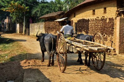
Bheja Village
Some quick example text to build on the card title and make up the bulk of the card's content.
Go somewhere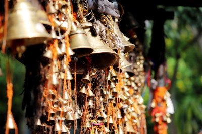
Bimal Nag Temple
Some quick example text to build on the card title and make up the bulk of the card's content.
Go somewhere
Chattragala Pass
Some quick example text to build on the card title and make up the bulk of the card's content.
Go somewhere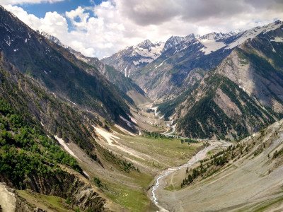
Chinta Valley
Some quick example text to build on the card title and make up the bulk of the card's content.
Go somewhere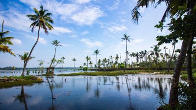
Dal Lake
Some quick example text to build on the card title and make up the bulk of the card's content.
Go somewhere
Dalain Village
Some quick example text to build on the card title and make up the bulk of the card's content.
Go somewhere
Devigol
Some quick example text to build on the card title and make up the bulk of the card's content.
Go somewhere
Dugli
Some quick example text to build on the card title and make up the bulk of the card's content.
Go somewhere
Gatha Bridge
Some quick example text to build on the card title and make up the bulk of the card's content.
Go somewhere
Gatha Resort
Some quick example text to build on the card title and make up the bulk of the card's content.
Go somewhere
Gupt Ganga Temple
Some quick example text to build on the card title and make up the bulk of the card's content.
Go somewhere
Gurdanda
Some quick example text to build on the card title and make up the bulk of the card's content.
Go somewherein Other Cities