Torna Fort
General information
-
Ideal Duration:
6 to 8 Hours (Full trek and exploration)Place Type:
Hill Fort, Trekking Destination, Historical LandmaEntry Fees:
No Official Entry Fees (at least ): As a protected monument, there is generally No Official Entry Fee to access Torna Fort. The monument is managed by the Archaeological Survey of India (ASI), which does not impose a ticket cost.
Local Contrib...No Official Entry Fees (at least ): As a protected monument, there is generally No Official Entry Fee to access Torna Fort. The monument is managed by the Archaeological Survey of India (ASI), which does not impose a ticket cost.
Local Contribution and Associated Costs: However, visitors should budget for nominal local charges:
Village Entry/Parking: A small amount (typically INR 10 to INR 50 per person or per vehicle) is collected by the Velhe Gram Panchayat (Village Council) at the base. This contribution helps in local road maintenance and sanitation in the village, which handles a significant tourist influx.
Guide Fees: Due to the difficulty and size of the fort, hiring a local guide from Velhe is highly recommended, especially for first-time visitors or during the Monsoon. Guide fees are variable but typically range from INR 500 to INR 1000 for a full-day guided trek.
Camping Fees: If camping, a small charge for water and using the local facilities may be collected by the villagers. It is advisable to support the local economy through these means.Timing:
Regular Timings (at least ): Torna Fort is an open hill fort and is accessible 24 hours a day for trekking. However, most local guides and villagers strongly advise against starting the trek after 3:00 PM due to the difficulty and the potential for getting lost in the dark ...Regular Timings (at least ): Torna Fort is an open hill fort and is accessible 24 hours a day for trekking. However, most local guides and villagers strongly advise against starting the trek after 3:00 PM due to the difficulty and the potential for getting lost in the dark or encountering wildlife. Daytime exploration is recommended between 6:00 AM and 6:00 PM. Those who intend to camp overnight usually arrive between 3:00 PM and 5:00 PM to set up camp before sunset.
Ideal Visit Time: The Ideal Visit Time is Early Morning (4:30 AM to 5:30 AM start) to reach the summit for the spectacular sunrise (around 6:30 AM to 7:00 AM). The Monsoon season (July to September) is the most beautiful time for the greenery, but the trek is extremely difficult and dangerous. The Post-Monsoon/Winter (October to January) period offers the best balance of clear weather, cool temperatures, and safe trekking conditions for a day hike. Mid-day is often too hot for the ascent.Special Events:
Shiv Jayanti Pilgrimage (at least ): The celebration of Shiv Jayanti (Chhatrapati Shivaji Maharaj's birth anniversary, typically February/March) is perhaps the most significant event. As the fort represents the beginning of the empire, huge groups of devotees and history en...Shiv Jayanti Pilgrimage (at least ): The celebration of Shiv Jayanti (Chhatrapati Shivaji Maharaj's birth anniversary, typically February/March) is perhaps the most significant event. As the fort represents the beginning of the empire, huge groups of devotees and history enthusiasts undertake the challenging trek to hoist the Bhagwa Flag (Maratha Flag) and celebrate with historical Powadas (ballads) and cultural programs. This transforms the trek into a large-scale patriotic pilgrimage.
Monsoon Trekking Meets: Similar to other forts, Torna hosts large, organized trekking meets throughout the Monsoon (July to September). The challenge of conquering the Prachandagad in the mist and rain attracts a huge number of young trekkers, turning weekend mornings into a highly social and physically taxing event. Local guides and villagers offer their services to large groups, which is a unique weekend phenomenon.Best Photo Spots:
The Zunjar Machi Point (at least ): The extreme western edge of the Zunjar Machi offers the most dramatic photos. It's the highest vantage point, providing a terrifying sense of height and wide-angle views of the deep valleys and the winding roads below. The ramparts here,...The Zunjar Machi Point (at least ): The extreme western edge of the Zunjar Machi offers the most dramatic photos. It's the highest vantage point, providing a terrifying sense of height and wide-angle views of the deep valleys and the winding roads below. The ramparts here, built onto the sheer rock, make for powerful, rugged architectural photos. Best captured at sunrise.
The Ridge View of Rajgad: From the eastern section of the Budhla Machi or along the start of the connecting ridge, you get a clear view of Rajgad Fort across the valley. Capturing these two historically linked giants in one frame is a symbolic and visually rewarding shot, particularly in the soft afternoon light.
The Koka Devi Talav: This large water tank, surrounded by ancient stonework and ruins, makes for an excellent historical detail shot. The stillness of the water, especially in the post-Monsoon months, reflecting the fort walls and the sky, creates a serene and powerful image, contrasting the fort's violent history.
The Ascent and Greenery (Monsoon): During the Monsoon, the lower slopes of Torna are blanketed in vibrant green, with wildflowers and mist. Capturing the sheer height of the fort with the trekking path winding up the slope, often shrouded in fog, provides a classic, moody Sahyadri trekking photograph. Use a telephoto lens to emphasize the steepness.Photo Gallery
Things To Do
-
The Ascent and Summit Trekking (at least ): The primary activity is the challenging trek from the base village of Velhe. This is considered a medium-to-difficult level trek, taking between 2. 5 and 4 hours one way, depending on fitness and weather. The path is steep and requires moderate rock-climbing/scrambling in a few sections, especially in the Monsoon. The reward is reaching the massive plateau at the top, one of the largest in the Sahyadris.
Exploring the Machis and Fortifications: Spend substantial time walking across the vast fort plateau to explore the two main outposts. The walk to the end of the Zunjar Machi is crucial for the best panoramic views of the entire region, including the distant Rajgad Fort. The walk to the Budhla Machi on the eastern end offers views into the Bhor region. These long walks within the...
Information
-
Why Famous:
The First Step of Swarajya (at least ): Torna's unparalleled fame rests on the fact that it was the first fort captured by Chhatrapati Shivaji Maharaj in 1646. This act was the symbolic and practical start of the Maratha Empire. By securing this massive stronghold at such ...The First Step of Swarajya (at least ): Torna's unparalleled fame rests on the fact that it was the first fort captured by Chhatrapati Shivaji Maharaj in 1646. This act was the symbolic and practical start of the Maratha Empire. By securing this massive stronghold at such a young age, Shivaji signalled his intent to challenge the regional powers. The fort is therefore known as the 'Gateway of Swarajya'. This historical significance makes it a place of pilgrimage for every follower of Maratha history.
Discovery of Hidden Treasure: Its historical narrative is further amplified by the legend of the hidden treasure of gold coins discovered on the fort by Shivaji Maharaj's men. This treasure provided the vital capital needed to launch further military campaigns and, crucially, to build the nearby Rajgad Fort, which served as the first capital of the Maratha Empire. This story adds a layer of mystical and dramatic appeal to the fort's history, attracting those interested in the foundational years of the Maratha rule. -
Architecture:
Massive Scale and Dual Outposts (at least with Dimension): The architecture of Torna is defined by its colossal scale, spread across a vast plateau, justifying its name Prachandagad. It is not a singular structure but a vast fortified mountain top. The main plateau has an approximate length of 2....Massive Scale and Dual Outposts (at least with Dimension): The architecture of Torna is defined by its colossal scale, spread across a vast plateau, justifying its name Prachandagad. It is not a singular structure but a vast fortified mountain top. The main plateau has an approximate length of 2. 5 KMS and a significant width, making the circumference of the fort walls one of the largest in the region.
The Machis (Outposts): The fort is protected by two major fortified outposts: the Zunjar Machi (Fighter's Outpost) on the western side and the Budhla Machi (Head-Shaped Outpost) on the eastern side. The Zunjar Machi is the most formidable structure, featuring robust bastions and walls built into the steep cliff edge. The stone construction here is typically dry masonry, utilizing large, locally quarried basalt blocks, with wall thickness reaching several feet in critical defensive zones.
Gateways and Water Systems: Access to the fort is primarily via the Bini Darwaza or the Kothi Darwaza (depending on the route), which are relatively simple in construction compared to other forts like Sinhagad or Lohagad, relying more on the steep ascent as the main deterrent. The most significant structures are the numerous ancient rock-cut cisterns (Talavs) and tanks, which collect and store rainwater. The largest of these is the Koka Devi Talav, essential for supporting the garrison. The ruins of the Mendhai Devi Temple and the Toranjai Devi Temple are also found, with simple stone structures typical of the Yadav/Shaiva period. -
How To Reach:
By Air (at least ): The nearest airport is Pune International Airport (PNQ), approximately 65-70 KMS from Velhe village (Torna's base).
Steps: From PNQ, hire a pre-paid or app-based taxi. The route involve... -
Near Tourist Places:
1.
Rajgad Fort: Approx. 10-12 KMS (via connecting ridge trek). 2.
Baneshwar Temple (Velhe): Approx. 5 KMS. 3.
Sinhagad Fort: Approx. 35 KMS. 4.
Panshet Dam and Lake: Approx. 40 KMS. 5.
Khadakwasla Dam: Approx. 40 KMS. 6.
Gunjawane Dam: Approx. 20 KMS. 7.
Purandar Fort: Approx. 75 KMS. 8.
Katraj Ghat (Pune Side): Approx. 45 KMS. 9.
Pabe Ghat (Viewpoint): Approx. 15 KMS. 10.
Mulshi Lake: Approx. 80 KMS.
Tourism Tips
-
Health & Safety (at least ):
Difficulty: Torna is a difficult trek. Carry sufficient water and snacks, and do not attempt if physically unfit or with very young children/elders.
Slippery Rocks: The path ...
Reviews
Pune Itineray And Cost:-
Information about New and Updated Locations() of Maharashtra Has Been Added :-
Card subtitle
Note:-
Information provided here in good Faith and for reference only.
All information and pictures will be updated soon, please keep visiting.
Near Places
Aga Khan Palace
Some quick example text to build on the card title and make up the bulk of the card's content.
Go somewhere
Bhandarkar Oriental Research Institute
Some quick example text to build on the card title and make up the bulk of the card's content.
Go somewhere
Bhuleshwar Temple
Some quick example text to build on the card title and make up the bulk of the card's content.
Go somewhere
Dagdusheth Halwai Ganpati Temple
Some quick example text to build on the card title and make up the bulk of the card's content.
Go somewhere
Darshan Museum
Some quick example text to build on the card title and make up the bulk of the card's content.
Go somewhere
Empress Botanical Garden
Some quick example text to build on the card title and make up the bulk of the card's content.
Go somewhere
Joshi's Museum of Miniature Railways
Some quick example text to build on the card title and make up the bulk of the card's content.
Go somewhere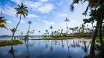
Khadakwasla Dam & Lake
Some quick example text to build on the card title and make up the bulk of the card's content.
Go somewhere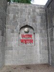
Lal Mahal
Some quick example text to build on the card title and make up the bulk of the card's content.
Go somewhere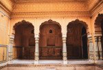
Lohagad Fort
Some quick example text to build on the card title and make up the bulk of the card's content.
Go somewherein Other Cities