

Vajrai Waterfall
General information
-
Ideal Duration:
1 to 2 HoursPlace Type:
Waterfall, Natural Wonder, Trekking Spot, MonsoonEntry Fees:
No Entry Fee for View:Generally, there is no official entry fee to view the falls from the safe, distant road head area.
Parking/Local Fee:A small, nominal fee or donation may be collected by local villagers for parking or access to specific...No Entry Fee for View:Generally, there is no official entry fee to view the falls from the safe, distant road head area.
Parking/Local Fee:A small, nominal fee or donation may be collected by local villagers for parking or access to specific viewpoints.
Trek Risk:The path leading to the base is extremely dangerous, especially in the monsoon, and should be avoided unless highly experienced and with local guidance.Timing:
Regular Timings:The viewpoint is generally accessible during daylight hours, from 8:00 AM to 6:00 PM.
Ideal Visit Time:The falls are best viewed during the peak flow in the monsoon and post-monsoon months (July to October). The morning (bef...Regular Timings:The viewpoint is generally accessible during daylight hours, from 8:00 AM to 6:00 PM.
Ideal Visit Time:The falls are best viewed during the peak flow in the monsoon and post-monsoon months (July to October). The morning (before 12:00 PM) is ideal for better light and less mist for photography.Special Events:
Monsoon Tourist Season Opening:The official opening of the viewing area during the peak monsoon, when the water flow is maximum, is often a locally celebrated event.
Local Village Fair:The nearby Bhambavali village may host traditional agric...Monsoon Tourist Season Opening:The official opening of the viewing area during the peak monsoon, when the water flow is maximum, is often a locally celebrated event.
Local Village Fair:The nearby Bhambavali village may host traditional agricultural or religious festivals.Best Photo Spots:
Distant Viewpoint:The designated, safe distant viewpoint provides the best perspective for capturing the entire 853-foot waterfall in its three-tiered glory.
Roadside Scenic Spots:The winding roads and viewpoints leading up to the falls, whi...Distant Viewpoint:The designated, safe distant viewpoint provides the best perspective for capturing the entire 853-foot waterfall in its three-tiered glory.
Roadside Scenic Spots:The winding roads and viewpoints leading up to the falls, which often overlook the Kaas Plateau area, are great for landscape photography.
Macro Flora Shots:Like Kaas, the surroundings during the monsoon are full of colorful, small flowers, ideal for macro photography.Photo Gallery
Things To Do
-
View from the Roadhead:Take in the full, magnificent view of the 853-foot waterfall from the safe viewing area near the road head, capturing the three tiers in a single frame.
Photography:Focus on the sheer scale of the falls, the water's mist, the lush green mountain slopes, and the dramatic cloud formations in the monsoon season.
Light Trekking:Undertake the moderately adventurous 500-meter walk toward a closer viewpoint (caution advised, especially for the path leading to the base, which is very risky).
Explore the Caves:For experienced trekkers, a cautious exploration of the small caves near the falls can be an adventurous activity.
Visit Urmodi Dam:Since the falls feed the Urmodi River, a short drive to the Urmodi Dam can be...
Information
-
Why Famous:
Reputed Height:It is most famous for its incredible height of 853 feet, claiming a spot as one of the tallest waterfalls in the country, a major draw for tourists.
Three-Tiered Structure:The unique spectacle of the water splitting and cascad...Reputed Height:It is most famous for its incredible height of 853 feet, claiming a spot as one of the tallest waterfalls in the country, a major draw for tourists.
Three-Tiered Structure:The unique spectacle of the water splitting and cascading down three distinct tiers makes for a visually stunning and photogenic natural feature.
Proximity to Kaas Plateau:Its close location to the UNESCO World Heritage Site of Kaas Plateau (Valley of Flowers) makes it an essential part of the regional tourism circuit, especially in the post-monsoon season. -
Architecture:
Natural Gorge Formation and Trek Path:The architecture here is entirely natural, focusing on the vertical gorge carved by the falling water over millennia.
Key Architectural Elements:There are no major man-made structures at the immediate si...Natural Gorge Formation and Trek Path:The architecture here is entirely natural, focusing on the vertical gorge carved by the falling water over millennia.
Key Architectural Elements:There are no major man-made structures at the immediate site, maintaining its untouched natural beauty. The primary 'architecture' consists of the three distinct rock faces over which the water cascades, making up the tiered structure. The approach includes a 500-meter trek path (partially maintained by local bodies) leading toward the base or a viewpoint. The surrounding area is dominated by the steep slopes of the Sahyadri hills.
Dimension:
The most significant dimension is the height: 260 meters (853 feet). The viewing experience is defined by the depth of the gorge and the long distance required to appreciate the three tiers, making it a vertical natural spectacle. -
How To Reach:
By Air:Nearest airport is Pune International Airport (PNQ) (130 KMs). Take a bus or taxi to Satara City.
By Train:The nearest station is Satara Railway Station (STR), about 30 KMs away. Hire a taxi/cab directly to the Bhambavali village si... -
Near Tourist Places:
Kaas Plateau (6 KMs), Thoseghar Waterfalls (30 KMs), Sajjangad Fort (25 KMs), Urmodi Dam (10 KMs), Satara City (28 KMs), Ajinkyatara Fort (30 KMs), Shivsagar Lake (30 KMs), Mahabaleshwar (40 KMs), Panchgani (50 KMs), Kalyangad Fort (45 KMs).
Tourism Tips
-
Health & Safety:Be highly cautious—the area is known for leeches during the monsoon and extremely slippery rocks. Do not attempt to go near the edge or the base of the falls.
Packing:Carry insect repellent for leeches and comfortable, sli...
Reviews
Vajrai Waterfall Tourism:-
Information about New and Updated Locations(608+) of Maharashtra Has Been Added :-
Card subtitle
Note:-
Information provided here in good Faith and for reference only.
All information and pictures will be updated soon, please keep visiting.
Near Places
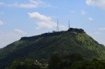
Ajinkyatara Fort
Some quick example text to build on the card title and make up the bulk of the card's content.
Go somewhere
Aundh
Some quick example text to build on the card title and make up the bulk of the card's content.
Go somewhere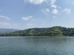
Bamnoli
Some quick example text to build on the card title and make up the bulk of the card's content.
Go somewhere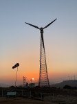
Chalkewadi Windmill Farms
Some quick example text to build on the card title and make up the bulk of the card's content.
Go somewhere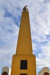
Char Bhinti Hutatma Smarak
Some quick example text to build on the card title and make up the bulk of the card's content.
Go somewhere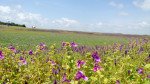
Kaas Lake
Some quick example text to build on the card title and make up the bulk of the card's content.
Go somewhere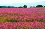
Kaas Plateau
Some quick example text to build on the card title and make up the bulk of the card's content.
Go somewhere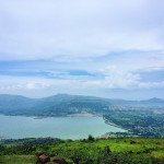
Kanher Dam
Some quick example text to build on the card title and make up the bulk of the card's content.
Go somewhere
Koyna Dam
Some quick example text to build on the card title and make up the bulk of the card's content.
Go somewhere
Mayani Bird Sanctuary
Some quick example text to build on the card title and make up the bulk of the card's content.
Go somewherein Other Cities