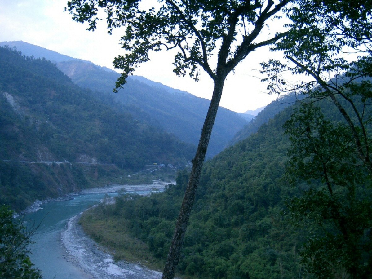
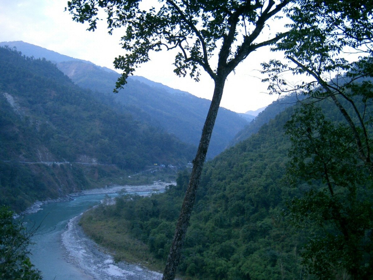
Teesta River View Point
General information
-
Ideal Duration:
45 Minutes (Ample time for photography and viewing the vast landscape).Place Type:
Natural Landmark, Scenic Viewpoint, and GeographicEntry Fees:
Viewpoint Access (Free of Charge): There is no official entry fee to visit the Teesta River View Point. Unrestricted Public Access and Natural Landmark Status: As a natural, publicly accessible geographical feature on the main highway, the viewing area is kept open and fre...Viewpoint Access (Free of Charge): There is no official entry fee to visit the Teesta River View Point. Unrestricted Public Access and Natural Landmark Status: As a natural, publicly accessible geographical feature on the main highway, the viewing area is kept open and free for all travelers, ensuring no financial barrier to enjoying this crucial regional vista.
Parking and Roadside Service Fee (Nominal): Local vendors or committees may charge a small, informal fee for parking your vehicle near the viewpoint, especially if you stop for an extended period.
Local Convenience Charge and Roadside Management: This fee, usually around Rs.20, is an unofficial convenience charge for roadside management and is generally minimal. There is also a small cost for purchasing any tea or snacks from the local stalls, which are independent of the viewpoint's access.Timing:
Regular Timings (Optimal Daylight Hours): The viewpoint is technically accessible 24 hours a day, but the ideal hours are from 6:00 AM to 5:00 PM.
Safe Viewing and Roadside Security: Daylight hours are the only time the view is truly visibl...Regular Timings (Optimal Daylight Hours): The viewpoint is technically accessible 24 hours a day, but the ideal hours are from 6:00 AM to 5:00 PM.
Safe Viewing and Roadside Security: Daylight hours are the only time the view is truly visible, and for safety (due to the narrow, winding hill road), it is highly recommended to only stop during daylight. Stopping after dark is strongly discouraged due to fog and poor lighting. Ideal Visit Time (Pre-Morning Haze and Photography Light): The absolute best time to visit is just after sunrise, around 6:30 AM to 8:00 AM.
Atmospheric Clarity and Lack of Heat Haze: The air is clearest in the early morning, offering the sharpest, most defined view of the distant mountains and the river below, before the midday sun creates heat haze that blurs the vast, far-reaching horizon.Special Events:
Annual Teesta Tourism Festival (Near the River): Though not held directly at the viewpoint, the closest significant event is the annual Teesta Tourism Festival, held down by the riverbanks, usually in February.
Regional Celebration and River Co...Annual Teesta Tourism Festival (Near the River): Though not held directly at the viewpoint, the closest significant event is the annual Teesta Tourism Festival, held down by the riverbanks, usually in February.
Regional Celebration and River Commemoration: This festival celebrates the life-giving nature of the river, featuring cultural programs, local music and dance performances, and exciting river sports like rafting and kayaking competitions, drawing large crowds of adventure seekers and local families.
Seasonal Roadside Farmer's Market (Occasional):
Spontaneous Local Trade and Agricultural Products: Occasionally, especially during the harvest months of October and November, local farmers set up small, informal stalls near the viewpoint to sell fresh, organic produce like oranges, vegetables, and homemade pickles. This spontaneous market provides a unique opportunity to taste and purchase authentic, fresh local goods directly from the producers.Best Photo Spots:
Foreground Railing Framing the River:
Leading Lines and Depth Perception: Stand close to the protective railing and use it as a leading horizontal line in your composition. This technique guides the viewer's eye down towards the river, emph...Foreground Railing Framing the River:
Leading Lines and Depth Perception: Stand close to the protective railing and use it as a leading horizontal line in your composition. This technique guides the viewer's eye down towards the river, emphasizing the immense vertical distance and the depth of the gorge, creating a powerful sense of perspective.
The Wide Valley Shot with Distant Fog:
Atmospheric Effect and Grand Scale: Capture a wide shot that encompasses the entire visible stretch of the valley and the opposing hills, ensuring you include any low-hanging clouds or mist. The presence of fog or mist adds an ethereal, mysterious quality to the image, enhancing the perception of the Himalayan wilderness and scale.
Detail Shot of the River's Flow and Color:
Water Dynamics and Chromatic Variation: Use a telephoto lens (or zoom) to focus directly on a section of the river far below. Try to capture the texture of the water flow the rapids, the calmer sections, and the striking color variation, which is often a vibrant turquoise or deep blue after the monsoons.Photo Gallery
Things To Do
-
Engage in Panoramic Landscape Photography:
Wide-Angle Scenic Capture and Composition Focus: Utilize the wide-open space to capture the expansive view of the Teesta River and the surrounding hills using a wide-angle lens. Experiment with composition by using the protective railing or nearby trees as a natural frame in the foreground to give depth and scale to the distant river winding through the valley.
Observe the Flow and Color of the Teesta River: Hydrological Appreciation and Seasonal Change Study: Spend time studying the river itself. Note how the water color changes based on the time of year deep blue or green in the dry season (November to February) and a strong, muddy brown during the peak monsoon flow. This helps appreciate the river's dynamic nature and its powerful, seasonal influe...
Hotels
● Delo Retreat
Address: Deolo, Kalimpong, West Bengal
Distance: 4.4 km
Details: Delo Retreat provides a peaceful and picturesque stay near the popular Deolo hill. The property is designed for those who appreciate nature and quiet ...
● Fortune Resort Kalimpong
Address: Kalimpong Khasmahal, Kalimpong, West Bengal
Distance: 0.7 km
Details: Fortune Resort Kalimpong, a member of the ITC Hotels Group, offers a high-end luxury experience. It features expansive grounds, elegant architecture, ...
● Hotel Paradiso
Address: Kalimpong Khasmahal, Kalimpong, West Bengal
Distance: 1.0 km
Details: Hotel Paradiso is a reliable budget-friendly option, favored by travelers for its clean rooms and friendly staff. It offers basic, practical facilitie...
● Mayfair Himalayan Spa Resort
Address: Kalimpong Khasmahal, Kalimpong, West Bengal
Distance: 0.24 km
Details: Mayfair Himalayan Spa Resort is a luxury 5-star property offering an opulent experience with stunning views. It features an upscale spa, large swimmin...
● SAY Homes Pinewood
Address: Dalapachan Khasmahal, Kalimpong, West Bengal
Distance: 8.6 km
Details: SAY Homes Pinewood is a charming homestay located a bit away from the main town, ensuring total peace and privacy. The rooms are clean, nicely decorat...
● Sinclairs Retreat Kalimpong
Address: Kalimpong Khasmahal, Kalimpong, West Bengal
Distance: 1.9 km
Details: Sinclairs Retreat Kalimpong is a well-known property offering a sophisticated stay in a beautiful, quiet location. The rooms are spacious, many with p...
● Sterling Park Kalimpong
Address: Kalimpong Khasmahal, Kalimpong, West Bengal
Distance: 0.5 km
Details: Sterling Park Kalimpong is a highly-rated, mid-range property known for its excellent service and comfortable rooms. The resort offers various ameniti...
● Summit Barsana Resort & Spa
Address: Kalimpong Khasmahal, Kalimpong, West Bengal
Distance: 0.67 km
Details: Summit Barsana Resort & Spa is a modern property that combines comfort with a beautiful mountain setting. The resort features a serene garden, a relax...
● Summit Sherpa Mountain Hotel & Spa
Address: Deolo, Kalimpong, West Bengal
Distance: 4.1 km
Details: Summit Sherpa Mountain Hotel & Spa is located near the beautiful Deolo Park. It offers clean, comfortable rooms with modern facilities, including an o...
● Teesta Hotels
Address: Kalimpong Khasmahal, Kalimpong, West Bengal
Distance: 0.1 km
Details: Teesta Hotels is a convenient, mid-range property located close to the heart of town. It offers comfortable rooms with all essential amenities and a r...
Show AllInformation
-
Why Famous:
Iconic Representation of the Teesta River:
Best Vantage Point for the Himalayan Lifeline: This spot is famously known as the best and safest accessible viewpoint to capture the raw scale and beauty of the Teesta River. The serpentine path o...Iconic Representation of the Teesta River:
Best Vantage Point for the Himalayan Lifeline: This spot is famously known as the best and safest accessible viewpoint to capture the raw scale and beauty of the Teesta River. The serpentine path of the river, winding through the colossal, steep gorges, is visually arresting and has been featured extensively in travel media, making it an instantly recognizable landscape feature of the region.
Dramatic Geographical Contrast:
Altitude Drop and Valley Depth Visualization: The fame also comes from the dramatic topographical display. Visitors are positioned at a high altitude, allowing them to witness the immense depth of the valley and the sheer size of the Teesta River below, a powerful contrast that emphasizes the turbulent geological history of the young Himalayan mountains and valleys. -
Architecture:
Functional Viewpoint Structure and Railing: The architecture of the Teesta River View Point is inherently functional, designed for safety and viewing efficiency. Safety Engineering and Viewing Platform Construction: The primary structure consists of a concrete or paved vie...Functional Viewpoint Structure and Railing: The architecture of the Teesta River View Point is inherently functional, designed for safety and viewing efficiency. Safety Engineering and Viewing Platform Construction: The primary structure consists of a concrete or paved viewing platform, typically a semi-circular area measuring about 15 meters in diameter, built right on the edge of the hill. Crucially, a robust, high-tensile steel railing (approximately 1. 5 meters high and 20 meters long) is mandatory, providing safety against the steep drop-off while ensuring an unobstructed view of the river below, sometimes utilizing reinforced glass sections for clarity.
Temporary Stalls and Shelter Design: Small, temporary wooden shacks or stalls are often erected nearby to serve tourists. Local Commerce Infrastructure and Simple Sheltering: These structures, averaging 3 meters by 3 meters in size, are made from locally sourced timber and corrugated iron sheets. They serve as tea shops and souvenir stands, offering basic shelter from the sun or sudden rain showers and adding a touch of local commerce to the scenic location without detracting from the natural beauty of the panorama. -
How To Reach:
By Air: The nearest airport is Bagdogra Airport (IXB).
Long-Distance Air Travel and Full Taxi Hire: The distance is approximately 92 KMS. From IXB, hire a reserved taxi directly to Kalimpong. Since the viewpoint is located on the way to K... -
Near Tourist Places:
Kalimpong Market: 12 KMS (Central hub)
Mangal Dham Temple: 10 KMS (Hindu temple)
Durpin Dara Hill: 15 KMS (Monastery and viewpoint)
Pine View Cactus Nursery: 14 KMS (Floral attraction)
Deolo Hill: 18 KMS (Highest viewpoint)
Teesta Bazar: 10 KMS (Riverside market)
Rishikhola: 30 KMS (Riverside camp)
Lava: 45 KMS (Forest town)
Algarah: 15 KMS (Historic town)
Morgan House: 14 KMS (Historic guesthouse)
Tourism Tips
-
Health & Safety (Roadside Danger and Sun Protection):
Road Safety Protocol and Sun Exposure: Never climb over the protective railings; the drop is sheer and extremely dangerous. Park your vehicle safely, well away from the main flow of traffic, as the road is narr...
Reviews
Kalimpong Itineray And Cost:-
Teesta River View Point Tourism:-
Information about New and Updated Locations() of West Bengal Has Been Added :-
Card subtitle
Note:-
Information provided here in good Faith and for reference only.
All information and pictures will be updated soon, please keep visiting.
Near Places
7th Mile Viewpoint
Some quick example text to build on the card title and make up the bulk of the card's content.
Go somewhere
Ahal Dara Viewpoint
Some quick example text to build on the card title and make up the bulk of the card's content.
Go somewhere
Bara Mangwa
Some quick example text to build on the card title and make up the bulk of the card's content.
Go somewhere
Changey Falls
Some quick example text to build on the card title and make up the bulk of the card's content.
Go somewhere
Chatakpur
Some quick example text to build on the card title and make up the bulk of the card's content.
Go somewhere
Chota Mangwa
Some quick example text to build on the card title and make up the bulk of the card's content.
Go somewhere
Deolo Hill
Some quick example text to build on the card title and make up the bulk of the card's content.
Go somewhere
Dr. Graham s Homes
Some quick example text to build on the card title and make up the bulk of the card's content.
Go somewhere
Durpin Dara Hill
Some quick example text to build on the card title and make up the bulk of the card's content.
Go somewhere
Durpin Monastery
Some quick example text to build on the card title and make up the bulk of the card's content.
Go somewherein Other Cities