

Tinsukia
General information
-
Ideal Duration:
2 to 3 DaysPlace Type:
Wildlife, Industrial, HeritageEntry Fees:
National Park Entry: The entry fee for Dibru-Saikhowa National Park is approximately 100 INR for Indians and higher for foreigners, plus safari boat charges.
Museum Fees: The Digboi Oil Centenary Museum has a nominal entry fee of around 20 I...National Park Entry: The entry fee for Dibru-Saikhowa National Park is approximately 100 INR for Indians and higher for foreigners, plus safari boat charges.
Museum Fees: The Digboi Oil Centenary Museum has a nominal entry fee of around 20 INR to 50 INR for visitors.Timing:
Regular Operating Timings: Most attractions like the National Park and Museums are open from 9:00 AM to 5:00 PM, while temples open earlier.
Ideal Visit Time: Early mornings at 6:00 AM are best for wildlife sightings, while evenings are perf...Regular Operating Timings: Most attractions like the National Park and Museums are open from 9:00 AM to 5:00 PM, while temples open earlier.
Ideal Visit Time: Early mornings at 6:00 AM are best for wildlife sightings, while evenings are perfect for exploring the local city markets.Special Events:
Dehing Patkai Festival: Held in January, this festival showcases the rich ethnic culture, food, and traditional sports of the Tinsukia and Dibrugarh regions.
Maga Bihu: Celebrated in January, it is the harvest festival where locals light "Me...Dehing Patkai Festival: Held in January, this festival showcases the rich ethnic culture, food, and traditional sports of the Tinsukia and Dibrugarh regions.
Maga Bihu: Celebrated in January, it is the harvest festival where locals light "Mejis" and share traditional Assamese snacks like Pitha and Jolpan.Best Photo Spots:
Maguri Beel at Sunrise: The reflection of the orange sky on the calm waters of the wetland makes for a world-class landscape photograph.
Tea Garden Vistas: The endless rows of green tea bushes at Doomdooma create a perfect rhythmic pattern f...Maguri Beel at Sunrise: The reflection of the orange sky on the calm waters of the wetland makes for a world-class landscape photograph.
Tea Garden Vistas: The endless rows of green tea bushes at Doomdooma create a perfect rhythmic pattern for photography enthusiasts.
Tilinga Mandir Bell Wall: The thousands of brass bells tied to the banyan tree provide a textured and culturally rich background for photos.Photo Gallery
Things To Do
 The Margherita Sunset Point is a breathtaking vantage point located on a small hillock overlooking the town. It offers a panoramic view of the vast tea estates, the meandering Dihing River, and the distant Patkai mountain range. As the sun begins to dip below the horizon, the entire sky transforms into a canvas of orange, pink, and purple hues. This spot has become a popular gathering place for locals and tourists alike who seek a moment of tranquility. The cool breeze at this elevation provides relief from the humid plains below. It is an ideal place for reflection and appreciating the raw beauty of Upper Assam. The location is relatively quiet, away from the hustle of the main town area. Many visitors come here to witness the "Golden Hour" which is perfect for photography and nature watching. The point is easily accessible by a short drive or a light trek up the hill.
The Bherjan-Borajan-Padumoni Wildlife Sanctuary is a small but incredibly vital protected area, officially established in 1999 in the Tinsukia district of Assam. It covers a relatively small area of 7.22 square kilometers, making it a highly accessible and manageable sanctuary for visitors. The name comes from the three fragmented forest blocks—Bherjan, Borajan, and Padumoni—that collectively form the sanctuary. This unique composition of three separate patches of semi-evergreen forest ensures a varied habitat for its inhabitants despite its size. It plays a crucial role in conserving the rich biodiversity of the Upper Assam region, which is characterized by dense forest cover and close proximity to the Brahmaputra valley. The sanctuary is considered a biodiversity hotspot, mainly due to its importance as a refuge for various primate species, several of which are endangered. The forest type is predominantly Tropical Moist Deciduous and Semi-Evergreen, providing a lush, green environment throughout the year. The terrain is generally flat, with some gentle undulations, which makes it suitable for nature walks and easy exploration. The area is surrounded by human settlements, particularly tea gardens, which highlights the critical role of the sanctuary in providing a safe ecological corridor for wildlife in a rapidly developing region. It is a key area for eco-tourism and wildlife research, offering a valuable insight into the unique ecosystems of Northeast India. It’s a classic example of fragmented forest conservation success, ensuring the survival of key species outside the larger national parks. The total extent of 7.22 square kilometers is actively managed by the Tinsukia Wildlife Division of the Forest Department. The sheer density of wildlife in such a small area makes it a captivating destination for nature lovers and a major attraction in Tinsukia tourism. The small size often means a higher chance of spotting animals, particularly the resident primates, which are the main focus of conservation efforts here. The sanctuary's existence is a testament to the commitment to preserving the region's natural heritage.
The Margherita Sunset Point is a breathtaking vantage point located on a small hillock overlooking the town. It offers a panoramic view of the vast tea estates, the meandering Dihing River, and the distant Patkai mountain range. As the sun begins to dip below the horizon, the entire sky transforms into a canvas of orange, pink, and purple hues. This spot has become a popular gathering place for locals and tourists alike who seek a moment of tranquility. The cool breeze at this elevation provides relief from the humid plains below. It is an ideal place for reflection and appreciating the raw beauty of Upper Assam. The location is relatively quiet, away from the hustle of the main town area. Many visitors come here to witness the "Golden Hour" which is perfect for photography and nature watching. The point is easily accessible by a short drive or a light trek up the hill.
The Bherjan-Borajan-Padumoni Wildlife Sanctuary is a small but incredibly vital protected area, officially established in 1999 in the Tinsukia district of Assam. It covers a relatively small area of 7.22 square kilometers, making it a highly accessible and manageable sanctuary for visitors. The name comes from the three fragmented forest blocks—Bherjan, Borajan, and Padumoni—that collectively form the sanctuary. This unique composition of three separate patches of semi-evergreen forest ensures a varied habitat for its inhabitants despite its size. It plays a crucial role in conserving the rich biodiversity of the Upper Assam region, which is characterized by dense forest cover and close proximity to the Brahmaputra valley. The sanctuary is considered a biodiversity hotspot, mainly due to its importance as a refuge for various primate species, several of which are endangered. The forest type is predominantly Tropical Moist Deciduous and Semi-Evergreen, providing a lush, green environment throughout the year. The terrain is generally flat, with some gentle undulations, which makes it suitable for nature walks and easy exploration. The area is surrounded by human settlements, particularly tea gardens, which highlights the critical role of the sanctuary in providing a safe ecological corridor for wildlife in a rapidly developing region. It is a key area for eco-tourism and wildlife research, offering a valuable insight into the unique ecosystems of Northeast India. It’s a classic example of fragmented forest conservation success, ensuring the survival of key species outside the larger national parks. The total extent of 7.22 square kilometers is actively managed by the Tinsukia Wildlife Division of the Forest Department. The sheer density of wildlife in such a small area makes it a captivating destination for nature lovers and a major attraction in Tinsukia tourism. The small size often means a higher chance of spotting animals, particularly the resident primates, which are the main focus of conservation efforts here. The sanctuary's existence is a testament to the commitment to preserving the region's natural heritage.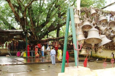 The Tilinga Mandir, literally meaning the Bell Temple in Assamese, is a highly revered Lord Shiva temple located in Bordubi, a small town near Tinsukia in Upper Assam. The temple is renowned worldwide for the extraordinary number of bells, in various shapes, sizes, and metals like brass, copper, and aluminum, that are tied to a gigantic Peepal (Banyan) tree within the complex and also hung around the temple premises. The temple is nearly half a century old, with its origin tracing back to 1965. Legend states that tea garden workers in the area observed a Shiva Lingam naturally emerging from the ground near the Peepal tree. This divine occurrence led the local administrators to construct a small temple at the site. The unique tradition of offering bells stems from a strong local belief. Devotees come here to pray to Lord Shiva for the fulfillment of a wish, and upon the wish being granted, they return to tie a bell (tilinga) to the tree or the temple structure as a token of gratitude and answered prayer. Alongside bells, devotees also frequently offer trishuls (Lord Shiva's trident) or pigeons. The continuous stream of offerings has led to an incredible collection of bells, making it a unique and spiritually captivating site. Some bells weigh as little as 50 grams while others can be as heavy as 55 kilograms. This vast collection has earned the temple a mention in the Limca Book of World Records for hosting the largest number of bells. The temple environment is serene, surrounded by the lush green expanse of tea gardens, offering a tranquil escape for spiritual seekers and tourists alike. The mystical power attributed to the temple and the visual spectacle of the thousands of bells make it a must-visit destination in Tinsukia.
 The Stilwell Road, originally known as the Ledo Road, is a historic highway built during World War II. It starts from Ledo in Assam and was designed to connect British India with Kunming, China, to supply the Allied forces. The road was built under the direction of General Joseph Stilwell and is a testament to the extreme sacrifices made by soldiers and laborers. It is often called the "Man-a-Mile Road" because of the high number of lives lost during its construction through treacherous jungles and mountains. The Ledo portion marks the beginning of this 1,736 KM long route. Today, it stands as a significant historical monument and a symbol of international cooperation during the war. Traveling along this road feels like a journey back in time, with old bridges and milestones still visible. The surrounding landscape of dense forests and tea gardens adds a dramatic backdrop to this historical route. It is a must-visit for history buffs and those interested in the military history of the South East Asian theater.
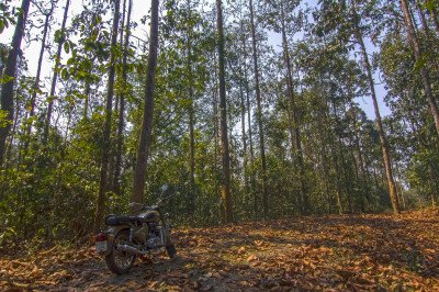 Dehing Patkai National Park is a sprawling sanctuary often referred to as the "Amazon of the East" due to its dense, multi-layered rainforest canopy and immense biodiversity. Spanning over 231.65 square kilometers, this park is the only patch of virgin lowland rainforest in India. It was upgraded to a National Park in June 2021 and is a critical part of the Dehing Patkai Elephant Reserve. The forest is characterized by giant Hollong trees, which are the state trees of Assam, reaching heights of over 50 meters. The ecosystem is incredibly complex, supporting a wide range of life forms from tiny orchids to the majestic Royal Bengal Tiger. It is also home to seven different species of wild cats, including the Clouded Leopard and the Marbled Cat. The park acts as a vital corridor for elephant migration and is a haven for primate species like the Western Hoolock Gibbon. Visitors can witness the raw beauty of nature, where the air is thick with the scent of wild flowers and the sound of exotic birds. The park’s geography is marked by the Dehing River flowing through it, creating a picturesque landscape that changes with the seasons. Historically, it was identified in the 1980s as a significant primate habitat and has since become a global site for the White-winged Wood Duck. The indigenous communities surrounding the park, such as the Tai Phake and Singpho, add a rich cultural layer to the experience. Exploring this park is not just a wildlife tour but a journey into one of the most carbon-dense forests in the world. :
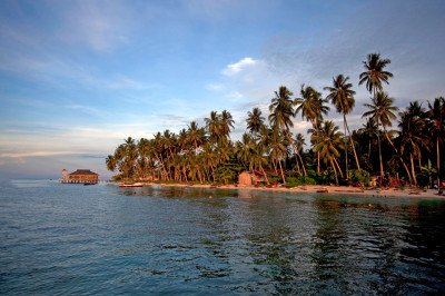 Rukmini Island, locally known as Rukmini Chapori, is a picturesque river island nestled in the mighty Brahmaputra River in Assam. The word 'Chapori' in Assamese refers to a sandbar or a small river island. This natural retreat offers a tranquil escape from the noise of city life, characterized by its lush greenery, vast sandbanks, and the calming flow of the river. It's a relatively untouched spot, and the minimal human intervention has helped maintain the sanctity of its delicate riverine ecosystem. The island is famed for its rich biodiversity, particularly its avian life, making it a paradise for ornithologists and nature lovers. It’s also known for the occasional sighting of the endangered Ganges River Dolphin. The name Rukmini is linked to local folklore, possibly deriving from a character in the Hindu epic Mahabharata, highlighting the region's deep cultural connections. Visitors mainly come here for picnicking, leisurely walks on the sandy beaches, and soaking in the undisturbed natural beauty. The experience offers a unique glimpse into the unhurried pace of life along the great river. Being a dynamic riverine island, its shape and size can slightly change with the seasonal flow of the Brahmaputra, especially during the heavy monsoon season, which adds to its enigmatic character. The island embodies the raw, untamed natural splendor of Northeast India. The local communities living nearby often practice traditional fishing and agriculture, offering a unique cultural experience to tourists.
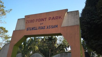 Ledo is a small but historically significant town in the Tinsukia district, famous for being the easternmost point of the Indian Railways network. For many years, it held the title of the "Last Station of the East." Like its neighbor Lekhapani, Ledo is inseparable from the history of World War II. It served as the primary logistics hub for the Allied forces’ Burma Campaign. The town is the actual birthplace of the Ledo Road (Stilwell Road), where General Joseph Stilwell oversaw the beginning of the monumental project to bypass the Japanese-occupied Burma Road. Today, Ledo is also known for its rich coal deposits and the Ledo Colliery, which was one of the earliest coal mines in India. The town has a rugged, industrial charm with old steam-era infrastructure still visible in parts of the railway yard. The landscape is a mix of coal mine scars, lush tea gardens, and the rising foothills of the Patkai Range. For travelers, Ledo is the jumping-off point for more adventurous journeys into Arunachal Pradesh and toward the Pangsau Pass on the Myanmar border. The town’s culture is a fascinating blend of Assamese, Bengali, and various tribal communities like the Singpho and Tangsa. Visiting Ledo feels like standing on the edge of the frontier. The sight of coal-laden trucks and local trains creates an atmosphere of a town that has been working hard for over a century. It is also a place where you can find unique Singpho architecture and traditional rice-based cuisine. The nearby Tikak Colliery offers a panoramic view of the entire valley, which is a favorite for visitors. Ledo remains a symbol of resilience, both for its wartime role and its continued importance as an energy hub for the nation. :Show All
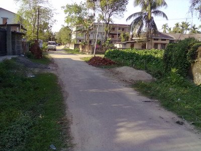 Thana Chariali serves as the bustling heart and central commercial hub of Tinsukia town in Upper Assam. The name literally translates to "Police Station Chowk/Junction," derived from "Thana" (Police Station) and "Chariali" (a four-way junction in Assamese). This busy intersection is where the pulse of the town is most palpable, acting as the primary point of convergence for trade, transport, and daily civic life. It is not a traditional tourist monument but an essential landmark that defines the town's geography and economy. The area is characterized by a high density of shops, banks, government offices, commercial complexes, and food establishments. It perfectly showcases the urban life of a major commercial town in Assam. The continuous movement of vehicles—from local auto-rickshaws (known as Totos or Vikrams) to buses and trucks—underscores its strategic importance as a transit corridor connecting different parts of the district. For any visitor trying to navigate Tinsukia, Thana Chariali is the undisputed reference point. The immediate vicinity includes institutions like the main police station, various corporate offices, and older established businesses, giving it a blend of civic authority and commercial enterprise. While many other spots in the district offer natural beauty or historical ruins, Thana Chariali offers a look into the vibrant, modern-day economic engine of Tinsukia, making it a cultural experience in its own right. It is particularly lively during the evenings when the markets are most active, and the junction lights up, providing a stark contrast to the surrounding quiet tea gardens and natural reserves that Tinsukia is also famous for.
Information
-
Why Famous:
Biodiversity Hotspot: It is the gateway to Dibru-Saikhowa National Park, famous for its Feral Horses and over 300 species of birds.
Oil and Tea Heritage: The region is home to Digboi, the site of Asia's first oil well, and produces some of t...Biodiversity Hotspot: It is the gateway to Dibru-Saikhowa National Park, famous for its Feral Horses and over 300 species of birds.
Oil and Tea Heritage: The region is home to Digboi, the site of Asia's first oil well, and produces some of the finest Assam Tea globally.
World War II History: The presence of the Stilwell Road and War Cemeteries makes it a significant site for historical researchers and enthusiasts. -
Architecture:
Regional Architectural Heritage: The architecture in Tinsukia reflects a mix of Mottock dynasty monuments and British colonial influences seen in the iconic tea estate bungalows.
Ancient Monuments: The Na-Pukhuri complex features a central t...Regional Architectural Heritage: The architecture in Tinsukia reflects a mix of Mottock dynasty monuments and British colonial influences seen in the iconic tea estate bungalows.
Ancient Monuments: The Na-Pukhuri complex features a central tank covering 11. 75 acres, surrounded by eight smaller ponds, showcasing advanced ancient hydraulic engineering.
Industrial and Colonial Structures: The Digboi area nearby features classic Assamese-British "Chang Bunglows" which are raised on stilts, typically measuring 2000 to 3000 sq ft, designed to withstand heavy rainfall and maintain ventilation. -
How To Reach:
By Air: The closest airport is Dibrugarh Airport (Mohanbari), situated about 40 KMS away, with regular flights from Delhi, Kolkata, and Guwahati.
By Train: Tinsukia Junction and New Tinsukia Junction are major railway stations connecting the...By Air: The closest airport is Dibrugarh Airport (Mohanbari), situated about 40 KMS away, with regular flights from Delhi, Kolkata, and Guwahati.
By Train: Tinsukia Junction and New Tinsukia Junction are major railway stations connecting the city to all parts of India via the North East Frontier Railway.
By Road: Tinsukia is accessible via National Highway 37, with regular luxury and state buses plying from Guwahati, Jorhat, and Itanagar.
By Local Transport: To get around the city and nearby towns, one can use shared "Magic" vans, auto-rickshaws, and private rental cars which are widely available. -
Weather and Best Time to Visit:
Winter Season: The months of October to March are ideal for wildlife safaris and birdwatching, as the weather is dry and pleasant.
Spring Season: In April, the region celebrates Bohag Bihu, offering a chance to see the traditional dance and ...Winter Season: The months of October to March are ideal for wildlife safaris and birdwatching, as the weather is dry and pleasant.
Spring Season: In April, the region celebrates Bohag Bihu, offering a chance to see the traditional dance and culture in the tea gardens.
Time of Day: Sunrise is the best time for visiting the national park, while the late evening is perfect for shopping in the local Tinsukia markets. -
Near Tourist Places:
1. Dibru-Saikhowa National Park (12 KMS), 2. Tilinga Mandir (17 KMS), 3. Digboi Oil Refinery (30 KMS), 4. Maguri Beel (9 KMS), 5. Na-Pukhuri (1 KM), 6. Stilwell Road (45 KMS), 7. Doomdooma Tea Estates (22 KMS), 8. Margherita (40 KMS), 9. Sadiya (50 KMS), 10. Dehing Patkai Wildlife Sanctuary (26 KMS)
Tourism Tips
-
Health & Safety: Always carry mosquito repellent when visiting the national park and wear sturdy boots to protect against leeches during treks.
Packing Essentials: Bring a good pair of binoculars for birdwatching and a lightweight jacket as ...Health & Safety: Always carry mosquito repellent when visiting the national park and wear sturdy boots to protect against leeches during treks.
Packing Essentials: Bring a good pair of binoculars for birdwatching and a lightweight jacket as temperatures can drop during the winter nights.
Accommodation: Consider staying in a traditional Tea Garden Bungalow for a unique colonial experience or choose from various budget hotels in the city.
Permit Requirements: If planning to visit nearby Arunachal Pradesh, ensure you have your Inner Line Permit (ILP) ready, which can be processed in Tinsukia.
Reviews
FAQs
Tinsukia Itineray And Cost:-
Information about New and Updated Locations() of Assam Has Been Added :-
Card subtitle
Note:-
Information provided here in good Faith and for reference only.
Near Places
Agnigarh
Some quick example text to build on the card title and make up the bulk of the card's content.
Go somewhere
Barpeta
Some quick example text to build on the card title and make up the bulk of the card's content.
Go somewhere
Bhalukpong
Some quick example text to build on the card title and make up the bulk of the card's content.
Go somewhere
Diphu
Some quick example text to build on the card title and make up the bulk of the card's content.
Go somewhere
Goalpara
Some quick example text to build on the card title and make up the bulk of the card's content.
Go somewhere
Guwahati
Some quick example text to build on the card title and make up the bulk of the card's content.
Go somewhere
Haflong
Some quick example text to build on the card title and make up the bulk of the card's content.
Go somewhere
Hajo
Some quick example text to build on the card title and make up the bulk of the card's content.
Go somewhere
Majuli Island
Some quick example text to build on the card title and make up the bulk of the card's content.
Go somewhere
Nagaon
Some quick example text to build on the card title and make up the bulk of the card's content.
Go somewhere
Silchar
Some quick example text to build on the card title and make up the bulk of the card's content.
Go somewhere
Sualkuchi
Some quick example text to build on the card title and make up the bulk of the card's content.
Go somewhere
Tezpur
Some quick example text to build on the card title and make up the bulk of the card's content.
Go somewhere
Tinsukia
Some quick example text to build on the card title and make up the bulk of the card's content.
Go somewhere
Umananda Island
Some quick example text to build on the card title and make up the bulk of the card's content.
Go somewherein Other Cities