...

Place To Visit And Things To Do In Lachen

Sikkim, India
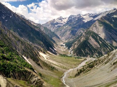
The Village Life: Lachen is a remote high-altitude village that serves as the base for the sacred Gurudongmar Lake. The town is inhabited by the Lachenpa community who follow a unique administrative system called Dzumsa. The atmosphere here is deeply serene with wooden homes, narrow alleys, and pray er flags fluttering in the mountain breeze. It is a place where time seems to slow down significantly. Natural Splendor: The region is surrounded by snow-capped peaks and thick alpine forests. During the winter, the entire landscape is covered in a thick blanket of snow, making it a wonderland for adventure seekers. In the summer, the valley transforms into a vibrant canvas of wildflowers and rhododendrons. The air is crisp and carries the fragrance of pine needles. Cultural Heritage: The local culture is a blend of Tibetan and Sikkimese traditions. Visitors can witness the traditional lifestyle of the nomadic yak herders during certain seasons. The Lachen Monastery stands as a testament to the spiritual roots of this high-altitude settlement. The people are known for their warm hospitality and simple way of living. Gateway to Heights: It is the primary starting point for treks and excursions to the northernmost parts of India. Being close to the Indo-China border, it remains a sensitive and pristine zone. The lack of modern commercialization keeps the natural beauty intact and authentic. It is an essential stop for anyone wishing to explore the rugged beauty of the North.

Things To Do

Card image cap
Chopta Valley

Chopta Valley is a high-altitude alpine meadow famed for its stunning biodiversity, especially during the spring when the valley floor transforms into...

Chopta Valley is a high-altitude alpine meadow famed for its stunning biodiversity, especially during the spring when the valley floor transforms into a colorful carpet of rhododendrons, primulas, and other wildflowers. It serves as a summer residence for the nomadic Lachenpas and marks the last stretch of lush greenery before the cold desert terrain towards Gurudongmar Lake. It offers breathtaking panoramic views of snow-capped Himalayan peaks and is crisscrossed by clear, meandering mountain rivers and streams. The untouched, pristine environment provides immense tranquility, making it a perfect spot for nature lovers and photographers. Due to its strategic location on the border route, a special Inner Line Permit (ILP) is mandatory for visitors, ensuring the area remains relatively secluded and less commercially exploited than other tourist spots in Sikkim. It is also the starting point for several challenging treks into the high-altitude valleys of North Sikkim, like Muguthang Valley. The crisp, clean mountain air and the sheer scale of the surrounding mountains contribute to its unforgettable charm. The natural ecosystem supports unique Himalayan fauna, including the Red Panda and various high-altitude bird species, though spotting them requires patience and luck. The change in landscape from rhododendron forests to rugged, open plains is a geological wonder to behold, making the journey as rewarding as the destination itself.:
Card image cap
Dzongu Valley

Dzongu Valley is an official reserve for the Lepcha tribe, the original inhabitants of Sikkim. Nestled in the foothills of Kanchenjunga, it offers a ...
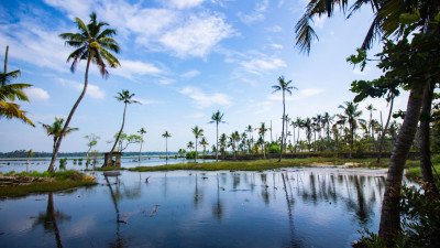
Dzongu Valley is an official reserve for the Lepcha tribe, the original inhabitants of Sikkim. Nestled in the foothills of Kanchenjunga, it offers a window into a world where life remains slow and deeply connected to nature. The valley is divided into Upper and Lower Dzongu, each with its own distinct charm and landscapes. It is a restricted area, ensuring the preservation of the Lepcha culture and the pristine environment of the Kanchenjunga National Park. Visitors can explore lush forests, sparkling waterfalls, and traditional villages like Passingdang and Tingvong. The valley is a paradise for those seeking solitude and an authentic tribal experience away from mass tourism. It is where mythical legends of the Lepchas come to life amidst the misty mountains.
Card image cap
East Upper Gurudongmar Lake

The East Upper Gurudongmar Lake refers to the area or viewpoint on the higher eastern periphery of the main Gurudongmar Lake complex, often used to de...

The East Upper Gurudongmar Lake refers to the area or viewpoint on the higher eastern periphery of the main Gurudongmar Lake complex, often used to denote the highest accessible plateau viewpoint near the main lake, or sometimes, the area towards the actual source/feeder stream. Due to its extreme altitude (above the main lake's 17,100 ft) and proximity to the international border, access is highly restricted, often entirely forbidden for civilian tourists, especially foreigners, and requires even more specific permits than the main lake. This area is characterized by an even more desolate, stark, and awe-inspiring landscape—a cold, saffron-colored high-altitude desert plateau ringed by immense, snow-covered peaks like Mount Gurudongmar and Mount Khangchengyao. It offers a truly unparalleled, panoramic, and more 'above-it-all' view of the main lake and the surrounding majestic mountain ranges, but the risks of Acute Mountain Sickness (AMS) are extremely high. The air is thin, and the temperature is perpetually freezing, cementing its status as an adventure for only the most determined and well-acclimatized travelers, often only accessible after a brief, permitted extension from the main lake. It is a place of profound silence, spiritual energy, and raw, untamed Himalayan nature, representing the ultimate northern frontier for tourists in Sikkim.:
Card image cap
Green Lake Trek Start Point

The Green Lake Trek is one of the most prestigious and challenging treks in Sikkim, starting from the small hamlet of Zema near Lachen. This trek lea...

The Green Lake Trek is one of the most prestigious and challenging treks in Sikkim, starting from the small hamlet of Zema near Lachen. This trek leads to the base of Mt. Kanchenjunga, specifically the Green Lake, which sits at an altitude of over 5,000 meters. The starting point at Zema is where the Zemu Chu and Thangu Chu rivers meet, creating a dramatic landscape of rushing water and rocky terrain. From here, trekkers enter the dense rhododendron and alpine forests of the Khangchendzonga National Park. The trail is known for its incredible biodiversity, including rare orchids and the elusive Red Panda. It is a route for serious adventurers, requiring high-altitude permits and physical fitness. The journey from the start point takes you through camps like Tallem, Jakthang, and Yabuk before reaching the final destination.
Card image cap
Gurudongmar Lake

Gurudongmar Lake is one of the highest lakes in the world and, arguably, the most famous and sacred site in North Sikkim. Located at a breathtaking al...

Gurudongmar Lake is one of the highest lakes in the world and, arguably, the most famous and sacred site in North Sikkim. Located at a breathtaking altitude of 17,100 feet on a high plateau, it is revered by Buddhists, who associate it with Guru Padmasambhava (Guru Rinpoche), and by Sikhs, who associate it with Guru Nanak Dev Ji. The journey from Lachen is long and arduous, passing through desolate high-altitude desert landscapes, but the sight of the turquoise-blue, crystal-clear water surrounded by massive, snow-capped mountains like Mount Kanchengyao and Mount Gurudongmar is profoundly rewarding. The most unique feature is the belief that a small section of the lake remains unfrozen even in the harshest winter, a miracle attributed to Guru Padmasambhava's touch, providing water to the local populace and attracting pilgrims. Due to its extreme altitude and proximity to the international border, access is strictly regulated by the Indian Army, requiring an Inner Line Permit (ILP) and an extremely early morning start from Lachen. The air is thin, the cold is intense, and visits must be brief, making it a challenging but unforgettable spiritual and natural adventure.:
Card image cap
Hot Springs

The region surrounding Lachen and its sister town Lachung is geologically active, leading to several natural hot springs. While the most famous and ac...

The region surrounding Lachen and its sister town Lachung is geologically active, leading to several natural hot springs. While the most famous and accessible hot springs are actually located in the Yumthang Valley near Lachung (approx. 2.5 hours drive from Lachen via Chungthang), they are often grouped together in North Sikkim tours. These springs are natural geothermal vents that release water rich in sulphur, believed by locals and visitors alike to possess significant medicinal and healing properties, particularly for skin and joint ailments. The area around the springs is serene, often featuring a small, basic hut and a separate pool for bathing, reached after a short, picturesque walk across a pedestrian bridge over the icy river, surrounded by vast meadows and towering, snow-dusted mountains. The contrast of the hot, therapeutic water with the cold, crisp mountain air makes the experience profoundly invigorating. The simplicity of the site emphasizes the raw, natural energy of the Himalayas. Visiting this spot is a key part of the Yumthang Valley experience, providing a relaxing, restorative break amidst a landscape of incredible beauty. Visitors must be prepared for basic, non-luxurious facilities, focusing instead on the natural wonder of the hot water emerging in the cold high-altitude environment.:
Card image cap
Kabi Longstok

Kabi Longstok is a site of immense historical and cultural significance located on the way to Lachen from Gangtok. It marks the spot where a historic...

Kabi Longstok is a site of immense historical and cultural significance located on the way to Lachen from Gangtok. It marks the spot where a historic treaty of "Blood Brotherhood" was signed between the Lepcha chief Thekong Tek and the Bhutia chief Khye Bumsa in the 13th century. This event is considered the foundational moment of ethnic harmony in Sikkim, bringing together the indigenous people and the Tibetan settlers. The site is located within a dense, sacred grove of ancient trees, creating a somber and spiritual atmosphere. Stone pillars were erected here to commemorate the oath, and today, life-size statues of the two chieftains stand as a testament to their peace. It is a mandatory stop for history buffs and those who want to understand the socio-political roots of the Sikkimese people. The surrounding forest is also rich in avian life and exotic plants.
Card image cap
Kalapatthar

Kalapatthar (meaning 'Black Rock') in North Sikkim is a spectacular, high-altitude viewpoint situated at an elevation of around 15,500 feet, making it...

Kalapatthar (meaning 'Black Rock') in North Sikkim is a spectacular, high-altitude viewpoint situated at an elevation of around 15,500 feet, making it a higher and more snow-covered destination than its neighbor, Chopta Valley. It is one of the more recently developed and accessible tourist spots on the route to Gurudongmar Lake, known primarily for its distinctive dark, volcanic rocks (the 'black rock') that stand in dramatic contrast against the perennial white snowscape. The road up to Kalapatthar is extremely rough and challenging, requiring a dedicated 4x4 vehicle and a special permit, but the reward is a landscape that is almost always covered in snow, even in the summer months. It is less crowded than Chopta or the main lake area and provides a profound sense of isolation and proximity to the enormous Himalayan peaks. The site offers incredible panoramic views of the surrounding mountains, providing a truly raw, high-altitude, and mesmerizing experience, often feeling like a 'mini-desert' of rock and snow. The black and white landscape makes it a favorite for stark, dramatic photography.:
Card image cap
Kanchenjunga View Point

The Kanchenjunga View Point in Lachen offers one of the most breathtaking and unobstructed views of the world’s third-highest peak. Unlike viewpoin...
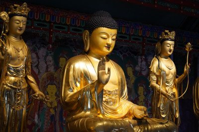
The Kanchenjunga View Point in Lachen offers one of the most breathtaking and unobstructed views of the world’s third-highest peak. Unlike viewpoints in lower regions, here you feel remarkably close to the massif. On a clear day, the entire range, including Mt. Siniolchu, is visible, glowing in shades of gold and pink during sunrise. The viewpoint is a simple, elevated platform located just a short drive from the main Lachen village. It serves as a perfect introduction for travelers heading further north toward Gurudongmar Lake. The air here is thin and crisp, and the silence of the mountains is only broken by the fluttering of colorful prayer flags. It is a place of profound beauty that humbles every visitor with the scale of the Himalayas. Many tourists gather here in the early hours of the morning to witness the "golden hour" when the first rays of sun touch the snow-capped summits.
Card image cap
Lachen

Lachen, meaning 'Big Pass,' is a quaint, high-altitude mountain town and the administrative headquarters for this part of North Sikkim. Perched at an ...

Lachen, meaning 'Big Pass,' is a quaint, high-altitude mountain town and the administrative headquarters for this part of North Sikkim. Perched at an elevation of 9,600 feet, it is strategically located near the confluence of the Lachen and Lachung Rivers, which eventually feed the mighty Teesta. It serves as the mandatory overnight base camp for all tourist excursions to the spectacular Gurudongmar Lake, Kalapatthar, and Chopta Valley. The town is characterized by traditional Tibetan-style wooden houses, small eateries, and a peaceful, unhurried pace of life. It is home to the indigenous Lachenpa community, who have a unique, traditional self-governance system called the Dzumsa. The town offers basic but comfortable accommodation (hotels and homestays), making it a crucial acclimatization stop for travelers heading to the extreme altitudes further north. The main attractions in the town are the Lachen Monastery and the stunning views of the surrounding mountains and the deep gorge of the Lachen Chu river. It is a place of transition, where the subtropical forests of lower Sikkim give way to the desolate, high-altitude plains of the north, and its authentic culture offers a fascinating glimpse into Himalayan life.:
Card image cap
Lachen Monastery

Lachen Monastery, also known as Ngodub Choling Gompa or Lachen Gompa, is an ancient and serene Buddhist monastery belonging to the Nyingma sect of Tib...

Lachen Monastery, also known as Ngodub Choling Gompa or Lachen Gompa, is an ancient and serene Buddhist monastery belonging to the Nyingma sect of Tibetan Buddhism, picturesquely situated on a small hillock that offers a commanding view of the entire Lachen town and the surrounding valley. It was founded in 1858 AD by Lama Karchen Dorje Drak, making it one of the oldest and most historically significant monasteries in North Sikkim. The monastery is dedicated primarily to Guru Padmasambhava (Guru Rinpoche), who is revered as the founder of Tibetan Buddhism. The main structure features classic, vibrant Tibetan architecture with colorful murals, ornate wooden carvings, and a beautiful collection of ancient scriptures, religious artifacts, and statues. It serves as the spiritual heart of the Lachenpa community, playing a crucial role in their religious and cultural life. It also houses a monastic school, preserving and passing on the traditional knowledge and spiritual practices of the region. The peaceful, spiritual atmosphere, combined with the stunning natural backdrop of forested mountains and the Lachen Chu river gorge, makes it a tranquil and mandatory stop for all visitors to Lachen.:
Card image cap
Lachen River Bed

@@Geographical Significance: The Lachen River is a vital tributary of the Teesta River, one of Sikkim's major waterways. It originates from the high-a...
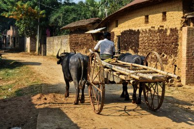
@@Geographical Significance: The Lachen River is a vital tributary of the Teesta River, one of Sikkim's major waterways. It originates from the high-altitude glaciers and snowmelt near the Indo-China border, flowing southward through the lush Lachen Valley. The river's course is characterized by a rocky, boulder-strewn bed, creating a dynamic and powerful stream. @@Ecological Role: Its crystal-clear, icy waters support unique high-altitude flora and fauna. The river bed itself is a constantly shifting landscape of smooth, grey, and white pebbles, contrasting sharply with the surrounding green slopes and alpine forests. It acts as the lifeline for the nomadic Lachenpa community. @@River's Journey: The river flows past the main settlement of Lachen, which is its namesake, and continues its journey until its confluence with the Lachung River at Chungthang, where the main Teesta River begins. The sheer force and sound of the water are defining characteristics of the region, embodying the raw, untouched beauty of the Eastern Himalayas.
Card image cap
Lachen Village

Lachen Village is a high-altitude settlement situated at an elevation of 2,750 meters. It serves as the base for the world-famous Gurudongmar Lake an...

Lachen Village is a high-altitude settlement situated at an elevation of 2,750 meters. It serves as the base for the world-famous Gurudongmar Lake and Chopta Valley tours. The village is inhabited by the Lachenpa community, a distinct Bhutia tribe that follows a unique traditional administrative system called the 'Dzumsa'. The village is characterized by its old wooden houses, narrow winding lanes, and a vibrant monastery overlooking the valley. Life here is regulated by the seasons; in winter, many residents move to lower altitudes, while in summer, the village bustles with tourists and alpine farming. It is a place of stark, raw beauty where the mountains seem to close in on all sides. The hospitality of the local people, coupled with the rugged landscape, makes Lachen an unforgettable destination for any traveler venturing into North Sikkim.
Card image cap
Lhonak Valley

@@Geographical Details: Often confused or associated with Muguthang Valley, Lhonak is a remote, high-altitude valley situated at an elevation of aroun...

@@Geographical Details: Often confused or associated with Muguthang Valley, Lhonak is a remote, high-altitude valley situated at an elevation of around 4,400 meters (14,430 feet). It is a unique trans-Himalayan grassland, part of the arid zone that borders the Tibetan Plateau. @@Ecology and Terrain: The landscape is stark and beautiful, featuring boggy marshes, glacial lakes (like Samiti Lake), barren scree slopes, and the source of the Teesta River (via Lhonak Chu). The vegetation is minimal, consisting primarily of cold-resistant grasses and mosses. @@Military Proximity: Due to its extreme proximity to the Indo-China border, the entire region is under strict military vigilance, making tourist access highly restricted and requiring multiple special permits. This remoteness preserves its pristine nature.
Card image cap
Muguthang Valley

@@Valley Overview: Situated at an elevation of around 4,570 meters (15,000 feet), Muguthang is a stunning, flat-bottomed high-altitude valley that ser...

@@Valley Overview: Situated at an elevation of around 4,570 meters (15,000 feet), Muguthang is a stunning, flat-bottomed high-altitude valley that serves as a key grazing ground for the nomadic yak herders of Lachenpa. It is less known than the route to Gurudongmar Lake, giving it a more secluded feel. @@The Landscape: The valley floor is wide and open, crisscrossed by snow-fed mountain streams and surrounded by massive, snow-capped peaks. The vegetation is sparse, dominated by alpine shrubs, mosses, and hardy grasses, reflecting its extreme climate. @@Gateway to Treks: It is a critical stopover and acclimatization point for those undertaking longer, strenuous treks towards the Lhonak Valley and other remote border areas. Access is strictly controlled by the Indian Army.
Card image cap
Phodong Monastery

The Phodong Monastery is a premier Buddhist institution located in the serene hills of North Sikkim. Founded in the early 18th Century by Chogyal Gyu...

The Phodong Monastery is a premier Buddhist institution located in the serene hills of North Sikkim. Founded in the early 18th Century by Chogyal Gyurmed Namgyal, it stands as one of the six most significant monasteries in the state. The monastery belongs to the Kagyu sect of Tibetan Buddhism and serves as a major center for spiritual learning and community gathering. Historically, it was the first Kagyupa monastery in Sikkim before the establishment of Rumtek. The current structure was rebuilt in 1977 after the original was damaged by an earthquake, yet it retains its ancient soul through preserved murals and sacred relics. It houses nearly 260 resident monks who dedicate their lives to prayer and ritual. The monastery is perched at an altitude of 4,500 Feet, offering a commanding view of the deep valleys and the winding Teesta river below. Visitors often find the atmosphere deeply meditative, filled with the scent of incense and the rhythmic sound of chanting. The monastery also played a role in international history, being the place where the famous French explorer Alexandra David-Neel studied Buddhism in the early 1912. Exploring the halls provides a deep dive into the religious fabric of the Himalayan region, where every corner tells a story of faith and resilience. It is an essential stop for anyone traveling toward the high-altitude terrains of Lachen.
Card image cap
Purni Point

@@Trek Route Significance: Purni Point, also known as Dokung, is a known rest point or viewpoint on the arduous and scenic trek towards the Green Lake...

@@Trek Route Significance: Purni Point, also known as Dokung, is a known rest point or viewpoint on the arduous and scenic trek towards the Green Lake Base Camp and the Zemu Glacier snout. It is located at a considerable altitude, possibly around 3,800-4,000 meters (12,500 - 13,100 feet). @@The Environment: The surrounding area is characterized by dense rhododendron forests and mixed alpine vegetation, gradually giving way to rockier, more exposed terrain as one ascends. It offers the first major views of the massive mountain ramparts that feed the glacier. @@Acclimatization Spot: It serves as an excellent spot to pause and acclimatize, providing relief from the steep initial climb after the trek begins from the road head near Zema.
Card image cap
Samdong

Samdong is a small, picturesque alpine hamlet situated at a high altitude on the route between Lachen and the Thangu Valley. Often overlooked by tour...

Samdong is a small, picturesque alpine hamlet situated at a high altitude on the route between Lachen and the Thangu Valley. Often overlooked by tourists rushing toward Gurudongmar Lake, it serves as a vital transition point where the landscape shifts from lush greenery to rugged Himalayan terrain. The village is characterized by its stone-walled houses, small potato patches, and the sound of the nearby Lachen Chu river. At an elevation of nearly 9,000 Feet, the air here is crisp and thin, providing a true mountain experience. Historically, Samdong has been a seasonal settlement for the Lachenpa community, who move their livestock here during the warmer months. The village offers a rare glimpse into the traditional lifestyle of North Sikkim, where people live in harmony with the harsh elements. The surrounding mountains are often capped with snow, even in late spring, creating a dramatic backdrop for the colorful prayer flags that flutter in the wind. It is a place of immense silence, broken only by the bells of passing yak caravans or the whistle of the wind through the pines. For travelers, Samdong is a perfect spot to pause, acclimatize, and soak in the raw beauty of the North Sikkim wilderness. It represents the "Old Sikkim" that remains untouched by mass commercialization, making it a sanctuary for nature lovers and those seeking solitude.
Card image cap
Singhik

Singhik is a small, picturesque village located just 4 KMS from the district headquarters of Mangan and serves as a major transit point for travelers...

Singhik is a small, picturesque village located just 4 KMS from the district headquarters of Mangan and serves as a major transit point for travelers heading to Lachen. It is globally renowned for its spectacular views of Mt. Kanchenjunga and Mt. Siniolchu. The village is perched on a ridge, offering a vantage point where one can see the convergence of the Teesta and Kanaka rivers thousands of feet below. Singhik provides a much more intimate look at the mountain ranges compared to the viewpoints in Gangtok. The atmosphere here is quiet and rustic, with traditional houses and small cardamom plantations dotting the hillsides. It is an ideal spot for a lunch break or an overnight stay to experience the rural Sikkimese lifestyle. The sunrise from Singhik is considered legendary among travelers and photographers.
Card image cap
Singhik View Point

Singhik View Point is widely regarded as one of the most spectacular vantage points in all of Sikkim. Located just a few kilometers from the district...

Singhik View Point is widely regarded as one of the most spectacular vantage points in all of Sikkim. Located just a few kilometers from the district headquarters of Mangan, it offers an unobstructed, breathtaking view of Mount Khangchendzonga and Mount Siniolchu. At an elevation of approximately 5,000 Feet, the viewpoint sits on a sharp ridge that looks directly across the valley toward the massive Himalayan giants. The sight of the sun's first rays hitting the snow-capped peaks, turning them into molten gold, is a spiritual experience for many. Below the viewpoint, one can see the confluence of the Teesta and Kanaka rivers, winding like silver threads through the green carpet of the valley. The area around Singhik is lush with temperate forests and small cardamom plantations, which are the main source of income for the local Lepcha community. Historically, this spot has been the "Gateway to North Sikkim," where travelers stop to catch their breath and witness the grandeur of the mountains they are about to enter. The viewpoint is equipped with a small garden and seating areas, making it a comfortable spot for long contemplation. Unlike the high-altitude points, the weather here remains pleasant for most of the year, allowing for a relaxed viewing experience. It serves as a reminder of the scale and beauty of the Himalayas, providing a perfect introduction to the wonders of the Lachen and Lachung valleys.
Card image cap
Thangu Valley

@@Village and Altitude: Thangu Valley is a quaint, high-altitude hamlet nestled at an elevation of around 3,962 meters (13,000 feet). It is a crucial ...

@@Village and Altitude: Thangu Valley is a quaint, high-altitude hamlet nestled at an elevation of around 3,962 meters (13,000 feet). It is a crucial rest and acclimatization point for travelers heading to the ultra-high altitude regions like Gurudongmar Lake and Tso Lhamo Lake. @@The Climate and Landscape: The valley remains snow-covered for a significant part of the year (October to March). In the late spring (May-June), the snow thaws to reveal stunning alpine meadows carpeted with vibrant wildflowers. It is criss-crossed by several mountain streams like the Chopta Chu and Thangu Chu. @@Community and Security: The area has a visible Indian Army presence due to its strategic location near the Indo-China border. The village is sparsely populated, mainly by nomadic tribes, and features simple wooden houses that often double as small eateries for passing tourists.
Card image cap
Tso Lhamo Lake

@@Geographical Marvel: Located at a staggering altitude of approximately 5,330 meters (17,490 feet), Tso Lhamo Lake (also spelled Cholamoo or Cho Lham...

@@Geographical Marvel: Located at a staggering altitude of approximately 5,330 meters (17,490 feet), Tso Lhamo Lake (also spelled Cholamoo or Cho Lhamo) is recognized as the highest lake in India and one of the highest in the world. @@Source of the Teesta: It is a significant glacial lake, fed by the surrounding snow-capped peaks and glaciers of the Himalayas, and is considered one of the primary sources of the mighty Teesta River. @@The View: The lake offers a mesmerizing, stark, and solemn landscape. It is surrounded by barren, severe, snow-clad mountains, with the lake's crystal-blue waters providing a stunning contrast. The air is extremely thin, and the weather is harsh. @@Security Status: Due to its position just 4-5 KMS from the international border with China (Tibet), this location is highly sensitive, and access is extremely restricted, requiring special permits even beyond the Gurudongmar Lake checkpoint. Foreigners are generally Not Permitted.
Card image cap
Zemu Glacier Trek Base

@@Glacier Significance: The Zemu Glacier is the largest glacier in the Eastern Himalayas, measuring about 26 KMS in length. It lies at the base of Mou...

@@Glacier Significance: The Zemu Glacier is the largest glacier in the Eastern Himalayas, measuring about 26 KMS in length. It lies at the base of Mount Khangchendzonga, the world's third-highest peak. The 'base' refers to the trailhead near Zema village, where the proper trek begins. @@The Trek Environment: The initial part of the trek from Zema is characterized by a gradual ascent through thick, pristine forests of rhododendron, fir, and pine, following the Zemu Chu river. It is a part of the protected Khangchendzonga National Park (KNP). @@Challenge Level: The full trek to the glacier snout (Green Lake) is rated as difficult/strenuous, taking approximately 10-15 days round trip. The base itself is the point of no return for an extended journey.
Show All

Lachen Itineray And Cost:-

Information about New and Updated Locations() of Sikkim Has Been Added :-
Card subtitle

Note:-

Information provided here in good Faith and for reference only.

All information and pictures will be updated soon, please keep visiting.

Near Places
...
Chungthang

Some quick example text to build on the card title and make up the bulk of the card's content.

Go somewhere
...
Gangtok

Some quick example text to build on the card title and make up the bulk of the card's content.

Go somewhere
...
Geyzing

Some quick example text to build on the card title and make up the bulk of the card's content.

Go somewhere
...
Jorethang

Some quick example text to build on the card title and make up the bulk of the card's content.

Go somewhere
...
Lachen

Some quick example text to build on the card title and make up the bulk of the card's content.

Go somewhere
...
Lachung

Some quick example text to build on the card title and make up the bulk of the card's content.

Go somewhere
...
Mangan

Some quick example text to build on the card title and make up the bulk of the card's content.

Go somewhere
...
Namchi

Some quick example text to build on the card title and make up the bulk of the card's content.

Go somewhere
...
Pakyong

Some quick example text to build on the card title and make up the bulk of the card's content.

Go somewhere
...
Pelling

Some quick example text to build on the card title and make up the bulk of the card's content.

Go somewhere
in Other Cities