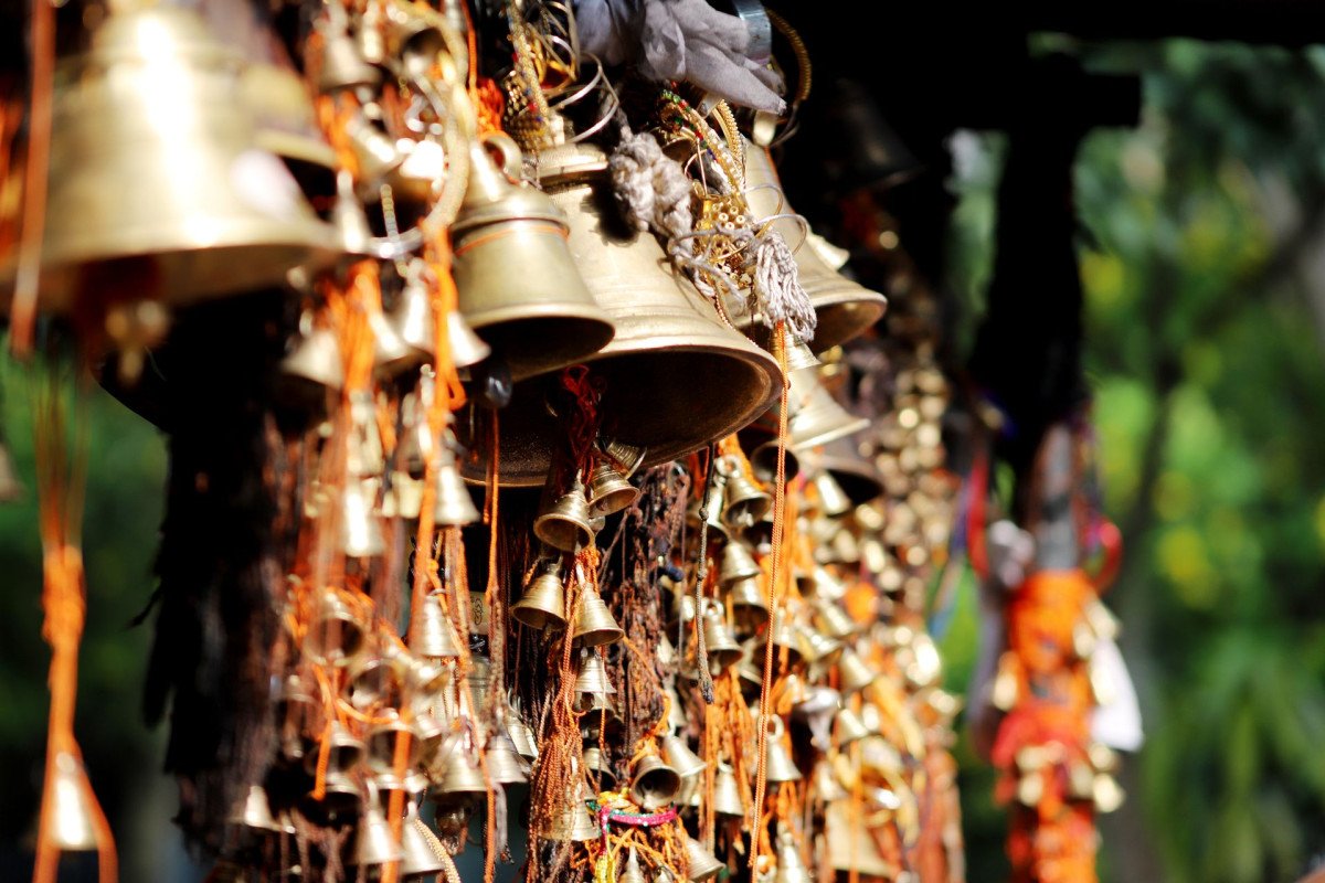
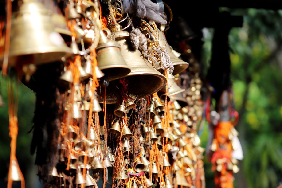
Jwalaji Temple
General information
-
Ideal Duration:
2 to 3 Hours (Excluding Travel to Cloud's End):Place Type:
Pilgrimage Site/Trekking/Viewpoint:Entry Fees:
No Entry Fee: There is absolutely No Entry Fee to visit the temple or the surrounding public land, making the pilgrimage entirely free of charge.
Trek Start Point Fee: Nominal fees may apply if you enter the surrounding Benog Wildlife Sanctu...No Entry Fee: There is absolutely No Entry Fee to visit the temple or the surrounding public land, making the pilgrimage entirely free of charge.
Trek Start Point Fee: Nominal fees may apply if you enter the surrounding Benog Wildlife Sanctuary near Cloud's End (where the trek begins), as it is a protected area.
Donations: Visitors are welcome to make voluntary donations (bheta) at the temple for its maintenance and religious activities, though this is not mandatory.
Guide Fee: Fees will apply if you choose to hire a local guide for the trek from Cloud's End or the village to ensure safety and navigation, which is highly recommended for first-timers.Timing:
Regular Timings: 7:00 AM to 6:00 PM (Daily) or sometimes 5:00 AM to 12:00 PM and 4:00 PM to 8:00 PM (confirm with locals), but the trail should not be attempted after daylight hours.
Ideal Visit Time: The Early Morning (7:00 AM to 10:00 AM) ...Regular Timings: 7:00 AM to 6:00 PM (Daily) or sometimes 5:00 AM to 12:00 PM and 4:00 PM to 8:00 PM (confirm with locals), but the trail should not be attempted after daylight hours.
Ideal Visit Time: The Early Morning (7:00 AM to 10:00 AM) is the best time for a comfortable uphill trek, offering cool air, good light for views, and avoiding midday heat. September to November is the best season for clear visibility.Special Events:
Navratri Festival: The most important annual event, occurring twice a year (typically March-April and September-October), where a large number of devout pilgrims complete the trek to offer prayers and participate in special ceremonies at the shrine.
Read MoreNavratri Festival: The most important annual event, occurring twice a year (typically March-April and September-October), where a large number of devout pilgrims complete the trek to offer prayers and participate in special ceremonies at the shrine.
Local Trekking Competitions: Occasionally, local adventure clubs organize guided, timed trekking and hiking events that use the challenging Benog Hill trail as a competitive or fitness route.Best Photo Spots:
Temple Entrance Arch: A classic photo spot capturing the simple, traditional architecture of the shrine framed against the dramatic backdrop of the sky and the mountain peaks.
The Yamuna Valley Viewpoint: A must-capture panoramic shot of the...Temple Entrance Arch: A classic photo spot capturing the simple, traditional architecture of the shrine framed against the dramatic backdrop of the sky and the mountain peaks.
The Yamuna Valley Viewpoint: A must-capture panoramic shot of the vast, distant Yamuna Valley, best taken on a clear day to highlight the depth and scale of the surrounding Himalayas.
The Deodar Forest Trail: Focus on atmospheric photos of the trekking path itself, capturing the dense, tall Pine and Deodar trees creating a dark, secluded tunnel-like effect, best in filtered morning light.
The Durga Idol: Although often restricted, if allowed, a respectful, well-lit close-up of the ancient stone idol of Goddess Durga in the inner sanctum captures the spiritual heart of the location.Photo Gallery
Things To Do
-
Undertake the Pilgrimage Trek: Begin the required 2 km uphill trek from Cloud's End through the pristine Benog Wildlife Sanctuary forest, taking time to pause and enjoy the challenging but peaceful nature walk.
Seek Blessings at the Shrine: Perform darshan (sacred viewing) of the ancient stone idol of Goddess Durga in the inner sanctum, participating in the quiet rituals of the temple and soaking in the spiritual atmosphere.
Enjoy Panoramic Photography: Spend time at the summit capturing the magnificent, wide-angle views of the entire Doon Valley and the expansive, lush greenery of the Yamuna Valley on the opposite side.
Nature Watching: Combine the pilgrimage with Nature Watching; the trail is part of the Benog Wildlife Sanctuary, offering opportunities to spot...Undertake the Pilgrimage Trek: Begin the required 2 km uphill trek from Cloud's End through the pristine Benog Wildlife Sanctuary forest, taking time to pause and enjoy the challenging but peaceful nature walk.
Seek Blessings at the Shrine: Perform darshan (sacred viewing) of the ancient stone idol of Goddess Durga in the inner sanctum, participating in the quiet rituals of the temple and soaking in the spiritual atmosphere.
Enjoy Panoramic Photography: Spend time at the summit capturing the magnificent, wide-angle views of the entire Doon Valley and the expansive, lush greenery of the Yamuna Valley on the opposite side.
Nature Watching: Combine the pilgrimage with Nature Watching; the trail is part of the Benog Wildlife Sanctuary, offering opportunities to spot Himalayan birds, including possible glimpses of Monals or Kalij Pheasants.
Visit Cloud's End: The trek often starts or ends at Cloud's End, a historic bungalow and a major tourist point that marks the geographical end of Mussoorie's western ridge, which can be explored before or after.
Picnic (limited): Have a small, pre-packed, light snack or water break at the summit or near the trail's base, remembering to carry all waste back, as facilities are minimal.
Meditation and Reflection: The silent, serene atmosphere at the temple and in the surrounding forest is ideal for meditation and quiet personal reflection, away from urban distractions.
Information
-
Why Famous:
The Sacred Trek: Its fame comes from the spiritual journey—the challenging 2 km uphill trek that pilgrims and tourists undertake through the dense Pine and Deodar forest from Cloud's End, symbolizing devotion and commitment.
Location at Benog ...The Sacred Trek: Its fame comes from the spiritual journey—the challenging 2 km uphill trek that pilgrims and tourists undertake through the dense Pine and Deodar forest from Cloud's End, symbolizing devotion and commitment.
Location at Benog Hill: The temple is perched on the summit of Benog Tibba, one of the highest points in the Mussoorie area, making it famous for its incredible, dual-sided views of the Doon Valley and the Yamuna Valley.
Goddess Durga Devotion: It is a major local pilgrimage center dedicated to Jwala Devi (Goddess Durga), drawing significant crowds, especially during the Navratri festival, reinforcing its religious importance. -
Architecture:
Architectural Style and Materials: The temple exhibits a simple, traditional Pahari-style architecture, typical of hill shrines, characterized by a small, stone-built structure with a sloping roof designed to withstand heavy rain and snow.
Dimen...Architectural Style and Materials: The temple exhibits a simple, traditional Pahari-style architecture, typical of hill shrines, characterized by a small, stone-built structure with a sloping roof designed to withstand heavy rain and snow.
Dimension and Layout: The temple is small and intimate, centered around a modest inner sanctum (Garbgriha) where the stone idol of Goddess Durga is housed. The total area of the shrine complex is relatively small compared to temples on the plains, reflecting the limited flat space available at the summit. The key structural elements are the use of local cut stone and a traditional wooden roof structure (often replaced/repaired over time). The path leading up is approximately 2 KM of steep, challenging trail, a crucial 'architectural' dimension of the entire pilgrimage experience.
Surroundings: The temple complex is not guarded by high walls, offering an immediate transition from the dense Deodar forest to the open, breathtaking cliff-edge views. -
How To Reach:
By Air: Fly to Jolly Grant Airport (DED) in Dehradun (approx. 62 km), then hire a taxi to the starting point of the trek, which is usually Cloud's End.
By Train: Take a train to Dehradun Railway Station (DDN) (approx. 37 km from Cloud's En...By Air: Fly to Jolly Grant Airport (DED) in Dehradun (approx. 62 km), then hire a taxi to the starting point of the trek, which is usually Cloud's End.
By Train: Take a train to Dehradun Railway Station (DDN) (approx. 37 km from Cloud's End), and then take a taxi or bus to Cloud's End from Mussoorie's Library Chowk.
By Road: Jwalaji Temple is about 9. 5 km from Mussoorie's Library Chowk. First, drive or take a local taxi to Cloud's End (about 7. 5 km from the Library), and then commence the 2 km uphill trek.
By Local Transport: Local taxis or shared cabs from Mussoorie can be hired to take you to the Cloud's End area, which is the closest motorable point to the temple. -
Weather and Best Time to Visit:
Different Types of Seasons: Summer (April to June) offers the most pleasant trekking conditions. The Post-Monsoon (September to November) is often considered the Best Time to Visit as the weather is cool, the air is clean, and the Himalayan views are often crystal clear. M...Different Types of Seasons: Summer (April to June) offers the most pleasant trekking conditions. The Post-Monsoon (September to November) is often considered the Best Time to Visit as the weather is cool, the air is clean, and the Himalayan views are often crystal clear. Monsoon (July-August) should be avoided due to the steep, slippery, and dangerous trail conditions.
Different Parts of the Day: Early Morning (7:00 AM-10:00 AM) is essential for a safe, comfortable trek and optimal photography. The temple is usually open by 7:00 AM, allowing for peaceful darshan before crowds arrive. -
Near Tourist Places:
1. Cloud's End (0 km, trek starts here), 2. Benog Wildlife Sanctuary (surrounding area), 3. George Everest's House (~8 km), 4. Mussoorie Lake (~10 km), 5. Kempty Falls (~10 km), 6. Library Bazaar (~9. 5 km), 7. Lal Tibba (~18 km), 8. Bhatta Falls (~15 km), 9. Company Garden (~12 km), 10. Gun Hill (~12 km).
Tourism Tips
-
Health & safety: The trek is steep and challenging; carry a trekking pole and wear sturdy hiking shoes; be aware of the risk of snakes and wild animals, especially early morning/late evening.
Packing: Carry enough water (no shops on the 2k...Health & safety: The trek is steep and challenging; carry a trekking pole and wear sturdy hiking shoes; be aware of the risk of snakes and wild animals, especially early morning/late evening.
Packing: Carry enough water (no shops on the 2km trek), light snacks, and a light jacket for the summit's wind; respect temple decorum by dressing modestly (fully covered clothes are advised).
Accommodation: Stay near Cloud's End for the earliest start to the trek, though all Mussoorie accommodations are feasible given a taxi ride to the base.
Other Different Topics heading: The trail is remote; avoid visiting alone; inform your hotel about your trek plans; the temple is a sacred site, so maintain absolute silence and respect the traditions.
Reviews
FAQs
Mussoorie Itineray And Cost:-
Other Places In Mussoorie :-
Other States In India :-
Information about New and Updated Locations() of Uttarakhand Has Been Added :-
Card subtitle
Note:-
Information provided here in good Faith and for reference only.
Near Places

Benog Wildlife Sanctuary
Some quick example text to build on the card title and make up the bulk of the card's content.
Go somewhere
Bhatta Falls
Some quick example text to build on the card title and make up the bulk of the card's content.
Go somewhere
Camel's Back Road
Some quick example text to build on the card title and make up the bulk of the card's content.
Go somewhere
Char Dukan
Some quick example text to build on the card title and make up the bulk of the card's content.
Go somewhere
Christ Church
Some quick example text to build on the card title and make up the bulk of the card's content.
Go somewhere
Cloud's End
Some quick example text to build on the card title and make up the bulk of the card's content.
Go somewhere
Company Garden
Some quick example text to build on the card title and make up the bulk of the card's content.
Go somewhere
George Everest House
Some quick example text to build on the card title and make up the bulk of the card's content.
Go somewhere
Gun Hill
Some quick example text to build on the card title and make up the bulk of the card's content.
Go somewhere
Happy Valley
Some quick example text to build on the card title and make up the bulk of the card's content.
Go somewhere
Himalayan Adventure Park
Some quick example text to build on the card title and make up the bulk of the card's content.
Go somewhere
Jabarkhet Wildlife Reserve
Some quick example text to build on the card title and make up the bulk of the card's content.
Go somewhere
Jharipani Falls
Some quick example text to build on the card title and make up the bulk of the card's content.
Go somewhere
Jwalaji Temple
Some quick example text to build on the card title and make up the bulk of the card's content.
Go somewhere
Kellogg Memorial Church
Some quick example text to build on the card title and make up the bulk of the card's content.
Go somewhere
Kempty Falls
Some quick example text to build on the card title and make up the bulk of the card's content.
Go somewherein Other Cities