

Reiek Tlang Peak
General information
-
Ideal Duration:
3-4 hours (For the trek, plus time at the summit)Place Type:
Nature, Adventure, Trekking, Scenic ViewpointEntry Fees:
Minimal Trekking Fee::There is usually a minimal entry or trekking fee to access the Reiek Tlang Peak trail, often collected at the base near the Tourist Rest House or the Heritage Village. This fee is generally around Rs.20 to Rs.50 per person and is utilized for trail mainten...Minimal Trekking Fee::There is usually a minimal entry or trekking fee to access the Reiek Tlang Peak trail, often collected at the base near the Tourist Rest House or the Heritage Village. This fee is generally around Rs.20 to Rs.50 per person and is utilized for trail maintenance and local conservation efforts.
Fee for Foreign Nationals::Foreign nationals may be subject to a slightly higher entry fee than Indian citizens, which is a standard practice at many Indian tourist sites, though the difference remains relatively small. It is recommended to have small denomination cash for the entrance.
Guide Charges::While the trail is well-marked and a guide is often not mandatory, hiring a local guide is highly recommended, especially for first-timers or if one plans to explore the less-traveled side trails or the Khuangchera Puk (cave). Guide charges vary significantly but are typically an additional Rs.500 to Rs.1000 for a half-day trek.
Parking Fee::If you arrive by private vehicle or taxi, there will be a separate, small parking fee collected at the designated parking area near the base of the mountain and the Heritage Village. These fees support the local infrastructure and management of the area.Timing:
Regular Timings for Trekking::The Reiek Tlang Peak trail itself is technically accessible from sunrise to sunset. The general operational hours for the area (including the Heritage Village) are typically from 9:00 AM to 5:00 PM. For safety reasons, it is strongly advised t...Regular Timings for Trekking::The Reiek Tlang Peak trail itself is technically accessible from sunrise to sunset. The general operational hours for the area (including the Heritage Village) are typically from 9:00 AM to 5:00 PM. For safety reasons, it is strongly advised to start the trek no later than 3:00 PM to ensure you are back at the base before dark.
Ideal Visit Time of Day::The Ideal Visit Time is the very early morning, starting the trek around 5:00 AM to reach the summit just before or during sunrise. This provides the best chances for clear views (before the haze or clouds set in), the coolest temperature for the climb, and the magical experience of watching the sun rise above a blanket of mist. Another excellent time is late afternoon (3:30 PM to 5:00 PM) for sunset views.
Safety Hours for Trail Use::The trail is not recommended for use after sunset. The forests are dense, and the sheer cliff edges pose a serious hazard in low light, making adherence to the prescribed hours critical for personal safety and rescue logistics. Always carry a flashlight for unforeseen delays.Special Events:
Anthurium Festival Trek::While the festival itself is held at the base, it often incorporates a celebratory group trek to the Reiek Tlang Peak as part of the overall festivities. This trek, usually in September or October, is a special event that combines the adventure of t...Anthurium Festival Trek::While the festival itself is held at the base, it often incorporates a celebratory group trek to the Reiek Tlang Peak as part of the overall festivities. This trek, usually in September or October, is a special event that combines the adventure of the climb with the cultural celebration, offering a vibrant atmosphere.
New Year's Day Sunrise Trek::Many local groups and tourists organize a special, early-morning trek to the summit on January 1st to witness the first sunrise of the New Year. This is a special, unofficial cultural event that draws a large crowd seeking a unique and auspicious start to the year amidst the stunning mountain views.
Local Community Clean-up Drives::The local community and tourism groups often organize special clean-up drives or nature walks on the mountain on local holidays or environment days. Participating in these is a unique, meaningful special event that contributes to responsible tourism and allows for a deeper connection with the local environment and people.Best Photo Spots:
The Summit Boulder::The highest point, marked by the large, jutting boulder, is the definitive Best Photo Spot. It offers the quintessential 360-degree panorama, perfect for wide-angle landscape shots, capturing the vastness of the valley, and for iconic, triumphant summit ...The Summit Boulder::The highest point, marked by the large, jutting boulder, is the definitive Best Photo Spot. It offers the quintessential 360-degree panorama, perfect for wide-angle landscape shots, capturing the vastness of the valley, and for iconic, triumphant summit selfies.
The Sheer Cliff Viewpoint::A designated, safe viewpoint near the sheer cliff face (cuesta drop) offers a dramatic photo spot. Shots taken here can highlight the unique geology, contrasting the lush slope with the vertical drop, giving a sense of scale and adventure. Ensure to follow all safety warnings and stay behind railings.
Sunrise Point on the Trail::There are specific clearings on the trail, often at the one-third mark, that are perfect for capturing the sunrise. These spots are ideal for capturing the misty valleys with the sun's first rays filtering through the tree canopy, offering a more atmospheric and soft light shot than the harsh light at the peak itself.
The Forest Canopy Tunnel::The dense, arched sections of the trekking trail where the temperate trees form a natural, dark canopy tunnel are excellent for unique, moody nature photography. These shots emphasize the deep forest cover and the solitude of the hike, creating an enclosed, mysterious contrast to the open peak views.Photo Gallery
Things To Do
-
Trekking to the Summit::Undertake the moderately challenging, yet rewarding, trek to the Reiek Tlang Peak summit. The trail, which is approximately 2-5 KMs one way (depending on the starting point), takes around 1 to 2 hours to complete. The hike through the lush, dense temperate forest provides excellent natural immersion and fresh air.
Panoramic Photography::Engage in landscape and panoramic photography from the summit. The unobstructed 360-degree view of the Mizo Hills, the city of Aizawl, the Tlawng River Valley, and the plains of Bangladesh on clear days offers unparalleled opportunities for stunning scenic shots, especially during sunrise and sunset.
Birdwatching and Nature Spotting::Utilize the dense forests as a haven for birdwatching. Carry binoculars and a field guide to spot unique...Trekking to the Summit::Undertake the moderately challenging, yet rewarding, trek to the Reiek Tlang Peak summit. The trail, which is approximately 2-5 KMs one way (depending on the starting point), takes around 1 to 2 hours to complete. The hike through the lush, dense temperate forest provides excellent natural immersion and fresh air.
Panoramic Photography::Engage in landscape and panoramic photography from the summit. The unobstructed 360-degree view of the Mizo Hills, the city of Aizawl, the Tlawng River Valley, and the plains of Bangladesh on clear days offers unparalleled opportunities for stunning scenic shots, especially during sunrise and sunset.
Birdwatching and Nature Spotting::Utilize the dense forests as a haven for birdwatching. Carry binoculars and a field guide to spot unique local species, including the renowned Peregrine Falcon. The peak's ecosystem is rich, making it an ideal activity for ecologists and nature enthusiasts.
Sunrise and Sunset Viewing::Plan a visit to coincide with the sunrise or sunset. The experience of watching the sun rise above a blanket of mist-filled valleys or set in a blaze of color over the western horizon is a highly recommended and therapeutic activity. This requires an early morning start or an evening stay at the nearby rest house.
Caving at Khuangchera Puk::For the adventurous, explore the nearby Khuangchera Puk (cave). Located close to the mountain's base, this long cave system offers an exciting spelunking experience, provided you carry a good flashlight and adhere to safety guidelines. This activity should only be undertaken with a local guide.
Adventure Sports (Rappelling)::During certain seasons or by pre-arrangement, organized adventure sports activities like rappelling are conducted on the steep rocky cliffs of the peak's sheer side. This provides an adrenaline-pumping way to experience the unique geological structure of the cuesta formation under professional guidance.
Picnicking and Relaxation::Find a spot at the base near the Heritage Village or along the trail's rest points for a relaxing picnic with a view. The cool, crisp mountain air and serene environment make it an ideal spot to unwind and enjoy packed meals. Be sure to carry all trash back.
Forest Bathing::Simply walking slowly through the temperate forest, engaging your senses, and taking in the clean, oxygen-rich air is a form of "forest bathing" (Shinrin-yoku). This is a therapeutic activity recommended for mental and physical rejuvenation away from city stress.
Information
-
Why Famous:
The Panoramic View::Reiek Tlang is globally famous for its unparalleled, breathtaking panoramic view. From the summit, visitors are rewarded with a 360-degree vista that encompasses the entire Aizawl city below, the sprawling Tlawng River Valley, and on a clear day, the dis...The Panoramic View::Reiek Tlang is globally famous for its unparalleled, breathtaking panoramic view. From the summit, visitors are rewarded with a 360-degree vista that encompasses the entire Aizawl city below, the sprawling Tlawng River Valley, and on a clear day, the distant, shimmering plains of Bangladesh. This stunning natural panorama is the single biggest reason for its popularity, especially among photographers and nature enthusiasts.
Birdwatcher's Paradise::The forests surrounding the peak are renowned for their rich biodiversity and are a paradise for birdwatching. The hill is a protected habitat for a fascinating variety of hill birds, including the rare and majestic Peregrine Falcon, which is often sighted perched on the rocky ledges or soaring above the cliffs. This specific avian presence contributes significantly to its fame among ecological tourists.
Accessibility of the Trek::Unlike many peaks that require multi-day strenuous hikes, the trek to Reiek Tlang is moderately easy, taking only about 45 minutes to 1. 5 hours from the base (Tourist Lodge area). Its proximity to the capital Aizawl (under 30 KMs) and the relatively short, well-marked trail make it a highly accessible and popular day-trek destination for both locals and tourists, ensuring its continued fame. -
Architecture:
Cuesta Formation::The core architecture of Reiek Tlang is its unique natural geological formation as a Cuesta. This specific structure is defined by its asymmetry: one flank features a gentle, long slope covered in vegetation, which is typically the ascent route, while the ...Cuesta Formation::The core architecture of Reiek Tlang is its unique natural geological formation as a Cuesta. This specific structure is defined by its asymmetry: one flank features a gentle, long slope covered in vegetation, which is typically the ascent route, while the other side drops off in a dramatically steep, often sheer, rocky precipice. This sheer cliff face, sometimes over 100 meters high, forms the breathtaking, dangerous edge of the viewpoint.
Summit Boulder and Viewpoint::The physical summit is marked by a large, distinctive rocky boulder jutting out over the high precipice. This boulder is a natural architectural landmark that defines the main viewpoint. The total elevation is approximately 1,465 meters (4,806 feet) above mean sea level. The mountain ridge itself acts as a natural corridor of approximately 2 to 4 KMs, lined with unique indigenous flora. The trekking trail has an overall moderate length of about 4-5 KMs one way from the base, with a final elevation gain of about 400 to 500 meters from the Heritage Village.
Natural Cave Systems::Near the peak, within the natural geological architecture, lies Khuangchera Puk, a significant natural cave system. This cave, named after the legendary Mizo warrior Khuangchera, is the longest known cave in Mizoram, reaching a length of approximately 162 meters and a height of 10 meters in some sections, representing an underground architectural marvel. -
How To Reach:
By Air::The nearest airport is Lengpui Airport (AJL), situated approximately 50 to 60 KMS from the Reiek Tlang base. It offers direct connectivity from major hubs like Kolkata and Guwahati. From the airport, a private or pre-booked taxi is the most convenient way to reach ...By Air::The nearest airport is Lengpui Airport (AJL), situated approximately 50 to 60 KMS from the Reiek Tlang base. It offers direct connectivity from major hubs like Kolkata and Guwahati. From the airport, a private or pre-booked taxi is the most convenient way to reach Reiek village, taking about 2-3 hours. Due to the mountain location, direct public transport from the airport is not readily available.
By Train::The closest major railhead is Silchar Railway Station (SCL) in Assam, about 185 to 200 KMS away. The journey from Silchar requires a long road trip (approx. 6-8 hours) by shared Sumo or taxi to Aizawl, and then a local taxi to Reiek. This is the least convenient option due to the long road travel involved.
By Road::Reiek Tlang's base is easily reached by road from Aizawl, the capital city, which is only about 29 KMS away. Hiring a dedicated local taxi for a round trip from Aizawl is the most reliable option, costing an estimated Rs.2500-Rs.3500. Shared taxis (Sumos) are available for a more budget-friendly option, dropping you at the village or the nearest junction, from where the trek starts. The road is scenic but winding.
By Local Transport::Once at the Reiek Heritage Village complex, the trek to the peak is exclusively done on foot. The trail is well-maintained and marked, making a local guide optional for the main ascent but highly recommended for exploring side attractions like the Khuangchera Puk cave. Local transport within the small village area is non-existent; walking is the only means of exploration. -
Weather and Best Time to Visit:
Different Types of Seasons::
Winter Season (October to March): This is the Ideal Time to Visit for trekking. The weather is cool and clear, with minimal fog, which maximizes the chances of getting the famous panoramic views, including the dis...Different Types of Seasons::
Winter Season (October to March): This is the Ideal Time to Visit for trekking. The weather is cool and clear, with minimal fog, which maximizes the chances of getting the famous panoramic views, including the distant plains of Bangladesh. The temperatures are comfortable for strenuous physical activity.
Summer Season (April to May): A decent time to visit; temperatures are warm but manageable, and the forests are lush. However, heat and high humidity can make the climb more difficult, and haze might slightly obscure the most distant views.
Monsoon Season (June to September): This is the least favorable time. Heavy rains make the trail slippery and dangerous, visibility is frequently reduced to near zero due to thick fog, and there is a high risk of landslides, so trekking should be avoided during these months.
Different Parts of the Day::The Ideal Time of Day is definitely the pre-dawn hours, starting the climb around 5:00 AM to catch the Sunrise from the summit. Failing that, an early morning start (7:00 AM to 8:00 AM) ensures the best views before the mid-day heat and potential cloud buildup, which often obscures the distant horizon. -
Near Tourist Places:
Reiek Heritage Village::Reiek Heritage Village (Base of the peak, 0 KMs) - Cultural, Historical;
Khuangchera Puk (Cave)::Khuangchera Puk, Ailawng (Approx. 5 KMS) - Historical Cave, Adventure;
Aizawl City Center::Aizawl (Approx. 29 KMS) - City Sightseeing, Shopping, Museums;
Solomon's Temple::Solomon's Temple, Aizawl (Approx. 35 KMS) - Religious Site, Architectural Marvel;
Durtlang Hills::Durtlang Hills, Aizawl (Approx. 39 KMS) - Panoramic Views, Sunset Viewpoint;
Mizoram State Museum::Mizoram State Museum, Aizawl (Approx. 30 KMS) - Historical, Cultural Artifacts;
Hmuifang Tlang::Hmuifang Tlang (Approx. 65 KMS) - Mountain Peak, Hill Station, Camping;
Vantawng Falls::Vantawng Falls, Serchhip (Approx. 75 KMS) - Natural Waterfall, Scenic Spot;
Tamdil Lake::Tamdil Lake, Saitual (Approx. 110 KMS) - Natural Lake, Picnic Spot, Boating;
Thenzawl Town::Thenzawl Town, Serchhip (Approx. 80 KMS) - Weaving Centre, Golf Resort;
Tlawng River::Tlawng River Valley (Approx. 10 KMS) - River Valley Views, Scenic Drive.
Tourism Tips
-
Health & Safety::The most critical tip is to Stay Away from the Cliff Edge; the peak features a sheer vertical drop, and winds can be strong and unpredictable. Always stay behind marked railings and avoid the edges, especially during foggy or windy conditions. Carry suffi...Health & Safety::The most critical tip is to Stay Away from the Cliff Edge; the peak features a sheer vertical drop, and winds can be strong and unpredictable. Always stay behind marked railings and avoid the edges, especially during foggy or windy conditions. Carry sufficient water and light snacks, as there are no food vendors on the trail itself.
Packing::Wear sturdy, non-slip trekking shoes with good grip, as the trail can be loose and slippery in patches, particularly near the top. Pack a light windproof jacket or shell, as the temperature and wind chill at the 1,465-meter summit can be significantly cooler than at the base. Carry a headlamp or flashlight if attempting a pre-dawn or sunset trek.
Accommodation::Booking accommodation in advance is highly recommended, especially if you plan an early morning sunrise trek. The Mizoram Tourist Rest House near the base is the most convenient option. Alternatively, comfortable homestays are available in Reiek village, offering dinner and packed breakfast for the early trek.
Other Different Topics::
Go Early for Views: To guarantee the famous panoramic view and the sighting of the Bangladesh plains, start the trek before sunrise. Views degrade quickly as the day progresses.
Use a Local Guide for Caves: If you plan to explore the Khuangchera Puk cave, hiring a local guide is mandatory for safety and to gain historical insight into the region.
Carry Back Trash: The mountain is pristine; practice Leave No Trace principles by carrying out all waste, especially plastic.
Reviews
FAQs
Reiek Itineray And Cost:-
Reiek Tlang Peak Tourism:-
Other Places In Reiek :-
Other States In India :-
Information about New and Updated Locations() of Mizoram Has Been Added :-
Card subtitle
Note:-
Information provided here in good Faith and for reference only.
Near Places
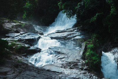
Azuali Falls
Some quick example text to build on the card title and make up the bulk of the card's content.
Go somewhere
Falkawn Village
Some quick example text to build on the card title and make up the bulk of the card's content.
Go somewhere
Lungkulh Village
Some quick example text to build on the card title and make up the bulk of the card's content.
Go somewhere
Pikpuat Spot
Some quick example text to build on the card title and make up the bulk of the card's content.
Go somewhere
Pukzing Cave
Some quick example text to build on the card title and make up the bulk of the card's content.
Go somewhere
Reiek Heritage Village
Some quick example text to build on the card title and make up the bulk of the card's content.
Go somewhere
Reiek Tlang Peak
Some quick example text to build on the card title and make up the bulk of the card's content.
Go somewhere
Reitlang Lungdawh
Some quick example text to build on the card title and make up the bulk of the card's content.
Go somewhere
Sakawrhmuituai Tlang
Some quick example text to build on the card title and make up the bulk of the card's content.
Go somewhere
Tlawng River
Some quick example text to build on the card title and make up the bulk of the card's content.
Go somewhere
Tuisen Tlabung Falls
Some quick example text to build on the card title and make up the bulk of the card's content.
Go somewherein Other Cities