

Sakawrhmuituai Tlang
General information
-
Ideal Duration:
5 to 6 HoursPlace Type:
Adventure & NatureEntry Fees:
General Entry: Currently, there is no formal entry fee for the mountain, as it is an open natural site maintained by the local village community.
Guide Services: Hiring a local guide for the more difficult trails usually costs between INR 5...General Entry: Currently, there is no formal entry fee for the mountain, as it is an open natural site maintained by the local village community.
Guide Services: Hiring a local guide for the more difficult trails usually costs between INR 500 to INR 800 depending on the group size.Timing:
Regular Timings: Open 24 hours, but it is strongly advised to visit between 7:00 AM and 4:00 PM for safety on the steep slopes.
Ideal Visit Time: Late afternoon around 3:30 PM is ideal to catch the changing colors of the sky as the sun prep...Regular Timings: Open 24 hours, but it is strongly advised to visit between 7:00 AM and 4:00 PM for safety on the steep slopes.
Ideal Visit Time: Late afternoon around 3:30 PM is ideal to catch the changing colors of the sky as the sun prepares to set.Special Events:
Downhill Track Ride: An annual competition held in December where local and regional mountain bikers race from the peak to the valley floor.
Nature Awareness Camps: Occasional workshops held by local environmental groups to educate visitors...Downhill Track Ride: An annual competition held in December where local and regional mountain bikers race from the peak to the valley floor.
Nature Awareness Camps: Occasional workshops held by local environmental groups to educate visitors about the unique volcanic ecosystem of the Tlang.Best Photo Spots:
The Skywalk Edge: The edge of the cliff offers a dramatic drop-off shot, perfect for capturing the scale and height of the mountain range.
Basalt Rock Faces: The dark, rugged textures of the volcanic rocks provide an excellent background fo...The Skywalk Edge: The edge of the cliff offers a dramatic drop-off shot, perfect for capturing the scale and height of the mountain range.
Basalt Rock Faces: The dark, rugged textures of the volcanic rocks provide an excellent background for portraits and close-up nature photography.
Valley Panorama: A wide-angle shot from the summit capturing the zigzagging mountain roads and the distant clusters of white village houses.Photo Gallery
Things To Do
-
Downhill Mountain Biking: For professional cyclists, the steep trails offer one of the most challenging downhill terrains in the entire state of Mizoram.
Geological Exploration: Study the unique rock types and volcanic soil that differentiate this peak from the surrounding sedimentary mountain formations.
Mist Photography: Use the frequent fog and mist to capture atmospheric landscape shots that look like scenes from a mystical fairytale.
Ridge Walking: Traverse the narrow ridgeline trail that connects different viewpoints, offering views of both the Aizawl and Mamit districts simultaneously.
Flora Documentation: Catalog the various high-altitude mosses and ferns that cover the damp, shaded rock faces of the mountain's northern ...Downhill Mountain Biking: For professional cyclists, the steep trails offer one of the most challenging downhill terrains in the entire state of Mizoram.
Geological Exploration: Study the unique rock types and volcanic soil that differentiate this peak from the surrounding sedimentary mountain formations.
Mist Photography: Use the frequent fog and mist to capture atmospheric landscape shots that look like scenes from a mystical fairytale.
Ridge Walking: Traverse the narrow ridgeline trail that connects different viewpoints, offering views of both the Aizawl and Mamit districts simultaneously.
Flora Documentation: Catalog the various high-altitude mosses and ferns that cover the damp, shaded rock faces of the mountain's northern side.
Sunset Watching: The peak offers an unobstructed view of the western horizon, making it one of the best spots to watch the sun dip below the hills.
Picnicking at the Base: The flatter areas near the base are perfect for family outings, providing a scenic backdrop for a relaxing afternoon meal.
Information
-
Why Famous:
Volcanic Origin: It is famous for its rare geological status as a peak with volcanic history, which is uncommon in the Lushai mountain range.
Adventure Sports: The mountain is renowned for hosting high-adrenaline downhill cycling events tha...Volcanic Origin: It is famous for its rare geological status as a peak with volcanic history, which is uncommon in the Lushai mountain range.
Adventure Sports: The mountain is renowned for hosting high-adrenaline downhill cycling events that attract participants from across Northeast India. -
Architecture:
Natural Volcanic Formation: Unlike man-made structures, the architecture here is defined by basaltic rock formations and steep escarpments measuring over 300 meters in vertical drop.
Proposed Skywalk Infrastructure: The planned skywalk is d...Natural Volcanic Formation: Unlike man-made structures, the architecture here is defined by basaltic rock formations and steep escarpments measuring over 300 meters in vertical drop.
Proposed Skywalk Infrastructure: The planned skywalk is designed to be a steel and glass cantilevered platform extending 20 meters over the gorge to provide a thrilling view. -
How To Reach:
By Air: Fly into Lengpui Airport, then take a pre-paid taxi towards Aizawl and follow the North Aizawl route towards the Siphir area.
By Train: Reach Silchar Railway Station, followed by a 6 to 8 hour drive to Aizawl, then a local taxi to t...By Air: Fly into Lengpui Airport, then take a pre-paid taxi towards Aizawl and follow the North Aizawl route towards the Siphir area.
By Train: Reach Silchar Railway Station, followed by a 6 to 8 hour drive to Aizawl, then a local taxi to the Sakawrhmuituai base.
By Road: The mountain is accessible via the Aizawl-Siphir road; the journey takes about 45 minutes from the city center in a private vehicle.
By Local Transport: Shared taxis (Sumos) plying between Aizawl and Lungdai can drop passengers at the trekking starting point along the highway. -
Weather and Best Time to Visit:
Autumn (September to November): The weather is clear after the rains, providing the best visibility and making the trails less slippery for hikers.
Spring (March to May): This is the time when the wild orchids and mountain flowers are in fu...Autumn (September to November): The weather is clear after the rains, providing the best visibility and making the trails less slippery for hikers.
Spring (March to May): This is the time when the wild orchids and mountain flowers are in full bloom, adding vibrant colors to the landscape. -
Near Tourist Places:
1. Durtlang Hills (12 KMS), 2. KV Paradise (14 KMS), 3. Solomon’s Temple (10 KMS), 4. Mizoram State Museum (22 KMS), 5. Bara Bazar (21 KMS), 6. Reiek Tlang (45 KMS), 7. Saitual Village (60 KMS), 8. Bak Puk Cave (15 KMS), 9. Muthi Tlang (18 KMS), 10. Berawtlang Tourist Complex (16 KMS).
Tourism Tips
-
Health & Safety: Be cautious of the steep edges as there are no safety railings in most areas; avoid trekking during heavy rain due to landslide risks.
Packing: Carry enough water and energy snacks as there are no shops once you start the ...Health & Safety: Be cautious of the steep edges as there are no safety railings in most areas; avoid trekking during heavy rain due to landslide risks.
Packing: Carry enough water and energy snacks as there are no shops once you start the ascent; wear windproof jackets as it gets very breezy.
Accommodation: Look for homestays in Siphir Village or stay in the main Aizawl City hotels and make a half-day trip to the mountain.
Cash & Connectivity: UPI is generally available in the nearby villages, but cash is king for small tea stalls; Jio and Airtel provide decent coverage.
Reviews
FAQs
Reiek Itineray And Cost:-
Sakawrhmuituai Tlang Tourism:-
Other Places In Reiek :-
Other States In India :-
Information about New and Updated Locations() of Mizoram Has Been Added :-
Card subtitle
Note:-
Information provided here in good Faith and for reference only.
Near Places
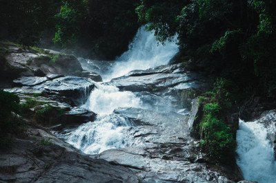
Azuali Falls
Some quick example text to build on the card title and make up the bulk of the card's content.
Go somewhere
Falkawn Village
Some quick example text to build on the card title and make up the bulk of the card's content.
Go somewhere
Lungkulh Village
Some quick example text to build on the card title and make up the bulk of the card's content.
Go somewhere
Pikpuat Spot
Some quick example text to build on the card title and make up the bulk of the card's content.
Go somewhere
Pukzing Cave
Some quick example text to build on the card title and make up the bulk of the card's content.
Go somewhere
Reiek Heritage Village
Some quick example text to build on the card title and make up the bulk of the card's content.
Go somewhere
Reiek Tlang Peak
Some quick example text to build on the card title and make up the bulk of the card's content.
Go somewhere
Reitlang Lungdawh
Some quick example text to build on the card title and make up the bulk of the card's content.
Go somewhere
Sakawrhmuituai Tlang
Some quick example text to build on the card title and make up the bulk of the card's content.
Go somewhere
Tlawng River
Some quick example text to build on the card title and make up the bulk of the card's content.
Go somewhere
Tuisen Tlabung Falls
Some quick example text to build on the card title and make up the bulk of the card's content.
Go somewherein Other Cities