

Chabimura View Point
General information
-
Ideal Duration:
1 to 2 HoursPlace Type:
Archaeological & NatureEntry Fees:
Standard Access: Entry to the viewpoint is generally free, but guide charges are around Rs.100.
Boat Combo: Often included in the overall Rs.1000 boat trip package. ...Standard Access: Entry to the viewpoint is generally free, but guide charges are around Rs.100.
Boat Combo: Often included in the overall Rs.1000 boat trip package.Special Events:
Pous Sankranti: A local festival where tribal communities gather near the river.
Annual Pilgrimage: Thousands visit during the holy dip season. ...Pous Sankranti: A local festival where tribal communities gather near the river.
Annual Pilgrimage: Thousands visit during the holy dip season.Best Photo Spots:
The River Bend: Capturing the U-turn of the Gomati River from above.
Sunset Silhouette: Photographing the hills during the golden hour for dramatic shadows. ...The River Bend: Capturing the U-turn of the Gomati River from above.
Sunset Silhouette: Photographing the hills during the golden hour for dramatic shadows.Photo Gallery
Things To Do
-
Trekking the Trails: Hiking through the dense forest trails to reach the summit.
Bird Watching: Spotting rare tropical birds that nest in the high cliffs.
Landscape Photography: Capturing the 360-degree view of the Gomati valley.
Nature Walks: Exploring the unique flora including rare orchids.
Picnicking: Enjoying a quiet meal at the designated shaded spots.
Educational Tours: Learning about the 15th-century history from local tribal guides.
Meditation: Finding peace in the serene, high-altitude atmosphere. ...Trekking the Trails: Hiking through the dense forest trails to reach the summit.
Bird Watching: Spotting rare tropical birds that nest in the high cliffs.
Landscape Photography: Capturing the 360-degree view of the Gomati valley.
Nature Walks: Exploring the unique flora including rare orchids.
Picnicking: Enjoying a quiet meal at the designated shaded spots.
Educational Tours: Learning about the 15th-century history from local tribal guides.
Meditation: Finding peace in the serene, high-altitude atmosphere.
Information
-
Why Famous:
The Great Wall of Images: Famous for being the gateway to the massive Mahishasura Mardini rock carving.
Cultural Significance: It is renowned for its association with the Jamatia tribe who consider these hills sacred. ...The Great Wall of Images: Famous for being the gateway to the massive Mahishasura Mardini rock carving.
Cultural Significance: It is renowned for its association with the Jamatia tribe who consider these hills sacred. -
Architecture:
Rock Face Engineering: The architecture here is essentially natural, featuring light yellow sandstone cliffs that have been weathered over centuries to form stable viewing platforms.
Dimensions and Scale: The viewpoint sits approximately 150...Rock Face Engineering: The architecture here is essentially natural, featuring light yellow sandstone cliffs that have been weathered over centuries to form stable viewing platforms.
Dimensions and Scale: The viewpoint sits approximately 150 feet above the river level, providing a clear line of sight for over 5 kilometers of the river's path. -
How To Reach:
By Air: Fly to Agartala Airport, then drive 82 km.
By Train: Reach Udaipur Railway Station, then take a taxi for 30 km.
By Road: Well connected via the Udaipur-Amarpur highway.
...By Air: Fly to Agartala Airport, then drive 82 km.
By Train: Reach Udaipur Railway Station, then take a taxi for 30 km.
By Road: Well connected via the Udaipur-Amarpur highway.
Local Transport: Hire an auto or Eeco from Amarpur stand. -
Weather and Best Time to Visit:
Seasonal Variation: Winter (October to March) is the peak season.
Time of Day: Early Morning offers the clearest skies and least humidity. ...Seasonal Variation: Winter (October to March) is the peak season.
Time of Day: Early Morning offers the clearest skies and least humidity. -
Near Tourist Places:
Udaipur (30 km), Dumboor Lake (45 km), Neermahal (55 km), Tripura Sundari Temple (32 km), Unakoti (180 km), Agartala (82 km), Sepahijala (65 km), Kailashahar (170 km), Jampui Hills (220 km), Pilak (70 km)
Tourism Tips
-
Health and Safety: Wear sturdy hiking boots as the paths are slippery.
Packing: Carry plenty of water and insect repellent for the forest.
Cash and Connectivity: Mobile signal is weak; carry Rs.2000 cash as A...Health and Safety: Wear sturdy hiking boots as the paths are slippery.
Packing: Carry plenty of water and insect repellent for the forest.
Cash and Connectivity: Mobile signal is weak; carry Rs.2000 cash as ATMs are in Amarpur.
Accommodation: Stay at Sagarika Parjatan Niwas in nearby Amarpur.
Reviews
FAQs
Chabimura Itineray And Cost:-
Chabimura View Point Tourism:-
Other Places In Chabimura :-
Other States In India :-
Information about New and Updated Locations() of Tripura Has Been Added :-
Card subtitle
Note:-
Information provided here in good Faith and for reference only.
Near Places
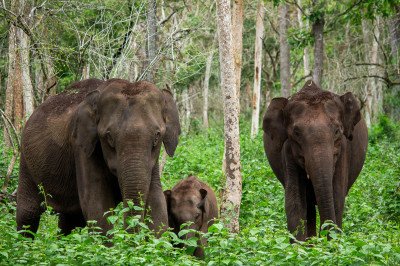
Bagma Reserve Forest
Some quick example text to build on the card title and make up the bulk of the card's content.
Go somewhere
Bagma Town Centre
Some quick example text to build on the card title and make up the bulk of the card's content.
Go somewhere
Baramura Reserve Forest
Some quick example text to build on the card title and make up the bulk of the card's content.
Go somewhere
Chabimura Cave
Some quick example text to build on the card title and make up the bulk of the card's content.
Go somewhere
Chabimura Rock Carvings
Some quick example text to build on the card title and make up the bulk of the card's content.
Go somewhere
Chabimura View Point
Some quick example text to build on the card title and make up the bulk of the card's content.
Go somewhere
Dixit View Point
Some quick example text to build on the card title and make up the bulk of the card's content.
Go somewhere
Enviro Green Camping Site
Some quick example text to build on the card title and make up the bulk of the card's content.
Go somewhere
Kailashahar Tea Garden
Some quick example text to build on the card title and make up the bulk of the card's content.
Go somewhere
M.A.K. Waterfall
Some quick example text to build on the card title and make up the bulk of the card's content.
Go somewhere
Mountain View
Some quick example text to build on the card title and make up the bulk of the card's content.
Go somewhere
Naithau Moing Tila View Point
Some quick example text to build on the card title and make up the bulk of the card's content.
Go somewhere
Nauka Ghat
Some quick example text to build on the card title and make up the bulk of the card's content.
Go somewherein Other Cities