
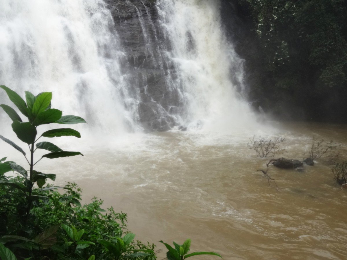
Kalhatty Waterfalls
General information
-
Ideal Duration:
1-2 hours (Excluding Trek Time)Place Type:
Waterfall and Biodiversity Hotspot:Entry Fees:
General Entry: Generally No Entry Fee for the falls/viewpoint.
Trek Permission Fee: Minimal to nominal fee (or forest department permission) may be required for the 3 km trek to the base (confirm locally).
Parki...General Entry: Generally No Entry Fee for the falls/viewpoint.
Trek Permission Fee: Minimal to nominal fee (or forest department permission) may be required for the 3 km trek to the base (confirm locally).
Parking Fee: Nominal fee (often Rs. 20-50) for parking near the main viewpoint.
Camera Fees: Generally No Camera Fees.Timing:
Regular Timings: 8:00 AM to 6:00 PM (Recommended for daylight and safe travel).
Ideal Visit Time: Mid-Morning (9:00 AM - 1:00 PM) to allow for the trek and travel time back on the ghat road. Avoid Late Evenings due to the risk of encounteri...Regular Timings: 8:00 AM to 6:00 PM (Recommended for daylight and safe travel).
Ideal Visit Time: Mid-Morning (9:00 AM - 1:00 PM) to allow for the trek and travel time back on the ghat road. Avoid Late Evenings due to the risk of encountering wildlife and the danger of driving on the ghat road in the dark.Special Events:
No specific public events are held at the waterfall. Its "special event" is its natural peak flow.
Monsoon Peak Flow: The falls are at their most voluminous and spectacular during the heavy monsoon season (July to September) and immediately afterward, in October an...No specific public events are held at the waterfall. Its "special event" is its natural peak flow.
Monsoon Peak Flow: The falls are at their most voluminous and spectacular during the heavy monsoon season (July to September) and immediately afterward, in October and November. This peak water flow is the annual natural event that makes it a sight to behold.
Annual Migratory Bird Season: The arrival of specific migratory bird species during the winter months (e. g. , November to February) is a key attraction for dedicated birdwatchers.Best Photo Spots:
The Roadside Viewpoint: The elevated spot on the Ghat Road (often a hairpin bend) gives a distant, sweeping view of the falls in the landscape.
The Base of the Falls: For those who trek down, the spot right at the bottom provides a dramatic,...The Roadside Viewpoint: The elevated spot on the Ghat Road (often a hairpin bend) gives a distant, sweeping view of the falls in the landscape.
The Base of the Falls: For those who trek down, the spot right at the bottom provides a dramatic, close-up photo opportunity with the cascading water.
Framed by Foliage: Use the thick, lush green forest canopy to frame the falls from a distance, highlighting its natural setting.Photo Gallery
Things To Do
-
Trekking: Embark on the challenging 3 km trek down to the base of the falls (ensure safety and check local advisories).
Bird Watching: Carry binoculars and a field guide to spot the diverse birdlife in the surrounding trees.
Wildlife Spotting: Look out for animals like Bison and Sambhar near the water's edge, especially early in the morning.
Photography: Capture the waterfall in its full flow and the lush greenery of the Sigur Plateau.
Picnicking: A scenic spot for a quick picnic (pack out all trash).
Nature Walks: Take short, supervised walks along the forest trails near the viewpoint (do not venture deep alone due to wildlife).
Enjoy the Ghat Drive: The drive t...Trekking: Embark on the challenging 3 km trek down to the base of the falls (ensure safety and check local advisories).
Bird Watching: Carry binoculars and a field guide to spot the diverse birdlife in the surrounding trees.
Wildlife Spotting: Look out for animals like Bison and Sambhar near the water's edge, especially early in the morning.
Photography: Capture the waterfall in its full flow and the lush greenery of the Sigur Plateau.
Picnicking: A scenic spot for a quick picnic (pack out all trash).
Nature Walks: Take short, supervised walks along the forest trails near the viewpoint (do not venture deep alone due to wildlife).
Enjoy the Ghat Drive: The drive to and from the falls on the Sigur Ghat Road is inherently scenic and an experience in itself.
Information
-
Why Famous:
The 40-Meter Water Cascade: The sheer height and volume of the waterfall, especially in the post-monsoon period, make it a spectacular sight cascading down the steep rock face.
Bird Watcher's Falls: The dense forest and rich water source att...The 40-Meter Water Cascade: The sheer height and volume of the waterfall, especially in the post-monsoon period, make it a spectacular sight cascading down the steep rock face.
Bird Watcher's Falls: The dense forest and rich water source attract a diverse range of avian life, making it a prime spot for ornithologists and bird lovers.
Gateway to Sigur Plateau Wildlife: Its location on the Sigur Ghat road means it’s on the edge of the wildlife-rich Mudumalai area. It is one of the few places where you might spot large animals (like Indian Gaur or Deer) coming to the stream for water. -
Architecture:
Natural Water Cascade and Minimalist Viewpoint Architecture: The core architecture is the natural rock face over which the water falls, approximately 40 meters in height.
Trekking Path: The primary "architecture" is the 3 km natural trail, often just a dirt path, le...Natural Water Cascade and Minimalist Viewpoint Architecture: The core architecture is the natural rock face over which the water falls, approximately 40 meters in height.
Trekking Path: The primary "architecture" is the 3 km natural trail, often just a dirt path, leading from the main road near Kalhatty village down to the base of the falls. This path is informal and requires careful navigation.
Viewing Platform (Minimal): Near the road on the ghat, there is often a simple, small viewing platform or a roadside pull-over spot with basic railings, built to allow a safe, long-distance view of the waterfall as it cascades down the rock face. There is no major construction at the base, emphasizing its natural, untamed character.
Forest Rest House: The area around the falls or in the village may feature old forest department or PWD rest houses, built in a simple, sturdy masonry style common in forest regions. -
How To Reach:
By Air: Nearest airport is Coimbatore International Airport (CJB) (approx. 105 km). Hire a taxi to Ooty and then proceed to the falls.
By Train: Nearest major railhead is Coimbatore Junction (CBE). Nearest meter-gauge station is Mettupala...By Air: Nearest airport is Coimbatore International Airport (CJB) (approx. 105 km). Hire a taxi to Ooty and then proceed to the falls.
By Train: Nearest major railhead is Coimbatore Junction (CBE). Nearest meter-gauge station is Mettupalayam (MTP), take the Nilgiri Mountain Railway to Ooty. From Ooty, hire a private cab.
By Road: Ooty to Kalhatty Falls is about 13-15 km on the Ooty-Mysore Road (Sigur Ghat). It is essential to hire a private taxi or cab; local bus services are limited and the ghat road is very steep and winding.
By Local Transport: Private Cabs/Taxis are the only reliable and safe option for the steep ghat road. -
Weather and Best Time to Visit:
Post-Monsoon (October to November): This is the absolute best time, as the water flow is high, the surrounding foliage is intensely green, and the weather is pleasant.
Monsoon (July to September): The falls are at their maximum flow, but the...Post-Monsoon (October to November): This is the absolute best time, as the water flow is high, the surrounding foliage is intensely green, and the weather is pleasant.
Monsoon (July to September): The falls are at their maximum flow, but the steep trek can be extremely dangerous and slippery. Visibility on the ghat road is also poor due to mist and heavy rain.
Summer (March to June): Low water flow, but the weather is ideal for trekking.
Ideal Part of the Day: Mid-Morning when the sun hits the falls at a good angle and before the mist sets in. -
Near Tourist Places:
Mudumalai Wildlife Sanctuary (Entrance Approx. 20-25 KMS) Pykara Lake and Waterfalls (Approx. 20 KMS) Needle Rock View Point (Approx. 30 KMS) Doddabetta Peak (Approx. 20-25 KMS) Glenmorgan (Approx. 25-30 KMS) Ooty Lake (Approx. 15 KMS) Kamaraj Sagar Dam (Approx. 10 KMS) St. Stephen's Church (Approx. 15 KMS) Ooty Town Center (Approx. 15 KMS) Ooty Radio Telescope (Approx. 20 KMS)
Tourism Tips
-
Health & Safety: The ghat road is extremely steep (36 hairpin bends); drive carefully. Be vigilant for wild animals (Bison, Elephants) that often cross the road. Do not trek alone to the base; hire a local guide and check forest department rules.
Read MoreHealth & Safety: The ghat road is extremely steep (36 hairpin bends); drive carefully. Be vigilant for wild animals (Bison, Elephants) that often cross the road. Do not trek alone to the base; hire a local guide and check forest department rules.
Packing: Carry plenty of water, trekking shoes (if planning the descent), and insect repellent.
Accommodation: Stay in Ooty or Masinagudi (near Mudumalai). Very limited accommodation nearby.
Other Tips: Do not feed or disturb any wildlife. Do not attempt to swim in the fall pools. Respect the forest and pack out all your trash.Reviews
FAQs
Ooty Itineray And Cost:-
Kalhatty Waterfalls Tourism:-
Other Places In Ooty :-
Other States In India :-
Information about New and Updated Locations() of Tamil Nadu Has Been Added :-
Card subtitle
Note:-
Information provided here in good Faith and for reference only.
Near Places
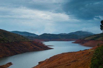
Avalanche Lake
Some quick example text to build on the card title and make up the bulk of the card's content.
Go somewhere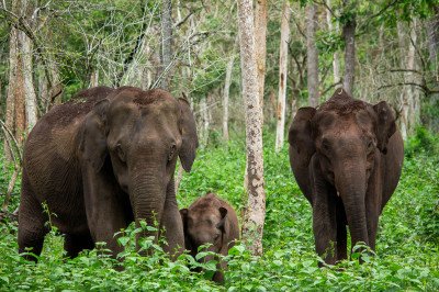
Cairn Hill Reserve Forest
Some quick example text to build on the card title and make up the bulk of the card's content.
Go somewhere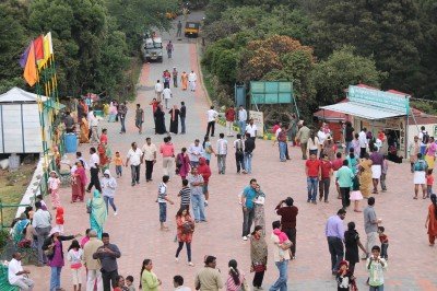
Doddabetta Peak
Some quick example text to build on the card title and make up the bulk of the card's content.
Go somewhere
Emerald Lake
Some quick example text to build on the card title and make up the bulk of the card's content.
Go somewhere
Glenmorgan
Some quick example text to build on the card title and make up the bulk of the card's content.
Go somewhere
Government Botanical Garden
Some quick example text to build on the card title and make up the bulk of the card's content.
Go somewhere
Government Museum
Some quick example text to build on the card title and make up the bulk of the card's content.
Go somewhere
Government Rose Garden
Some quick example text to build on the card title and make up the bulk of the card's content.
Go somewhere
Kalhatty Waterfalls
Some quick example text to build on the card title and make up the bulk of the card's content.
Go somewhere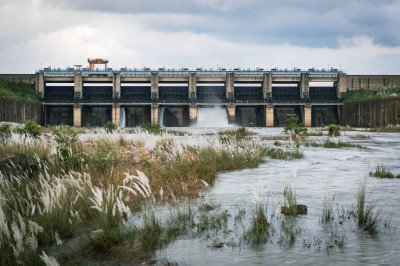
Kamaraj Sagar Dam
Some quick example text to build on the card title and make up the bulk of the card's content.
Go somewhere
Karnataka Siri Horticulture Garden
Some quick example text to build on the card title and make up the bulk of the card's content.
Go somewhere
Ketti Valley View
Some quick example text to build on the card title and make up the bulk of the card's content.
Go somewhere
Mudumalai National Park
Some quick example text to build on the card title and make up the bulk of the card's content.
Go somewhere
Mukurthi National Park
Some quick example text to build on the card title and make up the bulk of the card's content.
Go somewhere
Needle Rock View Point
Some quick example text to build on the card title and make up the bulk of the card's content.
Go somewhere
Ooty Boat House
Some quick example text to build on the card title and make up the bulk of the card's content.
Go somewherein Other Cities