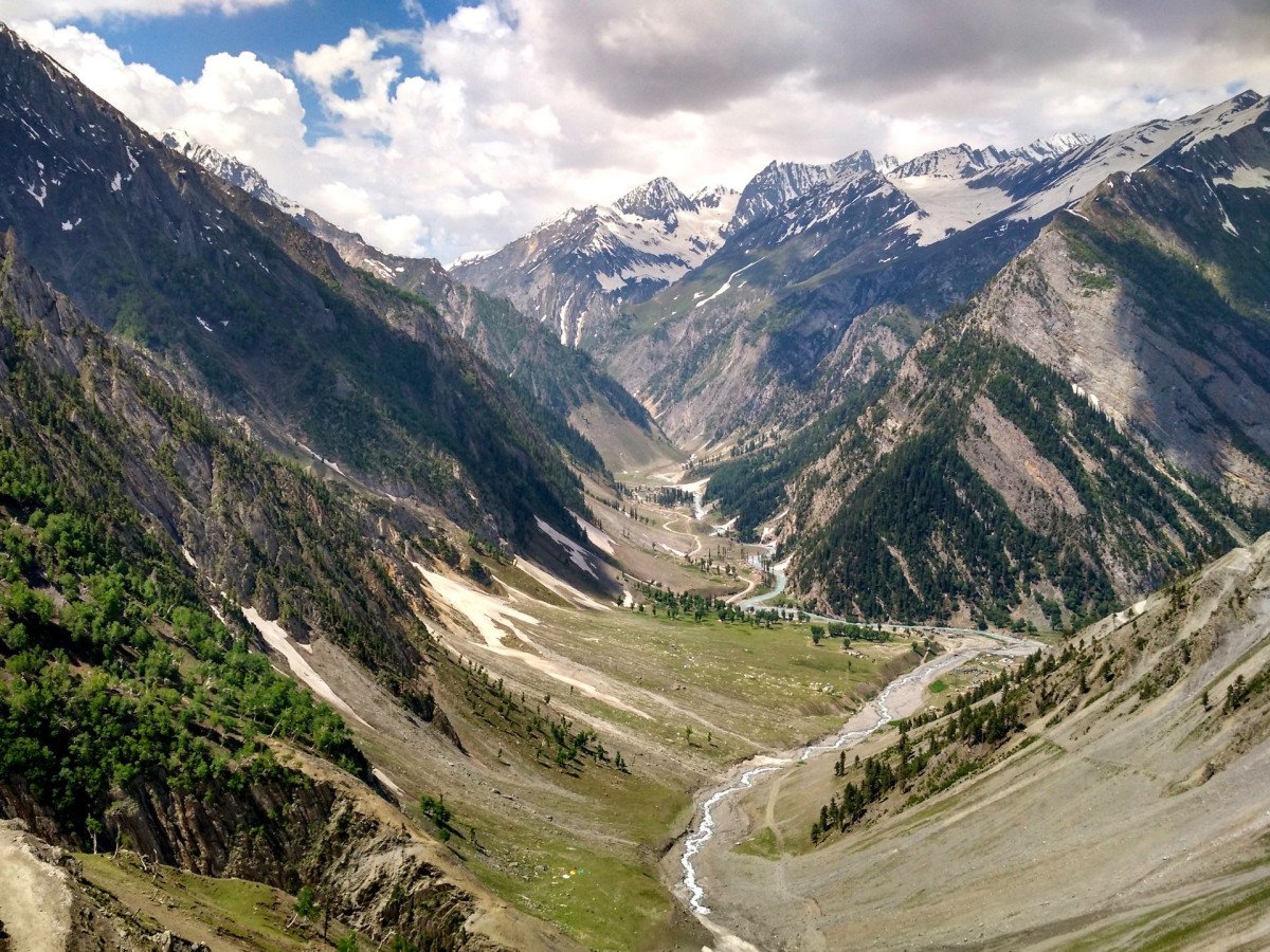
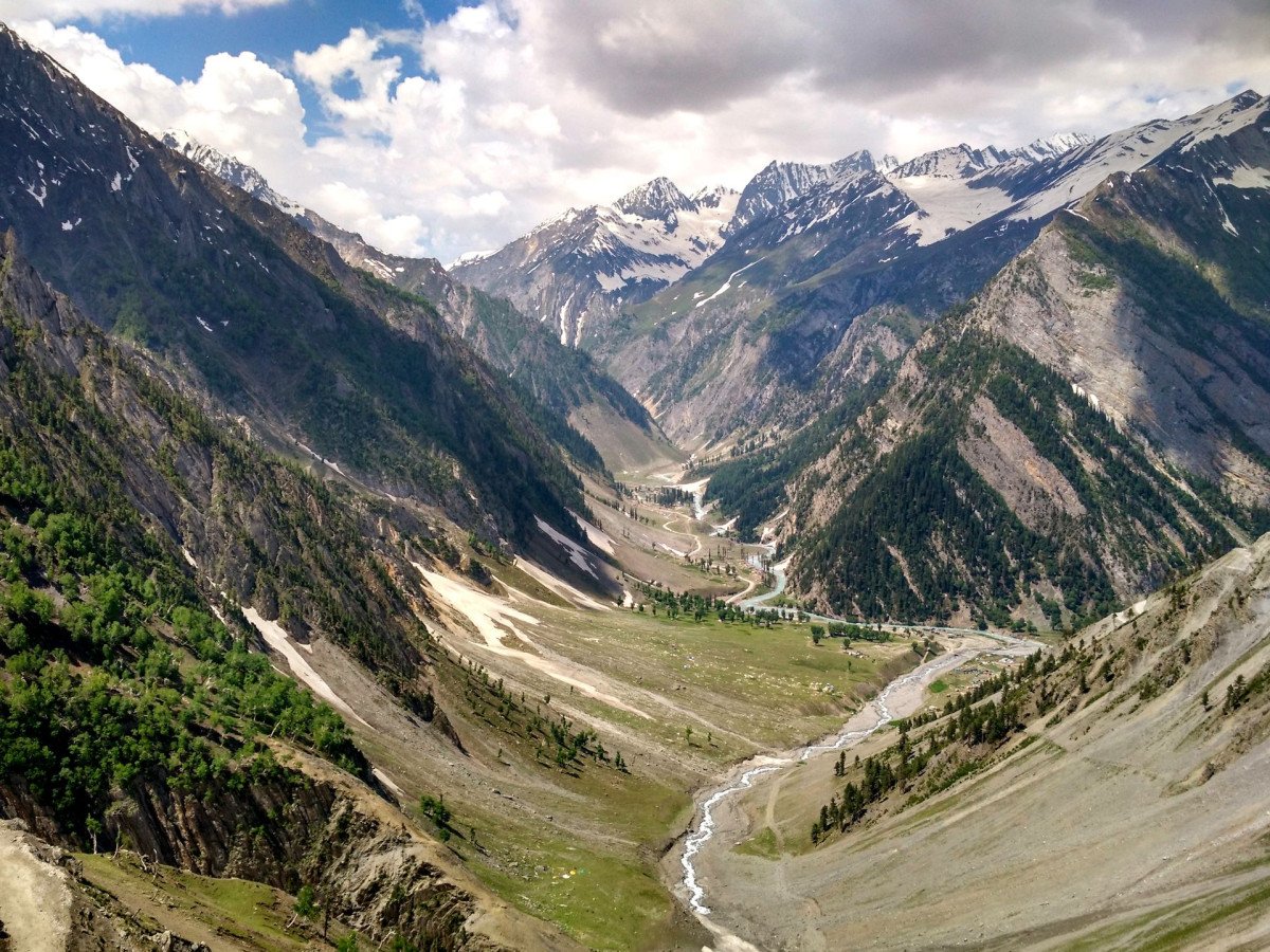
Montang Valley
General information
-
Ideal Duration:
Half-Day to Full-Day (including travel, best for an overnight stay)Place Type:
Hill Station/Scenic Viewpoint/TrekkingEntry Fees:
Development and Maintenance Fee: There are often small, nominal Development or Entry Fees charged by the local community or forest department, typically ranging from Rs.20 to Rs.50 per person, used for road maintenance, waste management, and local community support.Development and Maintenance Fee: There are often small, nominal Development or Entry Fees charged by the local community or forest department, typically ranging from Rs.20 to Rs.50 per person, used for road maintenance, waste management, and local community support.
:
Parking Charges: A dedicated fee for Vehicle Parking is usually charged, given the limited space at the top. This can range from Rs.50 to Rs.100 per car/jeep.
:
Accommodation Fee: Staying in a Tong Ghar or using a designated camping spot involves a higher, fixed fee, which is variable but can be around Rs.1,000 to Rs.2,000 per night for the basic amenities provided.
:Timing:
Regular Timings: The site is technically Open 24 Hours, but the best visiting hours are dictated by the sunrise/sunset. Day visitors should aim to arrive between 06:00 AM and 08:00 AM and leave by 05:00 PM before dark due to the challenging road conditions.Regular Timings: The site is technically Open 24 Hours, but the best visiting hours are dictated by the sunrise/sunset. Day visitors should aim to arrive between 06:00 AM and 08:00 AM and leave by 05:00 PM before dark due to the challenging road conditions.
:
Ideal Visit Time: Early Morning is the ideal time to guarantee the cloud view. October and November, just after the monsoon, and the mild Winter months (December to February) are the best seasons for clear skies and the most dramatic cloud formations.
:
Access Window: Travel is safest between 07:00 AM and 04:00 PM. Avoid traveling on the narrow, hilly road at night or during heavy rainfall for safety reasons, which restricts the daily access window.
:Special Events:
New Year's Day Picnic Rush: The biggest informal event is the massive influx of local tourists on New Year's Day (January 1st). While not officially organized, the sheer number of people celebrating at the viewpoint creates a festive, high-energy atmosphere, making it a spe...New Year's Day Picnic Rush: The biggest informal event is the massive influx of local tourists on New Year's Day (January 1st). While not officially organized, the sheer number of people celebrating at the viewpoint creates a festive, high-energy atmosphere, making it a special, crowded event.
:
Local Harvest Festivals: Depending on the specific local community (e. g. , Chakma or Tripuri), participation in local Harvest Festivals like Bizu (around April) or Garia Puja can be a special experience, often involving local dances and music, though these are typically held in nearby villages, not the viewpoint itself.
:Best Photo Spots:
The Sea of Clouds Vista: The Main Viewpoint itself, capturing the dramatic clouds filling the valley below, is the single most important photo spot. A wide-angle lens is essential to capture the entire expanse of the phenomenon.The Sea of Clouds Vista: The Main Viewpoint itself, capturing the dramatic clouds filling the valley below, is the single most important photo spot. A wide-angle lens is essential to capture the entire expanse of the phenomenon.
:
Forest Road Hairpins: The steep, winding, and forested Approach Road offers stunning opportunities to photograph vehicles navigating the hairpin bends against a backdrop of dense foliage, conveying the adventurous nature of the trip.
:
The Traditional Tong Ghar: The Tong Ghar architecture, especially at dawn or dusk, can be photographed beautifully to frame the cultural aspect of the landscape. Use the stilts and thatch roof to frame the distant valley view.
:Photo Gallery
Things To Do
-
Cloud and Sunrise Photography: The primary activity is early morning Sunrise and Cloud Photography. Arrive before dawn to capture the golden light hitting the clouds and the distant hills.
:
Short Treks and Nature Walks: Engage in Short, Guided Treks around the main viewpoint area. The forest is dense; ensure you have a local guide to explore the specific, marked trails that lead to other small viewpoints or water streams.
:Cloud and Sunrise Photography: The primary activity is early morning Sunrise and Cloud Photography. Arrive before dawn to capture the golden light hitting the clouds and the distant hills.
:
Short Treks and Nature Walks: Engage in Short, Guided Treks around the main viewpoint area. The forest is dense; ensure you have a local guide to explore the specific, marked trails that lead to other small viewpoints or water streams.
:
Overnight Camping/Stay: Opt for an Overnight Stay in a local Tong Ghar or a supervised camping area (if available) to experience the quietness of the mountains at night and ensure you catch the morning cloud view. This is a profound experience in nature.
:
Meeting the Local Tribes: Spend time interacting with the local Tripuri community who manage the site. Learning about their Culture, Language, and Traditional Way of Life is an enriching activity, particularly concerning their use of bamboo and the forest resources.
:
Rubber Plantation Visit: The approach road is lined with Rubber Plantations. Ask a local guide to take you through a plantation to understand the process of tapping rubber from the trees, a crucial economic activity in the region.
:
Picnic with a View: Pack a meal and enjoy a Picnic at the scenic viewpoint. However, be extremely mindful to carry all waste back down, as the area is primarily a natural reserve.
:
Information
-
Why Famous:
The Floating Clouds Phenomenon: It is most famous for the spectacular sight of Floating Clouds or a sea of clouds visible below the viewpoint, which has earned it the nickname "Mountain of Peace. " This is a rare sight in Tripura and has become viral on social media, leading...The Floating Clouds Phenomenon: It is most famous for the spectacular sight of Floating Clouds or a sea of clouds visible below the viewpoint, which has earned it the nickname "Mountain of Peace. " This is a rare sight in Tripura and has become viral on social media, leading to its sudden popularity.
:
Emerging Eco-Tourism Destination: The valley has gained fame as a rapidly Emerging Tourist Destination that showcases the unexplored natural beauty of the Atharamura Hill Range. Its recent discovery and development as a community-based tourism site make it famous as a testament to local initiative.
: -
Architecture:
Traditional Tong Ghar: The most prominent feature is the Tong Ghar, a traditional wooden hut-style accommodation built on stilts (piles), native to the Tripuri community. The typical dimensions of a hut are around 3 meters by 4 meters, designed to protect inhabitants from w...Traditional Tong Ghar: The most prominent feature is the Tong Ghar, a traditional wooden hut-style accommodation built on stilts (piles), native to the Tripuri community. The typical dimensions of a hut are around 3 meters by 4 meters, designed to protect inhabitants from wild animals and provide ventilation.
:
The Viewpoint Platform: The main tourist feature is an unpaved or minimally paved Viewpoint Platform (estimated dimensions 20 meters by 10 meters) constructed at a strategic high point to provide uninterrupted views of the valley and the cloud cover. Construction is typically simple, involving earthwork, local stone, and some basic fencing.
:
Road Construction: The architecture of note is the recently improved connecting PMGSY Road from NH 8 near Teliamura. This road, though hilly and challenging, is a feat of civil engineering that opened up the remote location to tourism, with an emphasis on durable, low-maintenance construction materials like asphalt and concrete retaining walls.
: -
How To Reach:
By Air: The nearest airport is Agartala Airport (IXA), approximately 90 KMS away. Hire a sturdy SUV or Jeep for the trip to Montang Valley, as the final stretch of the road is difficult.
...By Air: The nearest airport is Agartala Airport (IXA), approximately 90 KMS away. Hire a sturdy SUV or Jeep for the trip to Montang Valley, as the final stretch of the road is difficult.
:
By Train: The nearest station is Teliamura Railway Station (TLMR), approximately 35 KMS away. From there, you must hire a private jeep or shared taxi (specifically a 4x4 if possible) as regular auto-rickshaws cannot handle the terrain.
:
By Road: From Teliamura, take NH 8 for a short distance and then turn off onto the local road leading to Nunachhara and up the Atharamura Hills. The total distance is about 30 KMS, but the journey can take up to 2 hours due to the rough, hilly terrain.
:
By Local Transport: Shared jeeps are the only viable local public transport that goes close to the top, but their frequency is low. It is highly recommended to Book a Private Vehicle from Teliamura or Agartala for a return trip.
: -
Weather and Best Time to Visit:
Different Types of Seasons: Post-Monsoon (October/November) and Winter (December to February) are the Best Time to Visit for the highest chance of seeing the "Sea of Clouds" and enjoying cool, dry weather. Summer is hot, and the Monsoon season (heavy rain) makes the road tr...Different Types of Seasons: Post-Monsoon (October/November) and Winter (December to February) are the Best Time to Visit for the highest chance of seeing the "Sea of Clouds" and enjoying cool, dry weather. Summer is hot, and the Monsoon season (heavy rain) makes the road treacherous.
:
Different Parts of the Day: Sunrise (05:00 AM to 06:30 AM) is the absolute best time for the cloud phenomenon and photography. Mid-Day offers clear, distant valley views but is hot. The late afternoon (04:00 PM) provides a beautiful setting sun over the hills.
: -
Near Tourist Places:
Baramura Eco Park (12 KMS), Chakmaghat Boat Ghat (25 KMS), Atharamura Hill Range (The range it is in), Hathai Kotor Park (20 KMS), Teliamura Town Center (30 KMS), Kalyanpur River View Point (35 KMS), Ompi Chowmuhani (40 KMS), Gakulpur Mulberry Park (35 KMS), Jampui Hill (200 KMS - distant attraction), Neermahal Palace (90 KMS).
Tourism Tips
-
Health & Safety: The road is challenging; use a Skilled Driver and a robust vehicle (Jeep/SUV). Carry a small First-Aid Kit for minor cuts. Trekking requires a local Guide to avoid getting lost in the dense forest.Health & Safety: The road is challenging; use a Skilled Driver and a robust vehicle (Jeep/SUV). Carry a small First-Aid Kit for minor cuts. Trekking requires a local Guide to avoid getting lost in the dense forest.
:
Packing: Pack warm clothing (sweater/jacket) for the early morning cold, even if the weather in the plains is warm. Carry sufficient Water, Snacks, and a power bank, as facilities are minimal. Sturdy Footwear is a must for walking.
:
Accommodation: Very Limited Accommodation is available, mainly simple Tong Ghar or camping. Book well in advance. Alternatively, stay in a comfortable Tourist Lodge in Teliamura and start very early.
:
Other Different Topics: Respect the Indigenous Culture of the Tripuri people who manage the site. Do not litter, especially on the trails. Inform your accommodation of your travel plans and expected return time.
:
Reviews
FAQs
Teliamura Itineray And Cost:-
Other Places In Teliamura :-
Other States In India :-
Information about New and Updated Locations() of Tripura Has Been Added :-
Card subtitle
Note:-
Information provided here in good Faith and for reference only.
Near Places
Atharomura Waterfall
Some quick example text to build on the card title and make up the bulk of the card's content.
Go somewhere
Baramura Eco Park
Some quick example text to build on the card title and make up the bulk of the card's content.
Go somewhere
Chabimura View Point
Some quick example text to build on the card title and make up the bulk of the card's content.
Go somewhere
Chakmaghat Barrage View
Some quick example text to build on the card title and make up the bulk of the card's content.
Go somewhere
Chakmaghat Boat Ghat
Some quick example text to build on the card title and make up the bulk of the card's content.
Go somewhere
Dixit View Point
Some quick example text to build on the card title and make up the bulk of the card's content.
Go somewhere
Green Island
Some quick example text to build on the card title and make up the bulk of the card's content.
Go somewhere
Hachwk Twisa Waterfall
Some quick example text to build on the card title and make up the bulk of the card's content.
Go somewhere
Kalyanpur River View Point
Some quick example text to build on the card title and make up the bulk of the card's content.
Go somewhere
Khowai Chowmohni
Some quick example text to build on the card title and make up the bulk of the card's content.
Go somewhere
Laxmilunga Tea Garden
Some quick example text to build on the card title and make up the bulk of the card's content.
Go somewhere
Montang Valley
Some quick example text to build on the card title and make up the bulk of the card's content.
Go somewhere
Ompi Chowmuhani
Some quick example text to build on the card title and make up the bulk of the card's content.
Go somewhere
Raima Waterfall
Some quick example text to build on the card title and make up the bulk of the card's content.
Go somewhere
Thum Hatai
Some quick example text to build on the card title and make up the bulk of the card's content.
Go somewhere
View Point
Some quick example text to build on the card title and make up the bulk of the card's content.
Go somewherein Other Cities