Shankarmara Dam
General information
-
Ideal Duration:
2 - 3 HoursPlace Type:
Nature, Picnic, and PhotographyEntry Fees:
No Entry Fee: Currently, there is no entry fee to visit Shankarmara Dam. It is a public resource and open to everyone without any ticketing system. This makes it an ideal spot for frequent visits by locals and budget-conscious travelers.
Parki...No Entry Fee: Currently, there is no entry fee to visit Shankarmara Dam. It is a public resource and open to everyone without any ticketing system. This makes it an ideal spot for frequent visits by locals and budget-conscious travelers.
Parking and Maintenance: While there is no official parking fee, visitors are expected to park their vehicles responsibly to avoid blocking the dam access road. There are no commercial stalls, so the "cost" of the trip is essentially just your travel and food expenses.Timing:
Regular Timings: The dam is accessible from Sunrise to Sunset (approx. 6:00 AM to 6:00 PM). There is no gate as such, but for safety reasons, it is not advisable to stay after dark as the area is quite remote and lacks artificial lighting.
Ide...Regular Timings: The dam is accessible from Sunrise to Sunset (approx. 6:00 AM to 6:00 PM). There is no gate as such, but for safety reasons, it is not advisable to stay after dark as the area is quite remote and lacks artificial lighting.
Ideal Visit Time: The best time to arrive is either early morning (6:30 AM) to see the mist over the water or late afternoon (4:00 PM) to enjoy the sunset. The midday heat can be intense as there is limited shade on the dam wall itself.Special Events:
Annual Community Feast: During the month of January, local village communities often organize a large "Van Bhoji" (Forest Feast) near the dam. It is a time of communal harmony where traditional Odia dishes are prepared over wood fires and shared among everyone.Annual Community Feast: During the month of January, local village communities often organize a large "Van Bhoji" (Forest Feast) near the dam. It is a time of communal harmony where traditional Odia dishes are prepared over wood fires and shared among everyone.
Water Celebration: During years of good rainfall, when the dam reaches its full capacity, the locals perform small rituals at the spillway to thank the water deities for a prosperous farming season.Best Photo Spots:
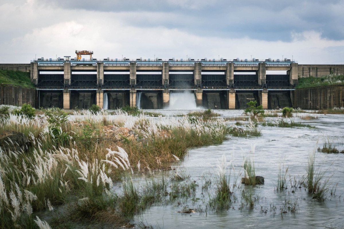
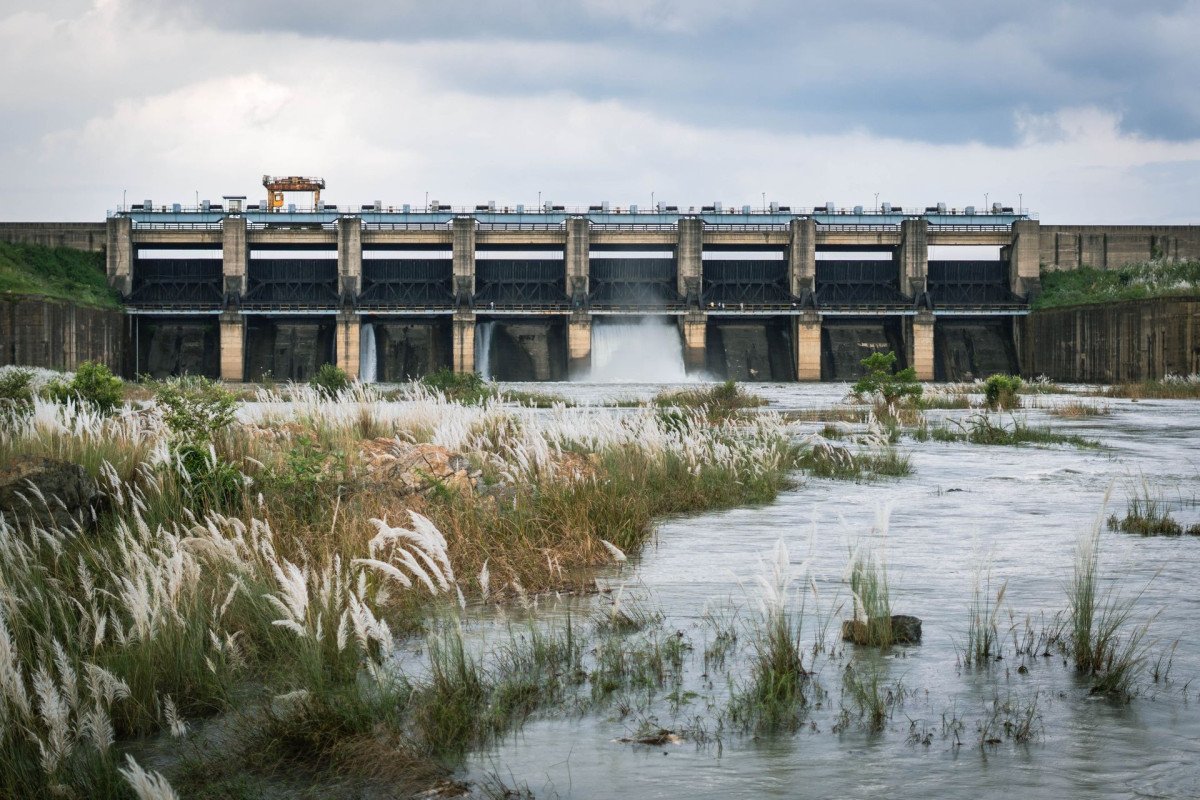
The Spillway Edge: Standing near the concrete spillway with the rushing water in the background (during monsoon) or the dry geometric patterns (in summer) makes for a powerful architectural photo.
Hill-View Point: Walk to the far end of the ...The Spillway Edge: Standing near the concrete spillway with the rushing water in the background (during monsoon) or the dry geometric patterns (in summer) makes for a powerful architectural photo.
Hill-View Point: Walk to the far end of the embankment to get a shot that includes both the curve of the dam and the highest hill in the background.
Golden Hour: The 30 minutes before sunset is the "Best Photo Spot. " The reflection of the sun on the still water creates a shimmering golden path that is perfect for silhouette photography.Photo Gallery
Things To Do
-
Photography: The dam is an excellent location for landscape photography. The symmetry of the dam structure against the organic shapes of the hills provides great composition opportunities. Capturing the local fishermen in their small boats adds a human element to the natural scenery.
Boating (Informal): Occasionally, local fishermen may offer to take visitors for a short ride in their traditional wooden boats. While not an official service, it provides a unique perspective of the dam from the middle of the water.
Birdwatching: Bring your binoculars to observe the diverse avian life. The quiet nature of the spot ensures that birds are not easily scared away, allowing for prolonged observation of their behavior in the natural habitat.
Nature Walks: Walk along t...Photography: The dam is an excellent location for landscape photography. The symmetry of the dam structure against the organic shapes of the hills provides great composition opportunities. Capturing the local fishermen in their small boats adds a human element to the natural scenery.
Boating (Informal): Occasionally, local fishermen may offer to take visitors for a short ride in their traditional wooden boats. While not an official service, it provides a unique perspective of the dam from the middle of the water.
Birdwatching: Bring your binoculars to observe the diverse avian life. The quiet nature of the spot ensures that birds are not easily scared away, allowing for prolonged observation of their behavior in the natural habitat.
Nature Walks: Walk along the length of the dam's embankment. The breeze from the water keeps the temperature lower than the surrounding plains, making it a refreshing exercise.
Stargazing: Because the area is far from city lights, the night sky is exceptionally clear. While staying overnight is not permitted, an early evening visit allows for a glimpse of the emerging constellations.
Local Interaction: Talk to the villagers who come to the dam for their daily needs. Learning about their life and how the dam has changed their agriculture provides a deep cultural insight.
Sketching and Painting: For artists, the still waters and the layered hills offer a perfect subject. The lack of crowds means you can set up an easel and work undisturbed for hours.
Information
-
Why Famous:
A Picnic Paradise: Shankarmara is famously known among the locals of Baripada and Rairangpur as one of the best "undiscovered" picnic spots. The availability of flat, shaded areas near the water makes it perfect for large groups to set up a temporary kitchen and enjoy a mea...A Picnic Paradise: Shankarmara is famously known among the locals of Baripada and Rairangpur as one of the best "undiscovered" picnic spots. The availability of flat, shaded areas near the water makes it perfect for large groups to set up a temporary kitchen and enjoy a meal in the wild.
Sunset Views: The dam is renowned for its spectacular sunsets. As the sun dips behind the surrounding hills, the entire reservoir is bathed in shades of orange and purple, creating a romantic and peaceful setting. -
Architecture:
Engineering and Design: The dam is a masonry and earth-fill structure designed to harvest rainwater and stream runoff. It features a solid concrete spillway that manages the overflow during the heavy monsoon rains. The main embankment stretches several hundred meters, prov...Engineering and Design: The dam is a masonry and earth-fill structure designed to harvest rainwater and stream runoff. It features a solid concrete spillway that manages the overflow during the heavy monsoon rains. The main embankment stretches several hundred meters, providing a wide walkway for visitors to enjoy the view from an elevated vantage point.
Dimensions and Capacity: While specific technical blueprints are kept by the irrigation department, the dam reservoir covers a significant acreage, with the depth reaching up to 40-50 feet near the gates during peak season. The stone pitching on the inner slopes is expertly laid to prevent erosion, showcasing the durable rural engineering of the region. -
How To Reach:
By Air: The closest airport is Biju Patnaik International Airport (Bhubaneswar), roughly 260 KM away. A more convenient option for some might be the Netaji Subhash Chandra Bose International Airport in Kolkata (approx. 245 KM), followed by a train or bus to Baripada.
<...By Air: The closest airport is Biju Patnaik International Airport (Bhubaneswar), roughly 260 KM away. A more convenient option for some might be the Netaji Subhash Chandra Bose International Airport in Kolkata (approx. 245 KM), followed by a train or bus to Baripada.
By Train: Baripada Railway Station is the nearest major rail link (45 KM). From the station, one can hire a private taxi or a "Bolero" (local SUV) to reach Badgaon. The train journey from Bhubaneswar or Kolkata to Baripada is scenic and comfortable.
By Road: Mayurbhanj is well-serviced by state highways. From Baripada, take the road towards Rairangpur. You will need to take a detour toward Badgaon village. The roads are generally in good condition, though the final few kilometers near the dam might be narrow.
By Local Transport: Private hire is the best way to reach Shankarmara. While local buses run between towns, they will drop you on the main road, from where the dam might be a long walk. Hiring an auto-rickshaw from the nearest village market is a feasible local option. -
Weather and Best Time to Visit:
Winter (October to February): This is the absolute best time. The weather is cool, the water level is stable, and the surrounding forest is a beautiful olive green. It is the peak season for picnics and birdwatching.
Monsoon (July to September...Winter (October to February): This is the absolute best time. The weather is cool, the water level is stable, and the surrounding forest is a beautiful olive green. It is the peak season for picnics and birdwatching.
Monsoon (July to September): The dam is at its most dramatic. The spillways might be active, and the clouds hanging low over the hills create a mystical "Malabar" like feel. However, be careful of slippery paths.
Summer (March to June): The water level recedes, exposing the stone bed of the reservoir. While hot, the area remains a few degrees cooler than the city. It's a good time for those who prefer absolute silence and fewer people. -
Near Tourist Places:
1. Baripada City (45 KM), 2. Similipal National Park (50 KM), 3. Sulaipat Dam (40 KM), 4. Khadakhai Dam (38 KM), 5. Haripur Garh (55 KM), 6. Jagannath Temple (46 KM), 7. Deuli Dam (60 KM), 8. Kuchai (52 KM), 9. Sitakund (65 KM), 10. Jwalamukhi Temple (58 KM)
Tourism Tips
-
Health and Safety: There are no lifeguards at the dam; swimming is strictly discouraged as the water depth can be deceptive and the floor may have sharp rocks. Carry a basic medical kit for minor scratches during forest walks.
Packing Essentia...Health and Safety: There are no lifeguards at the dam; swimming is strictly discouraged as the water depth can be deceptive and the floor may have sharp rocks. Carry a basic medical kit for minor scratches during forest walks.
Packing Essentials: This is a "no-facility" zone. You must carry your own drinking water, snacks, and trash bags. Wear light, breathable cotton clothing and a pair of comfortable walking shoes.
Accommodation and Cash: The nearest hotels are in Baripada. Do not expect any lodges near the dam. Ensure you have enough cash for fuel and small village purchases, as the nearest ATM would be 15-20 KM away in a larger village or town.
Connectivity: Mobile network (Jio/Airtel) is functional but might have "dark spots" near the hills. There is no public Wi-Fi. Inform your family or hotel about your location before heading into the more remote parts of the reservoir.
Reviews
FAQs
Mayurbhanj Itineray And Cost:-
Other Places In Mayurbhanj :-
Other States In India :-
Information about New and Updated Locations() of Odisha Has Been Added :-
Card subtitle
Note:-
Information provided here in good Faith and for reference only.
Near Places
Aarikulo Dam
Some quick example text to build on the card title and make up the bulk of the card's content.
Go somewhere
Alkudar Waterfall
Some quick example text to build on the card title and make up the bulk of the card's content.
Go somewhere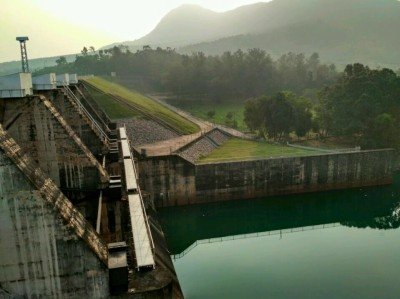
Balidiha Dam
Some quick example text to build on the card title and make up the bulk of the card's content.
Go somewhere
Bhimkund Waterfall
Some quick example text to build on the card title and make up the bulk of the card's content.
Go somewhere
Brahman Kundo
Some quick example text to build on the card title and make up the bulk of the card's content.
Go somewhere
Chaulabhaja Waterfall
Some quick example text to build on the card title and make up the bulk of the card's content.
Go somewhere
Devkund Waterfall & Temple
Some quick example text to build on the card title and make up the bulk of the card's content.
Go somewhere
Haripur Garh
Some quick example text to build on the card title and make up the bulk of the card's content.
Go somewhere
Joranda Waterfall
Some quick example text to build on the card title and make up the bulk of the card's content.
Go somewhere
Kakharua Vaidyanath Temple
Some quick example text to build on the card title and make up the bulk of the card's content.
Go somewhere
Kapadgadi Waterfall
Some quick example text to build on the card title and make up the bulk of the card's content.
Go somewhere
Kichakeswari Temple
Some quick example text to build on the card title and make up the bulk of the card's content.
Go somewhere
Lulung Tourist Spot
Some quick example text to build on the card title and make up the bulk of the card's content.
Go somewhere
Munsi Bandha
Some quick example text to build on the card title and make up the bulk of the card's content.
Go somewhere
Ramtirtha Crocodile Project
Some quick example text to build on the card title and make up the bulk of the card's content.
Go somewhere
Samibrukhya Hill
Some quick example text to build on the card title and make up the bulk of the card's content.
Go somewherein Other Cities