
Handawada Waterfall
General information
-
Ideal Duration:
A minimum of 8 to 10 hours is required for the entire journey (including travel from Narayanpur, trekking, and time at the fall). It is recommended as an overnight camping trip.Place Type:
Natural Wonder and Trekking Destination:Entry Fees:
Mandatory Guide Fee: The primary Entry Fee is the mandatory cost of hiring a local guide, which is essential for navigating the difficult, unmarked trails and ensuring respectful interaction with the environment. This typically costs between Rs. 1,500 to Rs. 3,000 per day...Mandatory Guide Fee: The primary Entry Fee is the mandatory cost of hiring a local guide, which is essential for navigating the difficult, unmarked trails and ensuring respectful interaction with the environment. This typically costs between Rs. 1,500 to Rs. 3,000 per day per group.
Permit Costs: If entering from the restricted Abujhmarh side (via Barsur), official forest permits may be required, incurring an administrative fee (typically Rs. 200 to Rs. 500 per person). Visitors must ensure they have all necessary paperwork to avoid legal issues in the sensitive zone.
River Crossing Charges: During the post-monsoon period, local guides may charge a small fee (approx. Rs. 50 to 100) for assisting with the crossing of the Indravati River by small boat or making arrangements for crossing the shallower nalas. This payment ensures local collaboration and safety. As a raw natural site, there are no fixed tickets or gate charges.Timing:
Regular Timings: Access to the trekking path is typically restricted to daylight hours, from 7:00 AM to 4:00 PM, as the forest path becomes dangerous after dark. Visitors must plan to exit the trekking area by sunset.
Ideal Visit Time: The ...Regular Timings: Access to the trekking path is typically restricted to daylight hours, from 7:00 AM to 4:00 PM, as the forest path becomes dangerous after dark. Visitors must plan to exit the trekking area by sunset.
Ideal Visit Time: The ideal time is the Winter season, from December to May, when the unmetalled roads and stream crossings are dry and manageable for vehicles. The period from January to March is perfect for comfortable trekking. The Monsoon (June to October) should be avoided entirely due to severe road blockages and dangerous river flows.
Mid-day Sun: While mid-day is generally hot, it ensures the water flow is visible, but early morning is best for light and atmosphere.Special Events:
Post-Monsoon River Crossing Ritual and Local Deity Worship: The most significant special event, though largely unofficial and tribal, is the ritualistic crossing and blessing of the Indravati River near the Saath-dhaar bridge and the subsequent Goyder Nala crossings, which local tribes perform after...Post-Monsoon River Crossing Ritual and Local Deity Worship: The most significant special event, though largely unofficial and tribal, is the ritualistic crossing and blessing of the Indravati River near the Saath-dhaar bridge and the subsequent Goyder Nala crossings, which local tribes perform after the peak Monsoon season (around October or November).
Trekking Season Opening: The official January 20th opening of the approach road is treated as a major local event, as it signals the start of the accessible tourist season and the arrival of supplies and researchers.
Village Ceremonies: Due to the falls' proximity to tribal villages in the Orchha region, the falls are often the site of specific ceremonies related to the harvest or thanking nature for water (jal pooja), especially after the Monsoon. These are highly localized and not public tourist events, but visitors in November or December might witness them from a respectful distance.Best Photo Spots:
The Upper Ridge Panoramic View: This spot, accessible by the less-adventurous path, offers a clear, distant, wide-angle view of the sheer drop, capturing the mountain scenery and the vast forest canopy surrounding the falls.
The Plunge Pool Basi...The Upper Ridge Panoramic View: This spot, accessible by the less-adventurous path, offers a clear, distant, wide-angle view of the sheer drop, capturing the mountain scenery and the vast forest canopy surrounding the falls.
The Plunge Pool Basin: The base of the falls provides the most dramatic, up-close shots, capturing the tremendous force of the water and the mist in the air, requiring a waterproof camera or protection. The large, smooth, polished rock structures around the kund make for unique foreground elements.
The Forest Trek Trail: The trek itself is a series of photo opportunities, capturing the dense forest, the small, hidden streams, and the intricate root systems that cling to the earth. Look for rays of sunlight piercing the dense canopy.
Mid-Fall Vistas: Capturing the falls in a frame created by the surrounding jungle foliage, focusing on the segmented nature of the fall across the rocky cliff face, provides a sense of discovery and framing.Photo Gallery
Things To Do
-
Advanced Trekking, Nature Photography, and Stream Exploration:
The 5 km Adventure Trek ( target): The core activity is the challenging 3 to 5 km trek from Handawada village to the falls, which is suitable only for those with good physical fitness. The path requires navigating uneven terrain, crossing several rocky streams (some requiring wading), and traversing dense forest sections. This trek is an opportunity to practice advanced navigation skills and true wilderness survival.
A key focus is the soundscape: listening for the constant, increasing roar of the falling water, which acts as the natural guide.
Panoramic Photography and Viewpoint Hunting: Dedicated photographers should allocate time to reach the two key viewpoints: the upper ridge offering a dramatic downward view of the she...Advanced Trekking, Nature Photography, and Stream Exploration:
The 5 km Adventure Trek ( target): The core activity is the challenging 3 to 5 km trek from Handawada village to the falls, which is suitable only for those with good physical fitness. The path requires navigating uneven terrain, crossing several rocky streams (some requiring wading), and traversing dense forest sections. This trek is an opportunity to practice advanced navigation skills and true wilderness survival.
A key focus is the soundscape: listening for the constant, increasing roar of the falling water, which acts as the natural guide.
Panoramic Photography and Viewpoint Hunting: Dedicated photographers should allocate time to reach the two key viewpoints: the upper ridge offering a dramatic downward view of the sheer drop and the lower basin for a majestic, wide-angle shot of the cascade and the plunge pool. The optimal time for photography is early morning when the mist rises from the kund, or late afternoon for golden hour lighting on the waterfall face. Carrying a tripod and wide-angle lens is essential for capturing the scale.
Stream Ecology and Micro-Nature Observation: Spend time carefully exploring the Goyder Nala stream, looking for freshwater species, unique mosses, ferns, and riparian zone flora. This micro-observation is a meditative activity, forcing a slow, careful pace. Collect and identify plant samples (only through photography, without disturbing the environment).
Picnicking and Rest at the Kund: After the strenuous trek, relaxing by the natural kund (plunge pool) is rewarding. Since no food facilities are available, a well-planned, zero-waste picnic is mandatory. The cold spray from the waterfall acts as natural air conditioning, making it a perfect spot for extended rest and reflection.
Guiding and Cultural Respect: Engage the local tribal guide (mandatory) not just for navigation but to learn about the forest's history and their traditional connection to the falls, which they may consider sacred. Showing deep respect for the surrounding environment and the local community is a prerequisite for a fulfilling experience.
Overnight Camping (with permission): For the ultimate experience, consider setting up a secure camp near the village or an authorized safe location, allowing for an incredible view of the night sky free from light pollution, turning the journey into a multi-day expedition.
Information
-
Why Famous:
Height, Remoteness, and Pristine Condition: Handawada is famous for being one of the tallest waterfalls in Chhattisgarh, with its approximate 400-foot drop. Its fame is rooted in its extreme remoteness and the challenging journey required to reach it, which deters casual vi...Height, Remoteness, and Pristine Condition: Handawada is famous for being one of the tallest waterfalls in Chhattisgarh, with its approximate 400-foot drop. Its fame is rooted in its extreme remoteness and the challenging journey required to reach it, which deters casual visitors. This ensures the waterfall remains in an extraordinarily pristine, 'virgin' condition, offering a rare glimpse of untouched natural beauty. The powerful visual impact, often compared to the grandeur of the Baahubali film set, adds to its mystique and reputation among adventure travelers. Furthermore, its location deep within the Abujhmarh forest area links it culturally to the indigenous tribes, giving it a dual identity as both a natural wonder and a tribal gateway. The natural lake it forms at the bottom is highly revered by locals. -
Architecture:
Geological Formation and Natural Dams: The Architecture of Handawada Waterfall is purely geological, sculpted by the natural erosion of the Goyder Nala over ancient rock strata.
The Cliff Face and Drop: The waterfall's primary architectural ...Geological Formation and Natural Dams: The Architecture of Handawada Waterfall is purely geological, sculpted by the natural erosion of the Goyder Nala over ancient rock strata.
The Cliff Face and Drop: The waterfall's primary architectural feature is the near-vertical cliff face, composed of hard basalt or granite rock, from which the water makes its dramatic, segmented drop. The estimated vertical height of the main cascade is significant, reaching up to 120 meters (400 feet), placing immense pressure on the underlying structure. The multiple segments or 'blocks' mentioned in local lore suggest a stair-step erosion pattern where the water momentarily gathers before plunging again, rather than a single freefall.
The Reservoir (Kund): At the bottom, the forceful impact of the water has carved out a large, natural plunge pool (kund), which acts as a foundational element. The size and depth of this reservoir change seasonally, but its existence is a testament to the immense erosive power over geologic time. The surrounding area is dominated by large, smooth, polished rock formations (sheer-faced granite slabs) created by millennia of water flow. The natural forest canopy acts as a protective, living Architecture over the entire environment, keeping the water pristine and the air cool. -
How To Reach:
By Air: The nearest major airport is Swami Vivekananda Airport (RPR) in Raipur (approx. 338 KMS). From there, take a taxi or bus to Narayanpur city. Jagdalpur Airport (JGA) is another point of entry (approx. 115 KMS).
By Train: The close...By Air: The nearest major airport is Swami Vivekananda Airport (RPR) in Raipur (approx. 338 KMS). From there, take a taxi or bus to Narayanpur city. Jagdalpur Airport (JGA) is another point of entry (approx. 115 KMS).
By Train: The closest major railhead is Jagdalpur Railway Station (JAG) (approx. 150 KMS) or Dantewada Railway Station (approx. 60 KMS to Barsur). From either station, hire a private taxi to Narayanpur town or, more directly, to Barsur (which is a common starting point for the route via Muchnar).
By Road: Handawada is deep within the Orchha block. From Narayanpur city, hire a 4×4 vehicle towards Barsur or Orchha. The route often involves traveling approximately 70 km to Barsur, then crossing the Indravati River at Muchnar (often via a boat or a ford during the dry season), and then proceeding another 30 km on an extremely rough, unmetalled road to Handawada village, followed by the 3 km final trek. Road access is only reliable in the dry season (January to May).
By Local Transport: Local transport is unreliable beyond Barsur. You must pre-arrange a private, high-clearance jeep from Narayanpur or Barsur and budget for a mandatory guide. Two-wheelers are possible but require high skill. -
Weather and Best Time to Visit:
The Peak Dry Winter (January to March): This provides the best combination of pleasant weather (15Rs.C to 28Rs.C), safe road conditions (dry stream beds and roads), and spectacular water visibility. This period is highly recommended for trekking.
T...The Peak Dry Winter (January to March): This provides the best combination of pleasant weather (15Rs.C to 28Rs.C), safe road conditions (dry stream beds and roads), and spectacular water visibility. This period is highly recommended for trekking.
The Summer Access (April to May): While hot (up to 40Rs.C), access is easiest as all roads and stream beds are completely dry. However, the waterfall's volume may be slightly reduced compared to the post-monsoon period, and heat stroke is a major risk.
Different Parts of the Day: Sunrise to Mid-morning (6:00 AM to 10:00 AM) is the only safe and comfortable window for the main trek and initial viewing before the high sun hits. Plan the entire day trip to reach the base by 11:00 AM and start the return trek by 2:00 PM. -
Near Tourist Places:
Barsur Temple Ruins (Dantewada, 40 KMS away), Gadiya Mountain (Kanker, 140 KMS away), Khursel Ghati (100 KMS away, difficult link road), Kachchapal Waterfall (105 KMS away, different direction), Chitrakote Falls (130 KMS away), Tirathgarh Waterfall (150 KMS away), Dantewada Town (60 KMS to Barsur), Indravati National Park (90 KMS away), Murtasur Shiv Temple (90 KMS away), Maa Mavali Temple (Narayanpur, 111 KMS away).
Tourism Tips
-
Health & Safety First: Given the extreme remoteness and the challenging trek, Health & Safety demands a pre-trip health check. The trek involves potential hazards like rocky paths, river crossings, and wildlife (snakes). Carry a satellite phone or emergency communication d...Health & Safety First: Given the extreme remoteness and the challenging trek, Health & Safety demands a pre-trip health check. The trek involves potential hazards like rocky paths, river crossings, and wildlife (snakes). Carry a satellite phone or emergency communication device if possible, as mobile connectivity is non-existent. Inform forest authorities and a reliable third party of your route.
Packing Essentials: Packing must prioritize water (at least 3 liters per person), high-quality trekking gear, an extra pair of shoes for wading, a dry bag for electronics, and all necessary food/snacks. Leave no trash behind (strictly zero-waste policy). A knowledgeable local guide is the most important piece of "equipment.
" Accommodation Protocol: There are no hotels. Plan for a day trip or primitive camping (only with official permission and guide support) in Handawada village or near an Aashram if available. Staying in Narayanpur or Barsur is the only reliable option.
Other Important Topics: Never attempt the journey alone. Be aware of the area's sensitive status. Factor in the time needed to cross the Indravati River, which can involve waiting for a boat.
Reviews
FAQs
Narayanpur Itineray And Cost:-
Handawada Waterfall Tourism:-
Other Places In Narayanpur :-
Other States In India :-
Information about New and Updated Locations() of Chhattisgarh Has Been Added :-
Card subtitle
Note:-
Information provided here in good Faith and for reference only.
Near Places

Abujhmarh
Some quick example text to build on the card title and make up the bulk of the card's content.
Go somewhere
Dhokra Bell Metal Handicraft Centre
Some quick example text to build on the card title and make up the bulk of the card's content.
Go somewhere
Handawada Waterfall
Some quick example text to build on the card title and make up the bulk of the card's content.
Go somewhere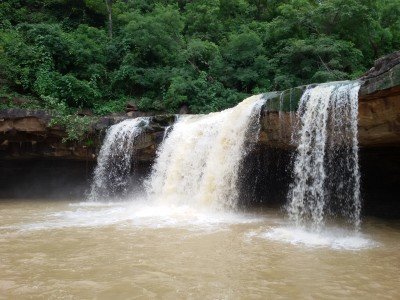
Kachchapal Waterfall
Some quick example text to build on the card title and make up the bulk of the card's content.
Go somewhere
Khursel Ghati
Some quick example text to build on the card title and make up the bulk of the card's content.
Go somewhere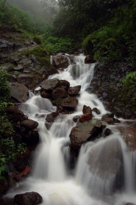
Khursel Waterfall
Some quick example text to build on the card title and make up the bulk of the card's content.
Go somewhere
Mata Mavli Mela Ground
Some quick example text to build on the card title and make up the bulk of the card's content.
Go somewhere
Pahadi Mata Mandir
Some quick example text to build on the card title and make up the bulk of the card's content.
Go somewhere
Ramkrishna Mission Ashram
Some quick example text to build on the card title and make up the bulk of the card's content.
Go somewhere
Statue of Lord Shiva
Some quick example text to build on the card title and make up the bulk of the card's content.
Go somewherein Other Cities