

Khursel Ghati
General information
-
Ideal Duration:
A day trip focused on the waterfall requires 6 hours to 8 hours. A full exploration of the valley and trekking would require 2 days to 3 days.Place Type:
Scenic Mountain Valley and Biodiversity Hotspot:Entry Fees:
Minimal Local Fees: Similar to Kachchapal, there is generally No Fixed Entry Fee to the valley or the waterfall. It is a natural forest area.
Guide Fees (Recommended): Hiring a local guide from Narayanpur or Gudabheda is highly recommended ...Minimal Local Fees: Similar to Kachchapal, there is generally No Fixed Entry Fee to the valley or the waterfall. It is a natural forest area.
Guide Fees (Recommended): Hiring a local guide from Narayanpur or Gudabheda is highly recommended for trekking in the deep valley and is the primary cost (approx. Rs. 1,500 to Rs. 2,500 per group per day), covering the guide's expertise, safety, and cultural intermediation.
Toll or Checkpoint Contribution: A nominal fee (approx. Rs. 50 to 100) may be collected by local forestry checkpoints near the entry point of the valley, primarily for basic road maintenance or documentation purposes. This amount is minimal but necessary for controlled access. As an ecological area, the investment in a guide is the most important expenditure.Timing:
Regular Timings: Access is generally restricted to daylight hours, from 7:00 AM to 5:00 PM. Due to the density of the forest and the difficult roads, visitors should plan to exit the valley well before dusk (by 4:00 PM).
Ideal Visit Time: T...Regular Timings: Access is generally restricted to daylight hours, from 7:00 AM to 5:00 PM. Due to the density of the forest and the difficult roads, visitors should plan to exit the valley well before dusk (by 4:00 PM).
Ideal Visit Time: The ideal time for both trekking and enjoying the scenery is during the Winter months, from November to February, when the climate is cool (10Rs.C to 25Rs.C), and the forest is at its most comfortable. The flow of the falls is usually good following the monsoon.
Morning Hours: Early morning (6:00 AM to 11:00 AM) is perfect for the main trek and wildlife spotting, as the temperature is low and the light is soft.Special Events:
Tribal Harvest Feasts and Monsoon Retreat: While there are no large-scale, commercial events, the valley is a traditional site for local tribal families from nearby villages like Gudabheda to celebrate the success of the harvest with small, communal feasts, usually around No...Tribal Harvest Feasts and Monsoon Retreat: While there are no large-scale, commercial events, the valley is a traditional site for local tribal families from nearby villages like Gudabheda to celebrate the success of the harvest with small, communal feasts, usually around November and March.
Annual Monsoon Retreat (Local): The valley's pleasant climate makes it a preferred local spot for tribal communities to gather during the dry spells of the Monsoon season (July-August) for social gatherings and traditional rituals, often involving music and the sharing of folklore. These intimate gatherings are special events that underscore the local significance of the site, though they are not tourism-centric.
Adventure Tourism Camp: Occasionally, local adventure clubs or government tourism bodies organize multi-day adventure camping and trekking events in the valley, usually in February or March, which is a special chance for structured exploration.Best Photo Spots:
The Valley Crest Viewpoint: Capture the magnificent panoramic view from the top of the Ghati, showing the entire 9. 5 km valley stretching out below, framed by the distant peaks. This is best done in early morning for the best light and sense of scale.
Read MoreThe Valley Crest Viewpoint: Capture the magnificent panoramic view from the top of the Ghati, showing the entire 9. 5 km valley stretching out below, framed by the distant peaks. This is best done in early morning for the best light and sense of scale.
The 400-foot Cascade: Photographing the Khursel Waterfall from a mid-level vantage point to capture the water cascading over the multiple rocky steps, giving a sense of the height and segmentation. Use a slow shutter speed for a silky water effect.
The Ramayana Trees: Finding and photographing the ancient, massive Teak trees in the Kurandi forest, capturing their size and age as a tribute to the forest's history.
The Large Boulders and Pools: Close-up photography of the intricate patterns created by water erosion on the large boulders near the stream and the clear, reflective surfaces of the multiple kunds formed by the falling water.Photo Gallery
Things To Do
-
Trekking, Waterfall Showering, and Wildlife Spotting:
Scenic Valley Trekking ( target): Engage in challenging yet rewarding trekking along the rim and floor of the 9. 5 km long valley. The goal is to reach viewpoints that offer sweeping, unobstructed vistas of the vast valley and the surrounding high ridges. The trek is physically demanding, requiring comfortable trekking shoes and a guide. Focus on exploring the various levels of the Khursel Waterfall and the multiple kunds it creates, taking care around slippery, moss-covered rocks. The valley floor offers easier, meandering walks through open meadows interspersed with dense thickets.
Waterfall Showering and Natural Baths: A major draw is the opportunity to take a refreshing shower under the multiple segments of the Khursel Waterfall during the non-monsoon months. ...Trekking, Waterfall Showering, and Wildlife Spotting:
Scenic Valley Trekking ( target): Engage in challenging yet rewarding trekking along the rim and floor of the 9. 5 km long valley. The goal is to reach viewpoints that offer sweeping, unobstructed vistas of the vast valley and the surrounding high ridges. The trek is physically demanding, requiring comfortable trekking shoes and a guide. Focus on exploring the various levels of the Khursel Waterfall and the multiple kunds it creates, taking care around slippery, moss-covered rocks. The valley floor offers easier, meandering walks through open meadows interspersed with dense thickets.
Waterfall Showering and Natural Baths: A major draw is the opportunity to take a refreshing shower under the multiple segments of the Khursel Waterfall during the non-monsoon months. The water is pristine and ice-cold, providing a revitalizing natural bath. Always check the force of the flow and only bathe in the established, shallower pools to ensure safety. This activity provides an intense physical connection to the environment.
Wildlife and Bird Watching: The valley is a critical wildlife habitat. Dedicated early morning and late afternoon trips should be planned for quiet observation, specifically targeting the diverse birdlife and looking for signs of larger mammals like bison or antelope. This requires silence, patience, and the use of binoculars.
Picnicking and Bastar Cuisine: The valley offers beautiful, shaded picnic spots, making it a wonderful place to spend several hours. Carry locally sourced Bastar food items (laddus, pithas) and enjoy a meal in the serene atmosphere. Always adhere to a strict carry-in, carry-out (zero-waste) policy.
Forest Botany Study: Engage with a local expert to undertake an amateur study of the forest's immense botanical wealth, focusing on the medicinal herbs, the diverse tree species, and the unique fungi. This turns a simple walk into an educational experience.
Meditation and Photography: Use the solitude of the deep valley for quiet meditation and reflection. The different light conditions—from the misty morning fog to the intense, directional sunlight—make the valley an ever-changing canvas for dedicated nature photography, focusing on macro-shots of plants and wide-angle shots of the layered mountain ridges.
Information
-
Why Famous:
Exceptional Natural Beauty and Historic Name: Khursel Ghati is famously known as the "Nainital of Bastar," a historical moniker that highlights its year-round pleasant climate and breathtaking, unspoiled mountain scenery. This fame dates back to the British administration, ...Exceptional Natural Beauty and Historic Name: Khursel Ghati is famously known as the "Nainital of Bastar," a historical moniker that highlights its year-round pleasant climate and breathtaking, unspoiled mountain scenery. This fame dates back to the British administration, who recognized its strategic beauty and unique topography. The presence of the spectacular Khursel Waterfall, which plunges approximately 400 feet in sections, is a major draw. The valley is also famous for its rich biodiversity, acting as a crucial sanctuary and corridor for regional wildlife like the Bison and the Four-Horned Antelope. Its seclusion ensures that the forest cover remains remarkably dense and vibrant, making it a critical ecological reference point in the Chhattisgarh state. The wide, sweeping vistas of the valley floor, framed by the high ridges, are widely celebrated. -
Architecture:
Valley Topology and Natural Defense: The Architecture of the Khursel Ghati is defined by its defensive geological structure: a narrow, sheltered valley surrounded on three sides (North, East, and South) by imposing, high ridges, with a dense belt of protected forest acting a...Valley Topology and Natural Defense: The Architecture of the Khursel Ghati is defined by its defensive geological structure: a narrow, sheltered valley surrounded on three sides (North, East, and South) by imposing, high ridges, with a dense belt of protected forest acting as a natural barrier to the West.
The Terraced Cascades: The main architectural feature is the Khursel Waterfall, characterized by a 120 meter (400 feet) vertical drop that is broken into multiple horizontal blocks or segments by sharp, rocky ledges. The water flows over large stone blocks, creating a stair-step cascade that carves out several distinct plunge pools (kunds). This segmented design is a unique architectural element of the falls.
Botanical Architecture: The valley's flora contributes a significant "botanical architecture," featuring massive, ancient trees. The nearby Kurandi forest is famed for its four large Teak trees, traditionally named after the four brothers of the Ramayana (Rama, Lakshman, Bharat, and Shatrughan), symbolizing the age and cultural significance of the forest structure. The high density of medicinal plants forms a specialized ecological zone. -
How To Reach:
By Air: The nearest major airport is Swami Vivekananda Airport (RPR) in Raipur (approx. 320 KMS). From Raipur, hire a private taxi to Narayanpur. Jagdalpur Airport (JGA) is another key access point (approx. 130 KMS).
By Train: The neares...By Air: The nearest major airport is Swami Vivekananda Airport (RPR) in Raipur (approx. 320 KMS). From Raipur, hire a private taxi to Narayanpur. Jagdalpur Airport (JGA) is another key access point (approx. 130 KMS).
By Train: The nearest railhead is Jagdalpur Railway Station (JAG) (approx. 140 KMS) or Dantewada Railway Station (approx. 110 KMS). From there, hire a vehicle to Narayanpur.
By Road: Khursel Ghati is about 40 KMS northwest of Narayanpur city. The route involves traveling via Koylibeda or a road near Gudabheda. The road quality can be challenging in the last few kilometers, requiring a sturdy vehicle or a high-clearance jeep. A private taxi from Narayanpur is the most convenient option, taking about 1. 5 to 2 hours.
By Local Transport: Shared jeeps or local transport buses run from Narayanpur toward the Koylibeda block, dropping passengers at villages like Gudabheda or Khursel village. The final 9 km trek to the waterfall from Gudabheda must be completed on foot or by a local, specialized transport arrangement. -
Weather and Best Time to Visit:
The Post-Monsoon Greenery (October to November): This time is spectacular, with the forest at its lushest and the waterfall running at high volume, making the valley's nickname, "Nainital of Bastar," feel most appropriate. The air is cool and clean.
Read MoreThe Post-Monsoon Greenery (October to November): This time is spectacular, with the forest at its lushest and the waterfall running at high volume, making the valley's nickname, "Nainital of Bastar," feel most appropriate. The air is cool and clean.
The Winter Peak (December to February): Offers the most comfortable climate for extended trekking and camping, with little risk of extreme heat or rain. This is the optimal period for photography.
Different Parts of the Day: Early Morning is ideal for spotting wildlife and enjoying the peaceful atmosphere of the valley before the sun rises high. Late Afternoon is perfect for visiting the waterfall and capturing the golden light on the cascades.Near Tourist Places:
Kachchapal Waterfall (30 KMS away), Ramakrishna Mission Ashram (Narayanpur, 40 KMS away), Maa Mavali Temple (Narayanpur, 40 KMS away), Binjali Dam (35 KMS away), Binagunda Village (25 KMS away), Koylibeda Town (50 KMS away), Chhota Dongar Town (60 KMS away), Keshkal Ghat (100 KMS away), Gadiya Mountain (Kanker, 100 KMS away), Handawada Waterfall (100 KMS away, difficult link road).Tourism Tips
-
Health & Safety First: Health & Safety requires vigilance against wildlife (bison, snakes) and potential dangers from the steep, slippery cliffs near the 400-foot falls; always maintain distance from the edges. Carry an emergency whistle and comprehensive first-aid kit. M...Health & Safety First: Health & Safety requires vigilance against wildlife (bison, snakes) and potential dangers from the steep, slippery cliffs near the 400-foot falls; always maintain distance from the edges. Carry an emergency whistle and comprehensive first-aid kit. Mobile network coverage is sparse or non-existent inside the deep valley.
Packing Essentials: Packing essentials include sturdy hiking boots, layered clothing (as the valley can get cold), insect repellent, a high-capacity water bottle, and a powerful zoom lens for wildlife spotting. Carry sufficient cash, as no digital transactions are possible.
Accommodation Protocol: Stay in a hotel in Narayanpur city. Primitive, authorized camping is possible inside the valley (with permission and a guide), but requires bringing all supplies, including tents and cooking equipment.
Other Important Topics: Respect the forest laws. Do not disturb the flora or fauna. The valley is known for medicinal plants, so do not harvest anything. Always inform the local forest range office before embarking on a deep trek.
Reviews
FAQs
Narayanpur Itineray And Cost:-
Other Places In Narayanpur :-
Other States In India :-
Information about New and Updated Locations() of Chhattisgarh Has Been Added :-
Card subtitle
Note:-
Information provided here in good Faith and for reference only.
Near Places

Abujhmarh
Some quick example text to build on the card title and make up the bulk of the card's content.
Go somewhere
Dhokra Bell Metal Handicraft Centre
Some quick example text to build on the card title and make up the bulk of the card's content.
Go somewhere
Handawada Waterfall
Some quick example text to build on the card title and make up the bulk of the card's content.
Go somewhere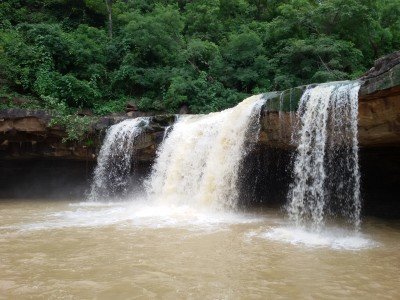
Kachchapal Waterfall
Some quick example text to build on the card title and make up the bulk of the card's content.
Go somewhere
Khursel Ghati
Some quick example text to build on the card title and make up the bulk of the card's content.
Go somewhere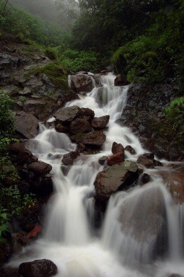
Khursel Waterfall
Some quick example text to build on the card title and make up the bulk of the card's content.
Go somewhere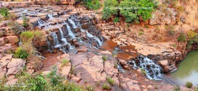
Mata Mavli Mela Ground
Some quick example text to build on the card title and make up the bulk of the card's content.
Go somewhere
Pahadi Mata Mandir
Some quick example text to build on the card title and make up the bulk of the card's content.
Go somewhere
Ramkrishna Mission Ashram
Some quick example text to build on the card title and make up the bulk of the card's content.
Go somewhere
Statue of Lord Shiva
Some quick example text to build on the card title and make up the bulk of the card's content.
Go somewherein Other Cities