


Ayodhya Hills
General information
-
Ideal Duration:
2 Days to 3 Days:Place Type:
Nature, Adventure, Mythology:Entry Fees:
Forest and Dam Area Access Fees: Most natural sites in the Ayodhya Hills are managed by the Forest Department or the PPSP project. Generally, there is No Entry Fee for the main Ayodhya Hilltop area or general driving. However, some specific spots often require a nominal e...Forest and Dam Area Access Fees: Most natural sites in the Ayodhya Hills are managed by the Forest Department or the PPSP project. Generally, there is No Entry Fee for the main Ayodhya Hilltop area or general driving. However, some specific spots often require a nominal environmental or access fee. For instance, the gate leading to Bamni Falls may charge an individual entry fee, typically around 20 to 50 INR per person. Access to the viewpoints or specific dams like Upper Dam and Lower Dam are free, but the hydroelectric project area itself is restricted.
Vehicle Entry and Parking Fees: If you are traveling with a private vehicle (car or hired jeep), there is usually a small, mandatory entry fee for the vehicle itself to enter the main tourist areas. This fee can range from 50 to 150 INR per vehicle. Parking near popular spots like Bamni Falls or Sita Kund is managed by local committees, which charge a small parking fee, usually 20 to 30 INR per hour or per visit. Always carry small change for these localized fees.
Activity-Based Charges: Activities such as rock climbing or organized camping require payment to the local operators or authorized agencies. A guided trek to Gorgaburu or a short rock climbing session can cost between 500 to 1,500 INR per person, depending on the duration and equipment provided. The purchase of a Chhau mask in Charida varies widely based on size and intricacy, typically starting from 300 INR for a small, simple mask up to several thousand for a full, elaborate one.Timing:
Regular Timings: Most spots in Ayodhya Hills, being natural, do not have fixed closing gates like museums or forts. They are open from Sunrise to Sunset. It is strongly recommended to start sightseeing early, around 6:00 AM, and finish by 5:30 PM. The forest roads, espec...Regular Timings: Most spots in Ayodhya Hills, being natural, do not have fixed closing gates like museums or forts. They are open from Sunrise to Sunset. It is strongly recommended to start sightseeing early, around 6:00 AM, and finish by 5:30 PM. The forest roads, especially those leading to secluded spots like Bamni Falls or Turga Dam, become unsafe and deserted after dark. The PPSP Dam viewpoints are best visited between 9:00 AM and 5:00 PM.
Ideal Visit Time:
Early Morning and Late Afternoon: The ideal time to visit is in the early morning, just after Sunrise, especially for viewpoints and trekking. The air is crisp, the light is soft for photography, and the environment is exceptionally peaceful. For example, starting the Bamni Falls trek by 8:00 AM helps avoid the midday heat. The late afternoon, around 4:00 PM to 5:30 PM, is the second best time, specifically for visiting the Upper Dam viewpoint to catch the magnificent sunset. Avoid midday (11:00 AM to 3:00 PM) during summer months, as the heat can be intense.Special Events:
Tusu Festival (Makar Sankranti): The most significant local event is the Tusu Festival, celebrated around Makar Sankranti in the middle of January. This is a harvest festival, primarily celebrated by the tribal and semi-tribal communities of the region. The festival is de...Tusu Festival (Makar Sankranti): The most significant local event is the Tusu Festival, celebrated around Makar Sankranti in the middle of January. This is a harvest festival, primarily celebrated by the tribal and semi-tribal communities of the region. The festival is dedicated to the Goddess Tusu. It involves women singing folk songs (Tusu Gaan) and crafting colorful, intricate miniature temples made of wood or clay, called Tusu Chawdals. These are beautifully decorated and carried in processions, often ending with the immersion of the Chawdal into a nearby river or dam water, symbolizing the cycle of life and harvest. The entire district, especially the villages around Ayodhya Hills, buzzes with music and festive spirit during this time. The Tusu songs are spontaneous, reflecting daily life, love, and grievances. The festival offers a profound glimpse into the local folk religion and community life.
Chhau Festival (Spring/Bhoj): While not strictly timed like Tusu, the Chhau dance is traditionally performed during the Chaitra festival (March-April) and in local celebrations or 'Bhoj' (feasts). During the peak tourist season in winter, special performances are often arranged for visitors. The Chhau dance is a spectacle, featuring mythological themes from the Ramayana and Mahabharata, performed by masked dancers. These performances are typically held in an open arena with traditional music played on instruments like the Dhol (drum) and Shehnai (pipe). Observing a Chhau performance is essential to understanding the cultural richness of the Purulia district.Best Photo Spots:
Upper Dam and Sunset Point: The viewpoint near the PPSP Upper Dam offers a wide, dramatic panorama. Photographers should aim for the 'Golden Hour' just before sunset. The vast expanse of the artificial lake reflecting the intense colors of the sky from deep oranges to pur...Upper Dam and Sunset Point: The viewpoint near the PPSP Upper Dam offers a wide, dramatic panorama. Photographers should aim for the 'Golden Hour' just before sunset. The vast expanse of the artificial lake reflecting the intense colors of the sky from deep oranges to purples provides an excellent backdrop. The contrasting texture of the rocky slopes in the foreground against the smooth water and distant hills creates visual depth. A popular composition includes capturing the sheer scale of the massive dam structure itself, often with a long exposure to smooth out the water surface.
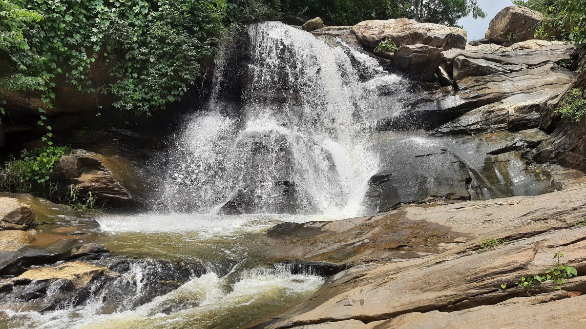
Bamni Falls Gorge: This spot is challenging but rewarding. To capture the full majesty of Bamni Falls, photographers must brave the descent. The best shots are often taken from the bottom of the gorge, looking up at the multi-tiered waterfall cascading over the rocks. Using a slow shutter speed is highly recommended to give the falling water a silky, ethereal look. During the monsoon, the surrounding lush greenery provides a beautiful, saturated frame for the cascading white water. Be extremely mindful of the camera gear due to the moisture and mist.
The Palash Tree Landscape (Spring): During February and March, the entire landscape transforms due to the blooming Palash trees. The best photo spots are the rural roads and hill slopes near Matha Forest and the Baghmundi area. The goal here is to capture the vast expanse of the red-orange flowers against the red soil. Wide-angle shots are essential to convey the sweeping, fiery look of the forest. Closer shots of the flowers themselves, with the dry, thorny branches, also make for striking, detail-oriented photos, especially when paired with a clear blue sky.Photo Gallery

Things To Do
-
Serious Trekking and Hiking: Ayodhya Hills is a trekker's dream. The most rewarding trek is to Gorgaburu, the highest peak, offering challenging trails and magnificent sunrise views. Another popular, moderate hike leads to Bamni Falls. The trails are generally well-marked but require sturdy shoes, especially during the post-monsoon months when the paths are slightly damp and slippery. Many trails start near the Matha Forest Rest House area or the Baghmundi side. Trekkers should always carry sufficient water and snacks, as facilities are scarce on the upper slopes. For beginners, a short, accessible trail is the walk to Mayur Pahar, which offers quick, rewarding views without extreme elevation gain.
Waterfall Chasing and Natural Pool Dips: The monsoon and post-monsoon seasons bring the several seasonal and perennial waterf...
Information
-
Why Famous:
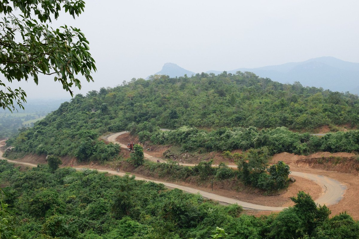
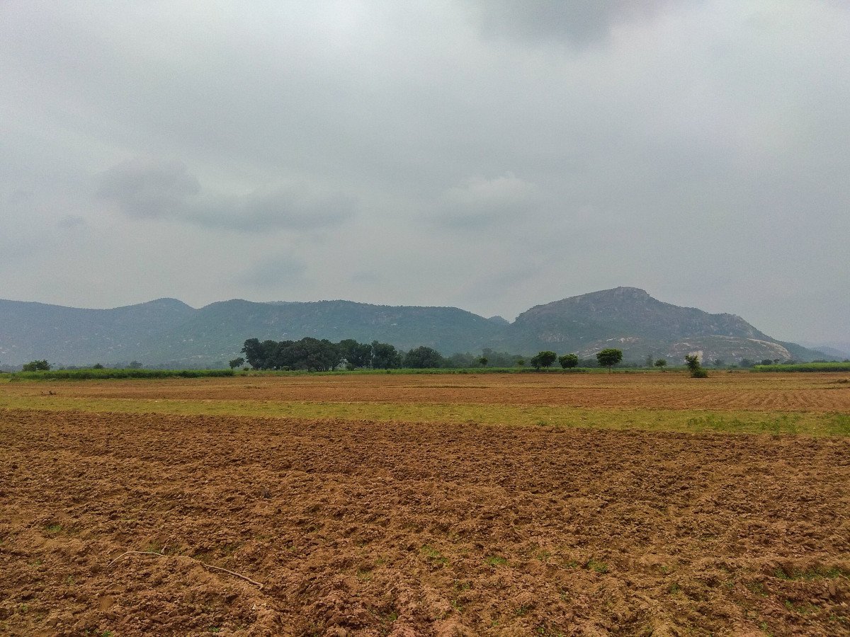
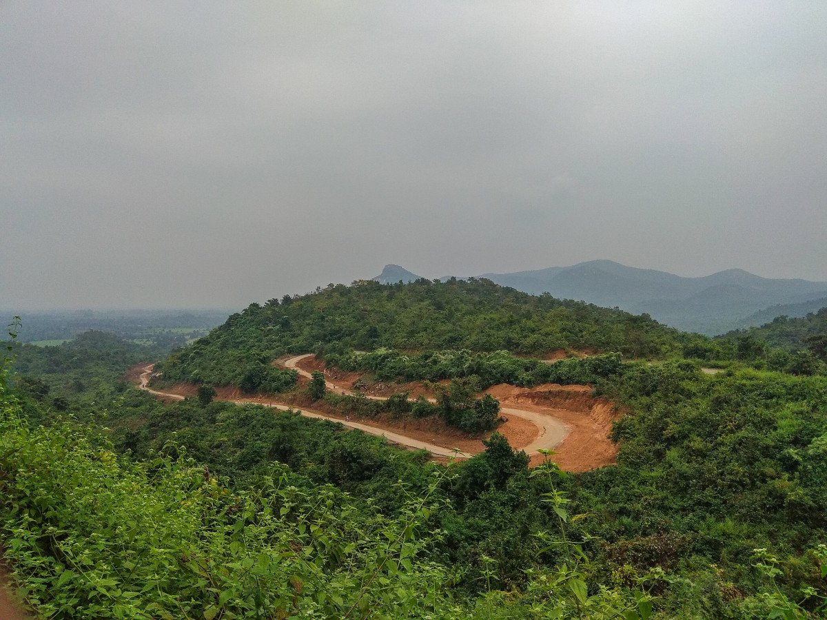
Natural Beauty and Distinct Plateau: Ayodhya Hills is primarily famous for being the most scenic and geographically distinct location in Purulia. It represents the last uplifted portion of the ancient Chota Nagpur Plateau before it descends into the Bengal plains. This un...Natural Beauty and Distinct Plateau: Ayodhya Hills is primarily famous for being the most scenic and geographically distinct location in Purulia. It represents the last uplifted portion of the ancient Chota Nagpur Plateau before it descends into the Bengal plains. This unique geography provides rolling hills, expansive plateaus, and stunning gorges, which are a major draw for photographers and nature enthusiasts. The contrast between the red, laterite soil and the vibrant green of the deciduous forest is visually spectacular, especially during the post-monsoon and winter seasons. The panoramic views from points like Chamtuburu and the Hairpin Bend are unparalleled.
Hub for Adventure Sports and Trekking: The rugged terrain of the hills makes it an ideal destination for adventure activities. The slopes of peaks like Gorgaburu and Mayur Pahar are famous training grounds for young mountaineers and rock climbers. The hill area offers numerous established trekking routes, catering to various difficulty levels, including the popular trek to Bamni Falls and the difficult climb to the highest peaks. The availability of camping sites and organized outdoor activities firmly establishes it as the adventure capital of Purulia.
Cultural Significance (Chhau Dance Origin): The Ayodhya Hills area is the cultural heartland of the Chhau dance, a semi-classical Indian dance form characterized by elaborate masks, high energy, and martial arts elements. The nearby village of Charida is dedicated entirely to the craft of making these masks. Visitors flock here to witness performances and purchase authentic masks, making the region crucial for preserving this UNESCO-recognized intangible cultural heritage. This strong cultural identity adds a unique layer to its fame, distinguishing it from purely natural tourist spots. -
Architecture:
Hydel Project Structures: The most prominent 'architecture' in Ayodhya Hills relates to the Purulia Pumped Storage Hydel Power Project (PPSP). This massive engineering undertaking features two large artificial reservoirs, the Upper Dam and the Lower Dam, constructed to gen...Hydel Project Structures: The most prominent 'architecture' in Ayodhya Hills relates to the Purulia Pumped Storage Hydel Power Project (PPSP). This massive engineering undertaking features two large artificial reservoirs, the Upper Dam and the Lower Dam, constructed to generate hydroelectricity. The Upper Dam is situated at an elevation of approximately 495 meters above Mean Sea Level (MSL), while the Lower Dam is at around 300 meters above MSL. The dams themselves are earth-fill structures, designed to manage enormous volumes of water. The sheer scale of the reservoirs, with their extensive catchment areas and large, concrete spillways, is impressive. The architecture here is purely utilitarian, focusing on stability and function to manage the water flow between the two levels for power generation.
Local Temple Design and Dimension: Scattered across the hill and nearby villages are smaller religious structures, such as the Ram Mandir and the structure surrounding Sita Kund. These structures are typically built using local materials, primarily laterite stones and brick, adhering to the traditional architectural style prevalent in rural West Bengal. A typical small temple might have a base of about 10 meters 10 meters with a Rekha Deul (tower) style dome or a simple hut-like structure. The architecture is characterized by simplicity and direct utility, often painted brightly. The dimensions are modest, integrating seamlessly into the natural, forested environment, unlike the grand historical temples found elsewhere in Purulia. The focus is less on ornate carvings and more on providing a sheltered space for worship at the natural sacred spots. -
How To Reach:
By Air (Nearest Airports): The closest major airport is Netaji Subhas Chandra Bose International Airport (CCU) in Kolkata, approximately 320 KMs away. A closer, though smaller, option is Birsa Munda Airport (IXR) in Ranchi, approximately 170 KMs away, or the Kazi Nazrul Is... -
Near Tourist Places:
Bamni Falls: 10 KMs
Upper Dam Viewpoint: 6 KMs
Lower Dam: 9 KMs
Charida Village (Chhau Masks): 21 KMs
Murguma Dam: 20 KMs
Turga Dam and Falls: 18 KMs
Khairabera Dam: 30 KMs (via Baghmundi)
Pakhi Pahar: 4 KMs
Sita Kund: 1 KM
Matha Forest: 23 KMs
Tourism Tips
-
Health & Safety:
Hydration and Sun Protection: The sun can be harsh even in winter. Always carry at least 2 liters of water per person during treks. Use sunscreen, hats, and sunglasses.
Trekking Safet...
Reviews
Information about New and Updated Locations(575+) of West Bengal Has Been Added :-
Card subtitle
Note:-
Information provided here in good Faith and for reference only.
All information and pictures will be updated soon, please keep visiting.
Near Places
Ajodhya Hill View Point
Some quick example text to build on the card title and make up the bulk of the card's content.
Go somewhere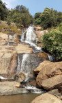
Ajodhya Hills Dams & Bamni Falls
Some quick example text to build on the card title and make up the bulk of the card's content.
Go somewhere
Ajodhya Pahar Hairpin View Point
Some quick example text to build on the card title and make up the bulk of the card's content.
Go somewhere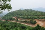
Ayodhya Hills
Some quick example text to build on the card title and make up the bulk of the card's content.
Go somewhere
Bamni Falls
Some quick example text to build on the card title and make up the bulk of the card's content.
Go somewhere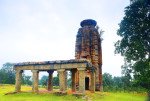
Banda Deul
Some quick example text to build on the card title and make up the bulk of the card's content.
Go somewhere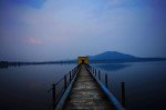
Baranti Reservoir
Some quick example text to build on the card title and make up the bulk of the card's content.
Go somewhere
Begunkodar
Some quick example text to build on the card title and make up the bulk of the card's content.
Go somewhere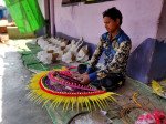
Charidah
Some quick example text to build on the card title and make up the bulk of the card's content.
Go somewhere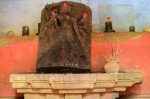
Deulghata Temple Ruins
Some quick example text to build on the card title and make up the bulk of the card's content.
Go somewherein Other Cities