

Heirok Hill
General information
-
Ideal Duration:
1-2 hours (for the ascent and view)Place Type:
Hillock, Scenic Viewpoint, Trekking SpotEntry Fees:
Admission: Free, as it is a natural public area.
Guiding/Local Support: You might hire a local guide for a small fee for an enhanced experience, but it is not mandatory. ...Admission: Free, as it is a natural public area.
Guiding/Local Support: You might hire a local guide for a small fee for an enhanced experience, but it is not mandatory.Timing:
Regular Timings: Open from Sunrise to Sunset (5:30 AM to 6:00 PM), but the trails are not secured or lit for night use.
Ideal Visit Time: Early Morning for clear views and comfortable trekking temperature, or Late Afternoon for the sunset vi...Regular Timings: Open from Sunrise to Sunset (5:30 AM to 6:00 PM), but the trails are not secured or lit for night use.
Ideal Visit Time: Early Morning for clear views and comfortable trekking temperature, or Late Afternoon for the sunset view and cooler air.Special Events:
Community Events: The base or the summit of the hill may occasionally host small, local community gatherings or religious events, particularly associated with the agricultural cycle or local deities. ...Community Events: The base or the summit of the hill may occasionally host small, local community gatherings or religious events, particularly associated with the agricultural cycle or local deities.Best Photo Spots:
Summit View: The ultimate spot for a wide-angle, panoramic shot of the entire Heirok plain and the ribbon-like Heirok River.
Trail Side Frames: Use the local foliage and trees along the trail to frame shots of the descending landscape.
<...Summit View: The ultimate spot for a wide-angle, panoramic shot of the entire Heirok plain and the ribbon-like Heirok River.
Trail Side Frames: Use the local foliage and trees along the trail to frame shots of the descending landscape.
Agricultural Fields: Capture the geometric patterns of the paddy fields at the base, often visible from the upper slopes.Photo Gallery
Things To Do
-
Trekking/Hiking: Enjoy the simple, refreshing hike to the top of the hill.
Photography: Take landscape photos of the valley, the Heirok River winding through the fields, and the small settlements below.
Meditation/Relaxation: Find a quiet spot to sit, enjoy the cool breeze, and soak in the peaceful surroundings.
Birdwatching: The foliage on the slopes attracts various local birds.
Picnic: Carry a light snack to enjoy at the summit while admiring the view.
Nature Sketching: The vast vista is a perfect subject for sketching.
Exploring the Base: Walk through the fields at the base to see local farming practices. ...Trekking/Hiking: Enjoy the simple, refreshing hike to the top of the hill.
Photography: Take landscape photos of the valley, the Heirok River winding through the fields, and the small settlements below.
Meditation/Relaxation: Find a quiet spot to sit, enjoy the cool breeze, and soak in the peaceful surroundings.
Birdwatching: The foliage on the slopes attracts various local birds.
Picnic: Carry a light snack to enjoy at the summit while admiring the view.
Nature Sketching: The vast vista is a perfect subject for sketching.
Exploring the Base: Walk through the fields at the base to see local farming practices.
Information
-
Why Famous:
Panoramic Valley Views: Famous for the spectacular views of the plains and the distant horizon, especially rewarding at sunrise or sunset.
Trekking for Beginners: It offers an accessible, easy trekking experience for locals and visitors who ...Panoramic Valley Views: Famous for the spectacular views of the plains and the distant horizon, especially rewarding at sunrise or sunset.
Trekking for Beginners: It offers an accessible, easy trekking experience for locals and visitors who want a short hike. -
Architecture:
Natural Hillock Formation: The architecture is predominantly natural, characterized by its low-lying, rolling topography typical of the valley-rim hillocks.
Hill Dimension and Trails: The elevation is moderate, and the structure includes nat...Natural Hillock Formation: The architecture is predominantly natural, characterized by its low-lying, rolling topography typical of the valley-rim hillocks.
Hill Dimension and Trails: The elevation is moderate, and the structure includes natural trails and possibly steps or a simple road leading to the summit or key viewing points. Any existing structures (like a small temple or watchtower) are usually simple, local designs, harmonizing with the environment. -
How To Reach:
By Air: Nearest airport is Imphal International Airport (IMF) (approx. 65 KMS). Hire a taxi directly to Heirok Village, then walk/hike up the hill.
By Train: Nearest major railhead is Dimapur Railway Station (approx. 250 KMS). The rest o...By Air: Nearest airport is Imphal International Airport (IMF) (approx. 65 KMS). Hire a taxi directly to Heirok Village, then walk/hike up the hill.
By Train: Nearest major railhead is Dimapur Railway Station (approx. 250 KMS). The rest of the journey is by road via Imphal to Heirok.
By Road: Take the Imphal-Moreh road (NH-102), exit towards Heirok. Local taxis/jeeps are available from Thoubal town (20 KMS).
By Local Transport: Local shared taxis or auto-rickshaws frequently ply the route between Thoubal and Heirok town/village. -
Weather and Best Time to Visit:
Dry Season (Oct to May): Best Time for clear skies, easy trekking, and maximum visibility of the surrounding plains.
Monsoon (June to Sep): Avoid during heavy rain; the trails can become slippery and muddy, though the landscape is incredibl...Dry Season (Oct to May): Best Time for clear skies, easy trekking, and maximum visibility of the surrounding plains.
Monsoon (June to Sep): Avoid during heavy rain; the trails can become slippery and muddy, though the landscape is incredibly green.
Different Parts of the Day: Pre-dawn to Sunrise is recommended for photographers for the mist and soft light. -
Near Tourist Places:
1. Heirok River (Base) 2. Thoubal River (20 KMS) 3. Kakching Hill (15 KMS) 4. Wabagai (25 KMS) 5. Arong Dam (20 KMS) 6. Khongjom War Memorial (30 KMS) 7. Kakching Town (15 KMS) 8. Ikop Lake (25 KMS) 9. Pumlen Lake (35 KMS) 10. Wangjing Town (10 KMS)
Tourism Tips
-
Health & Safety: Wear sturdy shoes for the hike, carry sufficient water, and inform someone of your route if venturing far from the main trail.
Packing Essentials: Camera with a wide-angle lens, binoculars for viewing the landscape, and inse...Health & Safety: Wear sturdy shoes for the hike, carry sufficient water, and inform someone of your route if venturing far from the main trail.
Packing Essentials: Camera with a wide-angle lens, binoculars for viewing the landscape, and insect repellent.
Accommodation: Accommodation should be booked in Thoubal or Imphal.
Other Tips: Hike with a partner, respect the private land around the base, and carry all trash back with you to keep the hill clean.
Reviews
FAQs
Thoubal Itineray And Cost:-
Other Places In Thoubal :-
Other States In India :-
Information about New and Updated Locations() of Manipur Has Been Added :-
Card subtitle
Note:-
Information provided here in good Faith and for reference only.
Near Places
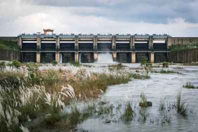
Arong Dam
Some quick example text to build on the card title and make up the bulk of the card's content.
Go somewhere
Eikhoi Gi Khongnang Makhong
Some quick example text to build on the card title and make up the bulk of the card's content.
Go somewhere
Heirok Hill
Some quick example text to build on the card title and make up the bulk of the card's content.
Go somewhere
Heirok Part III
Some quick example text to build on the card title and make up the bulk of the card's content.
Go somewhere
Heirok River
Some quick example text to build on the card title and make up the bulk of the card's content.
Go somewhere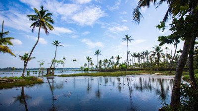
Ikop Lake
Some quick example text to build on the card title and make up the bulk of the card's content.
Go somewhere
Irong Chesaba
Some quick example text to build on the card title and make up the bulk of the card's content.
Go somewhere
Kakching Hill
Some quick example text to build on the card title and make up the bulk of the card's content.
Go somewhere
Kakching Lamkhai
Some quick example text to build on the card title and make up the bulk of the card's content.
Go somewhere
Kakching Town
Some quick example text to build on the card title and make up the bulk of the card's content.
Go somewhere
Khongjom War Memorial Complex
Some quick example text to build on the card title and make up the bulk of the card's content.
Go somewhere
Khudei Community Reserve
Some quick example text to build on the card title and make up the bulk of the card's content.
Go somewhere
Komlakhong Chingthi Hill
Some quick example text to build on the card title and make up the bulk of the card's content.
Go somewhere
Langol Tourist Watch Tower
Some quick example text to build on the card title and make up the bulk of the card's content.
Go somewhere
Litan Wangma
Some quick example text to build on the card title and make up the bulk of the card's content.
Go somewhere
Loukon Pat
Some quick example text to build on the card title and make up the bulk of the card's content.
Go somewherein Other Cities