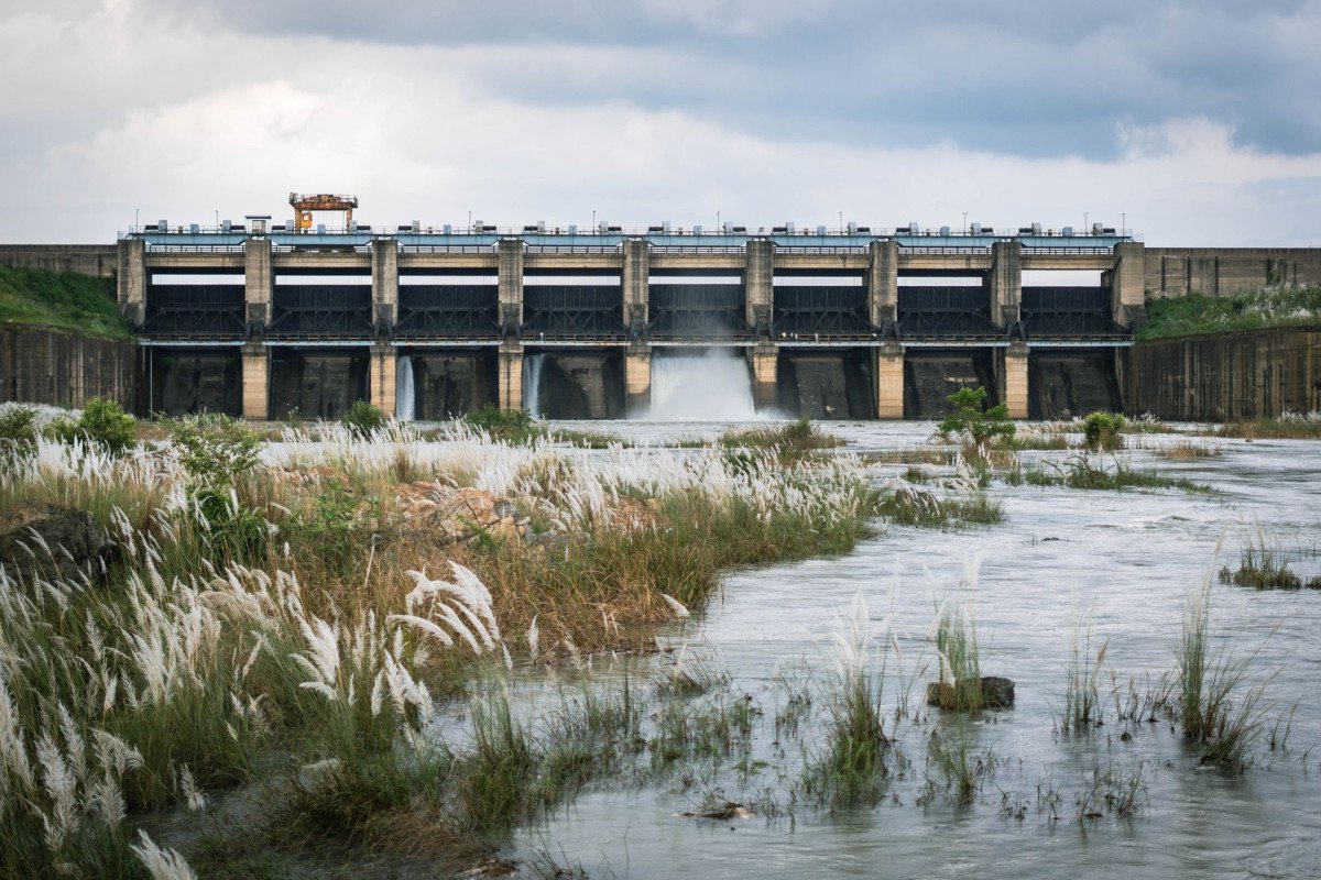
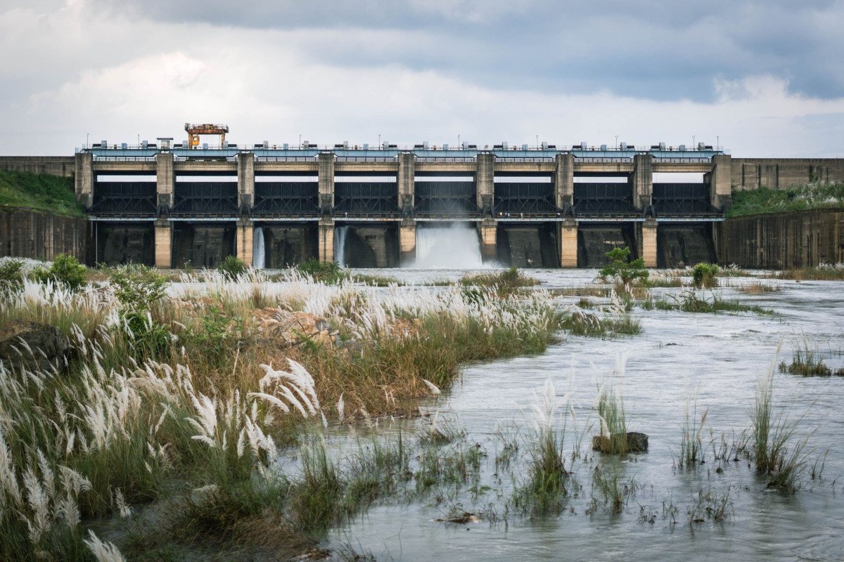
Thoubal Multi Purpose Dam
General information
-
Ideal Duration:
2-3 hoursPlace Type:
Infrastructure, Scenic Spot, Engineering MarvelEntry Fees:
Administrative Permit and Fees:
Core Access Permit: Access to the dam's core area (like the crest, power house, and spillway) is generally restricted and requires prior official permission from the Manipur government's Irrigation and Flood Co...Administrative Permit and Fees:
Core Access Permit: Access to the dam's core area (like the crest, power house, and spillway) is generally restricted and requires prior official permission from the Manipur government's Irrigation and Flood Control Department (IFCD) or the relevant power generation company. : The Permit Fee for such technical visits is usually nominal or sometimes waived for research students, but the application process is lengthy and formal, requiring a written request and identification. :
No General Entry Fee: For casual viewing from the external, designated viewpoints and surrounding areas near the dam, there is typically no general entry fee; the focus is on public safety and control, not commercial tourism. :
Photography/Videography Charges: For professional or commercial photography and videography, separate, often substantial, fees must be paid to the dam authorities; unauthorized use of drones or high-end equipment is strictly prohibited and can lead to confiscation, reflecting the strategic nature of the infrastructure. :
Local Guide Charges: Visitors should budget for a local guide to navigate the complex access roads and explain the dam's history and local context; these charges are negotiated and are an essential part of the visit's cost.Timing:
General Public Access Hours:
Daylight Hours Only: While there is no official 'entry gate' with fixed hours for external viewing, the area is generally accessible to the public from 6:00 AM to 6:00 PM (dawn to dusk), as movement is often restr...General Public Access Hours:
Daylight Hours Only: While there is no official 'entry gate' with fixed hours for external viewing, the area is generally accessible to the public from 6:00 AM to 6:00 PM (dawn to dusk), as movement is often restricted after dark for security reasons. :
Security Checkpoints: Visitors should expect to pass through security checkpoints, where timings are strictly monitored; access to the immediate dam structure is often completely closed on weekends and public holidays, prioritizing operational security. :
Ideal Visit Time:
Golden Hour Photography: The Ideal Visit Time for photography is during the early morning (7:00 AM to 9:00 AM) or late afternoon (4:00 PM to 6:00 PM) to capture the soft light, dramatic shadows, and water reflections, particularly in November or February. :
Technical Tour Time: For those seeking a technical understanding, a weekday visit between 10:00 AM and 2:00 PM is ideal, as this is when operational staff are most likely to be available for brief discussions, provided the necessary Permit is secured. :
Peak Flow Observation: To witness the dam at its most spectacular, the Monsoon season (July to September) is the best time, as the spillway is often active, though safety warnings must be strictly followed due to dangerous water levels and currents.Special Events:
Project Commissioning Ceremony: Major events are typically held only during the official commissioning or inauguration of new phases of the dam project or major maintenance milestones, which are large-scale, formal government ceremonies attended by state dignitaries and loca...Project Commissioning Ceremony: Major events are typically held only during the official commissioning or inauguration of new phases of the dam project or major maintenance milestones, which are large-scale, formal government ceremonies attended by state dignitaries and local leaders. : These events involve technical presentations, public addresses about the dam's benefits, and local cultural performances, though they are not regularly scheduled tourist attractions. :
Annual Maintenance and Safety Drills: Less celebratory but significant, the dam site hosts annual safety drills and emergency preparedness exercises, often involving the National Disaster Response Force (NDRF) and local bodies. : These drills are a rare opportunity to witness the sophisticated coordination and large-scale emergency response planning necessary for a structure of this magnitude, though public access may be restricted during the actual exercise. :
Local Commemoration Days: The nearest villages, particularly those affected by the submergence, sometimes hold their own private, poignant commemoration days or rituals near the reservoir banks, remembering their ancestral homes and performing traditional water rituals, which are deeply spiritual but generally private affairs.Best Photo Spots:
The Crest Viewpoint Panorama: The absolute best spot is the crest of the dam itself (if access is permitted), offering a direct, breathtaking view of the vast, turquoise reservoir on one side and the deep gorge of the river outlet on the other, creating a dramatic visual dic...The Crest Viewpoint Panorama: The absolute best spot is the crest of the dam itself (if access is permitted), offering a direct, breathtaking view of the vast, turquoise reservoir on one side and the deep gorge of the river outlet on the other, creating a dramatic visual dichotomy. : This location provides the perfect angle to capture the impressive Dimension and scale of the engineering feat against the natural backdrop of the Manipur hills. :
Downstream River Gorge: The viewpoint immediately downstream of the dam's outlet or spillway is a dramatic location to photograph the turbulent release of water, especially after heavy rains, showcasing the raw power of the regulated Thoubal River. : The spray and mist create excellent light diffusion for moody, high-contrast photos, capturing the force of the hydro-power mechanism. :
The Morning Mist over the Reservoir: An early morning visit, just before sunrise, to any accessible point overlooking the reservoir allows for capturing the ethereal beauty of mist rising from the water, with the sun's first rays piercing through, a scene of absolute tranquility. : This is perfect for soft-focus, atmospheric landscape shots, especially during the cool Winter months. :
Local Boats and Fishermen: To capture the human element, the best spots are the small jetties or banks where local fishermen moor their traditional boats, with the massive dam or the rolling hills as the backdrop. : These pictures, taken in the golden hour, provide a compelling narrative of local life adapting to the new geographical reality created by the dam.Photo Gallery
Things To Do
-
The Engineering Tour and Study:
Organize a Permitted Visit:: Try to secure a formal or informal permission from the relevant government or power department offices to visit the actual dam infrastructure, including the spillway and power house, for a deeper understanding of its colossal operations. :
Study the Hydraulics: Stand at the designated viewpoints and observe the flow dynamics of the river both upstream in the reservoir and downstream after the water release, contemplating the forces of nature and engineering at work. :
Engage with Project Personnel: If possible, converse with the on-site engineers or staff about the technical challenges overcome during the construction, the dam's daily operational parameters, and its long-term maintenance schedule. :The Engineering Tour and Study:
Organize a Permitted Visit:: Try to secure a formal or informal permission from the relevant government or power department offices to visit the actual dam infrastructure, including the spillway and power house, for a deeper understanding of its colossal operations. :
Study the Hydraulics: Stand at the designated viewpoints and observe the flow dynamics of the river both upstream in the reservoir and downstream after the water release, contemplating the forces of nature and engineering at work. :
Engage with Project Personnel: If possible, converse with the on-site engineers or staff about the technical challenges overcome during the construction, the dam's daily operational parameters, and its long-term maintenance schedule. :
Reservoir-Side Leisure Activities:
Picnicking by the Water's Edge:: Find a tranquil spot along the accessible banks of the vast reservoir for a peaceful day picnic, ensuring all waste is carried back. :
Stargazing on Clear Nights: The remote location and lack of light pollution make the dam area an exceptional spot for amateur stargazing, especially during the Winter months when the sky is clearest. :
Landscape Photography Challenge: Spend a day dedicated to capturing the dramatic landscape, focusing on the contrast between the rigid man-made structure and the soft, organic lines of the surrounding forested hills and the shimmering water surface. :
Sketching and Painting: Bring art supplies to sit and sketch the massive structure, the surrounding hills, or the activities of the local fishing community who use the new lake. :
Local Culture and Environmental Immersion:
Explore the Resettlement Villages:: Visit the new, nearby villages where the displaced communities were resettled to understand their transition and resilience, perhaps sampling their local cuisine or handicrafts. :
Participate in a Local Fishery: With permission, join local fishermen in their daily routine on the reservoir, learning traditional Meitei fishing techniques and the specific species that thrive in the new aquatic environment. :
Short Nature Hike: Embark on a short, guided nature trail in the surrounding forest areas, looking for native flora like orchids, medicinal plants, and various butterflies, keeping a keen eye out for any wildlife sightings. :
Attend a Village Feast: If your visit coincides with a local festival or feast (like a post-harvest celebration), respectfully request to observe or even participate to experience the community's traditional hospitality and vibrant culture. :
Documentary Filming: For enthusiasts, the site offers a compelling subject for a mini-documentary, covering themes of infrastructure, environment, displacement, and the new life sustained by the dam, requiring prior permissions for commercial work.
Information
-
Why Famous:
Source of Water and Power: The Thoubal Multi Purpose Dam is immensely famous as a primary source of water supply to the densely populated Imphal Valley, including the state capital itself, solving a perennial water scarcity problem. : It is renowned for its role in regional ...Source of Water and Power: The Thoubal Multi Purpose Dam is immensely famous as a primary source of water supply to the densely populated Imphal Valley, including the state capital itself, solving a perennial water scarcity problem. : It is renowned for its role in regional development, specifically its hydro-electric component which contributes to the state’s power grid, thus aiding industrial and domestic electrification, symbolized by its massive scale and economic significance. :
Modern Engineering Feat: It stands out as one of the largest and most ambitious civil engineering projects in Manipur, showcasing modern construction techniques applied to a challenging geographical terrain, drawing interest from engineers and students. : The sheer scale of the earthwork and the resulting enormous reservoir, which drastically changed the landscape, makes it a prominent geographical feature and a talking point in regional development discussions. :
Controversy and Resilience: The dam is also famous (or infamous) due to the significant social and environmental controversies surrounding its construction, including the displacement of multiple villages, which has sparked long-running debates on development versus indigenous rights. : It has become a symbol of regional political discourse, representing the complex balance between necessary infrastructure development and community resettlement, lending it a layered socio-political significance. -
Architecture:
Core Structure and Materials: The Mapithel Dam is an earth-fill and rock-fill embankment dam, a design chosen for its stability in the seismically active region of Northeast India. : This architecture utilizes locally sourced materials like earth, clay, and rock, compacted t...Core Structure and Materials: The Mapithel Dam is an earth-fill and rock-fill embankment dam, a design chosen for its stability in the seismically active region of Northeast India. : This architecture utilizes locally sourced materials like earth, clay, and rock, compacted to create a massive wall that withstands the pressure of the stored water. :
Dimension: The dam has a maximum height of approximately 66 meters (about 216 feet) above the river bed and a crest length that spans several hundred meters, creating a formidable barrier and a massive reservoir. : The embankment structure features multiple layers, each with specific filter zones to prevent internal erosion and ensure the structural integrity of the main body, a key element of modern dam engineering. :
Hydro-Electric Component: The structure is complemented by a spillway designed to handle excess water during the monsoon season, which employs a controlled chute mechanism to safely release discharge, preventing overtopping and subsequent failure. : The associated hydro-electric power house, though separate from the main embankment, features specialized civil architecture for housing heavy turbines and generators, often built of reinforced concrete to withstand the vibrations and operational stress. : The design adheres to contemporary international safety standards for large dams, incorporating sophisticated monitoring instruments to track seepage, pressure, and earth movement, reflecting a focus on longevity and disaster resilience in its engineering blueprint. -
How To Reach:
By Air: The nearest major airport is Imphal International Airport (IMF), located approximately 50-60 KMS away. : After landing at IMF, travelers can hire a pre-paid taxi or a radio cab directly to the dam site, which takes about 2-3 hours, depending on traffic and the specif...By Air: The nearest major airport is Imphal International Airport (IMF), located approximately 50-60 KMS away. : After landing at IMF, travelers can hire a pre-paid taxi or a radio cab directly to the dam site, which takes about 2-3 hours, depending on traffic and the specific location of the dam access road near Mapithel. : Private vehicle hire is recommended for the most comfortable and direct journey from the airport terminal to the relatively remote dam site. :
By Train: Manipur does not have a comprehensive railway network; the nearest major railhead is Dimapur Railway Station (DMV) in Nagaland, which is a significant distance of about 250 KMS. : From DMV, one must hire a full-day private taxi or take a shared taxi to Imphal, and then arrange for local transport from Imphal to the dam site in Thoubal, a very long and complex journey requiring about 8-10 hours of total travel time. :
By Road: The dam is situated off a state highway connected to National Highway 102 (the Imphal-Moreh road), making road travel the most practical option. : From Thoubal City Center, one can hire a local cab or an auto-rickshaw (for the initial part) and then transfer to a jeep or private car capable of handling the interior, sometimes rough, roads leading to the final viewpoint. : The drive from Thoubal town to the dam site is approximately 1. 5 to 2 hours, depending on the exact access road used and the seasonal road conditions. :
By Local Transport: Shared taxis or Winger vehicles ply the route from Thoubal to nearby towns like Wangjing or Kakching, but direct local transport to the dam is scarce; a final leg involving a reserved local cab or a hired motorcycle is almost always required for the last 10-15 KMS. -
Weather and Best Time to Visit:
Seasons Ideal - Winter (October to March): The Winter season offers cool, pleasant weather, clear skies for excellent photography, and the lowest chance of travel disruption due to rain or floods, making it the most comfortable time for the long drive and outdoor viewing. :<...Seasons Ideal - Winter (October to March): The Winter season offers cool, pleasant weather, clear skies for excellent photography, and the lowest chance of travel disruption due to rain or floods, making it the most comfortable time for the long drive and outdoor viewing. :
Avoid - Monsoon (June to September): The Monsoon brings heavy rainfall, making the approach roads muddy and slippery, increasing the risk of landslides, and often resulting in cloud cover that obscures the scenic views, though the water release is spectacular. : Different Parts of the Day Best - Early Morning and Late Afternoon: Visiting between 7:00 AM and 9:00 AM or 4:00 PM and 6:00 PM provides the best light conditions, often with mist or golden hour effects over the reservoir, perfect for photography and sightseeing before or after the heat of the day. :
Midday Visit: The period from 11:00 AM to 3:00 PM is generally hot, with harsh light and high security activity, but is the best time for official visits or coordinating meetings with the engineering staff if a technical tour is planned. -
Near Tourist Places:
Khongjom War Memorial (8-10 KMS), Waithou Lake (20-25 KMS), Kakching Garden (30 KMS), Kakching Manao Ching (25 KMS), Pallel Town (35 KMS), Luwangpokpa Ema Emoinu Temple (40 KMS), Heirok Village (45 KMS), Ikop Lake (50 KMS), Khuman Lampak Sports Complex (60 KMS), Shri Govindajee Temple Imphal (65 KMS)
Tourism Tips
-
Health & Safety:
Wear Life Vests: If you manage to hire a boat for reservoir viewing, absolutely insist on and wear a life vest, as water currents can be unpredictable and the water is very deep; swimming is strongly discouraged. :Health & Safety:
Wear Life Vests: If you manage to hire a boat for reservoir viewing, absolutely insist on and wear a life vest, as water currents can be unpredictable and the water is very deep; swimming is strongly discouraged. :
Stay Clear of Restricted Zones: Strictly obey all signage and security warnings, particularly regarding the spillway and power house areas, as these are high-danger zones with sudden water discharge potential. :
Packing:
Carry an Inner Line Permit (ILP): While generally not required for Thoubal district, as the dam is close to the state's border, it is wise for foreign nationals and sometimes domestic tourists to check the current permit status for any potentially sensitive areas near the dam site. :
Bring Strong Sunscreen and Hat: The open environment means direct sunlight exposure is high; a wide-brimmed hat, sunglasses, and high-SPF sunscreen are essential, even in Winter. :
Accommodation:
Stay in Thoubal or Imphal: There is no formal, reliable tourist accommodation immediately near the dam; the best and most comfortable option is to stay in a hotel or guesthouse in Thoubal town or take a day trip from Imphal, which offers a wider range of lodging. :
Bring Snacks and Water: Carry all necessary food and bottled water, as reliable shops or restaurants are non-existent in the remote area surrounding the dam, and the journey is long and tiring. :
Other Different Topics Heading:
Respect Local Sentiments: Be sensitive to the local communities, especially those that were displaced by the reservoir, and refrain from making insensitive comments about the development or loss of their ancestral lands, maintaining cultural respect. :
Hire an Experienced Local Driver: The approach roads can be challenging, involving steep climbs and rough terrain; hire a local driver who is highly familiar with the specific access points and the local road conditions for a safer journey.
Reviews
FAQs
Thoubal Itineray And Cost:-
Thoubal Multi Purpose Dam Tourism:-
Other Places In Thoubal :-
Other States In India :-
Information about New and Updated Locations() of Manipur Has Been Added :-
Card subtitle
Note:-
Information provided here in good Faith and for reference only.
Near Places
Arong Dam
Some quick example text to build on the card title and make up the bulk of the card's content.
Go somewhere
Eikhoi Gi Khongnang Makhong
Some quick example text to build on the card title and make up the bulk of the card's content.
Go somewhere
Heirok Hill
Some quick example text to build on the card title and make up the bulk of the card's content.
Go somewhere
Heirok Part III
Some quick example text to build on the card title and make up the bulk of the card's content.
Go somewhere
Heirok River
Some quick example text to build on the card title and make up the bulk of the card's content.
Go somewhere
Ikop Lake
Some quick example text to build on the card title and make up the bulk of the card's content.
Go somewhere
Irong Chesaba
Some quick example text to build on the card title and make up the bulk of the card's content.
Go somewhere
Kakching Hill
Some quick example text to build on the card title and make up the bulk of the card's content.
Go somewhere
Kakching Lamkhai
Some quick example text to build on the card title and make up the bulk of the card's content.
Go somewhere
Kakching Town
Some quick example text to build on the card title and make up the bulk of the card's content.
Go somewhere
Khongjom War Memorial Complex
Some quick example text to build on the card title and make up the bulk of the card's content.
Go somewhere
Khudei Community Reserve
Some quick example text to build on the card title and make up the bulk of the card's content.
Go somewhere
Komlakhong Chingthi Hill
Some quick example text to build on the card title and make up the bulk of the card's content.
Go somewhere
Langol Tourist Watch Tower
Some quick example text to build on the card title and make up the bulk of the card's content.
Go somewhere
Litan Wangma
Some quick example text to build on the card title and make up the bulk of the card's content.
Go somewhere
Loukon Pat
Some quick example text to build on the card title and make up the bulk of the card's content.
Go somewherein Other Cities