
How To Reach Ayodhya Hills
How to Reach
By Train (Major Rail Hubs): The nearest and most convenient railway station is Purulia Junction (PRR), which is well-connected to major cities like Kolkata (via trains like Rupashi Bangla Express and Howrah-Purulia Express), Tatanagar, and Ranchi. The journey from Kolkata takes approximately 5 to 7 hours. From Purulia Junction, Ayodhya Hills is about 42 KMs. The closest local station is Balarampur (BQA), about 39 KMs away, which is convenient for some local trains. From the station, you can hire a private taxi or use shared jeeps (available from Purulia Bus Stand) that run towards Baghmundi and the hill base.
By Road (Driving Directions): Purulia is well-connected by road, making a self-drive or hired taxi a popular option. From Kolkata, the distance is approximately 300 KMs, taking about 7 to 8 hours. The typical route involves taking NH19 (formerly NH-2) towards Asansol, then diverting onto state highways and NH32 towards Purulia. Once near the town, one of the three main routes can be taken to reach the hilltop: via Jhalda, via Sirkabad, or via Baghmundi. The Baghmundi route is scenic and generally preferred.
By Local Transport (Hilltop): On the hill itself, local transport is essential. Shared jeeps and autos operate between the main base points, such as Baghmundi and the hill top, but they follow fixed, crowded routes. For comprehensive sightseeing (visiting multiple dams, falls, and the artisan village), it is highly recommended to hire a private car or an entire local jeep for the duration of the visit. Negotiate the rate for a full day of sightseeing before starting, which typically costs around 2,500 to 3,500 INR.
Information about New and Updated Locations(575+) of West Bengal Has Been Added :-
Card subtitle
Note:-
Information provided here in good Faith and for reference only.
All information and pictures will be updated soon, please keep visiting.
Near Places
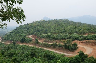
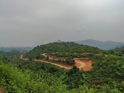
Ajodhya Hill View Point
Some quick example text to build on the card title and make up the bulk of the card's content.
Go somewhere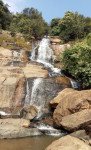
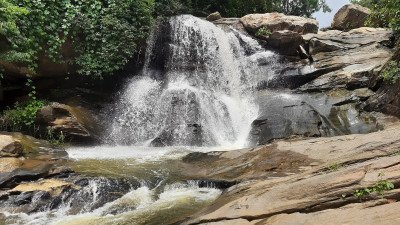
Ajodhya Hills Dams & Bamni Falls
Some quick example text to build on the card title and make up the bulk of the card's content.
Go somewhere
Ajodhya Pahar Hairpin View Point
Some quick example text to build on the card title and make up the bulk of the card's content.
Go somewhere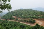
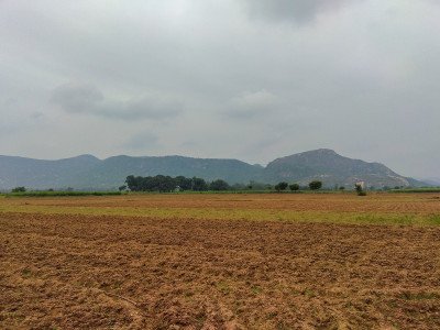
Ayodhya Hills
Some quick example text to build on the card title and make up the bulk of the card's content.
Go somewhere
Bamni Falls
Some quick example text to build on the card title and make up the bulk of the card's content.
Go somewhere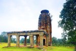
Banda Deul
Some quick example text to build on the card title and make up the bulk of the card's content.
Go somewhere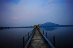
Baranti Reservoir
Some quick example text to build on the card title and make up the bulk of the card's content.
Go somewhere
Begunkodar
Some quick example text to build on the card title and make up the bulk of the card's content.
Go somewhere
Charidah
Some quick example text to build on the card title and make up the bulk of the card's content.
Go somewhere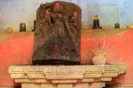
Deulghata Temple Ruins
Some quick example text to build on the card title and make up the bulk of the card's content.
Go somewhere