
...

Place To Visit And Things To Do In Chopta

Uttarakhand, India.
Overview of Chopta: Chopta is a small, serene region in the Rudraprayag district, often hailed as the "Mini Switzerland of India" due to its lush meadows. It is situated at an altitude of 2,680 meters and is part of the Kedarnath Wildlife Sanctuary. Unlike other hill stations, Chopta has no permanen t human settlements or large concrete structures, preserving its raw natural beauty. It serves as the base for the trek to Tungnath, the highest Shiva temple in the world. The area is a paradise for trekkers, birdwatchers, and anyone looking to disconnect from the digital world and reconnect with nature. History and Heritage: The heritage of Chopta is deeply intertwined with Hindu mythology and the Panch Kedar pilgrimage circuit. According to legend, the Pandavas built the Tungnath Temple to atone for their sins after the Kurukshetra war. The region has been a spiritual sanctuary for sages and trekkers for centuries, offering a path to the sacred Chandrashila peak. The local folklore is filled with stories of Lord Shiva and the Goddess Parvati, who are believed to reside in these heights. The absence of commercial development has allowed the spiritual and natural heritage of the land to remain pure and unaffected. Natural Landscapes: The landscape of Chopta is characterized by "Bugyals" or high-altitude alpine meadows that stay emerald green in summer and turn golden in autumn. It offers a 360-degree view of the majestic Himalayan peaks, including Nanda Devi, Trishul, and Chaukhamba. The dense forests surrounding the meadows are home to the rare Musk Deer and the colorful Himalayan Monal bird. In winter, the entire region is buried under several feet of snow, making it a hotspot for snow trekking and camping. The silence of the woods, broken only by the whistling of the wind and bird calls, is a soul-stirring experience. Modern Significance: Today, Chopta is one of the most popular trekking destinations in Northern India, especially for beginners and weekend adventurers. It has become a significant hub for bird photography, attracting enthusiasts from across the globe to capture rare Himalayan species. The rise of eco-camps and solar-powered stays reflects a modern commitment to sustainable tourism in this ecologically sensitive zone. It is a major highlight of the Uttarakhand tourism map, offering an "off-the-grid" experience without sacrificing accessibility. Whether it is yoga, meditation, or adventure, Chopta provides the perfect environment for holistic well-being.

Things To Do

Card image cap
Bisuri Tal

Bisuri Tal is a pristine high-altitude glacial lake nestled at an elevation of approximately 4,000 meters in the Mandakini valley of the Garhwal Hima...

Bisuri Tal is a pristine high-altitude glacial lake nestled at an elevation of approximately 4,000 meters in the Mandakini valley of the Garhwal Himalayas. This hidden treasure remains largely unexplored by the mainstream tourist crowd due to its demanding trekking route, making it a sanctuary for those seeking absolute solitude and raw natural beauty. The lake is surrounded by towering snow-clad peaks and alpine meadows that change color with the seasons. According to local folklore, the water of this lake possesses medicinal properties capable of curing various skin ailments. The trek to the lake takes you through the heart of the Kedarnath Wildlife Sanctuary, where the air is thin but filled with the scent of wild herbs and rhododendrons. The silence of the area is only broken by the sound of distant waterfalls and the occasional call of high-altitude birds. It is a place where time seems to stand still, offering a profound sense of peace. The crystal-clear water of the lake reflects the surrounding ridges like a mirror, creating a surreal atmosphere. Visitors often find themselves in awe of the sheer scale of the landscape and the untouched nature of the trail. The journey involves crossing high ridges and navigating through dense forests, making the arrival at the lake a deeply rewarding experience for any adventurer. It represents the untamed spirit of the Himalayas, away from any commercial interference.
Card image cap
Chandrashila Peak

@@Overview of the Summit and Views: Chandrashila literally means 'Moon Rock' and is a summit at an altitude of about 4,000 meters (13,000 ft) above se...

@@Overview of the Summit and Views: Chandrashila literally means 'Moon Rock' and is a summit at an altitude of about 4,000 meters (13,000 ft) above sea level, offering a spectacular 360-degree panoramic view of the majestic Himalayan peaks. Trekking to this peak is a popular and relatively short extension (1.5 km) from the sacred Tungnath Mahadev Temple. The peak provides mesmerizing views of prominent Himalayan ranges, including Nanda Devi, Trishul, Chaukhamba, Kedar Peak, and Bandarpunch mountains. It is a key destination for high-altitude trekking enthusiasts and nature lovers, accessible for most of the year except for heavy snow in deep winter. The trek is challenging but rewarding, often taken early in the morning to witness the breathtaking sunrise over the snow-capped mountains. The peak is steeped in mythology, believed to be the spot where Lord Rama meditated after defeating Ravana, adding a spiritual dimension to the adventure. The serene and unpolluted environment makes it an ideal spot for contemplation and photography, culminating the beautiful journey that begins from Chopta. The views are considered some of the best unobstructed mountain vistas in the region.
Card image cap
Chaukhamba Peak View

The Chaukhamba Peak View from Chopta and its surrounding heights is one of the most spectacular sights in the Indian Himalayas. Chaukhamba is a mount...
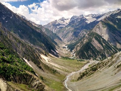
The Chaukhamba Peak View from Chopta and its surrounding heights is one of the most spectacular sights in the Indian Himalayas. Chaukhamba is a mountain massif in the Gangotri Group of the Garhwal Himalaya, featuring four distinct peaks that resemble the four pillars of a cosmic palace. From the vantage points in Chopta, particularly the Chandrashila summit, visitors are treated to an unobstructed 360-degree panorama of this majestic range. The peaks are perpetually covered in snow, glowing with a golden hue during sunrise and a soft pink during sunset. This view is not just a visual treat but a spiritual experience, as these mountains are considered sacred in Hindu mythology. The crisp, unpolluted mountain air enhances visibility, making the peaks appear much closer than they actually are. Watching the clouds dance around the base of the massif while the summits pierce the clear blue sky is a memory that stays with every traveler. The viewpoint serves as a reminder of the raw power and timeless beauty of nature. It attracts photographers from all over the world who wish to capture the interplay of light and shadow on the serrated ridges of the peaks. The silence at these heights allows one to truly connect with the grandeur of the mountains. Whether you are at the base in Chopta or have trekked up to the temple, the presence of Chaukhamba dominates the horizon, acting as a silent guardian of the valley. It is the highlight of any trip to this region, providing a sense of scale and wonder.
Card image cap
Chopta Valley

@@Description of the Lush Meadows and Environment: Often called the 'Mini Switzerland of India', Chopta Valley is a breathtaking expanse of lush, verd...
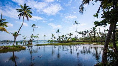
@@Description of the Lush Meadows and Environment: Often called the 'Mini Switzerland of India', Chopta Valley is a breathtaking expanse of lush, verdant meadows (bugyals) and thick forests of oak, pine, and rhododendron, serving as the base camp for the Tungnath and Chandrashila trek. Situated at an altitude of approximately 2,680 meters (8,790 ft), it provides stunning, up-close views of the major Himalayan peaks. The valley is a serene destination, untouched by commercial tourism, offering tranquility, clean air, and vibrant natural beauty throughout the year, especially during the spring bloom when the rhododendrons paint the hills red and pink. It is a part of the Kedarnath Wildlife Sanctuary, ensuring a rich biodiversity of flora and fauna. The area is a haven for birdwatchers, with species like the Himalayan Monal frequently sighted. It is the starting point for the famous Panch Kedar pilgrimage trek to Tungnath (the third Kedar), making it a significant spiritual and trekking hub in the Garhwal Himalayas. The local community provides basic but comfortable homestays and camping options for tourists:
Card image cap
Deoria Tal Lake

Deoria Tal is a mesmerizing high-altitude lake situated at an elevation of 2,438 meters, surrounded by thick forests of pine, oak, and rhododendron. ...

Deoria Tal is a mesmerizing high-altitude lake situated at an elevation of 2,438 meters, surrounded by thick forests of pine, oak, and rhododendron. The lake is legendary for its still, emerald waters that provide a flawless reflection of the Chaukhamba peaks on clear mornings. According to Hindu mythology, this is the very spot where the Pandavas were tested by the Yaksha with a series of riddles during their exile. It is also believed that the gods (Devas) used to bathe in this lake, giving it the name "Deoria." The trek from Sari Village to the lake is a gentle uphill climb through terraced fields and dense woods, making it accessible for families and beginners alike. Once you reach the top, the forest opens up to a vast meadow with the lake at its center. The area is part of the Kedarnath Wildlife Sanctuary, and one can often spot Himalayan birds and small animals nearby. The lake offers a 300-degree panoramic view of the Himalayan ranges. Camping was once popular directly at the lakeside, but now it is regulated to protect the ecology. The peaceful atmosphere, combined with the historical and spiritual weight of the location, makes it a must-visit. During the spring, the surrounding rhododendrons bloom in shades of red and pink, adding a vibrant border to the serene water. It is a place of deep reflection, both literally and figuratively.
Card image cap
Dugalbitta

Dugalbitta is a charming and tranquil hamlet that serves as a perfect alternative base for travelers exploring the Chopta region. Situated at an alti...

Dugalbitta is a charming and tranquil hamlet that serves as a perfect alternative base for travelers exploring the Chopta region. Situated at an altitude of 2,600 meters, its name literally translates to the "space between two mountains." Unlike the main Chopta area, which has strict regulations on permanent structures, Dugalbitta offers several cozy resorts, eco-lodges, and Swiss tents. The hamlet is enveloped by lush green pasture lands and dense forests that are part of the Kedarnath Wildlife Sanctuary. It is an ideal spot for those who want to enjoy the beauty of the Himalayas without the crowds. The views of the snow-clad peaks from here are equally stunning, and the area is a hotspot for birdwatchers. Many travelers choose to stay here because the road remains accessible even during heavy winters when the road further up to Chopta might be blocked by snow. The atmosphere is laid-back, making it perfect for a digital detox. You can spend your days walking through the tall dark woods or simply sitting in the meadows with a book. The proximity to various trek starting points makes it strategically convenient. In the evenings, the temperature drops significantly, and the clear skies offer a brilliant display of stars. It represents the quintessential Garhwali mountain life, blended with modern hospitality for tourists.
Card image cap
Duggalwala

Duggalwala is a lesser-known but equally enchanting segment of the greater Chopta region, often grouped with Dugalbitta. It is a place where the land...

Duggalwala is a lesser-known but equally enchanting segment of the greater Chopta region, often grouped with Dugalbitta. It is a place where the landscape is dominated by rolling meadows and clusters of traditional mountain homes. At an altitude of about 2,550 meters, it offers a more authentic "local" feel compared to the more tourist-centric parts of Chopta. The area is primarily used by local shepherds to graze their livestock, and seeing herds of sheep and goats against the backdrop of the Himalayas is a common sight. It provides an excellent vantage point for the Kedar range and Chaukhamba. The lack of commercial activity here ensures that the natural ecosystem remains pristine. For a traveler, Duggalwala represents the chance to see the true rural life of the Garhwal region. The air is exceptionally clean, and the area is free from the noise of typical tourist hubs. It is a place for slow travel, where you can spend hours just watching the light change on the mountains. Small mountain streams crisscross the meadows, adding to the picturesque setting. It is also an excellent spot for amateur astronomers due to the zero light pollution. Visiting Duggalwala allows you to experience the silence of the mountains in its purest form, making it a favorite for writers and artists seeking inspiration.
Card image cap
Gopeshwar Town

Gopeshwar is a mesmerizing town nestled in the Chamoli district of Uttarakhand, serving as the administrative headquarters. Situated at an elevation ...
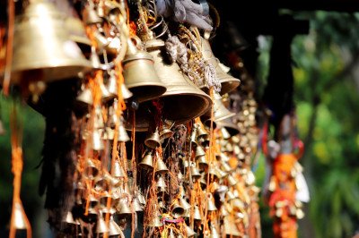
Gopeshwar is a mesmerizing town nestled in the Chamoli district of Uttarakhand, serving as the administrative headquarters. Situated at an elevation of 1,308 meters, this town is a perfect blend of natural beauty and spiritual significance. The town is most famous for the ancient Gopinath Temple, dedicated to Lord Shiva, which draws thousands of pilgrims annually. Historically, the name Gopeshwar is linked to Lord Krishna, adding a layer of mythological importance to its identity. The town is surrounded by lush green mountain ranges, terrace farms, and small lakes that create a serene atmosphere. Unlike busier tourist hubs, Gopeshwar offers a tranquil environment for those seeking peace and reflection. It acts as a major transit point for trekkers heading towards Rudranath or pilgrims on the Char Dham Yatra. The climate remains pleasant throughout the year, making it an ideal offbeat hill station. Local markets in Gopeshwar are vibrant, offering traditional Garhwali crafts and local produce. The town's layout is characterized by steep winding roads and traditional stone houses that reflect the local culture. Exploring Gopeshwar allows visitors to witness the authentic lifestyle of the Himalayan people. The town also houses several other smaller shrines and the sacred Vaitarni Kund, where devotees take holy dips. Its proximity to Chopta makes it a must-visit for anyone exploring the Garhwal region. The combination of its religious aura and the surrounding oak and rhododendron forests makes it a unique destination. Visitors often find themselves captivated by the panoramic views of the Himalayan peaks visible on clear days. Whether you are a spiritual seeker or a nature lover, Gopeshwar provides an enriching experience that stays with you long after you leave. The town is also known for its educational institutions, adding a youthful energy to its ancient roots. :
Card image cap
Kalpeshwar Temple

Kalpeshwar Temple is a sacred Hindu shrine and the final stop in the prestigious Panch Kedar pilgrimage circuit. Located at an altitude of 2,200 mete...

Kalpeshwar Temple is a sacred Hindu shrine and the final stop in the prestigious Panch Kedar pilgrimage circuit. Located at an altitude of 2,200 meters in the serene Urgam Valley of Chamoli, it is uniquely known as the only Panch Kedar temple that remains accessible throughout the year. The temple is dedicated to Lord Shiva, specifically his Jata or matted hair, which according to legend, appeared here after the Pandavas sought his blessings. The journey to the temple is a blend of a scenic drive and a short, easy trek through lush forests and apple orchards. The Urgam Valley itself is a hidden paradise, characterized by terrace fields where locals grow potatoes and large apple orchards that fill the air with a sweet aroma. The Kalpganga River flows near the temple, adding to the tranquil environment. Unlike the more commercialized temples, Kalpeshwar offers a raw, spiritual experience. The temple is small and tucked away under a rock overhang, giving it a cave-like feel. The atmosphere here is one of absolute peace, with only the sound of the river and temple bells breaking the silence. Historically, the priests of this temple belong to the Dasnamis and Gosains sects, followers of Adi Shankaracharya. The valley is also famous for the Kalpavriksha, a wish-fulfilling tree mentioned in Hindu mythology. The trek to the temple is relatively easy, making it accessible for people of all ages. Visiting Kalpeshwar is not just a religious trip but an immersion into the pristine beauty of the Garhwal Himalayas. The simple lifestyle of the Urgam villagers and their warm hospitality add a special touch to the visit. It is a place where time seems to slow down, allowing for deep introspection. :
Card image cap
Kanchula Korak Musk Deer Sanctuary

@@Focus on Conservation and Biodiversity: The Kanchula Korak Musk Deer Sanctuary is a dedicated wildlife reserve, established primarily for the conser...

@@Focus on Conservation and Biodiversity: The Kanchula Korak Musk Deer Sanctuary is a dedicated wildlife reserve, established primarily for the conservation and protection of the highly endangered Himalayan Musk Deer, which is sought after for its musk glands. It spans a small but crucial area of approximately 5 square kilometers of high-altitude forests, forming a part of the larger Kedarnath Wildlife Sanctuary. The sanctuary, located at an altitude of around 2,500 meters, is characterized by dense temperate forests of oak, deodar, and vibrant rhododendrons, providing a perfect natural habitat for high-altitude Himalayan fauna. Beyond the elusive Musk Deer, the sanctuary is also home to various other animals like the Himalayan Tahr, Goral, Himalayan Black Bear, Indian Leopard, and numerous bird species, including the state bird, the Himalayan Monal. Its relative proximity to the main Chopta road makes it a popular stop for wildlife and nature enthusiasts, promoting eco-tourism and awareness about Himalayan conservation efforts. The best time for spotting wildlife is typically during the early morning and late evening hours, near water sources or clearings:
Card image cap
Kartik Swami Temple

Kartik Swami Temple is a breathtaking shrine dedicated to Lord Kartikeya, the elder son of Lord Shiva. Perched atop the Kronch Parvat at an altitude ...

Kartik Swami Temple is a breathtaking shrine dedicated to Lord Kartikeya, the elder son of Lord Shiva. Perched atop the Kronch Parvat at an altitude of 3,050 meters, it offers one of the most stunning 360-degree views of the Himalayan range. The temple is located in the Rudraprayag district and is reached via a 3 KM trek from the village of Kanakchauri. Legend has it that Lord Kartikeya, after losing a race around the universe to his brother Ganesha, offered his flesh to his father and his bones to the mountain as a mark of devotion. The temple houses a naturally occurring idol of the deity. The trek to the temple is moderately easy, passing through dense forests of oak and rhododendron. As you ascend, the trees thin out, revealing the sharp ridge on which the temple stands. The final stretch consists of roughly hundreds of stone steps that lead directly to the temple. The wind at the top is exceptionally strong, and the silence is profound. From the temple courtyard, one can see peaks like Chaukhamba, Trishul, Nanda Devi, and Kedarnath with unparalleled clarity. It is often described as a place where the earth meets the sky. The temple is simple, avoiding grand decorations in favor of spiritual austerity. The sound of hundreds of bells tied by devotees creates a rhythmic melody when the wind blows. It is a favorite among photographers for its spectacular sunrise and sunset views. Unlike other tourist-heavy spots, Kartik Swami remains relatively peaceful, offering a soul-stirring experience for those who make the climb. The surrounding area is also rich in biodiversity, with frequent sightings of rare birds. :
Card image cap
Kedarnath Wildlife Sanctuary

@@Overview of the Largest Western Himalayan Protected Area: The Kedarnath Wildlife Sanctuary (KWS), also known as the Kedarnath Musk Deer Sanctuary, i...
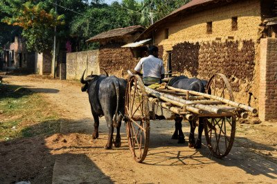
@@Overview of the Largest Western Himalayan Protected Area: The Kedarnath Wildlife Sanctuary (KWS), also known as the Kedarnath Musk Deer Sanctuary, is the largest protected area in the Western Himalayas, spanning an area of 975 square kilometers. It covers parts of both the Rudraprayag and Chamoli districts, with Chopta being a key entry point and central area within its boundaries. Established in 1972, its primary aim is the conservation of the endangered Himalayan Musk Deer and its high-altitude habitat. The sanctuary's altitude ranges dramatically from 1,160 meters to 7,068 meters (covering peaks like Chaukhamba), supporting a diverse range of ecosystems from temperate forests to alpine meadows (bugyals) and snow-clad peaks. It is a critical habitat for a vast array of flora and fauna, including the snow leopard, Himalayan tahr, Himalayan black bear, and over 230 species of birds. The sanctuary also holds deep spiritual significance as it surrounds the sacred Kedarnath Temple and includes the Panch Kedar shrines (Tungnath is within its boundary), offering a blend of pilgrimage and adventure:
Card image cap
Mandal Village

Mandal Village is a serene hamlet tucked away in the Garhwal Himalayas, often ignored by mainstream tourists flocking to Chopta. It serves as a vital...

Mandal Village is a serene hamlet tucked away in the Garhwal Himalayas, often ignored by mainstream tourists flocking to Chopta. It serves as a vital base camp for the arduous trek to Rudranath, one of the Panch Kedar temples. The village is characterized by its vibrant green landscape, traditional wooden houses, and a peaceful atmosphere that seems frozen in time. Unlike the high-altitude meadows of Chopta, Mandal is situated at a lower elevation of about 1,650 Meters, allowing for a rich diversity of flora and fauna. You will find orchards of local fruits and dense forests of oak and rhododendron surrounding the settlement. The village is also famous for the Anasuya Devi Temple, which is a 5-km trek from here. This place offers a raw glimpse into the Himalayan lifestyle where farming and animal husbandry are the primary occupations. The air here is incredibly fresh, and the sound of the nearby Balkhila River adds to the meditative quality of the environment. It is an ideal spot for those looking to escape the crowded trails of Tungnath and experience authentic Garhwali culture. Visitors often stay here to acclimatize before heading to higher altitudes or simply to enjoy the biodiversity of the Kedarnath Wildlife Sanctuary.
Card image cap
Rohini Bugyal

@@Description of the Picturesque Meadow and Surroundings: Rohini Bugyal is a beautiful, serene, high-altitude alpine meadow (bugyal) located in the Ch...

@@Description of the Picturesque Meadow and Surroundings: Rohini Bugyal is a beautiful, serene, high-altitude alpine meadow (bugyal) located in the Chopta Valley region. It serves as an important and highly picturesque campsite on the popular trek route that connects Deoria Tal to Chopta, via the Jhandi Dhar ridge. The meadow is nestled amidst a thick forest of Oak and Rhododendron, offering a tranquil environment and stunning views of the Garhwal Himalayas, including clear vistas of Kedar Peak, Chaukhamba, and Nilkantha mountains. Its lush green carpet in summer and pristine snow cover in winter make it a perfect destination for camping, birdwatching, and enjoying the unpolluted silence of the mountains. A perennial stream flows near the bugyal, providing a reliable water source, and the area is rich in birdlife. Its natural beauty and strategic location on the trekking circuit make it a favorite overnight stop for trekkers who prefer a quieter alternative to the main Chopta campsite. The gentle slope and open space are ideal for pitching tents:
Card image cap
Sari Village

Sari Village is a picturesque hamlet located at an altitude of about 2,000 Meters. It is most famous for being the base camp of the Deoria Tal trek, ...

Sari Village is a picturesque hamlet located at an altitude of about 2,000 Meters. It is most famous for being the base camp of the Deoria Tal trek, a short but steep 2.5-km trail leading to a majestic lake. The village is surrounded by thick forests of oak and rhododendron, which turn a fiery red during the spring months of March and April. Sari is a quiet settlement where the lifestyle revolves around agriculture; you can see vast stretches of step-farming on the mountain slopes. The people are incredibly warm and often open their homes as homestays for travelers. From the village, you get a clear view of the Chandrashila peak and the Tungnath range. It is significantly less commercialized than Chopta, making it a perfect spot for stargazing and peaceful retreats. The village has a few small shops and cafes catering to trekkers. Staying in Sari allows you to start the Deoria Tal trek early in the morning to witness the reflection of the Chaukhamba peaks in the lake’s water. The environment is pristine, and the village acts as a buffer zone for the Kedarnath Wildlife Sanctuary, meaning you might spot Himalayan wildlife nearby. It is a place that captures the essence of rural Uttarakhand with its narrow stone-paved paths and slate-roofed houses.
Card image cap
Tungnath Mahadev Temple

@@History and Spiritual Significance: Tungnath Mahadev Temple is the highest Shiva temple in the world, perched at an altitude of 3,680 meters (12,070...

@@History and Spiritual Significance: Tungnath Mahadev Temple is the highest Shiva temple in the world, perched at an altitude of 3,680 meters (12,070 ft), and is the third (Tritiya Kedar) of the five sacred Panch Kedar shrines dedicated to Lord Shiva. According to legend, the temple was built by the Pandavas to appease Lord Shiva after the Mahabharata war, with the arm of Shiva (represented by the swayambhu or self-manifested linga) appearing here. The temple is surrounded by a breathtaking natural setting, offering panoramic views of the Himalayan range. It is easily the most accessible of the Panch Kedar for trekkers, with a well-paved, moderate 3.5 KM trek starting from Chopta. The shrine closes during the winter (November to April) when the idol is ceremonially moved to the winter seat (Mukhunath) in Makkumath. The temple and its surroundings are a major pilgrimage destination, attracting both spiritual seekers and trekking enthusiasts year-round (except during heavy snow closure), serving as a crucial stop before the final ascent to Chandrashila Peak:
Card image cap
Tungnath Temple

Tungnath Temple is a legendary shrine and the highest Shiva temple in the world, perched at an altitude of 3,680 Meters. It is the third temple in th...

Tungnath Temple is a legendary shrine and the highest Shiva temple in the world, perched at an altitude of 3,680 Meters. It is the third temple in the Panch Kedar circuit and is believed to be over 1,000 Years old. The trek from Chopta to Tungnath is a well-paved stone path that winds through lush alpine meadows known as Bugyals. During the ascent, trekkers are treated to breathtaking panoramic views of the Nanda Devi, Trishul, and Chaukhamba peaks. The temple itself is a marvel of ancient architecture, built with heavy grey siltstone. According to mythology, the Pandavas built this temple to appease Lord Shiva. The spiritual energy here is palpable, especially during the morning Aarti. The temple remains closed during the winter months when the region is buried under several feet of snow, and the deity is moved to Makkumath. The surrounding area is part of the Kedarnath Wildlife Sanctuary, and it is very common to spot the Himalayan Monal bird with its iridescent feathers near the temple complex. Just 1.5 KMS above Tungnath is the Chandrashila summit, offering a 360-degree view of the Himalayas. Despite its high altitude, the trek is considered "easy to moderate," making it accessible to most people with basic fitness levels. It is a place where spirituality meets the raw, unbridled beauty of the high mountains.
Show All

Chopta Itineray And Cost:-

Information about New and Updated Locations() of Uttarakhand Has Been Added :-
Card subtitle

Note:-

Information provided here in good Faith and for reference only.

Near Places
...
Chakrata

Some quick example text to build on the card title and make up the bulk of the card's content.

Go somewhere
...
Chamba

Some quick example text to build on the card title and make up the bulk of the card's content.

Go somewhere
...
Chamoli

Some quick example text to build on the card title and make up the bulk of the card's content.

Go somewhere
...
Champawat

Some quick example text to build on the card title and make up the bulk of the card's content.

Go somewhere
...
Chopta

Some quick example text to build on the card title and make up the bulk of the card's content.

Go somewhere
...
Corbett

Some quick example text to build on the card title and make up the bulk of the card's content.

Go somewhere
...
Dehradun

Some quick example text to build on the card title and make up the bulk of the card's content.

Go somewhere
...
Dhanaulti

Some quick example text to build on the card title and make up the bulk of the card's content.

Go somewhere
...
Gwaldam

Some quick example text to build on the card title and make up the bulk of the card's content.

Go somewhere
...
Haldwani

Some quick example text to build on the card title and make up the bulk of the card's content.

Go somewhere
...
Haridwar

Some quick example text to build on the card title and make up the bulk of the card's content.

Go somewhere
...
Joshimath

Some quick example text to build on the card title and make up the bulk of the card's content.

Go somewhere
...
Kanatal

Some quick example text to build on the card title and make up the bulk of the card's content.

Go somewhere
...
Kashipur

Some quick example text to build on the card title and make up the bulk of the card's content.

Go somewhere
...
Kausani

Some quick example text to build on the card title and make up the bulk of the card's content.

Go somewhere
...
Kedarnath

Some quick example text to build on the card title and make up the bulk of the card's content.

Go somewhere
in Other Cities