

Uttarkashi
General information
-
Ideal Duration:
2 to 3 DaysPlace Type:
Pilgrimage, Trekking, AdventureEntry Fees:
Temples: Entry is Free for all devotees and tourists.
NIM Museum: A small entry fee of around INR 50 is charged.
Trek Permits: Permits for Dodital cost about INR 150 to 200. ...Temples: Entry is Free for all devotees and tourists.
NIM Museum: A small entry fee of around INR 50 is charged.
Trek Permits: Permits for Dodital cost about INR 150 to 200.Timing:
Regular Timings: Temples are open from 6:00 AM to 8:00 PM.
Aarti Timing: Usually takes place between 6:30 PM to 7:00 PM.
Ideal Visit Time: Early morning for the best Himalayan views. ...Regular Timings: Temples are open from 6:00 AM to 8:00 PM.
Aarti Timing: Usually takes place between 6:30 PM to 7:00 PM.
Ideal Visit Time: Early morning for the best Himalayan views.Special Events:
Magh Mela: A week-long religious fair held in January. Villagers bring their local deities in colorful palanquins to the town.
Ganga Dussehra: Thousands gather to take a holy dip in the Bhagirathi. The river is worshipped with flowers and ...Magh Mela: A week-long religious fair held in January. Villagers bring their local deities in colorful palanquins to the town.
Ganga Dussehra: Thousands gather to take a holy dip in the Bhagirathi. The river is worshipped with flowers and oil lamps at night.Best Photo Spots:
Maneri Dam: For the vast turquoise water and green hills.
Vishwanath Temple: The ancient stone walls provide a rustic look.
Dayara Bugyal: For the endless green or white snowy meadows. ...Maneri Dam: For the vast turquoise water and green hills.
Vishwanath Temple: The ancient stone walls provide a rustic look.
Dayara Bugyal: For the endless green or white snowy meadows.Photo Gallery
Things To Do
 Barkot is a serene and picturesque hill station located at an elevation of 1,220 meters above sea level. This town serves as a vital stopover for pilgrims traveling toward the Yamunotri shrine, but it has its own distinct charm that attracts nature lovers. Surrounded by dense forests of pine and deodar, the town offers a panoramic view of the snow-capped Bandarpunch peaks and other Himalayan ranges. The air is crisp and clean, providing a perfect escape from the humid plains. Culturally, the town is a melting pot of Garhwali traditions, where the locals are known for their hospitality and simple lifestyle. The Yamuna River flows gracefully nearby, adding a rhythmic soundtrack to the town's daily life. Historically, the region gained prominence during the colonial era for its strategic location on the pilgrimage route. Today, it is evolving into a hub for adventure seekers who use it as a base for various treks. The town market is vibrant with local handicrafts and fresh mountain produce. Visiting Barkot feels like stepping back into a simpler time where nature dictates the pace of the day. It is not just a transit point but a destination that invites deep contemplation and relaxation. :
The Rupin Pass Trek is one of the most diverse and spectacular high-altitude treks in India, starting in Uttarkashi (Uttarakhand) and ending in Sangla (Himachal Pradesh). Reaching an altitude of 15,250 feet, the trek is famous for its dramatic landscape changes, ranging from lush green forests and hanging villages to glacial meadows and a massive three-stage waterfall. The journey begins at Dhaula, a small village on the banks of the Rupin River. As you ascend, you pass through the unique 'hanging' village of Jakha, where houses seem to cling to the steep mountain slopes. The trek offers a rare opportunity to witness two different cultures: the Garhwali culture at the start and the Kinnauri culture at the end. One of the highlights is the Dhanderas Thatch, a vast meadow at the base of the towering Rupin waterfall. The final climb to the pass is a challenging ascent through a steep, narrow gully often filled with snow. From the summit, trekkers are rewarded with a 360-degree view of the Kinner Kailash range and the peaks of the Great Himalayas. This trek is considered moderate to difficult and requires good physical fitness. It is a legendary route used for centuries by local shepherds and traders to cross between the two states. :
@@The Abandoned Engineering Marvel: Lohari Nag Pala was a massive 600 MW hydroelectric project on the Bhagirathi River initiated by NTPC. It gained international attention when environmentalists and saints led by Professor G.D. Agrawal protested against it to save the pristine flow of the Ganga. The project was eventually scrapped in 2010 to preserve the river's ecological and religious sanctity. Today, the site stands as a haunting yet fascinating reminder of the conflict between development and conservation. Visitors can see the massive tunnels and structures that were once meant to power thousands of homes, now silent and reclaiming by nature.
@@ The Primordial Source and Glacial Majesty : Gaumukh, which literally translates to "Mouth of a Cow," is the precise snout of the Gangotri Glacier and the geographical origin of the Bhagirathi River. Located at an altitude of 3,892 meters, it is one of the most sacred and physically demanding pilgrimage destinations in India. The glacier once extended all the way to Gangotri, but due to climate change, it has receded to its current position, 19 KMS upstream. The trek to Gaumukh is a journey through the heart of the Gangotri National Park, offering views of some of the most stunning peaks in the world, including Shivling, Meru, and the Bhagirathi massif. The site itself is awe-inspiring; massive chunks of blue ice crash into the churning gray waters of the nascent river. Pilgrims often brave the freezing temperatures to collect the purest form of Ganga water directly from the source. The landscape is a mix of boulders, glacial moraines, and high-altitude meadows, creating a terrain that is both brutal and beautiful. @@ The Trekking Experience and Spiritual Quest : The trek begins from the Gangotri Temple and is usually spread over two days, with an overnight stay at Bhojbasa. The path is well-defined but passes through areas prone to rockfalls and steep climbs. As you move closer to Gaumukh, the vegetation thins out, leaving a stark, lunar-like landscape dominated by ice and rock. The spiritual significance of reaching the source is immense, as it represents the "birth" of the life-giving river that sustains millions in the plains of India. Many trekkers continue another 5 KMS to Tapovan, a high-altitude meadow known for its spiritual tranquility and unparalleled views of Mt. Shivling. The entire region is a plastic-free zone and requires special permits to enter, ensuring that the fragile ecosystem is preserved. Visiting Gaumukh is a humbling experience that reminds one of the grand scale of nature and the deep-rooted spiritual traditions of the Himalayas. It is a place where silence is profound, and every breath feels like a communion with the divine.
Barkot is a serene and picturesque hill station located at an elevation of 1,220 meters above sea level. This town serves as a vital stopover for pilgrims traveling toward the Yamunotri shrine, but it has its own distinct charm that attracts nature lovers. Surrounded by dense forests of pine and deodar, the town offers a panoramic view of the snow-capped Bandarpunch peaks and other Himalayan ranges. The air is crisp and clean, providing a perfect escape from the humid plains. Culturally, the town is a melting pot of Garhwali traditions, where the locals are known for their hospitality and simple lifestyle. The Yamuna River flows gracefully nearby, adding a rhythmic soundtrack to the town's daily life. Historically, the region gained prominence during the colonial era for its strategic location on the pilgrimage route. Today, it is evolving into a hub for adventure seekers who use it as a base for various treks. The town market is vibrant with local handicrafts and fresh mountain produce. Visiting Barkot feels like stepping back into a simpler time where nature dictates the pace of the day. It is not just a transit point but a destination that invites deep contemplation and relaxation. :
The Rupin Pass Trek is one of the most diverse and spectacular high-altitude treks in India, starting in Uttarkashi (Uttarakhand) and ending in Sangla (Himachal Pradesh). Reaching an altitude of 15,250 feet, the trek is famous for its dramatic landscape changes, ranging from lush green forests and hanging villages to glacial meadows and a massive three-stage waterfall. The journey begins at Dhaula, a small village on the banks of the Rupin River. As you ascend, you pass through the unique 'hanging' village of Jakha, where houses seem to cling to the steep mountain slopes. The trek offers a rare opportunity to witness two different cultures: the Garhwali culture at the start and the Kinnauri culture at the end. One of the highlights is the Dhanderas Thatch, a vast meadow at the base of the towering Rupin waterfall. The final climb to the pass is a challenging ascent through a steep, narrow gully often filled with snow. From the summit, trekkers are rewarded with a 360-degree view of the Kinner Kailash range and the peaks of the Great Himalayas. This trek is considered moderate to difficult and requires good physical fitness. It is a legendary route used for centuries by local shepherds and traders to cross between the two states. :
@@The Abandoned Engineering Marvel: Lohari Nag Pala was a massive 600 MW hydroelectric project on the Bhagirathi River initiated by NTPC. It gained international attention when environmentalists and saints led by Professor G.D. Agrawal protested against it to save the pristine flow of the Ganga. The project was eventually scrapped in 2010 to preserve the river's ecological and religious sanctity. Today, the site stands as a haunting yet fascinating reminder of the conflict between development and conservation. Visitors can see the massive tunnels and structures that were once meant to power thousands of homes, now silent and reclaiming by nature.
@@ The Primordial Source and Glacial Majesty : Gaumukh, which literally translates to "Mouth of a Cow," is the precise snout of the Gangotri Glacier and the geographical origin of the Bhagirathi River. Located at an altitude of 3,892 meters, it is one of the most sacred and physically demanding pilgrimage destinations in India. The glacier once extended all the way to Gangotri, but due to climate change, it has receded to its current position, 19 KMS upstream. The trek to Gaumukh is a journey through the heart of the Gangotri National Park, offering views of some of the most stunning peaks in the world, including Shivling, Meru, and the Bhagirathi massif. The site itself is awe-inspiring; massive chunks of blue ice crash into the churning gray waters of the nascent river. Pilgrims often brave the freezing temperatures to collect the purest form of Ganga water directly from the source. The landscape is a mix of boulders, glacial moraines, and high-altitude meadows, creating a terrain that is both brutal and beautiful. @@ The Trekking Experience and Spiritual Quest : The trek begins from the Gangotri Temple and is usually spread over two days, with an overnight stay at Bhojbasa. The path is well-defined but passes through areas prone to rockfalls and steep climbs. As you move closer to Gaumukh, the vegetation thins out, leaving a stark, lunar-like landscape dominated by ice and rock. The spiritual significance of reaching the source is immense, as it represents the "birth" of the life-giving river that sustains millions in the plains of India. Many trekkers continue another 5 KMS to Tapovan, a high-altitude meadow known for its spiritual tranquility and unparalleled views of Mt. Shivling. The entire region is a plastic-free zone and requires special permits to enter, ensuring that the fragile ecosystem is preserved. Visiting Gaumukh is a humbling experience that reminds one of the grand scale of nature and the deep-rooted spiritual traditions of the Himalayas. It is a place where silence is profound, and every breath feels like a communion with the divine.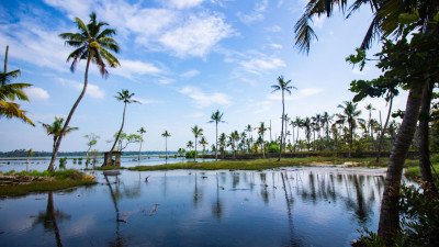 @@The Mythological Treasure: Nachiketa Lake is a pristine high-altitude lake named after Nachiketa, the young boy who sought the secret of life and death from Yama, the God of Death, as told in the Katha Upanishad. Surrounded by dense forests of oak and rhododendron, the lake remains hidden from the main tourist trail, offering absolute silence. The trek to the lake is a gentle 3 km walk through a canopy of trees that changes color with the seasons. It is a place of deep spiritual vibration, often frequented by meditators and nature lovers seeking solitude.
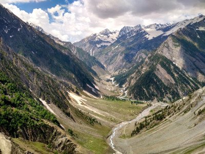 @@Description: Harsil Valley is a breathtaking hidden gem located on the banks of the Bhagirati River at an elevation of 2,620 meters. Often called the "Mini Switzerland of India," this valley is famous for its dense deodar forests, sprawling apple orchards, and the shimmering river that cuts through the landscape. The valley gained prominence during the British era when Frederick E. Wilson, a British army deserter, settled here and introduced apple cultivation. Today, the "Wilson Apples" of Harsil are famous across India. The valley is also spiritually significant as it lies on the way to Gangotri Dham. During the winter, when Gangotri becomes inaccessible due to snow, the idol of Goddess Ganga is brought down to the nearby village of Mukhba. The valley is dotted with traditional Bhotiya houses and offers a quiet retreat far from the commercial hustle. The air here is exceptionally pure, and the sound of the rushing river provides a constant natural symphony. It has also been a favorite spot for Bollywood, most notably for the film Ram Teri Ganga Maili. The valley serves as a base for several offbeat treks, including the one to Sattal (Seven Lakes). With its mist-covered peaks and serene atmosphere, Harsil is the perfect place for those looking to reconnect with nature in its rawest form.
The Dobra-Chanthi Bridge is an engineering marvel and a symbol of modern development in the Garhwal region. Spanning across the massive Tehri Lake, it is the longest motorable single-lane suspension bridge in India. For nearly 14 years, the local residents of Pratapnagar were cut off from the main city due to the flooding of the valley for the Tehri Dam. The completion of this bridge in 2020 finally restored connectivity, reducing travel time by several hours. Beyond its utility, the bridge has become a major tourist attraction due to its stunning aesthetic design. It looks like a giant silver ribbon suspended over the turquoise waters of the lake, against a backdrop of rolling green hills. At night, the bridge is illuminated with thousands of LED lights that change color, creating a magical reflection in the water below. The view point near the bridge offers a panoramic perspective of the vast reservoir, which resembles a sea in the middle of the mountains. Visitors can walk along the pedestrian path of the bridge to feel the slight sway and the breeze coming off the lake. It has quickly become a favorite spot for road trippers and photography enthusiasts. The bridge represents the resilience of the local community and the technological progress of the state. :Show All
Syanachatti is a picturesque little hamlet perched at an altitude of about 2,020 meters in the serene Yamuna Valley. It serves as a vital halting point for pilgrims traveling towards the Yamunotri Temple. The town is characterized by its dramatic views of the gushing Yamuna River and the steep, pine-covered cliffs that surround it. For many, Syanachatti is the first real taste of the high-altitude Himalayan landscape. The air here is noticeably cooler and crisper than in the lower valleys. The town is small, consisting of a few guesthouses, local dhabas, and shops, but its natural setting is grand. The roaring sound of the river is a constant companion, providing a meditative soundtrack to your stay. It is an ideal spot for those who want to acclimatize before the final trek to Yamunotri. The surrounding forests are perfect for short nature walks, where one can see the traditional terraced farming of the Garhwal region. Local life here is simple and deeply connected to the rhythm of the mountains and the river. Despite being a transit point, the beauty of the Yamuna Valley at this specific location makes it a destination in its own right, offering a quiet sanctuary away from the crowded bus terminals.
@@Description: Harsil Valley is a breathtaking hidden gem located on the banks of the Bhagirati River at an elevation of 2,620 meters. Often called the "Mini Switzerland of India," this valley is famous for its dense deodar forests, sprawling apple orchards, and the shimmering river that cuts through the landscape. The valley gained prominence during the British era when Frederick E. Wilson, a British army deserter, settled here and introduced apple cultivation. Today, the "Wilson Apples" of Harsil are famous across India. The valley is also spiritually significant as it lies on the way to Gangotri Dham. During the winter, when Gangotri becomes inaccessible due to snow, the idol of Goddess Ganga is brought down to the nearby village of Mukhba. The valley is dotted with traditional Bhotiya houses and offers a quiet retreat far from the commercial hustle. The air here is exceptionally pure, and the sound of the rushing river provides a constant natural symphony. It has also been a favorite spot for Bollywood, most notably for the film Ram Teri Ganga Maili. The valley serves as a base for several offbeat treks, including the one to Sattal (Seven Lakes). With its mist-covered peaks and serene atmosphere, Harsil is the perfect place for those looking to reconnect with nature in its rawest form.
The Dobra-Chanthi Bridge is an engineering marvel and a symbol of modern development in the Garhwal region. Spanning across the massive Tehri Lake, it is the longest motorable single-lane suspension bridge in India. For nearly 14 years, the local residents of Pratapnagar were cut off from the main city due to the flooding of the valley for the Tehri Dam. The completion of this bridge in 2020 finally restored connectivity, reducing travel time by several hours. Beyond its utility, the bridge has become a major tourist attraction due to its stunning aesthetic design. It looks like a giant silver ribbon suspended over the turquoise waters of the lake, against a backdrop of rolling green hills. At night, the bridge is illuminated with thousands of LED lights that change color, creating a magical reflection in the water below. The view point near the bridge offers a panoramic perspective of the vast reservoir, which resembles a sea in the middle of the mountains. Visitors can walk along the pedestrian path of the bridge to feel the slight sway and the breeze coming off the lake. It has quickly become a favorite spot for road trippers and photography enthusiasts. The bridge represents the resilience of the local community and the technological progress of the state. :Show All
Syanachatti is a picturesque little hamlet perched at an altitude of about 2,020 meters in the serene Yamuna Valley. It serves as a vital halting point for pilgrims traveling towards the Yamunotri Temple. The town is characterized by its dramatic views of the gushing Yamuna River and the steep, pine-covered cliffs that surround it. For many, Syanachatti is the first real taste of the high-altitude Himalayan landscape. The air here is noticeably cooler and crisper than in the lower valleys. The town is small, consisting of a few guesthouses, local dhabas, and shops, but its natural setting is grand. The roaring sound of the river is a constant companion, providing a meditative soundtrack to your stay. It is an ideal spot for those who want to acclimatize before the final trek to Yamunotri. The surrounding forests are perfect for short nature walks, where one can see the traditional terraced farming of the Garhwal region. Local life here is simple and deeply connected to the rhythm of the mountains and the river. Despite being a transit point, the beauty of the Yamuna Valley at this specific location makes it a destination in its own right, offering a quiet sanctuary away from the crowded bus terminals.Information
-
Why Famous:
Kashi of North: It is considered as holy as the main city of Varanasi. The presence of Lord Vishwanath makes it a primary spiritual hub.
Adventure Base: It is the headquarters for mountaineering in India. The Nehru Institute of Mountaineer...Kashi of North: It is considered as holy as the main city of Varanasi. The presence of Lord Vishwanath makes it a primary spiritual hub.
Adventure Base: It is the headquarters for mountaineering in India. The Nehru Institute of Mountaineering is located here.
Natural Gateway: It provides access to the Gangotri Glacier and meadows. The town is the starting point for the world-famous treks. -
Architecture:
Vishwanath Temple: Built in the ancient Katyuri style of architecture. It features a slanted roof to withstand heavy Himalayan snow.
Shakti Trident: A 6-meter high trident made of brass and copper. It is an engineering wonder of the ancien...Vishwanath Temple: Built in the ancient Katyuri style of architecture. It features a slanted roof to withstand heavy Himalayan snow.
Shakti Trident: A 6-meter high trident made of brass and copper. It is an engineering wonder of the ancient world's metallurgy.
Nehru Institute: The NIM campus features modern mountain-style cottages. They are designed to blend with the natural forest surroundings. -
How To Reach:
By Air: Jolly Grant Airport in Dehradun is 170 KM away.
By Train: The nearest railhead is at Rishikesh or Dehradun.
By Road: Regular buses and taxis are available from Dehradun.
...By Air: Jolly Grant Airport in Dehradun is 170 KM away.
By Train: The nearest railhead is at Rishikesh or Dehradun.
By Road: Regular buses and taxis are available from Dehradun.
Local Transport: Shared taxis and small buses connect nearby villages. -
Weather and Best Time to Visit:
Summer Season: April to June is perfect for trekking and visits.
Winter Season: November to February is great for seeing snow.
Best Part of Day: Mornings are crisp and offer the clearest views. ...Summer Season: April to June is perfect for trekking and visits.
Winter Season: November to February is great for seeing snow.
Best Part of Day: Mornings are crisp and offer the clearest views. -
Near Tourist Places:
Gangotri (95km), Harsil (73km), Barkot (80km), Dharasu (28km), Maneri (13km), Yamunotri (120km), Mussoorie (140km), Tehri (110km), Chamba (125km), Nachiketa Tal (30km)
Tourism Tips
-
Health & Safety: Be careful of altitude sickness during high treks.
Packing: Carry heavy woolens if visiting during the winter months.
Accommodation: Stay in local homestays to experience Garhwali culture. <...Health & Safety: Be careful of altitude sickness during high treks.
Packing: Carry heavy woolens if visiting during the winter months.
Accommodation: Stay in local homestays to experience Garhwali culture.
General: Always hire a local guide for treks like Dodital or Dayara.
Reviews
FAQs
Uttarkashi Itineray And Cost:-
Other Places In Uttarakhand :-
Other States In India :-
Information about New and Updated Locations() of Uttarakhand Has Been Added :-
Card subtitle
Note:-
Information provided here in good Faith and for reference only.
Near Places
Chakrata
Some quick example text to build on the card title and make up the bulk of the card's content.
Go somewhere
Chamba
Some quick example text to build on the card title and make up the bulk of the card's content.
Go somewhere
Chamoli
Some quick example text to build on the card title and make up the bulk of the card's content.
Go somewhere
Champawat
Some quick example text to build on the card title and make up the bulk of the card's content.
Go somewhere
Chopta
Some quick example text to build on the card title and make up the bulk of the card's content.
Go somewhere
Corbett
Some quick example text to build on the card title and make up the bulk of the card's content.
Go somewhere
Dehradun
Some quick example text to build on the card title and make up the bulk of the card's content.
Go somewhere
Dhanaulti
Some quick example text to build on the card title and make up the bulk of the card's content.
Go somewhere
Gwaldam
Some quick example text to build on the card title and make up the bulk of the card's content.
Go somewhere
Haldwani
Some quick example text to build on the card title and make up the bulk of the card's content.
Go somewhere
Haridwar
Some quick example text to build on the card title and make up the bulk of the card's content.
Go somewhere
Joshimath
Some quick example text to build on the card title and make up the bulk of the card's content.
Go somewhere
Kanatal
Some quick example text to build on the card title and make up the bulk of the card's content.
Go somewhere
Kashipur
Some quick example text to build on the card title and make up the bulk of the card's content.
Go somewhere
Kausani
Some quick example text to build on the card title and make up the bulk of the card's content.
Go somewhere
Kedarnath
Some quick example text to build on the card title and make up the bulk of the card's content.
Go somewherein Other Cities