...

Place To Visit And Things To Do In Gwaldam

Uttarakhand, India
Place Details: Gwaldam is a picturesque little town situated on the border of the Garhwal and Kumaon regions. At an elevation of 1,700 meters, it is surrounded by deep pine forests and sprawling apple orchards. The town is famous for providing some of the most stunning views of the Nanda Devi, Trish ul, and Nanda Ghunti peaks. It serves as an important base camp for several treks, including the world-famous Roopkund trek and the Lord Curzon trail. Historically, it was an important trading post and remains a quiet, offbeat destination far from the tourist rush. The Pindari river flows nearby, adding to the scenic charm of the valley. It is an ideal spot for those who want to experience the raw beauty of the Himalayas in its purest form.

Things To Do

Card image cap
Angora Farm

The Angora Farm in Gwaldam is a state-run facility established in the year 1987 to promote the cultivation of high-quality wool from Angora Rabbits. ...
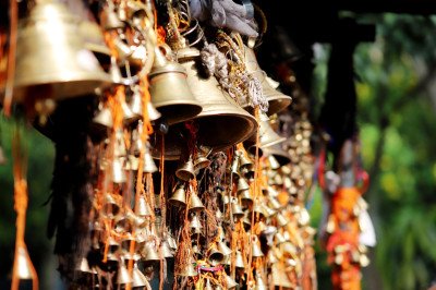
The Angora Farm in Gwaldam is a state-run facility established in the year 1987 to promote the cultivation of high-quality wool from Angora Rabbits. This farm is spread across a lush green area and serves as a vital center for animal husbandry in the Chamoli region. Visitors can see a large number of German Angora Rabbits and Mohair Goats kept in clean, well-maintained enclosures. The farm plays a significant role in the local economy by providing an alternative to traditional sheep rearing. It is a fascinating place for children and families to learn about the process of wool extraction and the breeding habits of these exotic animals. The serene environment and the sight of fluffy rabbits make it a unique stop in the hills. The staff here is knowledgeable and often explains the meticulous care required for these delicate creatures. The farm also houses several Shila houses where the animals are kept safely during the night while they graze in nearby meadows during the day. It is a perfect example of sustainable agricultural practices in the Himalayan belt.
Card image cap
Badhangarhi Temple

The Badhangarhi Temple is a highly revered shrine dedicated to Goddess Kali and Lord Shiva, perched at an altitude of 2,260 meters. It is situated on...

The Badhangarhi Temple is a highly revered shrine dedicated to Goddess Kali and Lord Shiva, perched at an altitude of 2,260 meters. It is situated on a narrow ridge that marks the boundary between the Kumaon and Garhwal regions. The temple has deep historical roots, once being one of the 52 Garhs (forts) of the Garhwal Kingdom. Legend has it that the idol of Nanda Devi was once kept here before being moved to Almora after a battle. The trek to the temple is an experience in itself, passing through dense forests of oak and rhododendron. From the top, one can witness a 360-degree panoramic view of the majestic Himalayan peaks including Nanda Devi, Trishul, and Panchachuli. The atmosphere is spiritually charged, and local devotees from Tharali and Dewal visit in large numbers. It is believed that any wish made here with a pure heart is granted by the Goddess. The site also contains remnants of the old fort walls, telling stories of ancient warriors. The silence of the peak is only broken by the sound of temple bells and the whistling wind.
Card image cap
Bekaltal

Bekaltal is a stunning high-altitude lake nestled amidst a dense forest of oak and cedar trees. It serves as the first major campsite for the world-f...

Bekaltal is a stunning high-altitude lake nestled amidst a dense forest of oak and cedar trees. It serves as the first major campsite for the world-famous Roopkund Trek and the Brahmatal Trek. The lake is unique because its waters remain dark and deep, often reflecting the green canopy above. During the winter months, the lake completely freezes over, turning into a shimmering sheet of ice. The trek to Bekaltal starts from the village of Lohajung, which is a scenic drive from Gwaldam. The trail is a moderate climb of about 6 KM, offering glimpses of the Nanda Ghunti peak. The silence of the forest is therapeutic, and the area is rich in Himalayan biodiversity. Local legends say that the lake is protected by the mountain gods, and it is a place of great serenity. Camping by the lake under a starlit sky is a dream for every adventure enthusiast. The surrounding meadows, known as Bugyals, are vibrant with wildflowers during the monsoon and spring seasons. It is an offbeat destination that offers a raw connection with nature, away from the commercial tourist spots.
Card image cap
Benital

Benital is a hidden gem that has recently gained fame as India's First Astro Village. Situated at an altitude of 2,600 meters, it offers an unobstruc...

Benital is a hidden gem that has recently gained fame as India's First Astro Village. Situated at an altitude of 2,600 meters, it offers an unobstructed 270-degree view of the Himalayas and some of the darkest skies in the country. The district administration has developed this site specifically for astronomy enthusiasts, equipping it with high-end telescopes and an observatory. The village is surrounded by lush green meadows and dense forests, making it a perfect spot for eco-tourism during the day and stargazing at night. The lack of light pollution here allows visitors to see the Milky Way, various planets, and star clusters with incredible clarity. Educational workshops on rocketry and space science are frequently held here for students and tourists. Beyond the stars, the meadows of Benital are ideal for long walks and bird watching. It is a quiet retreat where the only sounds are the chirping of birds and the rustling of leaves. The village also showcases local Kumaoni and Garhwali culture through its homestays and traditional food. For those seeking an intellectual and spiritual connection with the universe, Benital is an unmissable destination near Gwaldam.
Card image cap
Buddhist Khamba Temple

The Buddhist Khamba Temple, also known as the Baudh Math, is a serene religious site located just a short distance from the Gwaldam market. Establish...

The Buddhist Khamba Temple, also known as the Baudh Math, is a serene religious site located just a short distance from the Gwaldam market. Established in the year 1953, it serves as a spiritual home for a small community of Bhotia and Tibetan families who settled here decades ago. The temple is famous for its vibrant architecture and the peaceful aura that surrounds it. Inside the sanctum, one can find beautifully carved stone statues representing various incarnations of Lord Buddha. The atmosphere is reminiscent of a mini Dharamshala or Ladakh, with colorful prayer flags fluttering in the mountain breeze. The temple is owned by the Government of Uttarakhand and is a significant landmark for cultural tourism in the region. Visitors can often hear the rhythmic chanting of monks and the sound of traditional Tibetan bells. The site offers a panoramic view of the Katyur Valley and the surrounding terraced fields. It is a place where architecture, spirituality, and nature come together in perfect harmony. For those looking to escape the noise of the market, the Khamba Temple provides a quiet corner for reflection and meditation. The intricate stone sculptures are a testament to the artistic skills of the Buddhist craftsmen who built this sanctuary.
Card image cap
Chandpur Garhi

@@Introduction to History: Chandpur Garhi is recognized as the strongest of the 52 garhs (forts) that once existed in the Garhwal region of Uttarakhan...

@@Introduction to History: Chandpur Garhi is recognized as the strongest of the 52 garhs (forts) that once existed in the Garhwal region of Uttarakhand. It served as the capital of the Panwar dynasty founded by Kanak Pal in the 9th century. The site is a protected monument under the Archaeological Survey of India (ASI) and holds deep historical significance as the cradle of Garhwali royalty. Visitors can see the remains of the old palace walls and stone structures that whisper tales of ancient battles and royal administration. The fort is perched on a hilltop offering a 360-degree view of the surrounding valleys and the Pindar river. Exploring these ruins provides a unique window into the medieval era of the Himalayas. The atmosphere here is quiet and reflective, perfect for those who enjoy history away from the modern hustle. It is a place where stones tell stories of a kingdom that eventually moved its capital to Srinagar. @@Natural and Cultural Blend: Surrounded by dense forests and rural villages like Nauti, the fort is not just a pile of stones but a cultural landmark. It marks the transition between the Kumaon and Garhwal regions, showcasing a blend of both traditions. The trek to the fort is relatively easy and passes through scenic landscapes filled with local flora. Local legends say the fort was impregnable due to its strategic positioning and the bravery of its soldiers. Today, it serves as a major stop for pilgrims during the Nanda Devi Raj Jat Yatra, the long pilgrimage held every 12 years. The site is an excellent example of how ancient civilizations utilized the rugged Himalayan terrain for defense and living. It remains one of the most important archaeological sites in the entire Chamoli district.
Card image cap
Dharali Valley View Point

@@The Scenic Beauty: Dharali Valley View Point is one of the most breathtaking stops near Gwaldam, offering a deep view into the lush green Pindar val...

@@The Scenic Beauty: Dharali Valley View Point is one of the most breathtaking stops near Gwaldam, offering a deep view into the lush green Pindar valley. This spot is famous for its vast stretches of terraced fields that look like a giant green staircase descending into the river bed. On a clear day, the reflection of the sun on the winding river below creates a shimmering silver line that is visible from miles away. The viewpoint is situated on a curve that allows a wide-panoramic view of the surrounding mountain ranges. It is a favorite spot for travelers who want to experience the "Switzerland of India" vibe that Gwaldam is often compared to. The air here is crisp and filled with the scent of pine needles from the nearby forests. It provides a peaceful escape from the main town where one can just sit and watch the clouds float by. @@Flora and Fauna: The area surrounding the viewpoint is rich in biodiversity, featuring oak, deodar, and rhododendron trees. During the spring, the entire valley turns red with blooming rhododendrons, making the view from this point even more spectacular. You can often spot local Himalayan birds like the Monal or various species of eagles soaring in the thermals over the valley. The valley is also home to small apple orchards that add to the charm of the landscape. It is a perfect spot for nature lovers and landscape photographers who want to capture the raw beauty of the Garhwal region. The local community takes pride in maintaining the cleanliness of this natural balcony.
Card image cap
Gwaldam

@@General Description: Gwaldam is a hidden gem of Uttarakhand, located at an altitude of 1,700 meters on the border of the Garhwal and Kumaon regions....

@@General Description: Gwaldam is a hidden gem of Uttarakhand, located at an altitude of 1,700 meters on the border of the Garhwal and Kumaon regions. It is a quiet town surrounded by dense pine forests and sprawling apple orchards that bloom beautifully in the spring. Unlike other crowded hill stations, Gwaldam offers a serene environment where you can actually hear the wind rustling through the trees. The town serves as a vital base camp for several famous treks, including the one to Roopkund Lake. Its unique location allows visitors to experience a mix of two distinct mountain cultures. You can find traditional Pahari food and warm hospitality in the local markets. The view of the Pindar river flowing below adds to the town's majestic charm. It is a place where time seems to slow down, making it perfect for long walks and deep relaxation. @@Economic and Cultural Life: The economy of the town revolves around agriculture, wool production, and limited tourism. Gwaldam is home to the famous Angora farm where high-quality wool is produced from rabbits. The town also has a significant military presence with a training center for the Sashastra Seema Bal (SSB), adding a sense of discipline and safety to the area. Culturally, the town is a melting pot where you can hear both Garhwali and Kumaoni dialects spoken fluently. Local festivals like the Nanda Devi fair bring the entire community together in a display of colorful traditions. The apple orchards of Gwaldam were once very famous across North India and are currently being revived. For a traveler, this town is the perfect starting point to explore the deeper mysteries of the Himalayas.
Card image cap
Himalaya View Point

@@The Grandeur of Peaks: The Himalaya View Point in Gwaldam is one of the premier locations in North India to witness the majesty of the high peaks. F...

@@The Grandeur of Peaks: The Himalaya View Point in Gwaldam is one of the premier locations in North India to witness the majesty of the high peaks. From this specific altitude, the Nanda Devi (7,817m), Trishul (7,120m), and Nanda Ghunti (6,309m) appear so close that you feel you could almost touch them. This spot is unique because it offers an unobstructed horizontal view of the massive snow range without any intervening hills. The sight of the sun hitting the peaks at dawn, turning them from cold blue to fiery orange, is a spiritual experience for many. The silence at this viewpoint is profound, broken only by the occasional cry of a mountain bird. It is a place for contemplation and for appreciating the sheer scale of nature. The viewpoint is well-maintained and has become a pilgrimage of sorts for those who love high-altitude scenery but cannot trek to the base camps. @@Atmosphere and Surroundings: The area around the viewpoint is dominated by a mix of high-altitude grasslands and dark coniferous forests. The air is thinner here and significantly colder than in the main Gwaldam market, adding to the high-mountain feel. During the winter months, the entire area is covered in a thick blanket of snow, turning it into a white wonderland. Even in the height of summer, the cool breeze coming off the glaciers makes this spot a refreshing retreat. It serves as an educational site where one can identify the different peaks of the central Himalayas. The local administration has placed benches and information boards to help tourists understand the geography of what they are seeing. It is truly the crown jewel of the Gwaldam tourism circuit.
Card image cap
Kuari Pass Trek Base

The Kuari Pass Trek is a legendary Himalayan expedition often referred to as the Lord Curzon Trail. Starting from the base near Joshimath, this trek t...

The Kuari Pass Trek is a legendary Himalayan expedition often referred to as the Lord Curzon Trail. Starting from the base near Joshimath, this trek takes you through some of the most diverse landscapes in the Garhwal region. The trail is characterized by ancient forests of Oak and Rhododendron, which open up into massive alpine meadows known as Bugyals. From the summit at 12,516 feet, one can witness an unparalleled 360-degree view of the high Himalayas, including Nanda Devi, Dronagiri, and Kamet. It serves as a perfect introduction for beginners while offering enough grandeur for veterans. The history of this route dates back to 1905 when the British Viceroy Lord Curzon trekked here, making it a trail of historical significance. The path winds through remote villages like Tugasi, where the traditional lifestyle of the mountain people remains untouched by modern haste. During winters, the entire landscape is draped in a thick blanket of snow, turning the meadows into a white paradise. The crisp mountain air and the scent of pine needles create a therapeutic environment for every traveler. The trek usually culminates at the pass, where a cold breeze and warm sun welcome successful hikers. It is not just a walk but a journey through the heart of the Nanda Devi Biosphere Reserve buffer zone.
Card image cap
Monal Top

Monal Top is a relatively unexplored and hidden gem located in the Chamoli district, acting as a superb alternative to more crowded trails. The trek s...

Monal Top is a relatively unexplored and hidden gem located in the Chamoli district, acting as a superb alternative to more crowded trails. The trek starts from the scenic Wan Village, which is also the last civilian outpost for many major treks. Standing at an altitude of approximately 12,000 feet, the top is named after the Himalayan Monal, the state bird of Uttarakhand, which is frequently spotted here. The trail passes through some of the thickest Rhododendron and Oak forests in the region, which turn a vibrant red and pink during the spring season. Unlike other treks, Monal Top offers a very intimate experience with nature, as the number of visitors is quite low. The summit provides a panoramic 360-degree view of the Greater Himalayas, with a stunning perspective of Mt. Trishul and Nanda Ghunti. The path is a mix of steep climbs and gentle walks across ridges, making it an excellent choice for beginner trekkers and families. One of the most enchanting aspects of this trek is the cultural immersion in Wan Village, where the locals still practice age-old traditions and live in harmony with the wilderness. The silence at the top is profound, broken only by the whistling of the wind and the calls of high-altitude birds. It is a place of spiritual and natural rejuvenation.
Card image cap
Nanda Devi National Park

The Nanda Devi National Park is one of the most spectacular wilderness areas in the world, dominated by the peak of Nanda Devi, which rises to 7,816 m...

The Nanda Devi National Park is one of the most spectacular wilderness areas in the world, dominated by the peak of Nanda Devi, which rises to 7,816 meters. Established in 1982 and later designated as a UNESCO World Heritage Site, the park is a sanctuary for some of the rarest high-altitude flora and fauna. The park is divided into inner and outer sanctuary areas; while the inner core is strictly restricted to protect the fragile ecosystem, the buffer zones offer incredible trekking opportunities. The landscape is rugged and dramatic, featuring deep canyons, glaciated valleys, and lush alpine meadows. It is home to the Snow Leopard, Himalayan Musk Deer, and the Bharal (Blue Sheep). The trek usually starts from Lata village, a culturally rich settlement where the Bhotia tribes reside. The biodiversity here is staggering, with over 300 species of flora, including several endangered medicinal plants. Visiting this park is a privilege that requires strict adherence to environmental guidelines, as it is one of the last remaining pristine wildernesses in the Himalayas. The views of the Zanskar and Great Himalayan ranges from the park's periphery are legendary, offering a sense of scale and majesty that few other places can match.
Card image cap
Pindari Glacier Trek Base

The Pindari Glacier Trek is the crown jewel of the Kumaon region, starting from the base camp at Khati. Known as the "Softest Glacier" to reach, it is...

The Pindari Glacier Trek is the crown jewel of the Kumaon region, starting from the base camp at Khati. Known as the "Softest Glacier" to reach, it is highly popular among beginners and families. The trek follows the Pindar River upstream through dense forests of Boxwood and Oak. The final destination is the Zero Point, situated at an altitude of 12,010 feet, where the massive glacier is visible between the peaks of Nanda Kot and Nanda Khat. The trek offers a diverse landscape, from the lush green meadows of Dhakuri to the rugged moraines near the glacier snout. Khati village, the last inhabited settlement on the route, serves as a bustling hub for trekkers. The local Kumaoni culture is vibrant here, with traditional hospitality that makes every traveler feel at home. The glacier itself is about 3 KM long and is the source of the Pindar River, which later joins the Alaknanda. The trail is historically significant, as it was a major trade route and has been visited by explorers for over a century. The ease of the trail combined with the grandeur of the glacial valley makes it a must-visit for anyone looking to experience the high Himalayas without extreme technical difficulty.
Card image cap
Roopkund Trek Start Point

The Roopkund Trek Start Point, located in the scenic village of Lohajung, serves as the primary base for one of India’s most famous high-altitude t...

The Roopkund Trek Start Point, located in the scenic village of Lohajung, serves as the primary base for one of India’s most famous high-altitude treks. This spot is the threshold to the legendary Skeleton Lake, sitting at an elevation of 4,800 meters. The journey from Gwaldam to Lohajung is a short but winding drive through dense oak and rhododendron forests that set the mood for the adventure ahead. Trekkers gather here to organize their gear and prepare for a week-long expedition into the Garhwal Himalayas. The village itself is perched on a ridge, offering a stunning 180-degree view of the Wan Valley and the Didna village trail. It is a bustling hub for the trekking community, where stories of past expeditions are shared over steaming cups of tea. The air here is crisp, and the atmosphere is filled with anticipation and excitement. Lohajung is not just a transit point but a cultural immersion into the lives of the high-altitude villagers who have called these rugged terrains home for centuries. The trek from here passes through two of Asia’s largest high-altitude meadows, Ali Bugyal and Bedni Bugyal, which are often compared to the Swiss Alps for their rolling green landscapes and majestic backdrop of peaks like Trishul and Nanda Ghunti.
Card image cap
Rudranath Temple Trek Base

Sagar Village is the most popular starting point for the trek to Rudranath, the third temple in the prestigious Panch Kedar circuit. For travelers co...

Sagar Village is the most popular starting point for the trek to Rudranath, the third temple in the prestigious Panch Kedar circuit. For travelers coming from Gwaldam, this journey takes you deeper into the heart of the Garhwal region. The trek is widely considered the most difficult of the five Kedar temples due to its steep inclines and the sheer distance of 22 km one way. As you leave the base at Sagar, you enter a world of dense ancient forests that eventually open up into the vast, ethereal meadows of Panar Bugyal. The temple itself is a natural rock structure where Lord Shiva is worshipped in his 'Mukha' or facial form. Unlike other pilgrimage sites that have become commercialized, the path from Sagar remains rugged and pristine, appealing to both devout pilgrims and hardy trekkers. The village of Sagar serves as a quiet preparatory ground where one can find basic homestays and local guides. The trek challenges your physical limits but rewards you with some of the most intimate views of the Himalayan giants. It is a journey of faith and endurance that starts amidst the apple orchards and potato fields of the lower valleys and ends in the silent, misty heights of the alpine pastures.
Card image cap
Seem Tal

Seem Tal, more commonly known as Macchi Tal, is a serene, hidden lake nestled in a thicket of deodar and oak trees near Gwaldam. Originally establish...

Seem Tal, more commonly known as Macchi Tal, is a serene, hidden lake nestled in a thicket of deodar and oak trees near Gwaldam. Originally established in 1928 during the British era, this place was intended as a fish breeding center for the personal consumption of British officers stationed in the region. Today, it is maintained by the State Government's fisheries department as a significant fish production farm. The lake is fed by a sparkling perennial stream that ensures the water remains fresh and oxygenated for the trout and other fish species. For tourists, Seem Tal offers a perfect escape from the more popular trekking routes. It is a place characterized by its profound silence, broken only by the chirping of birds and the gentle ripple of water. The surrounding forest is so dense that even on a sunny day, the lake remains cool and shaded. It is a favorite spot for local families for weekend picnics, but it remains largely undiscovered by the larger tourist crowds. The walk to the lake is as beautiful as the destination itself, passing through small mountain hamlets and terraced fields where local farmers grow seasonal vegetables. It represents the quiet, pastoral side of Uttarakhand that is often overlooked in favor of the high peaks.
Card image cap
Viewpoint for Trishul Peak

The Viewpoint for Trishul Peak in Gwaldam offers one of the most magnificent and unobstructed panoramas of the high Himalayas. While many hill statio...

The Viewpoint for Trishul Peak in Gwaldam offers one of the most magnificent and unobstructed panoramas of the high Himalayas. While many hill stations claim to have mountain views, Gwaldam’s unique position on the border of Kumaon and Garhwal places it directly in front of the Trishul massif (7,120m). This viewpoint is a high ridge located just a short walk from the main market, often near the BSF training camp area. On a clear day, the three peaks that form the 'Trident' of Lord Shiva stand out in stark white against the deep blue sky. Along with Trishul, one can also see the majestic Nanda Ghunti and the massive Nanda Devi peak. The beauty of this spot is that it requires no grueling trek to reach, making it accessible to everyone. The viewpoint overlooks the deep Pindar River valley, providing a sense of immense scale. In the early mornings, the valley is often filled with a sea of clouds, with the snow peaks rising above them like islands in a white ocean. It is a place for quiet contemplation, where the sheer scale of nature humbles the observer. As the sun sets, the peaks turn from brilliant white to a soft gold, and finally to a cold, ethereal blue, a spectacle that draws photographers from all over the country.
Show All

Gwaldam Itineray And Cost:-

Information about New and Updated Locations() of Uttarakhand Has Been Added :-
Card subtitle

Note:-

Information provided here in good Faith and for reference only.

Near Places
...
Chakrata

Some quick example text to build on the card title and make up the bulk of the card's content.

Go somewhere
...
Chamba

Some quick example text to build on the card title and make up the bulk of the card's content.

Go somewhere
...
Chamoli

Some quick example text to build on the card title and make up the bulk of the card's content.

Go somewhere
...
Champawat

Some quick example text to build on the card title and make up the bulk of the card's content.

Go somewhere
...
Chopta

Some quick example text to build on the card title and make up the bulk of the card's content.

Go somewhere
...
Corbett

Some quick example text to build on the card title and make up the bulk of the card's content.

Go somewhere
...
Dehradun

Some quick example text to build on the card title and make up the bulk of the card's content.

Go somewhere
...
Dhanaulti

Some quick example text to build on the card title and make up the bulk of the card's content.

Go somewhere
...
Gwaldam

Some quick example text to build on the card title and make up the bulk of the card's content.

Go somewhere
...
Haldwani

Some quick example text to build on the card title and make up the bulk of the card's content.

Go somewhere
...
Haridwar

Some quick example text to build on the card title and make up the bulk of the card's content.

Go somewhere
...
Joshimath

Some quick example text to build on the card title and make up the bulk of the card's content.

Go somewhere
...
Kanatal

Some quick example text to build on the card title and make up the bulk of the card's content.

Go somewhere
...
Kashipur

Some quick example text to build on the card title and make up the bulk of the card's content.

Go somewhere
...
Kausani

Some quick example text to build on the card title and make up the bulk of the card's content.

Go somewhere
...
Kedarnath

Some quick example text to build on the card title and make up the bulk of the card's content.

Go somewhere
in Other Cities