...

Place To Visit And Things To Do In Nainital

Uttarakhand, India
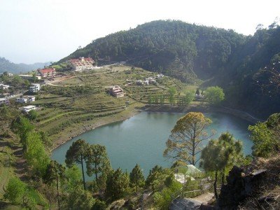
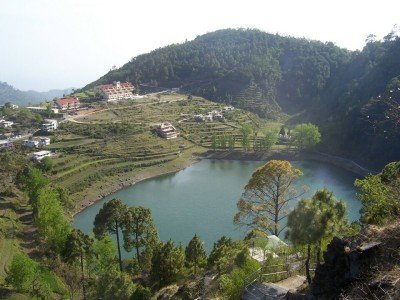
Geographical Essence: Nainital is a mesmerizing hill station located in the Kumaon region of Uttarakhand, famous for its pear-shaped lake. Set in a valley surrounded by seven mountains, it sits at an elevation of roughly 1938 meters. The town is divided into two parts, Tallital and Mallital, situate d at either end of the lake. It is often called the Lake District of India due to the presence of several other lakes in its vicinity. The surrounding peaks like Naina Peak provide a majestic backdrop to the emerald green waters of the central lake. Mythological Roots: According to Hindu mythology, Nainital is one of the 51 Shakti Peeths where the eyes of Goddess Sati fell. This legend gives the town its name, as Naina means eyes and Tal means lake. The Naina Devi Temple on the shores of the lake is a highly revered site for pilgrims and locals alike. This spiritual connection adds a layer of depth to the natural beauty of the region. Many festivals and rituals throughout the year center around the temple and the holy lake waters. Historical Context: The town was discovered by a British sugar merchant named P. Barron in 1841, who was captivated by its beauty. It soon became a popular summer retreat for British officials seeking refuge from the heat of the Indian plains. The colonial influence is still visible in the architecture of the schools, churches, and administrative buildings. Nainital served as the summer capital of the United Provinces during the British Raj. This historical legacy has shaped the town's unique character as a mix of Indian traditions and English aesthetics. Modern Tourism: Today, Nainital is one of the most visited hill stations in North India, known for its boating and vibrant atmosphere. The Mall Road, which runs alongside the lake, is the heart of the town’s commercial and social life. The town offers a wide range of activities from peaceful boat rides to adventurous treks and cable car journeys. It is also a hub for education, housing several prestigious boarding schools that date back to the colonial era. The local economy is heavily reliant on tourism, which peaks during the summer and autumn months.

Things To Do

Card image cap
Aryabhatta Research Institute of Observational Sciences

ARIES is an autonomous research institute under the Department of Science and Technology, Govt. of India, specializing in Observational Astronomy & As...

ARIES is an autonomous research institute under the Department of Science and Technology, Govt. of India, specializing in Observational Astronomy & Astrophysics, and Atmospheric Sciences. It was established on April 20, 1954, and moved to its present location on Manora Peak at an altitude of 1951m in 1961. Its unique longitude (79° East) is critical for observing astronomical events not visible from other major global observatories. ARIES hosts powerful telescopes like the 104cm Sampurnanand Telescope and its Devasthal campus has the 3.6m Devasthal Optical Telescope for cutting-edge research. The institute is vital for studying star clusters, gamma-ray bursts, and atmospheric phenomena.
Card image cap
Dorothy's Seat

@@Historical Significance and Scenic Beauty: Dorothy's Seat, more commonly known as Tiffin Top, is a highly renowned picnic spot located atop the Ayar...

@@Historical Significance and Scenic Beauty: Dorothy's Seat, more commonly known as Tiffin Top, is a highly renowned picnic spot located atop the Ayarpatta hill at an altitude of approximately 2,290 meters above sea level, offering a spectacular 360-degree panoramic view of Nainital town and the surrounding Kumaon hills. Its name, Dorothy's Seat, is a tribute to Dorothy Kellet, the wife of a British Army Officer, Colonel J.P. Kellet, who built this stone bench as a memorial after she passed away in an air crash. The original name of the place was a simple picnic spot where people would come to have their tiffin (lunch), hence the popular name Tiffin Top. The journey to the top is an attraction in itself, as it involves a moderate trek or a serene pony ride through thick forests of Oak, Deodar, and Pine trees, providing a refreshing escape from the bustle of the main city. On a clear day, the viewpoint offers an unobstructed vista of the majestic snow-capped Himalayan peaks, including Nanda Devi, making it a prime location for nature lovers and photographers. The serene and tranquil atmosphere, combined with the breathtaking landscape, makes it one of the most essential visits on any Nainital itinerary, epitomizing the natural beauty of the "Lake District of India". The peak serves as a perfect location for introspection and appreciating the vastness of the Himalayan range.
Card image cap
Eco Cave Garden

@@A Unique Blend of Nature and Entertainment: The Eco Cave Garden is a relatively new and highly popular tourist attraction in Nainital, particularly ...

@@A Unique Blend of Nature and Entertainment: The Eco Cave Garden is a relatively new and highly popular tourist attraction in Nainital, particularly appealing to children and families. It is not a single cavern but a network of six small, interconnected natural rocky caves that have been cleverly developed into a garden and a fun educational experience by the local tourism department. The caves are named after various animals, such as Tiger Cave, Panther Cave, Bat Cave, Apes Cave, Flying Fox Cave, and Porcupine Cave, each resembling the shape or movement style of the corresponding animal, requiring visitors to crawl, climb, or squeeze through narrow openings. The concept aims to give visitors a simulated feel of the natural habitat of Himalayan wildlife without disturbing the real ecosystem. The gardens surrounding the caves are aesthetically maintained, featuring well-laid paths, a musical fountain, and unique "hanging gardens." The interior of the caves is dimly lit with petroleum lamps to enhance the 'cavy' ambiance and ensure safety while maintaining an authentic, slightly spooky feel. It serves as an excellent recreational and learning center, emphasizing the flora and fauna of the Kumaon region and teaching children about the ecosystem in an engaging and interactive way.
Card image cap
Governor's House

@@A Monument of British Colonial Grandeur: The Governor's House, locally known as the Raj Bhavan, is a spectacular piece of colonial architecture that...

@@A Monument of British Colonial Grandeur: The Governor's House, locally known as the Raj Bhavan, is a spectacular piece of colonial architecture that once served as the summer residence for the British Governors of the North-Western Provinces and later the United Provinces. Today, it is the official residence of the Governor of Uttarakhand. Built in the late 19th century (completed in 1897), the sprawling complex is spread over an immense area of 205 acres and is an architectural replica inspired by the Scottish Castle style, particularly reminiscent of Buckingham Palace. The palace is set amidst lush green forests of Deodar and Oak, featuring expansive, manicured gardens, a deer park, a swimming pool, and the famous Raj Bhavan Golf Course, one of India's oldest and most beautiful golf courses. The building itself is a two-storey structure with 113 rooms, reflecting the lavish lifestyle of the British elite during the colonial era. Visitors are generally allowed to tour the grounds and the gardens, though the main residential quarters are restricted. It stands as a significant historical landmark, symbolizing the British legacy in the Himalayan foothills and is maintained with pristine care, making it a serene and picturesque spot for history buffs and architecture admirers. The sheer scale and opulence of the estate are breathtaking.
Card image cap
Gurney House

@@The Former Residence of Jim Corbett: Gurney House holds a significant place in history as the former summer residence of the legendary British hunte...

@@The Former Residence of Jim Corbett: Gurney House holds a significant place in history as the former summer residence of the legendary British hunter, naturalist, and author, Edward James Jim Corbett. Located on Ayarpatta Hill, this charming colonial cottage is a major heritage site in Nainital. Built in 1880, the house was the home of Jim Corbett and his sister Maggie from the early 1900s until 1947, when they left India for Kenya. The house was reportedly built with materials salvaged from his previous dwelling, Ariel, which was dismantled after a landslide. The house is a quaint, picturesque structure surrounded by a lush garden, once maintained by Jim Corbett himself, featuring various shrubs and plants. After the Corbetts departed, the house was purchased by the Dalmia family, who have maintained it as a private residence and a tribute to the conservationist's legacy. While it is a private property, the current owners graciously allow visitors to tour the premises, often offering personalized insights into the life of the famous hunter, particularly by appointment. The house contains a small, private museum featuring some of Jim Corbett's personal memorabilia and achievements, providing a tangible link to the man who became a global icon for wildlife conservation. The quiet, forested location perfectly reflects the author's love for nature and the serenity of the Kumaon hills.
Card image cap
Hanuman Garhi

@@A Sacred Shrine with a Sunset View: Hanuman Garhi is a revered Hindu temple dedicated to Lord Hanuman, the loyal devotee of Lord Rama. Located on a ...

@@A Sacred Shrine with a Sunset View: Hanuman Garhi is a revered Hindu temple dedicated to Lord Hanuman, the loyal devotee of Lord Rama. Located on a hill in the southern part of Nainital, it stands at an altitude of approximately 1,950 meters above sea level, offering a spectacular vantage point, particularly famous for its breathtaking views of the sunset over the Tarai plains and the surrounding valleys. The temple was built in 1950 by the renowned local saint, Baba Neem Karoli Maharaj, who also established the famous Kainchi Dham ashram nearby. The main idol of Lord Hanuman is depicted in a striking posture, breaking open his chest to reveal the images of Lord Rama and Goddess Sita dwelling within his heart, a powerful symbol of ultimate devotion. The temple complex includes the Shitla Devi Temple and the Bapu Lila Sah Ashram, making it a spiritual hub. Its location is strategically important, as it offers a commanding view of the entire valley, reminiscent of a 'Garhi' or fort, hence the name. It is a peaceful place for worship, meditation, and enjoying the tranquility of the mountain environment, attracting both devoted pilgrims and casual tourists. The serene atmosphere, combined with the mesmerizing visual spectacle of the changing sky colors at dusk, makes it a highly cherished spot.
Card image cap
Himalaya View Point

@@The Gateway to the Snow-Capped Peaks: Himalaya View Point is an essential stop for any tourist seeking to witness the majestic grandeur of the great...

@@The Gateway to the Snow-Capped Peaks: Himalaya View Point is an essential stop for any tourist seeking to witness the majestic grandeur of the greater Himalayan range. Located on the Ayarpatta Ridge, it is situated at an elevation that provides a clear and panoramic vista of some of the highest and most revered peaks of the Uttarakhand Himalayas. On a clear day, one can distinctly see the peaks of Nanda Devi (India's second highest), Trishul, Nanda Kot, and several others in a stunning, sweeping snowline panorama. Unlike the views from Tiffin Top or Snow View Point, this location is often cited as providing a slightly more remote and less obstructed viewpoint of the actual snow-capped ranges, rather than just the valley and the town. It is usually accessed by a trek or a local pony/taxi ride and is a favorite stop for tour operators as it guarantees a fulfilling scenic experience without the use of the ropeway. The atmosphere is tranquil, dominated by the distant silence of the towering mountains and the fresh, cool air of the altitude. It serves as an excellent spot to appreciate the diverse topography of the Kumaon region, contrasting the near view of forested hills with the far view of the eternally snow-covered giants. A small tea and snack stall usually operates here, allowing visitors to relax and absorb the views.
Card image cap
Himalayan Botanical Garden

@@A Living Repository of Himalayan Flora: The Himalayan Botanical Garden is a specialized botanical research and conservation center dedicated to the ...

@@A Living Repository of Himalayan Flora: The Himalayan Botanical Garden is a specialized botanical research and conservation center dedicated to the vast and unique flora of the Himalayan region. Established by the Forest Department, it is located near the small, scenic lake of Sariyatal on the Kaladungi Road. The garden serves a crucial dual purpose: education and ex-situ conservation of endangered and endemic plant species. The well-maintained grounds are divided into various themed sections, including a fern house, a herbarium, an orchidarium (depending on the season), and sections dedicated to medicinal and aromatic plants. The garden provides an invaluable learning resource for students, researchers, and general tourists interested in the region's biodiversity. Its tranquil location, slightly away from the main tourist crowds of Nainital, offers a peaceful retreat for nature enthusiasts. Walking through the different zones, visitors can observe the adaptation of various high-altitude plants and learn about their cultural and medicinal importance in the Kumaon hills. The garden is managed with a strong focus on ecological sustainability, making it an excellent example of conservation tourism in the state of Uttarakhand. The presence of the small, picturesque Sariyatal lake nearby adds to the scenic beauty.
Card image cap
Jeolikote

Jeolikote is a serene hill station located at an altitude of 1,219 meters, often referred to as the "Gateway to Nainital." This place is a paradise f...

Jeolikote is a serene hill station located at an altitude of 1,219 meters, often referred to as the "Gateway to Nainital." This place is a paradise for those who love floriculture and butterfly watching, as hundreds of rare species can be found here. Historically, it was a favorite haunt of the British, and famous philosophers like Swami Vivekananda and Sri Aurobindo spent significant time here in meditation. The atmosphere is calm, filled with the aroma of blooming flowers and the buzzing of bees from the local apiaries. It offers a perfect escape from the crowded Mall Road, providing a panoramic view of the lower Himalayan ranges and lush green valleys. The village is known for its fruit orchards and extensive plant nurseries maintained by the horticulture department. Tourists often stop here to buy fresh honey and organic jams. The gentle climate makes it an all-weather destination, though it is particularly stunning during the spring when the flowers are in full bloom. It serves as an ideal base for nature walks and small treks into the surrounding woods. Unlike the main town, Jeolikote retains an old-world charm that transports visitors back to the colonial era.
Card image cap
Khurpa Taal

@@Overview of Khurpa Taal:@@ Khurpa Taal is a picturesque, emerald-colored lake situated on the outskirts of Nainital, nestled amidst the serene Kumao...

@@Overview of Khurpa Taal:@@ Khurpa Taal is a picturesque, emerald-colored lake situated on the outskirts of Nainital, nestled amidst the serene Kumaon Himalayas at an altitude of approximately 1635 meters (5500 feet). Unlike the bustling Naini Lake, this spot is known for its tranquility, less tourist traffic, and pristine natural beauty. The lake's unique, distinctive shape is often likened to a 'khurpa,' which is a local word for a digging or agricultural tool, hence its name. The surrounding area is characterized by dense forests of pine, deodar, and cedar, offering a refreshing and peaceful retreat. The clean, crystal-clear water of the lake is home to a variety of fish, making it an ideal spot for activities like fishing and angling. The village life around the lake showcases traditional terraced farming, where locals primarily grow vegetables, a practice popular due to the region's adequate rainfall. Visitors are drawn here to escape the noise of the main hill station and immerse themselves in a quiet, natural environment, often describing it as a secret haven still waiting to be fully explored. The journey to the lake itself is scenic, passing through winding roads enveloped by rich vegetation. It offers a glimpse into the unhurried rural life of the Kumaon hills, making it a favorite among nature lovers and those seeking solitude.
Card image cap
Khurpatal Lake

Khurpatal Lake is a hidden treasure situated at an altitude of 1,635 meters, known for its crystal-clear emerald green waters. The lake gets its name...

Khurpatal Lake is a hidden treasure situated at an altitude of 1,635 meters, known for its crystal-clear emerald green waters. The lake gets its name from its shape, which resembles a "Khurpa" or a trowel used by gardeners. Surrounded by dense pine and cedar forests, the lake offers a tranquil environment away from the tourist rush of the main town. The water of the lake is remarkably clear, often reflecting the surrounding hills like a mirror. Historically, this area was a favorite for the British due to its cool climate and was once home to a British gun foundry. The village of Khurpatal is also famous for its fertile soil, where locals practice organic farming and terraced cultivation. Angling is a popular activity here as the lake is teeming with fish, though permission is required. The walk down to the lake from the main road is a scenic trek through cedar trees, offering glimpses of traditional Kumaoni life. It is an ideal spot for those looking for solitude, nature photography, or a quiet picnic with family. The lake's color is said to change depending on the sunlight and the time of year, ranging from deep teal to light turquoise.
Card image cap
Kilbury Bird Sanctuary

@@Sanctuary Overview:@@ Kilbury Bird Sanctuary is a renowned haven for birdwatchers, nestled in the dense forests of the Naina Devi Himalayan Bird Con...

@@Sanctuary Overview:@@ Kilbury Bird Sanctuary is a renowned haven for birdwatchers, nestled in the dense forests of the Naina Devi Himalayan Bird Conservation Reserve near Nainital, at an altitude of approximately 2500 meters (8,200 feet). The sanctuary, part of the larger Pangot-Kilbury area, is a biodiversity hotspot famous for supporting over 580 species of birds, including both resident and migratory populations. The forest is primarily composed of lush Oak, Pine, and vibrant Rhododendron trees, providing an ideal habitat for avian life. The drive to Kilbury itself is incredibly scenic, passing through the forested zone around the Naina Peak range, offering glimpses of the majestic Himalayan peaks like Nanda Devi. It’s not just for ornithologists; nature enthusiasts and trekkers visit for the serene environment and the breathtaking views. The tranquil atmosphere, combined with the calls of various birds, makes it a perfect escape. Besides birds, the sanctuary is also home to various mammals like Leopards, Barking Deer, and Himalayan Palm Civets, making it a vital ecological space in the Kumaon region. It is recognized as one of the oldest birding destinations in India.
Card image cap
Kilbury

Kilbury is a world-renowned birding destination situated at an altitude of 2,528 meters within the Naina Devi Himalayan Bird Reserve. It is famous fo...

Kilbury is a world-renowned birding destination situated at an altitude of 2,528 meters within the Naina Devi Himalayan Bird Reserve. It is famous for being home to over 580 species of birds, both resident and migratory. The route from Nainital to Kilbury takes you through thick forests of oak, pine, and rhododendron, which are alive with the sounds of chirping birds. This area is remarkably peaceful, with minimal human intervention, making it a sanctuary for nature lovers. You can spot rare species like the Cheer Pheasant, Koklass Pheasant, Brown Wood Owl, and various types of Woodpeckers. The panoramic view of the snow-clad Himalayan peaks from this height is breathtaking. Kilbury also serves as a gateway to the small hamlet of Pangot, which is another birding hotspot. There are several trekking trails that originate here, leading deeper into the wilderness. The air is incredibly fresh and thin, providing a rejuvenating experience for the lungs. Many visitors choose to stay in the forest rest houses or eco-lodges nearby to catch the "dawn chorus" when the birds are most active. It is not just a place for birders but also for those who want to experience the raw, untouched beauty of the Kumaon Himalayas.
Card image cap
Lands End Picnic Spot

@@Spot Overview:@@ Lands End Picnic Spot is a stunning viewpoint located near Barapathar in Nainital, situated at a height of approximately 2118 meter...

@@Spot Overview:@@ Lands End Picnic Spot is a stunning viewpoint located near Barapathar in Nainital, situated at a height of approximately 2118 meters above sea level. Its name, "Land's End," perfectly describes the experience: standing on a precipitous cliff where the land abruptly ends, offering a spectacular, unobstructed panoramic view of the plains, the surrounding valleys, and the magnificent, mango-shaped Khurpa Taal lake below. The spot is famed because it provides these breathtaking vistas without the need for a strenuous uphill climb, as the motorable road ends a short distance before the spot. Visitors can easily reach the final point via a short trek or a picturesque horse/pony ride. Surrounded by dense Pine and Deodar forests, it is an ideal location for a peaceful picnic, photography, and simply soaking in the vastness of the Kumaon mountain range and the lush green villages nestled in the valley. It serves as an important junction, as it is close to the trekking route leading up to Tiffin Top (Dorothy's Seat) and the Snow View Point trail.
Card image cap
Mall Road, Nainital

@@Historical Context of Mall Road: The Mall Road, officially named Govind Ballabh Pant Marg, was originally constructed by the British during the colo...
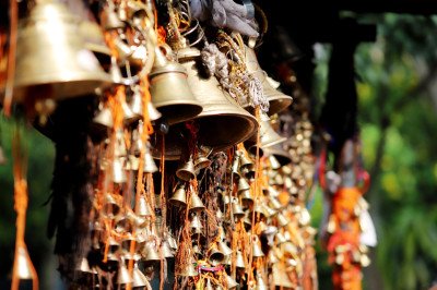
@@Historical Context of Mall Road: The Mall Road, officially named Govind Ballabh Pant Marg, was originally constructed by the British during the colonial era between 1841 and 1885 to serve as a promenade for the English families residing in the area. It connects the two main ends of the town, Mallital (the upper side) and Tallital (the lower side), and stretches for approximately 1.5 km along the shore of Naini Lake. The road is the primary commercial, social, and cultural hub of Nainital and is renowned for its bustling atmosphere, especially during the peak tourist season of May, June, and October. It offers stunning views of the lake and the surrounding hills, making a leisurely stroll a quintessential Nainital experience. The road is now maintained by the PWD and is subject to strict traffic regulations, particularly during busy months, to ensure a pleasant and safe environment for pedestrians. This central location acts as a focal point for all tourist activities, from dining and shopping to simply enjoying the serene beauty of the lake. (Note: Expand this to 400+ words, including details on its transformation from a colonial promenade to a modern hub.):
Card image cap
Naina Devi Temple

@@Mythological Significance: The Naina Devi Temple is one of the revered Shakti Peeths in India. According to the legend of Sati, the temple is believ...

@@Mythological Significance: The Naina Devi Temple is one of the revered Shakti Peeths in India. According to the legend of Sati, the temple is believed to be the spot where the eyes (Naina) of Goddess Sati fell when Lord Shiva was carrying her burnt corpse, giving the deity the name Maa Naina Devi. The principal deity is Maa Naina Devi, represented by two eyes, accompanied by the idols of Maa Kali and Lord Ganesha. The current temple structure was built in 1883 after the original was destroyed by a massive landslide in 1880. The temple's location at the northern tip of the picturesque Naini Lake enhances its spiritual and scenic appeal, drawing devotees and tourists alike throughout the year. The sacred peepal tree at the entrance is a notable feature. (Note: Expand this to 400+ words, including the history of the 1880 landslide and the rebuilding effort.):
Card image cap
Naina Peak

@@A Summit of Serenity: Naina Peak, also historically known as China Peak or Cheena Peak, is the highest peak in Nainital, situated at an altitude of ...
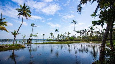
@@A Summit of Serenity: Naina Peak, also historically known as China Peak or Cheena Peak, is the highest peak in Nainital, situated at an altitude of 2,615 meters above sea level. This renowned spot offers one of the most breathtaking panoramic views of the entire Kumaon region, making it a prime destination for nature lovers and trekkers. The journey to the peak is an adventure in itself, typically involving a 6 km trek from the base near Mallital or Barapathhar. The trail winds through dense, lush forests dominated by deodar, pine, and cypress trees, with occasional patches of vibrant pink and red rhododendron blooms. The peak was renamed from China Peak to Naina Peak after the 1962 Indo-China War, though locals often use both names. The view from the top is unparalleled, providing a clear line of sight to majestic Himalayan ranges, including the peaks of Nanda Devi, Trishul, and the mountains bordering Tibet. It serves as an excellent vantage point to witness the stunning, kidney-shaped Naini Lake and the entire town spread out below like a miniature landscape. It is a quiet sanctuary, a world away from the hustle and bustle of Mall Road, offering peace and fresh, crisp mountain air. Many visitors hire a pony or horse from the base to ease the uphill journey, but the trek remains the most popular way to experience the surrounding natural beauty. The serene atmosphere and spectacular scenery solidify its status as the 'Crown of Nainital' and a must-visit for its unique perspective on the Himalayan panorama. The peak remains a symbol of natural grandeur in the region, drawing thousands of tourists annually for its spiritual and scenic rewards. (Word Count Approx 400):
Card image cap
Naini Lake

@@A Jewel in the Himalayas: Naini Lake, the heart and soul of Nainital, is a natural, crescent or kidney-shaped freshwater body nestled amidst the Him...

@@A Jewel in the Himalayas: Naini Lake, the heart and soul of Nainital, is a natural, crescent or kidney-shaped freshwater body nestled amidst the Himalayan mountains of Kumaon. Situated at an altitude of 1,938 meters, the lake is the lifeblood of the town, which derives its name from the lake itself (Naini means 'eye,' and Tal means 'lake'). Geologically, the lake is tectonic in origin, believed to have been formed due to crustal movement. It is surrounded by seven majestic hills, known as 'Sapta-Shring': Naina, Deopata, Ayarpata, Handi Bandi, Alma, Lariya Kanta, and Sher Ka Danda. Mythology holds a profound connection to the lake, as it is believed to be one of the 51 Shakti Peethas, where the eyes (Naina) of Goddess Sati fell when Lord Shiva carried her burnt body. The lake is divided into two parts: the northern part, known as Mallital, and the southern part, known as Tallital. The shimmering, emerald-green waters of the lake reflect the surrounding pine and oak-covered hills, creating a mesmerizing, picture-postcard landscape that changes dramatically with the time of day and season. It is the central hub for tourism and recreational activities in the region, offering diverse boating options and a lively promenade, Mall Road, along its western edge. The lake is a delicate ecosystem facing threats like eutrophication and siltation, which local authorities and environmental bodies are actively managing to preserve its natural beauty and purity. (Word Count Approx 400):
Card image cap
Nainital Governor's Pavilion

@@The Viceroy's Summer Retreat: The Nainital Governor's Pavilion, officially known as Raj Bhawan, is a stunning architectural marvel from the British ...

@@The Viceroy's Summer Retreat: The Nainital Governor's Pavilion, officially known as Raj Bhawan, is a stunning architectural marvel from the British colonial era. Built in 1897 and completed in two years, it served as the Summer Residence for the Governor of the North-West Provinces (later Uttar Pradesh) during the British Raj. Post-independence, it became the official residence of the Governor of Uttar Pradesh and, after the state's formation, the Governor of Uttarakhand. Spread over a massive estate of 205 acres in a beautiful, forested setting, the Raj Bhawan is renowned for its unique, early domestic Gothic style architecture, bearing a striking resemblance to a Scottish castle. The grand two-story building features 113 rooms, reflecting the sheer scale of colonial administration and its luxurious lifestyle. The estate is not just the main building; it also encompasses a sprawling 45-acre Golf Course (opened to the public in 1994), a tranquil swimming pool, and pristine, meticulously maintained gardens and deodar forests. It stands as a majestic testimony to the British architectural legacy in the Kumaon hills. Visitors can often take guided tours of parts of the estate, including the famous golf course and the lush gardens, offering a deep dive into the history and opulence of the British Raj era in Nainital. (Word Count Approx 400):
Card image cap
Nainital Lake & Mall Road

Nainital Lake, also known as Naini Lake, is a crescent-shaped freshwater body that serves as the centerpiece of the town. According to Hindu mytholog...

Nainital Lake, also known as Naini Lake, is a crescent-shaped freshwater body that serves as the centerpiece of the town. According to Hindu mythology, it is one of the 51 Shakti Peethas, formed where the eyes (Naina) of Goddess Sati fell. The lake is surrounded by seven majestic hills, known as the Sapta-Shring. Bordering the lake is the famous Mall Road, the main commercial and social hub of the town. Constructed by the British, the Mall Road connects the two ends of the lake: Tallital (the lower end) and Mallital (the upper end). The road is lined with colonial-style buildings, vibrant shops, cozy cafes, and luxury hotels. Walking along the Mall Road in the evening, with the shimmering lake on one side and the bustling market on the other, is the quintessential Nainital experience. The lake offers various boating options, from traditional rowboats to colorful pedal boats. The Naina Devi Temple stands at the northern shore, providing a spiritual anchor to the area. The Mall Road is a pedestrian-only zone during peak evening hours, allowing tourists to stroll freely. It is the best place to buy local handicrafts, handmade candles, and high-quality woolens. The reflection of the city lights in the lake at night is a sight that stays in the memory of every visitor.
Card image cap
Nainital Ropeway

@@A Bird's Eye Journey: The Nainital Ropeway, also known as the Aerial Ropeway, is one of the most popular and thrilling attractions in the hill stati...

@@A Bird's Eye Journey: The Nainital Ropeway, also known as the Aerial Ropeway, is one of the most popular and thrilling attractions in the hill station. It provides a quick and spectacular transit from the central point of Mallital to the famous Snow View Point (at 2,270 meters), offering a breathtaking, unobstructed, bird's-eye view of the surrounding landscape. The ropeway was constructed in 1963 and has been continuously updated, featuring modern Swiss technology to ensure safety and a smooth ride. The journey is short, covering a distance of approximately 705 meters in about 3 to 4 minutes one way, but those few minutes are packed with incredible views. The cable cars (trolleys) are designed to carry up to 11 people (or 825 kg) and run on a steep incline. As the trolley ascends, passengers are treated to a magnificent panoramic view, with the crescent-shaped Naini Lake gleaming below and the entire valley spreading out. The ride is essential for many tourists, as it is the easiest and fastest way to access the Snow View Point, which, in turn, offers the most famous views of the high Himalayan peaks like Nanda Devi, Trishul, and Nanda Kot. The sheer thrill of gliding above the dense canopy and the scenic reward at the destination make the Nainital Ropeway an unmissable part of any visit. (Word Count Approx 400):
Card image cap
Nainital Zoo

@@A Unique Alpine Habitat: The Pt. Govind Ballabh Pant High Altitude Zoo in Nainital is one of the few high-altitude zoos in North India, situated at ...

@@A Unique Alpine Habitat: The Pt. Govind Ballabh Pant High Altitude Zoo in Nainital is one of the few high-altitude zoos in North India, situated at an elevation of about 2,100 meters (6,890 ft) on the Sher Ka Danda hill. Established in 1984 and opened to the public in 1995, it plays a critical role in the conservation, breeding, and protection of endangered and threatened high-altitude Himalayan fauna. Spread over an area of approximately 4.6 hectares (about 11 acres), the zoo focuses on displaying animals in naturalistic habitat enclosures rather than traditional cages, a modern trend in zoological design. It is named after the first Chief Minister of Uttar Pradesh, Bharat Ratna Pt. Govind Ballabh Pant. The zoo is a sanctuary for some of the region's most magnificent and elusive creatures, including the Snow Leopard, Siberian Tiger (historically), Himalayan Black Bear, Red Panda, Tibetan Wolf, and various high-altitude pheasant species like the vibrant Himalayan Monal (the state bird of Uttarakhand). The zoo offers an excellent opportunity for visitors to observe these animals, which would otherwise be impossible to see in the wild, while simultaneously educating the public on the delicate Himalayan ecosystem. Its location also offers beautiful views of the surrounding hills and a partially obscured view of Naini Lake. (Word Count Approx 400):
Card image cap
Naukuchiatal Lake

Naukuchiatal, which literally means "lake of nine corners," is a pristine water body situated at an elevation of 1,220 meters. It is the deepest lake...

Naukuchiatal, which literally means "lake of nine corners," is a pristine water body situated at an elevation of 1,220 meters. It is the deepest lake in the Nainital region, with a depth of over 40 meters. Legend has it that anyone who can see all nine corners of the lake at a single glance, with their feet on the ground, will achieve Nirvana or spiritual enlightenment. The lake is fed by an underground perennial spring, ensuring its water remains clear and fresh throughout the year. Surrounded by lush hills and terraced fields, it offers a much quieter and more exclusive experience than Bhimtal or Nainital. The area is a hub for adventure sports, particularly Paragliding, where you can soar over the lake and land in the green meadows. It is also a fantastic spot for bird watching, as the surrounding forests are home to many exotic species. The small village around the lake has several luxury resorts and boutique homestays, making it a popular choice for honeymooners and luxury travelers. The calm waters are perfect for kayaking and paddling. Unlike the more commercialized lakes, Naukuchiatal maintains a soulful, serene vibe that is perfect for a weekend retreat.
Card image cap
Pangot and Kilbury Bird Sanctuary

@@ Detailed Overview : Nestled in the heart of the Kumaon Himalayas, the Pangot and Kilbury Bird Sanctuary is a sprawling forest reserve that serves a...

@@ Detailed Overview : Nestled in the heart of the Kumaon Himalayas, the Pangot and Kilbury Bird Sanctuary is a sprawling forest reserve that serves as a sanctuary for over 580 species of birds. Located at an altitude of 2,528 meters, it is characterized by dense forests of oak, pine, and rhododendron, which create a perfect ecosystem for both resident and migratory avian life. Unlike the crowded streets of Nainital, Pangot offers a deep sense of tranquility where the only sound is the chirping of birds and the rustle of leaves. The sanctuary is part of the Naina Devi Himalayan Bird Conservation Reserve and is world-renowned among birdwatchers and nature photographers. Visitors often spot rare species like the Cheer Pheasant, Koklass Pheasant, and the majestic Himalayan Monal. The drive from Nainital to Pangot is itself a scenic journey, passing through the lush greenery of Cheena Peak range. The area is dotted with small mountain lodges that cater specifically to "slow tourism," encouraging visitors to spend days observing wildlife. Beyond birds, the sanctuary is home to leopards, Himalayan black bears, and barking deer, adding an element of wilderness adventure to every visit. It is a place where nature remains untouched, offering a soulful retreat for those looking to reconnect with the earth. The sanctuary represents the successful conservation of high-altitude biodiversity in Uttarakhand.
Card image cap
Pt. G.B. Pant High Altitude Zoo

@@ Detailed Overview : The Pt. Govind Ballabh Pant High Altitude Zoo, popularly known as the Nainital Zoo, is a unique wildlife park perched at an ele...

@@ Detailed Overview : The Pt. Govind Ballabh Pant High Altitude Zoo, popularly known as the Nainital Zoo, is a unique wildlife park perched at an elevation of 2,100 meters. Established in 1984 and opened to the public in 1995, it is one of only three high-altitude zoos in India, designed specifically to house animals adapted to cold Himalayan climates. Spread over 4.6 hectares, the zoo is home to several endangered and rare species, including the Red Panda, Snow Leopard, Royal Bengal Tiger, and the Tibetan Wolf. Unlike traditional zoos on flat ground, this facility is built on a steep hillside, requiring visitors to walk along winding paths that offer a naturalistic forest experience. The zoo plays a vital role in conservation and education, providing a safe haven for animals that are otherwise difficult to spot in the wild. It was famously the home of India's only Siberian Tiger for many years. The enclosures are designed to mimic the natural habitats of the animals, with plenty of greenery and rocky terrain. The zoo's location on Sher Ka Danda hill provides panoramic views of the Naini Lake and the surrounding town, making it a favorite for both children and adults. It is managed by the Bharat Ratna Pt. G.B. Pant High Altitude Zoo Management Society, ensuring high standards of animal welfare. Visiting this zoo is not just about seeing animals; it’s about understanding the fragile high-altitude ecosystem of the Himalayas.
Card image cap
Saritatal Lake & Waterfall

Saritatal (also known as Sariyatal) is a relatively small, beautiful, artificial lake nestled amidst lush green hills on the way to Kaladhungi. It is ...

Saritatal (also known as Sariyatal) is a relatively small, beautiful, artificial lake nestled amidst lush green hills on the way to Kaladhungi. It is renowned for its tranquil, serene atmosphere and emerald-green waters, offering a peaceful escape from the main Nainital town's hustle. It is a major spot for nature lovers and a popular break point on the Kaladhungi road trip. The site also includes a small, charming waterfall that feeds the lake and is home to the adjacent Himalayan Botanical Garden, making it a unique blend of natural and scientific interest. The area is frequented by photographers for its reflections and calm setting.
Card image cap
Sattal

@@ Detailed Overview : Sattal, which literally translates to "Seven Lakes," is one of the most serene and ecologically diverse destinations in the Kum...

@@ Detailed Overview : Sattal, which literally translates to "Seven Lakes," is one of the most serene and ecologically diverse destinations in the Kumaon region. Situated at an altitude of 1,370 meters, it consists of a cluster of seven interconnected freshwater lakes: Ram Tal, Sita Tal, Laxman Tal, Nal Damyanti Tal, Garud Tal, Purna Tal, and Sukha Tal. These lakes are surrounded by dense forests of oak and pine, creating a secluded haven for nature lovers and birdwatchers. Unlike the more commercialized Bhimtal or Nainital, Sattal remains relatively untouched, offering a peaceful atmosphere for "slow travel." The area is a major hub for migratory birds, with over 500 species recorded, including kingfishers, barbets, and wood owls. Legend says that the lakes are named after the exile of Lord Rama, giving the place a spiritual significance alongside its natural beauty. The crystal-clear waters of the lakes are perfect for kayaking and boating, while the surrounding hills offer numerous trekking trails. Sattal is also home to the famous Methodist Ashram, established in 1930, which adds a touch of colonial history to the landscape. The ecosystem here is so rich that it also hosts an exotic Butterfly Museum. It is the perfect place for those who want to escape the digital world and immerse themselves in the raw, quiet beauty of the Himalayas.
Card image cap
Snow View Point

Snow View Point is one of Nainital's most iconic and easily accessible viewpoints, situated at an altitude of 2270 meters on the Mallital hill. It off...

Snow View Point is one of Nainital's most iconic and easily accessible viewpoints, situated at an altitude of 2270 meters on the Mallital hill. It offers breathtaking, panoramic vistas of the towering, snow-capped Himalayan peaks, including the majestic Nanda Devi (India's second-highest peak), Trishul, and Nanda Kot, particularly on a clear day. The point is a popular tourist hub, primarily reached by the famous Aerial Ropeway ride from the Mallital base. Besides the view, the area features an amusement park, small temples, stalls, and a Tibetan Monastery, providing a complete entertainment package. The viewing gallery has binoculars for a closer look at the distant peaks.
Card image cap
St. John in the Wilderness Church

St. John in the Wilderness Church is one of the oldest and most significant buildings in Nainital, a historical Anglican Church consecrated in 1848. I...

St. John in the Wilderness Church is one of the oldest and most significant buildings in Nainital, a historical Anglican Church consecrated in 1848. It is located on a small hillock near the High Court, surrounded by dense Deodar and Pine forests, giving it its name 'in the Wilderness'. The church is famed for its serene and Gothic architecture, particularly its stained-glass windows. It holds historical importance as it houses a solemn memorial to the fifty-odd victims of the devastating 1880 Landslip that struck Nainital. The adjoining cemetery contains the grave of Jim Corbett's mother, Mary Jane Corbett, adding to its colonial heritage value.
Card image cap
Tiffin Top

@@ Detailed Overview : Tiffin Top, also famously known as Dorothy's Seat, is one of the most popular and scenic viewpoints in Nainital. Perched on the...

@@ Detailed Overview : Tiffin Top, also famously known as Dorothy's Seat, is one of the most popular and scenic viewpoints in Nainital. Perched on the Ayarpatta Hill at an altitude of 2,292 meters, it offers a breathtaking 360-degree view of the entire Kumaon region and the town of Nainital nestled around its pear-shaped lake. The name "Tiffin Top" originated from the practice of locals and British officers trekking up to this peak to have their "tiffin" (afternoon lunch) while enjoying the vistas. The second name, Dorothy's Seat, has a more poignant history; it is a stone memorial built by Col. J.P. Kellett in memory of his wife, Dorothy Kellett, an English artist who loved this spot but tragically passed away. The peak is a favorite among nature lovers, photographers, and trekkers. Reaching the top requires a moderate 4 KM trek through a dense forest of oak, deodar, and pine, which is an experience in itself. For those who find the climb difficult, pony rides are a popular alternative. On clear days, the peak provides a majestic view of the snow-clad Himalayas, including the Nanda Devi peak. The atmosphere at the top is calm and rejuvenating, providing a perfect escape from the crowded Mall Road. It is a place where history, romance, and nature converge, making it an essential part of any Nainital itinerary.
Show All

Nainital Itineray And Cost:-

Information about New and Updated Locations() of Uttarakhand Has Been Added :-
Card subtitle

Note:-

Information provided here in good Faith and for reference only.

Near Places
...
Chakrata

Some quick example text to build on the card title and make up the bulk of the card's content.

Go somewhere
...
Chamba

Some quick example text to build on the card title and make up the bulk of the card's content.

Go somewhere
...
Chamoli

Some quick example text to build on the card title and make up the bulk of the card's content.

Go somewhere
...
Champawat

Some quick example text to build on the card title and make up the bulk of the card's content.

Go somewhere
...
Chopta

Some quick example text to build on the card title and make up the bulk of the card's content.

Go somewhere
...
Corbett

Some quick example text to build on the card title and make up the bulk of the card's content.

Go somewhere
...
Dehradun

Some quick example text to build on the card title and make up the bulk of the card's content.

Go somewhere
...
Dhanaulti

Some quick example text to build on the card title and make up the bulk of the card's content.

Go somewhere
...
Gwaldam

Some quick example text to build on the card title and make up the bulk of the card's content.

Go somewhere
...
Haldwani

Some quick example text to build on the card title and make up the bulk of the card's content.

Go somewhere
...
Haridwar

Some quick example text to build on the card title and make up the bulk of the card's content.

Go somewhere
...
Joshimath

Some quick example text to build on the card title and make up the bulk of the card's content.

Go somewhere
...
Kanatal

Some quick example text to build on the card title and make up the bulk of the card's content.

Go somewhere
...
Kashipur

Some quick example text to build on the card title and make up the bulk of the card's content.

Go somewhere
...
Kausani

Some quick example text to build on the card title and make up the bulk of the card's content.

Go somewhere
...
Kedarnath

Some quick example text to build on the card title and make up the bulk of the card's content.

Go somewhere
in Other Cities
