
...

Place To Visit And Things To Do In Uttarkashi

Uttarakhand, India
Introduction: Uttarkashi is a holy town located on the banks of the Bhagirathi. It is often compared to Varanasi and is called "Kashi of the North." The town is a major spiritual center for Shiva devotees. It is the administrative heart of the Uttarkashi district. High mountains and dense pine fores ts surround the valley. It serves as a base for many famous high-altitude treks. The atmosphere is deeply religious and naturally stunning. History: The town finds mention in the Kedarkhand section of Skanda Purana. It is believed that Lord Shiva lived here during the Kali Yuga. The Vishwanath Temple is said to be established by Sage Parashurama. It has been a seat of learning and meditation for centuries. Many great saints have performed penance on these river banks. The town survived a massive earthquake in 1991. It has since been rebuilt while keeping its spiritual roots intact. Geography: It is situated at an elevation of 1158 meters above sea level. The Bhagirathi river flows in a semi-circle around the town. The Varun and Asi rivers also join the main stream nearby. It is nestled between the Varunavat and Barkot mountain ranges. The climate is temperate, with very cold winters and pleasant summers. The surrounding hills are covered with oak and rhododendron trees. It is a landscape of deep gorges and high meadows. Spirituality: The town is filled with numerous ashrams and small temples. The chime of temple bells echoes through the valley at dawn. Pilgrims visit here before heading to Gangotri or Yamunotri. The Shakti Temple houses a massive ancient brass trident. Many people come here to study Sanskrit and Vedic scriptures. The river ghats are used for holy baths and evening prayers. It is a place of quiet reflection and divine connection.

Things To Do

Card image cap
Barkot

Barkot is a serene and picturesque hill station located at an elevation of 1,220 meters above sea level. This town serves as a vital stopover for pil...

Barkot is a serene and picturesque hill station located at an elevation of 1,220 meters above sea level. This town serves as a vital stopover for pilgrims traveling toward the Yamunotri shrine, but it has its own distinct charm that attracts nature lovers. Surrounded by dense forests of pine and deodar, the town offers a panoramic view of the snow-capped Bandarpunch peaks and other Himalayan ranges. The air is crisp and clean, providing a perfect escape from the humid plains. Culturally, the town is a melting pot of Garhwali traditions, where the locals are known for their hospitality and simple lifestyle. The Yamuna River flows gracefully nearby, adding a rhythmic soundtrack to the town's daily life. Historically, the region gained prominence during the colonial era for its strategic location on the pilgrimage route. Today, it is evolving into a hub for adventure seekers who use it as a base for various treks. The town market is vibrant with local handicrafts and fresh mountain produce. Visiting Barkot feels like stepping back into a simpler time where nature dictates the pace of the day. It is not just a transit point but a destination that invites deep contemplation and relaxation. :
Card image cap
Dayara Bugyal

Dayara Bugyal is often cited as one of the most breathtaking high-altitude meadows in the world. Situated at an elevation of 3,408 meters, it spreads...
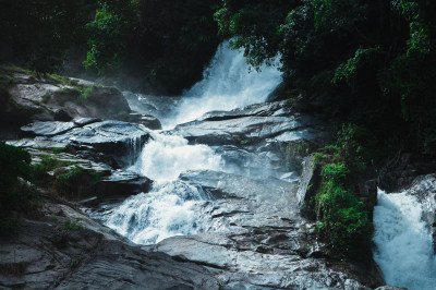
Dayara Bugyal is often cited as one of the most breathtaking high-altitude meadows in the world. Situated at an elevation of 3,408 meters, it spreads across a vast area of nearly 28 square kilometers. The word "Bugyal" in the local dialect means "high altitude meadow." During the summer months, these meadows are covered in a carpet of vibrant wildflowers and lush green grass, while in winter, they transform into a pristine white landscape perfect for skiing. The trek to Dayara Bugyal starts from the villages of Raithal or Barsu. The trail takes you through dense forests of oak and maple, where the sunlight filters through the canopy in magical patterns. As you ascend, the forest thins out to reveal the grand expanse of the meadows, framed by the towering peaks of the Gangotri range. From the top, one can witness the Srikanth, Draupadi ka Danda, and Jaonli peaks in all their glory. The ecosystem here is fragile and beautiful, home to various Himalayan birds and rare flora. For many trekkers, the experience of camping under the star-studded sky at Dayara Bugyal is a life-changing event. The silence of the mountains, interrupted only by the whistling wind, provides a deep sense of peace. It is a place where nature remains untouched by the chaos of urban civilization. :
Card image cap
Devrani-Ganga Falls

Devrani-Ganga Falls is a spectacular natural waterfall located on the route to Gangotri, near the hot springs of Gangatnani. This waterfall is unique...

Devrani-Ganga Falls is a spectacular natural waterfall located on the route to Gangotri, near the hot springs of Gangatnani. This waterfall is unique because it consists of twin streams that descend from a great height, merging into the Bhagirathi River. The falls are surrounded by sheer cliffs and dense coniferous forests, creating a secluded and mystical atmosphere. The roar of the falling water can be heard from a distance, inviting travelers to stop and admire the view. The water is ice-cold and crystal clear, originating from the high-altitude glaciers of the Himalayas. Local legends associate the waterfall with celestial beings, hence the name "Devrani," which refers to a divine sister-in-law in Indian mythology. The mist created by the falling water often produces small rainbows on sunny afternoons, adding to its ethereal beauty. Unlike more commercialized waterfalls, this spot remains relatively untouched, providing a raw and powerful experience of nature. The rocks around the base are slippery and covered in moss, requiring caution from visitors. It serves as a perfect refreshing break for pilgrims on their way to the higher shrines. The sheer vertical drop of the water against the dark mountain rocks makes it a visually striking landmark in the Uttarkashi district. :
Card image cap
Dobra-Chanthi View Point

The Dobra-Chanthi Bridge is an engineering marvel and a symbol of modern development in the Garhwal region. Spanning across the massive Tehri Lake, i...
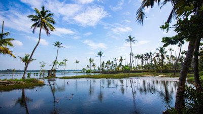
The Dobra-Chanthi Bridge is an engineering marvel and a symbol of modern development in the Garhwal region. Spanning across the massive Tehri Lake, it is the longest motorable single-lane suspension bridge in India. For nearly 14 years, the local residents of Pratapnagar were cut off from the main city due to the flooding of the valley for the Tehri Dam. The completion of this bridge in 2020 finally restored connectivity, reducing travel time by several hours. Beyond its utility, the bridge has become a major tourist attraction due to its stunning aesthetic design. It looks like a giant silver ribbon suspended over the turquoise waters of the lake, against a backdrop of rolling green hills. At night, the bridge is illuminated with thousands of LED lights that change color, creating a magical reflection in the water below. The view point near the bridge offers a panoramic perspective of the vast reservoir, which resembles a sea in the middle of the mountains. Visitors can walk along the pedestrian path of the bridge to feel the slight sway and the breeze coming off the lake. It has quickly become a favorite spot for road trippers and photography enthusiasts. The bridge represents the resilience of the local community and the technological progress of the state. :
Card image cap
Dodital Lake

Dodital is a breathtaking freshwater lake situated at an altitude of 3,024 meters, surrounded by dense forests of oak, pine, and rhododendron. Accord...
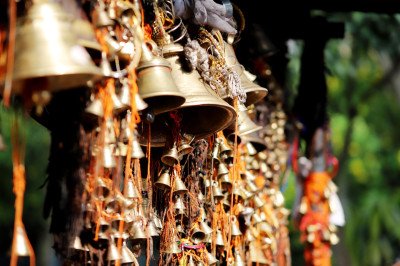
Dodital is a breathtaking freshwater lake situated at an altitude of 3,024 meters, surrounded by dense forests of oak, pine, and rhododendron. According to Hindu mythology, this serene lake is believed to be the birthplace of Lord Ganesha. There is a small, beautiful temple dedicated to him on the banks of the lake. The name "Dodi" refers to the Himalayan trout found in abundance here, making it a famous spot for angling (with permission). The trek to Dodital starts from Sangamchatti and passes through the charming villages of Agoda and Bebra. The trail is a delight for nature lovers, offering views of the Asi Ganga river and lush Himalayan valleys. The lake itself is crystal clear, reflecting the surrounding trees and the blue sky like a giant mirror. It is a perfect destination for those seeking both adventure and spiritual solace. The trek is moderately easy, making it accessible for beginners and families who enjoy the outdoors. During the winter, the lake often freezes, and the entire area is covered in thick snow, turning it into a winter wonderland. Historically, the lake has been a place of pilgrimage for locals for centuries. The peaceful environment, away from any motorable roads, ensures that the air remains pure and the silence remains undisturbed. It is a place where one can truly connect with the raw beauty of the Himalayas. :
Card image cap
Dunda

@@ Town Overview and Cultural Essence : Dunda is a serene and culturally vibrant town nestled along the banks of the Bhagirathi River in the Uttarkash...

@@ Town Overview and Cultural Essence : Dunda is a serene and culturally vibrant town nestled along the banks of the Bhagirathi River in the Uttarkashi district. It is widely recognized as a significant center for traditional Himalayan handloom and weaving, primarily inhabited by the Bhotiya tribe and migrant families from Himachal. The town offers a peaceful atmosphere far removed from the mainstream tourist rush, providing an authentic glimpse into the rural life of the Garhwal region. Visitors are often captivated by the rhythmic sound of wooden looms echoing through the narrow lanes where artisans create exquisite woolen masterpieces. The surrounding landscape is characterized by terraced fields, lush greenery, and the constant soothing murmur of the river, making it a perfect retreat for soul-seekers. Historically, it served as a vital trade link, and today it remains a repository of ancient craftsmanship that has been passed down through generations. The local lifestyle is deeply rooted in communal harmony and respect for nature, reflecting the true spirit of the mountains. @@ Artisanal Significance and Local Life : The heart of Dunda lies in its weaving heritage, where every household participates in the creation of Pankhi (traditional shawls), carpets, and blankets. The wool used is often sourced locally or from high-altitude pastures, ensuring the highest quality and warmth. Exploring the village allows one to interact with master weavers who are eager to share stories of their ancestry and the evolution of their craft. The town also serves as a gateway to several trekking routes and hidden waterfalls that remain unexplored by the general public. Education and traditional learning go hand in hand here, with children often learning the art of weaving alongside their formal schooling. The local market is a great place to buy authentic Himalayan products directly from the makers at fair prices. Overall, Dunda is not just a destination but a living museum of Himalayan culture and resilience.
Card image cap
Gangotri Temple

@@ Spiritual Eminence and Mythological Roots : The Gangotri Temple is one of the four prestigious sites of the Chota Char Dham pilgrimage, dedicated t...

@@ Spiritual Eminence and Mythological Roots : The Gangotri Temple is one of the four prestigious sites of the Chota Char Dham pilgrimage, dedicated to Goddess Ganga. Perched at an altitude of 3,100 meters, this white granite structure stands as a symbol of purity against the backdrop of the majestic Sudarchan Parvat. According to Hindu mythology, this is the spot where Goddess Ganga descended from heaven to earth in the locks of Lord Shiva to release the souls of King Sagara's sons. The temple was originally built by the Gorkha commander Amar Singh Thapa in the 18th century and later refurbished by the Royal family of Jaipur. The spiritual energy of the place is palpable, with the roaring Bhagirathi River flowing just steps away. Pilgrims from all over the world travel through treacherous mountain paths to offer prayers and take a holy dip in the freezing waters of the river. The temple remains closed during the winter months due to heavy snowfall, during which the idol is moved to Mukhba village. @@ Temple Atmosphere and Natural Splendor : The surroundings of the temple are filled with the scent of deodar trees and the sound of Vedic chants. The temple complex is impeccably maintained, featuring a large courtyard where devotees gather for the evening Aarti. The atmosphere during the Aarti is ethereal, with hundreds of lamps reflecting in the dark waters of the river. Beyond its religious significance, Gangotri serves as the base for many high-altitude treks, including the journey to the Gaumukh Glacier. The town itself is small, consisting mainly of ashrams, small hotels, and shops selling religious artifacts. The air is exceptionally thin and crisp, providing a sense of physical and spiritual lightness. Visiting Gangotri is not just a religious ritual but an encounter with the raw, unbridled power of the Himalayas. The temple's serene white facade represents the peace that seekers find at the source of India's holiest river.
Card image cap
Gartang Gali

@@ Historical Significance and Trade Legacy : Gartang Gali is an extraordinary 150-year-old wooden skywalk located in the Nelong Valley, near the Indo...

@@ Historical Significance and Trade Legacy : Gartang Gali is an extraordinary 150-year-old wooden skywalk located in the Nelong Valley, near the Indo-China border. This architectural marvel was painstakingly carved into a vertical granite cliff by Peshawari Pathans in the late 19th century. For decades, it served as a vital trade route between India and Tibet, used by nomadic traders (Bhotiyas) to transport salt, wool, and jaggery on the backs of yaks and sheep. The bridge was closed to the public following the 1962 Indo-China War and remained in a state of decay for nearly 59 years. It was finally restored and reopened to tourists in 2021, offering a spine-chilling yet exhilarating experience of walking on a narrow wooden ledge thousands of feet above the Jadh Ganga River. The path is a testament to the engineering ingenuity of the past, where workers used iron rods and wooden planks to create a stable walkway on a sheer rock face. Walking through Gartang Gali is like stepping back in time, feeling the pulse of an era when these mountains were the arteries of trans-Himalayan commerce. @@ Natural Beauty and Thrill : The trek to Gartang Gali is as beautiful as the bridge itself, passing through dense forests of pine and deodar. The air in the Nelong Valley is incredibly dry and crisp, reminiscent of the landscapes in Ladakh. As you approach the cliffside bridge, the valley opens up to reveal a stark, high-altitude desert beauty that is rare in other parts of Uttarakhand. The bridge itself is approximately 136 meters long and offers a panoramic view of the deep gorge below and the rugged peaks surrounding it. The silence of the valley is only broken by the whistling wind and the distant roar of the river. It is an ideal destination for adventure enthusiasts and history buffs who want to explore the "forbidden" frontier lands. The restoration was done carefully to maintain the original look while ensuring modern safety standards. Today, it stands as one of the most unique tourist attractions in the entire Himalayan range, combining history, engineering, and raw natural power.
Card image cap
Gaumukh Trek Point

@@ The Primordial Source and Glacial Majesty : Gaumukh, which literally translates to "Mouth of a Cow," is the precise snout of the Gangotri Glacier a...

@@ The Primordial Source and Glacial Majesty : Gaumukh, which literally translates to "Mouth of a Cow," is the precise snout of the Gangotri Glacier and the geographical origin of the Bhagirathi River. Located at an altitude of 3,892 meters, it is one of the most sacred and physically demanding pilgrimage destinations in India. The glacier once extended all the way to Gangotri, but due to climate change, it has receded to its current position, 19 KMS upstream. The trek to Gaumukh is a journey through the heart of the Gangotri National Park, offering views of some of the most stunning peaks in the world, including Shivling, Meru, and the Bhagirathi massif. The site itself is awe-inspiring; massive chunks of blue ice crash into the churning gray waters of the nascent river. Pilgrims often brave the freezing temperatures to collect the purest form of Ganga water directly from the source. The landscape is a mix of boulders, glacial moraines, and high-altitude meadows, creating a terrain that is both brutal and beautiful. @@ The Trekking Experience and Spiritual Quest : The trek begins from the Gangotri Temple and is usually spread over two days, with an overnight stay at Bhojbasa. The path is well-defined but passes through areas prone to rockfalls and steep climbs. As you move closer to Gaumukh, the vegetation thins out, leaving a stark, lunar-like landscape dominated by ice and rock. The spiritual significance of reaching the source is immense, as it represents the "birth" of the life-giving river that sustains millions in the plains of India. Many trekkers continue another 5 KMS to Tapovan, a high-altitude meadow known for its spiritual tranquility and unparalleled views of Mt. Shivling. The entire region is a plastic-free zone and requires special permits to enter, ensuring that the fragile ecosystem is preserved. Visiting Gaumukh is a humbling experience that reminds one of the grand scale of nature and the deep-rooted spiritual traditions of the Himalayas. It is a place where silence is profound, and every breath feels like a communion with the divine.
Card image cap
Govind Pashu Vihar National Park

@@ Ecological Diversity and Wilderness : Govind Pashu Vihar National Park is a massive protected area spanning 958 sq. km in the upper reaches of the ...
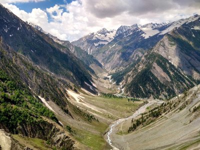
@@ Ecological Diversity and Wilderness : Govind Pashu Vihar National Park is a massive protected area spanning 958 sq. km in the upper reaches of the Garhwal Himalayas. Established in 1955, it was named after the prominent Indian freedom fighter Govind Ballabh Pant. The park is a sanctuary for some of the rarest Himalayan fauna, most notably the elusive Snow Leopard. It encompasses the stunning Tons River valley and features a wide range of altitudes, from 1,400 to 6,323 meters, resulting in diverse ecosystems ranging from subtropical forests to alpine meadows (Bugyals). The park is famous for the Har Ki Dun valley, often called the "Valley of Gods," which is a cradle-shaped hanging valley known for its surreal beauty. The forests here are dense with deodar, oak, and rhododendron, providing a home to the Himalayan Brown Bear, Musk Deer, and the vibrant Himalayan Monal. For nature lovers, the park is a pristine paradise where human interference is minimal and the laws of the wild prevail. @@ Trekking Paradise and Cultural Enclave : Beyond its wildlife, the park is a premier trekking destination, offering routes like Kedarkantha, Bali Pass, and Ruinsara Tal. The villages within and around the park, such as Sankri and Osla, are famous for their unique culture and ancient wooden temples dedicated to Duryodhana and Someshwar Mahadev. The people here follow age-old traditions and wear distinct woolen attire, living in harmony with the rugged terrain. The park serves as a vital catchment area for the Yamuna River, with the Rupin and Supin rivers flowing through its heart. The landscape is dotted with high-altitude lakes and snow-capped peaks like Swargarohini and Black Peak. Visiting the park is an immersion into a world where time seems to have stood still, offering a perfect blend of adventure, wildlife, and Himalayan heritage. It is one of the few places where the "Project Snow Leopard" is actively managed, making it a crucial site for conservationists and wildlife enthusiasts from around the globe.
Card image cap
Har Ki Doon Valley

@@Description: Har Ki Doon Valley is a cradle-shaped hanging valley nestled in the heart of the Garhwal Himalayas. Situated at an altitude of 3,566 me...

@@Description: Har Ki Doon Valley is a cradle-shaped hanging valley nestled in the heart of the Garhwal Himalayas. Situated at an altitude of 3,566 meters, it is one of the most remote and scenic valleys in Uttarkashi. The name literally translates to the "Valley of Lord Shiva" and is steeped in ancient Mahabharata legends. It is widely believed that the Pandavas took this exact route on their ascent to heaven via the Swargarohini peaks. The landscape is a mesmerizing blend of alpine meadows, dense deodar forests, and crystalline glacier-fed streams. The Supin River flows gracefully through the valley, providing life to the surrounding flora and fauna. Trekkers find this place magical due to its "step-back-in-time" feel, as the local villages like Osla and Gangaad still preserve centuries-old customs and wooden architecture. The valley remains snow-covered from December to March, transforming into a white paradise. During the summer months, it blooms with rare Himalayan wildflowers and orchids. The biodiversity here is rich, being part of the Govind Pashu Vihar National Park, where lucky visitors might spot the Himalayan Monal or the Musk Deer. The trek to the valley starts from the base camp at Sankri and passes through enchanting forests and high-altitude pastures like Devsu Bugyal. It is not just a trekking destination but a spiritual journey into the lap of nature. The peaks of Kalanag, Bandarpunch, and Swargarohini stand as silent sentinels guarding this pristine sanctuary. Whether you are a nature lover, a photographer, or a spiritual seeker, the silence of Har Ki Doon offers a profound sense of peace that is hard to find elsewhere.
Card image cap
Harsil Valley

@@Description: Harsil Valley is a breathtaking hidden gem located on the banks of the Bhagirati River at an elevation of 2,620 meters. Often called th...

@@Description: Harsil Valley is a breathtaking hidden gem located on the banks of the Bhagirati River at an elevation of 2,620 meters. Often called the "Mini Switzerland of India," this valley is famous for its dense deodar forests, sprawling apple orchards, and the shimmering river that cuts through the landscape. The valley gained prominence during the British era when Frederick E. Wilson, a British army deserter, settled here and introduced apple cultivation. Today, the "Wilson Apples" of Harsil are famous across India. The valley is also spiritually significant as it lies on the way to Gangotri Dham. During the winter, when Gangotri becomes inaccessible due to snow, the idol of Goddess Ganga is brought down to the nearby village of Mukhba. The valley is dotted with traditional Bhotiya houses and offers a quiet retreat far from the commercial hustle. The air here is exceptionally pure, and the sound of the rushing river provides a constant natural symphony. It has also been a favorite spot for Bollywood, most notably for the film Ram Teri Ganga Maili. The valley serves as a base for several offbeat treks, including the one to Sattal (Seven Lakes). With its mist-covered peaks and serene atmosphere, Harsil is the perfect place for those looking to reconnect with nature in its rawest form.
Card image cap
Kashi Vishwanath Temple

@@Description: The Kashi Vishwanath Temple in Uttarkashi is one of the oldest and most revered shrines in Northern India. Dedicated to Lord Shiva, it ...

@@Description: The Kashi Vishwanath Temple in Uttarkashi is one of the oldest and most revered shrines in Northern India. Dedicated to Lord Shiva, it is often compared to the famous temple in Varanasi. It is believed that after the town of Kashi (Varanasi) is submerged during the end of the Kalyuga, this temple will become the primary seat of Lord Shiva. The temple is situated on the banks of the holy Bhagirathi River, providing a serene and divine atmosphere for pilgrims. The presiding deity is a majestic Shivalinga that is tilted towards the south. Legend says that Sage Parshuram originally established this temple, and it was later renovated in 1857 by Maharani Khaneti. Within the temple complex, there is another significant shrine called the Shakti Temple, which houses a massive brass trident (Trishul) that is over 6 meters high. The temple is a hub of spiritual energy, especially during the evening Aarti when the sound of bells and Vedic chants echoes through the valley. It serves as a major stop for pilgrims undertaking the Char Dham Yatra, specifically those heading towards Gangotri. The temple complex also features smaller shrines dedicated to Goddess Parvati, Lord Ganesha, and Sage Markandeya. It is said that Lord Shiva protected the young Markandeya from the God of Death, Yama, at this very spot. The spiritual vibration here is palpable, making it a must-visit for anyone seeking inner peace.
Card image cap
Kedarkantha Peak

@@Description: Kedarkantha Peak is widely regarded as one of the best winter trekking destinations in India. Standing at an altitude of 3,800 meters (...

@@Description: Kedarkantha Peak is widely regarded as one of the best winter trekking destinations in India. Standing at an altitude of 3,800 meters (12,500 feet), the summit offers a breathtaking 360-degree view of the massive Himalayan ranges, including Swargarohini, Bandarpunch, and Black Peak. The trek starts from the picturesque village of Sankri and takes you through dense pine and oak forests that transform into a snowy paradise during the winter months. One of the highlights of the trek is the campsite at Juda Ka Talab, a high-altitude lake that remains completely frozen from December to March. Legend has it that Lord Shiva once meditated at the peak but moved to Kedarnath after being disturbed by a bull. The peak is adorned with a small stone shrine dedicated to Lord Shiva and Lord Ganesha. The climb to the summit is exhilarating, especially the final stretch which is usually covered in knee-deep snow. The sunrise from the peak is a life-changing experience, as the first rays of the sun turn the surrounding snow-capped peaks into glowing gold. The trek is beginner-friendly due to its gradual ascent and well-marked trails. Along the way, trekkers encounter beautiful meadows called "Bugyals" which are lush green in summer and pristine white in winter. The local villagers are incredibly hospitable, often sharing stories of mountain spirits and ancient traditions. It is a perfect blend of adventure, spirituality, and natural beauty.
Card image cap
Khedi Waterfall

@@Description: Khedi Waterfall is a stunning and powerful attraction located just a short drive from Uttarkashi city on the way to Maneri Dam. Interes...

@@Description: Khedi Waterfall is a stunning and powerful attraction located just a short drive from Uttarkashi city on the way to Maneri Dam. Interestingly, this is not a purely natural waterfall; it is the outlet of the overflow discharge from the Maneri Hydroelectric Project on the Bhagirathi River. Despite its artificial origin, the sheer force and volume of water cascading down the rocky cliffs make it look incredibly natural and majestic. The water gushes down with such intensity that it creates a permanent mist in the air, which often acts as a "natural air conditioner" for visitors. One of the most magical features of Khedi Waterfall is the appearance of a vibrant rainbow during the afternoon when the sunlight hits the water droplets at the perfect angle. The surrounding area is covered in lush greenery and rocky outcrops, providing a perfect backdrop for a quick stopover. There are multiple levels of viewpoints where visitors can stand and feel the spray of the water. For the more adventurous, there is a small trail that leads closer to the base, though it requires extreme caution due to the slippery rocks. A small local tea stall nearby allows travelers to enjoy a hot cup of "Chai" while listening to the thundering sound of the falls. It is a favorite spot for both locals and pilgrims heading towards Gangotri, offering a refreshing break from the winding mountain roads. During the monsoon, the waterfall becomes even more voluminous, and the entire valley often gets shrouded in low-hanging clouds, creating a dreamlike atmosphere.
Card image cap
Kuteti Devi Temple

@@The Legend of Kuteti Devi: The temple is dedicated to Goddess Kuteti Devi, an incarnation of Goddess Durga, who is believed to be the protector of t...

@@The Legend of Kuteti Devi: The temple is dedicated to Goddess Kuteti Devi, an incarnation of Goddess Durga, who is believed to be the protector of the local inhabitants. The history dates back to a king from Kota, Rajasthan, who lost his money during a pilgrimage. After praying at the Vishwanath Temple, he found his wealth and eventually married his daughter to a local priest's son. The princess, a devotee of Kuteti Devi, brought the goddess's essence to this hill. The temple provides a panoramic view of the Bhagirathi River and the town below, offering a serene atmosphere for meditation and prayer. It is highly revered by the local Garhwali community as their "Kuldevi" or family deity.
Card image cap
Lohari Nag Pala

@@The Abandoned Engineering Marvel: Lohari Nag Pala was a massive 600 MW hydroelectric project on the Bhagirathi River initiated by NTPC. It gained in...
@@The Abandoned Engineering Marvel: Lohari Nag Pala was a massive 600 MW hydroelectric project on the Bhagirathi River initiated by NTPC. It gained international attention when environmentalists and saints led by Professor G.D. Agrawal protested against it to save the pristine flow of the Ganga. The project was eventually scrapped in 2010 to preserve the river's ecological and religious sanctity. Today, the site stands as a haunting yet fascinating reminder of the conflict between development and conservation. Visitors can see the massive tunnels and structures that were once meant to power thousands of homes, now silent and reclaiming by nature.
Card image cap
Maneri Dam

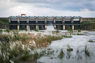
@@The Lifeblood of Local Power: Maneri Dam is a concrete gravity dam built across the Bhagirathi River. Completed in 1984, it diverts water to the Til...

@@The Lifeblood of Local Power: Maneri Dam is a concrete gravity dam built across the Bhagirathi River. Completed in 1984, it diverts water to the Tiloth Power Plant to generate 90 MW of electricity. The most striking feature of the dam is the large, turquoise-colored lake it creates, which reflects the surrounding pine forests and snow-capped peaks. It is a major stopover for pilgrims traveling to Gangotri Dham. The sight of the gushing water released from the spillway gates is both terrifying and magnificent. The area is developed as a picnic spot where tourists can relax and enjoy the cool Himalayan breeze.
Card image cap
Mori

@@The Land of Legend and Culture: Mori is a picturesque hamlet situated on the banks of the Tons River, a major tributary of the Yamuna. It is uniquel...

@@The Land of Legend and Culture: Mori is a picturesque hamlet situated on the banks of the Tons River, a major tributary of the Yamuna. It is uniquely famous for its cultural tilt towards the Kauravas and Pandavas of the Mahabharata. The village serves as a base for some of the most famous treks in India, including Har Ki Dun. The landscape is dominated by the tallest pine forests in Asia and golden paddy fields that turn vibrant green in summer. The locals, belonging to the Jaunsari tribe, have preserved their distinct dialect and traditions for centuries, making it a cultural goldmine.
Card image cap
Nachiketa Lake

@@The Mythological Treasure: Nachiketa Lake is a pristine high-altitude lake named after Nachiketa, the young boy who sought the secret of life and de...

@@The Mythological Treasure: Nachiketa Lake is a pristine high-altitude lake named after Nachiketa, the young boy who sought the secret of life and death from Yama, the God of Death, as told in the Katha Upanishad. Surrounded by dense forests of oak and rhododendron, the lake remains hidden from the main tourist trail, offering absolute silence. The trek to the lake is a gentle 3 km walk through a canopy of trees that changes color with the seasons. It is a place of deep spiritual vibration, often frequented by meditators and nature lovers seeking solitude.
Card image cap
Nehru Institute of Mountaineering

The Nehru Institute of Mountaineering (NIM) is globally recognized as one of the most prestigious mountaineering institutes in Asia. Established on N...

The Nehru Institute of Mountaineering (NIM) is globally recognized as one of the most prestigious mountaineering institutes in Asia. Established on November 14, 1965, to honor the vision of Pandit Jawaharlal Nehru, the institute aims to introduce the younger generation to the wonders of the Himalayas. Nestled amidst thick pine and deodar forests, the campus provides a serene atmosphere for adventure enthusiasts. It serves as a major training ground for world-class climbers, including Bachendri Pal, the first Indian woman to reach Mount Everest. The institute offers various technical courses like Basic Mountaineering and Advanced Mountaineering. Visitors can explore the campus and the Mountaineering Museum, which houses gear from historic expeditions. The environment is disciplined and reflects the spirit of high-altitude exploration. It is a must-visit for anyone interested in the history of Indian mountaineering and the technicalities of survival in the mountains. The sprawling green campus is located on the bank of the Bhagirathi River, offering stunning vistas of the surrounding peaks. NIM is also deeply involved in disaster relief and rescue operations in the Garhwal region. The vibe here is inspirational, encouraging visitors to push their physical and mental boundaries. It acts as a beacon for mountain lovers across the globe. :
Card image cap
Nelong Valley

Nelong Valley is a breathtaking cold desert located within the Gangotri National Park at an altitude of about 11,000 feet. Often compared to Ladakh a...

Nelong Valley is a breathtaking cold desert located within the Gangotri National Park at an altitude of about 11,000 feet. Often compared to Ladakh and Spiti because of its arid landscape and brown mountains, it was opened to domestic tourists in 2015 after being closed since the 1962 war. The valley was once a thriving trade route between India and Tibet, used by the Jad people who inhabited villages like Jadung and Nelong. Today, it is a restricted zone under the control of the Indian Army and ITBP, requiring special permits for entry. The terrain is characterized by deep gorges, rugged cliffs, and the Jad Ganga river flowing through the valley. Visitors can see the remains of ancient settlements and the famous Gartang Gali, a 150-year-old wooden skywalk built on a vertical cliff. The valley is home to rare wildlife like the snow leopard and blue sheep. Due to its strategic location near the Indo-China border, foreign nationals are not permitted to visit. The silence and the raw, unpolished beauty of the valley make it a paradise for adventure seekers. No overnight stay is allowed inside the valley, so visitors must return to Harsil or Gangotri by evening. It is one of the most unique geographical regions in the entire Himalayan belt. :
Card image cap
Patangarh

Patangarh is a picturesque village located in the Purola block of Uttarkashi district, known for its rich agricultural heritage and traditional woode...

Patangarh is a picturesque village located in the Purola block of Uttarkashi district, known for its rich agricultural heritage and traditional wooden architecture. This village is part of the Rawain region, which has a distinct culture and dialect compared to the rest of Garhwal. The inhabitants are primarily farmers, growing red rice, kidney beans (Rajma), and apples. The village is surrounded by lush green terraced fields and dense forests of oak and rhododendron. Patangarh offers a serene escape for those looking to experience authentic rural life in the Himalayas. The people here are known for their hospitality and traditional festivals like Bikhauti and Harela. The village is also a gateway to several lesser-known trekking trails that lead to high-altitude meadows. Staying in a local homestay here allows visitors to enjoy traditional Garhwali cuisine, including dishes like Mandua ki Roti and Gahat ki Dal. The air is pure, and the views of the Kamal River valley are spectacular. It is an ideal spot for writers, artists, and slow travelers who wish to disconnect from the modern world. The village maintains its traditional charm, with many houses still featuring intricate wood carvings that have been passed down through generations. :
Card image cap
Purola

Purola is a bustling mountain town located in the north-western part of the Uttarkashi district. It serves as a major administrative and commercial h...

Purola is a bustling mountain town located in the north-western part of the Uttarkashi district. It serves as a major administrative and commercial hub for the surrounding rural valleys. Known as the gateway to the famous Har Ki Dun and Kedarkantha treks, it is a vital stop for trekkers and adventurers. The town is situated at an altitude of approximately 1,500 meters and is blessed with a pleasant climate throughout the year. Purola is famous for its vast expanses of red rice fields and apple orchards that line the banks of the Kamal River. The town has a unique cultural identity, being the center of the Rawain region where people follow age-old traditions and folklore. Historically, the area is associated with the Mahabharata, and the locals hold deep reverence for the Pandavas. The market in Purola is a great place to buy local produce, especially the famous red rice and organic walnuts. It is much less crowded than Uttarkashi town, offering a more laid-back atmosphere for travelers. The town provides all essential amenities, including hotels, restaurants, and transport links to the remote interiors of the Garhwal Himalayas. It is a melting pot of trekkers heading to the mountains and villagers coming from the high ridges to trade. :
Card image cap
Rupin Pass Trek

The Rupin Pass Trek is one of the most diverse and spectacular high-altitude treks in India, starting in Uttarkashi (Uttarakhand) and ending in Sangl...

The Rupin Pass Trek is one of the most diverse and spectacular high-altitude treks in India, starting in Uttarkashi (Uttarakhand) and ending in Sangla (Himachal Pradesh). Reaching an altitude of 15,250 feet, the trek is famous for its dramatic landscape changes, ranging from lush green forests and hanging villages to glacial meadows and a massive three-stage waterfall. The journey begins at Dhaula, a small village on the banks of the Rupin River. As you ascend, you pass through the unique 'hanging' village of Jakha, where houses seem to cling to the steep mountain slopes. The trek offers a rare opportunity to witness two different cultures: the Garhwali culture at the start and the Kinnauri culture at the end. One of the highlights is the Dhanderas Thatch, a vast meadow at the base of the towering Rupin waterfall. The final climb to the pass is a challenging ascent through a steep, narrow gully often filled with snow. From the summit, trekkers are rewarded with a 360-degree view of the Kinner Kailash range and the peaks of the Great Himalayas. This trek is considered moderate to difficult and requires good physical fitness. It is a legendary route used for centuries by local shepherds and traders to cross between the two states. :
Card image cap
Sat Tal

Sat Tal is a breathtaking group of seven interconnected high-altitude lakes nestled amidst the lush green ridges of the Uttarkashi district. Unlike i...

Sat Tal is a breathtaking group of seven interconnected high-altitude lakes nestled amidst the lush green ridges of the Uttarkashi district. Unlike its namesake in Nainital, this Sat Tal is a rugged, alpine trekking destination that offers a profound sense of isolation and raw natural beauty. The trek starts from the quaint Saari Village, which serves as the base camp for adventurers looking to explore these pristine water bodies. Each of the seven lakes has its own unique character, ranging from deep turquoise to emerald green, depending on the sunlight and surrounding vegetation. The region is a haven for biodiversity, featuring rare Himalayan flora like the Brahma Kamal and fauna such as the Himalayan Monal. The silence of the mountains is only broken by the sound of gushing streams and the occasional call of mountain goats. Visiting Sat Tal is not just a journey; it is a spiritual retreat into the heart of the Garhwal Himalayas, where the air is pure and the vistas are infinite. The trail passes through dense forests of oak and rhododendron, opening up to vast meadows called 'Bugyals' that turn into a kaleidoscope of colors during the spring season. It is a must-visit for those who seek to escape the commercial tourist circuits and experience the untouched wilderness of Uttarakhand.
Card image cap
Shakti Temple

The Shakti Temple is one of the most spiritually charged locations in the Uttarkashi district, revered for its ancient origins and the miraculous 'Bi...

The Shakti Temple is one of the most spiritually charged locations in the Uttarkashi district, revered for its ancient origins and the miraculous 'Big Trident' (Trishul) it houses. Dedicated to Goddess Durga (Shakti), the temple stands as a symbol of feminine power and victory over evil. According to Hindu mythology, this is the spot where the Goddess hurled her massive trident to destroy the demons. The temple is part of the core religious circuit of the town, which is often referred to as the 'Kashi of the North' due to its similarity to Varanasi. The atmosphere inside is thick with the scent of incense and the sound of bells. Pilgrims from all over the world come here during the Char Dham Yatra to seek blessings for strength and protection. The shrine is small but holds a powerful energy that leaves visitors in awe. It is particularly famous for the mystery surrounding its trident, which is said to be made of an unknown alloy. The temple serves as a reminder of the rich Vedic heritage of Uttarakhand, where every stone and river has a story of the gods. Visiting during the evening Aarti is a soul-stirring experience, as the chants of the priests echo against the backdrop of the flowing Bhagirathi River.
Card image cap
Syanachatti

Syanachatti is a picturesque little hamlet perched at an altitude of about 2,020 meters in the serene Yamuna Valley. It serves as a vital halting poi...

Syanachatti is a picturesque little hamlet perched at an altitude of about 2,020 meters in the serene Yamuna Valley. It serves as a vital halting point for pilgrims traveling towards the Yamunotri Temple. The town is characterized by its dramatic views of the gushing Yamuna River and the steep, pine-covered cliffs that surround it. For many, Syanachatti is the first real taste of the high-altitude Himalayan landscape. The air here is noticeably cooler and crisper than in the lower valleys. The town is small, consisting of a few guesthouses, local dhabas, and shops, but its natural setting is grand. The roaring sound of the river is a constant companion, providing a meditative soundtrack to your stay. It is an ideal spot for those who want to acclimatize before the final trek to Yamunotri. The surrounding forests are perfect for short nature walks, where one can see the traditional terraced farming of the Garhwal region. Local life here is simple and deeply connected to the rhythm of the mountains and the river. Despite being a transit point, the beauty of the Yamuna Valley at this specific location makes it a destination in its own right, offering a quiet sanctuary away from the crowded bus terminals.
Card image cap
Yamuna River Photo Point

The Yamuna River Photo Point is a designated scenic stopover that has gained immense popularity in recent years due to its stunning panoramic views o...

The Yamuna River Photo Point is a designated scenic stopover that has gained immense popularity in recent years due to its stunning panoramic views of the Yamuna River snaking through the deep Himalayan valley. Located near the village of Kunwa, this spot provides one of the few unobstructed views where you can see the river's emerald waters contrasting against the dark, rugged rocks of the gorge. The point is strategically located on a sharp bend of the road, offering a wide-angle perspective that is perfect for landscape photography. On a clear day, the snow-capped peaks of the Bandarpunch Range are visible in the far distance, creating a layered composition of water, forest, and ice. It is a favorite stop for travelers to stretch their legs and capture the majesty of the Garhwal Himalayas. The sound of the river here is a distant roar, as the water flows hundreds of feet below the road level. There are small roadside stalls nearby selling local tea and snacks, making it a perfect 'Chai and View' spot. The location captures the essence of the Yamuna's journey from its glacial source toward the plains of India. It is especially beautiful during the golden hour when the sun rays hit the water at an angle, making it sparkle like diamonds.
Card image cap
Yamunotri Temple

Yamunotri Temple is one of the most significant pilgrimage sites in India, marking the start of the Char Dham Yatra. Dedicated to Goddess Yamuna, the...

Yamunotri Temple is one of the most significant pilgrimage sites in India, marking the start of the Char Dham Yatra. Dedicated to Goddess Yamuna, the temple is situated on the flanks of the Bandarpunch Parvat. The actual source of the river is the Champasar Glacier located further up, but the temple is the accessible point for worship. The shrine houses a black marble idol of the Goddess, adorned with flowers and silver ornaments. The journey to the temple is an arduous but rewarding trek from Janki Chatti, passing through high-altitude forests and crossing narrow bridges over the roaring river. Near the temple, there are several thermal springs, most notably Surya Kund, where the water is boiling hot. Devotees use this water to cook rice and potatoes as 'Prasad'. The spiritual significance of a dip in the freezing waters of the Yamuna, followed by a visit to the hot springs, is central to the experience. The temple's surroundings are characterized by steep vertical cliffs and cascading waterfalls. It is a place where faith meets the raw power of nature. Despite the challenging terrain, the site attracts millions who come to seek purification of the soul. The legend says that Yamuna is the daughter of the Sun God and sister of Yama, the God of Death, and bathing here protects one from an untimely demise.
Show All

Uttarkashi Itineray And Cost:-

Information about New and Updated Locations() of Uttarakhand Has Been Added :-
Card subtitle

Note:-

Information provided here in good Faith and for reference only.

Near Places
...
Chakrata

Some quick example text to build on the card title and make up the bulk of the card's content.

Go somewhere
...
Chamba

Some quick example text to build on the card title and make up the bulk of the card's content.

Go somewhere
...
Chamoli

Some quick example text to build on the card title and make up the bulk of the card's content.

Go somewhere
...
Champawat

Some quick example text to build on the card title and make up the bulk of the card's content.

Go somewhere
...
Chopta

Some quick example text to build on the card title and make up the bulk of the card's content.

Go somewhere
...
Corbett

Some quick example text to build on the card title and make up the bulk of the card's content.

Go somewhere
...
Dehradun

Some quick example text to build on the card title and make up the bulk of the card's content.

Go somewhere
...
Dhanaulti

Some quick example text to build on the card title and make up the bulk of the card's content.

Go somewhere
...
Gwaldam

Some quick example text to build on the card title and make up the bulk of the card's content.

Go somewhere
...
Haldwani

Some quick example text to build on the card title and make up the bulk of the card's content.

Go somewhere
...
Haridwar

Some quick example text to build on the card title and make up the bulk of the card's content.

Go somewhere
...
Joshimath

Some quick example text to build on the card title and make up the bulk of the card's content.

Go somewhere
...
Kanatal

Some quick example text to build on the card title and make up the bulk of the card's content.

Go somewhere
...
Kashipur

Some quick example text to build on the card title and make up the bulk of the card's content.

Go somewhere
...
Kausani

Some quick example text to build on the card title and make up the bulk of the card's content.

Go somewhere
...
Kedarnath

Some quick example text to build on the card title and make up the bulk of the card's content.

Go somewhere
in Other Cities