Wokha
General information
-
Ideal Duration:
1 to 2 DaysPlace Type:
Hill Station / Cultural HubEntry Fees:
Entry Requirements: There is no fee to enter Wokha town itself, but visitors must possess a valid Inner Line Permit (ILP). Specific sites like the Doyang project or certain community-managed parks may charge a small nominal fee of INR 20 to 50. ...Entry Requirements: There is no fee to enter Wokha town itself, but visitors must possess a valid Inner Line Permit (ILP). Specific sites like the Doyang project or certain community-managed parks may charge a small nominal fee of INR 20 to 50.Timing:
Regular Timings: Most government offices and markets operate from 9:00 AM to 4:00 PM. However, nature spots like Mount Tiyi are best visited from sunrise to avoid trekking in the dark.
Ideal Visit Time: The months of October and November ar...Regular Timings: Most government offices and markets operate from 9:00 AM to 4:00 PM. However, nature spots like Mount Tiyi are best visited from sunrise to avoid trekking in the dark.
Ideal Visit Time: The months of October and November are ideal for birdwatching, while March and April are best for trekking when the weather is clear.Special Events:
Tokhu Emong Festival: Celebrated in the first week of November, this is the post-harvest festival of the Lothas. The town erupts in celebration with traditional music, grand feasts, and community dances where everyone wears their finest colorful shawls. ...Tokhu Emong Festival: Celebrated in the first week of November, this is the post-harvest festival of the Lothas. The town erupts in celebration with traditional music, grand feasts, and community dances where everyone wears their finest colorful shawls.Best Photo Spots:
Mount Tiyi Summit: The top of the mountain offers an unobstructed view of the surrounding hills, making it the best spot for landscape and sunset photography. The mist rolling over the hills creates a mystical atmosphere perfect for creative shots.
Read MoreMount Tiyi Summit: The top of the mountain offers an unobstructed view of the surrounding hills, making it the best spot for landscape and sunset photography. The mist rolling over the hills creates a mystical atmosphere perfect for creative shots.
Doyang Reservoir: The vast expanse of water reflecting the blue sky and the surrounding green hills provides a serene backdrop for travel photography. During the falcon migration, the sky filled with birds offers a unique wildlife photography opportunity.Photo Gallery
Things To Do
 Pangti Village is a remote yet globally recognized settlement in the Wokha district of Nagaland. It gained international fame as the premier roosting site for the Amur Falcon, a migratory raptor that travels over 22,000 kilometers from Siberia to South Africa. Every year, millions of these birds congregate in the trees surrounding the village and the nearby Doyang Reservoir, creating a natural spectacle that is unparalleled. Historically, the villagers were hunters, but through a massive community conservation effort starting in 2012, they have become the primary protectors of these avian guests. The village is perched on a hill, offering panoramic views of the valley and the water body below. The atmosphere in Pangti during the migration season is one of quiet reverence and awe, as the sky literally turns black with the sheer number of birds. This transition from a hunting culture to a conservation-centric community has made Pangti a model for wildlife protection globally. Visitors can experience the warmth of the Lotha Naga hospitality while witnessing one of nature's greatest migrations. The village itself is small, with traditional houses and narrow paths that reflect the authentic Naga lifestyle. It serves as the gateway to the Doyang valley and remains the heart of birdwatching in Northeast India.
 Mount Tiyi, also known as the 'Mountain of Life', is the highest peak in the Wokha district and holds immense cultural and spiritual significance for the local Lotha Naga tribe. The mountain is believed to be the mythical abode of departed souls, surrounded by intriguing local folklore that speaks of a hidden, unearthly orchard discovered only by the most fortunate and pure-hearted. This legend adds a mystical allure to its already magnificent natural beauty. Standing at a majestic height of about 1,969.91 meters, the mountain is cloaked in dense, evergreen forest cover, which is home to rich biodiversity, including vibrant rhododendrons and numerous wild flowers that bloom throughout the pleasant seasons, painting the slopes with color. It is a vital source of spring water for the surrounding areas, justifying its 'Mountain of Life' moniker. The views from the summit are spectacular, offering a panoramic sweep of the entire Wokha landscape, the surrounding villages, and, on exceptionally clear days, distant views of the plains of Assam. It serves as a prime destination for trekking, mountaineering, and spiritual retreats. The sheer scale and the pristine environment make it a must-visit for anyone traveling to Nagaland seeking a blend of natural grandeur and local culture. The journey to the top is physically demanding but emotionally rewarding, providing a profound connection with the unspoiled nature of the Naga Hills.
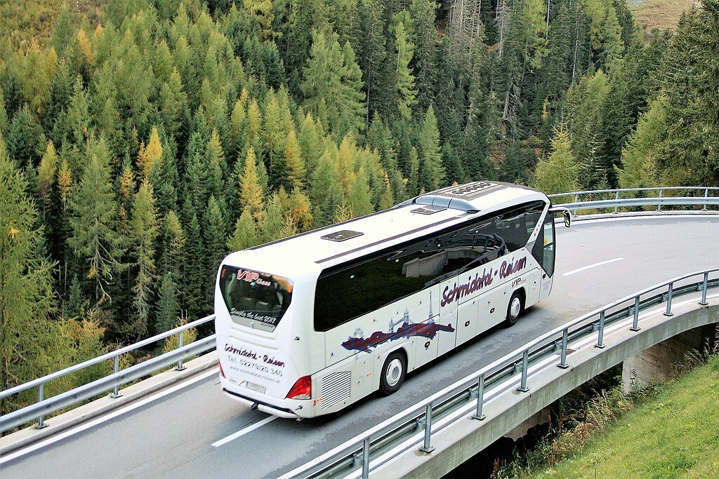 Bonchu Community Reserve is a pristine forest area dedicated to the preservation of indigenous flora and fauna. In Nagaland, community reserves are unique because the land is owned by the local village but managed under conservation laws to protect biodiversity. Bonchu is a prime example of this system, where the Lotha community has voluntarily restricted hunting and logging to allow the forest to thrive. The reserve is home to a variety of rare orchids, medicinal plants, and various species of Himalayan birds. The terrain is moderately hilly with dense canopy cover, making it a cool and refreshing escape. It acts as a vital carbon sink for the region and a reservoir for traditional ecological knowledge. Visitors to Bonchu can experience a true "jungle" atmosphere, with the sounds of cicadas and birds echoing through the trees. The reserve also serves as a study center for local youth to learn about their natural heritage. It is a quiet, contemplative space that emphasizes the deep spiritual connection the Naga people have with their land. The trails through the reserve are often used by researchers and nature lovers who wish to see the forest in its most natural state, undisturbed by commercial development or heavy foot traffic.
The Morashen View Point offers one of the most breathtaking panoramic vistas in the Wokha district, primarily famed for providing a spectacular overhead view of the sprawling Doyang Hydro Project Dam and the winding Doyang River. The site is nestled atop a hill, often referred to as the Morashen Tower area, which necessitates a pleasant yet challenging hike or climb, making it popular among both casual sightseers and enthusiastic trekkers. Surrounded by the dense, evergreen forests characteristic of Nagaland's hilly terrain, the location is a haven for nature lovers and birdwatchers. The atmosphere here is deeply serene and tranquil, allowing visitors a true escape into the wilderness. During the clear weather months, the view extends far into the horizon, showcasing numerous surrounding Lotha Naga villages and the vast, undulating hills. The viewpoint serves as a perfect spot to appreciate the sheer scale of the engineering marvel that is the Doyang Dam set against a pristine natural backdrop. It embodies the 'Land of Plenty' moniker given to Wokha, highlighting the region's rich natural resources and scenic splendour. The area is also significant for understanding the local topography and the impact of the Doyang River on the life and agriculture of the Lotha people who inhabit the region.
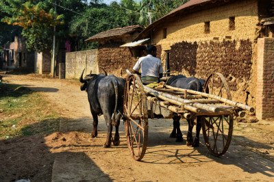 Pongidong Village is one of the most significant ancestral villages of the Lotha Naga tribe. Known for its rich cultural heritage and deep-rooted traditions, it offers visitors an authentic look into the tribal lifestyle of Nagaland. The village is perched on a ridge that provides a majestic view of the Doyang reservoir and the surrounding valleys. History flows through the narrow lanes of Pongidong, where traditional houses with carved motifs still stand as a reminder of the glorious past. The villagers are known for their hospitality and their dedication to preserving their customs, especially their unique folk dances and songs. Agriculture is the mainstay here, and the terraced fields surrounding the village are a sight to behold, especially during the harvest season. The village also plays a crucial role in the Tokhu Emong festival, where community bonding is at its peak. Visiting Pongidong is like stepping back in time; the pace of life is slow, and the connection with nature is profound. It serves as a base for many trekkers heading towards Mount Tiyi, as the local legends and paths are well-known to the village elders. The community is also active in eco-conservation, protecting the nearby forests that are home to diverse wildlife. For those interested in anthropology, the village provides a wealth of information regarding the social structure and migratory history of the Naga people. The serene environment and the panoramic vistas make it a must-visit for anyone traveling to the Wokha district. :
The Doyang River is the largest and most significant water body in the Wokha district, serving as a vital resource for agriculture and energy. It originates from the southern hills and meanders through the verdant landscapes of Nagaland before joining the Dhansiri River in Assam. The river is globally recognized as a stopover for millions of Amur Falcons during their annual migration from Siberia to South Africa. This natural phenomenon has placed Wokha on the international bird-watching map, attracting ornithologists and nature lovers from around the world. The river valley is also known for its fertile soil, where local farmers practice terrace cultivation of rice and seasonal vegetables. The serene waters reflect the lush green hills, creating a tranquil environment for those seeking peace away from urban life. It is not just a geographical feature but a cultural symbol for the Lotha people who live along its banks. :
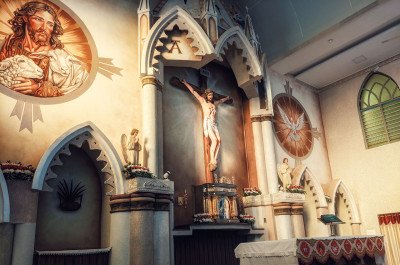 The Vankhosung Baptist Church holds a profound historical and spiritual significance, as it is widely regarded as the birthplace and epicenter of the Baptist Christian faith in the entire Wokha district among the Lotha Naga community. Established by American Baptist Missionaries in the early 20th century (1923), the church and its surrounding compound (known as KBES) have served as a center for religious, educational, and social development for over a century. The serene location in the foothills of Mount Tiyi enhances its tranquil and meditative atmosphere. It is not just a place of worship but a historical monument, reflecting the profound transformation of the Naga socio-cultural fabric following the advent of Christianity. Visitors are drawn to its peaceful ambiance and the opportunity to witness the vibrant Christian culture of the local community. The church continues to be a central hub for community events, religious gatherings, and educational initiatives. A visit offers a unique opportunity to understand the deep faith that permeates the lives of the Lotha people and to appreciate the cultural blend of traditional Naga motifs with modern religious practices. The site is a testament to the enduring legacy of the missionaries' work and the community's strong adherence to their faith.Show All
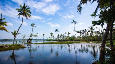 Totsu Wozhu Lake is a serene and mystical water body nestled at the foot of the Totsu Cliff. Unlike the larger reservoirs in the region, this lake is a natural pond that holds immense spiritual and mythological significance for the Lotha Naga people. It is famously associated with the legend of a mortal named Nsamo, who is said to have married a beautiful lady spirit of the lake. The waters are remarkably calm and reflect the surrounding greenery like a mirror. The lake is surrounded by a dense canopy of ancient trees, creating a quiet and contemplative atmosphere. Locals believe that the lake is sacred and must be treated with utmost respect; disturbing the waters or the surrounding environment is thought to bring bad luck. The area is a haven for small wildlife and various species of dragonflies and butterflies that dance over the water surface. For visitors, the lake offers a peaceful retreat after the strenuous trek to the nearby cliff. The legends of the lake are passed down through generations, and hearing them from a local elder while sitting by the water is a moving experience. The lake's size varies with the seasons, being most vibrant during the monsoon when it is fed by the run-off from the cliff above. It remains one of the most untouched and "pure" spots in the Wokha district, away from any commercial development. The ecological balance of the lake is carefully maintained by the nearby Phiro village community, ensuring that its mystical charm remains preserved for future generations. :
Information
-
Why Famous:
The Mount of Life: Wokha is famous for Mount Tiyi, a majestic peak believed by the locals to be the resting place of departed souls. It is a mystical site that offers breathtaking views and serves as the primary source of water for the entire town.
Read MoreThe Mount of Life: Wokha is famous for Mount Tiyi, a majestic peak believed by the locals to be the resting place of departed souls. It is a mystical site that offers breathtaking views and serves as the primary source of water for the entire town.
Amur Falcon Capital: The district is globally famous for being a stopover for millions of migrating Amur Falcons. During October and November, the skies and the Doyang reservoir are filled with these raptors, attracting birdwatchers from all over the world.Architecture:
Colonial and Tribal Blend: The town features a mix of British-era administrative buildings and traditional Lotha Morungs. Many modern houses still incorporate traditional motifs on their facades, such as the hornbill bird and mithun heads, symbolizing status.Colonial and Tribal Blend: The town features a mix of British-era administrative buildings and traditional Lotha Morungs. Many modern houses still incorporate traditional motifs on their facades, such as the hornbill bird and mithun heads, symbolizing status.
Vankhosung Village Style: Nearby Vankhosung village features old wooden churches and traditional houses that showcase the early transition of the tribe to Christianity. The structures often use local stone and timber, measuring about 40x25 feet for communal buildings.How To Reach:
By Air: Dimapur Airport (DMU) is the nearest airport, about 125 KMS away. Travelers can take a taxi from Dimapur to Wokha, which usually takes around 5 to 6 hours depending on road conditions and mountain traffic.
By Train: The closest rail...By Air: Dimapur Airport (DMU) is the nearest airport, about 125 KMS away. Travelers can take a taxi from Dimapur to Wokha, which usually takes around 5 to 6 hours depending on road conditions and mountain traffic.
By Train: The closest railhead is Dimapur Railway Station, connected to all major cities in India. From the station, shared Sumos and private taxis are readily available for the journey to Wokha through the picturesque NH-2.
By Road: Wokha is well-connected by road to Kohima (75 KMS) and Mokokchung (70 KMS). The roads are mostly paved but can be narrow and winding, requiring an experienced driver for the mountainous stretches.
By Local Transport: Within the town, local taxis are the primary mode of transport. For exploring nearby attractions like Doyang or Mount Tiyi, hiring a dedicated private taxi for the day is the most comfortable and reliable option for tourists.Weather and Best Time to Visit:
Winter (November-February): This is the most popular time to visit, featuring cool weather and the Amur Falcon migration. Temperatures hover between 5°C and 18°C, providing a perfect climate for outdoor activities and cultural festivals.
Summ...Winter (November-February): This is the most popular time to visit, featuring cool weather and the Amur Falcon migration. Temperatures hover between 5°C and 18°C, providing a perfect climate for outdoor activities and cultural festivals.
Summer (March-May): The weather is pleasant and warm, ideal for trekking to Mount Tiyi and exploring the fruit orchards. The clear skies during this time offer the best views of the distant Himalayan ranges from high viewpoints.
Monsoon (June-September): Heavy rainfall turns the district into a lush green paradise, but travel can be risky due to slippery roads. It is a good time for those who enjoy the rainy atmosphere and want to see the rivers and waterfalls in full flow.Near Tourist Places:
Doyang River (38 KMS), Mount Tiyi (5 KMS), Totsu Cliff (25 KMS), Kohima (75 KMS), Mokokchung (70 KMS), Zunheboto (60 KMS), Dimapur (125 KMS), Phek (145 KMS), Vankhosung (10 KMS), Pangti Village (30 KMS)Tourism Tips
-
Health and Safety: Keep a stock of warm clothes as the temperature can drop suddenly after sunset. It is advisable to travel during daylight hours as mountain roads can be challenging to navigate in the dark or during thick fog.
Packing Essenti...Health and Safety: Keep a stock of warm clothes as the temperature can drop suddenly after sunset. It is advisable to travel during daylight hours as mountain roads can be challenging to navigate in the dark or during thick fog.
Packing Essentials: Carry a pair of high-quality binoculars for birdwatching and a sturdy pair of boots for trekking. A good camera with a zoom lens is essential if you are visiting during the falcon migration in the autumn months.
Accommodation: Wokha offers several guesthouses and a few resorts like the Hammock Resort. It is recommended to book your stay at least a few weeks in advance if you plan to visit during the Tokhu Emong festival or the falcon season.
Local Etiquette: Respect the local beliefs regarding Mount Tiyi and avoid littering at sacred or natural sites. The Lotha people are known for their hospitality, so a friendly greeting in the local language can go a long way in making connections.
Reviews
FAQs
Wokha Itineray And Cost:-
Other Places In Nagaland :-
Other States In India :-
Information about New and Updated Locations() of Nagaland Has Been Added :-
Card subtitle
Note:-
Information provided here in good Faith and for reference only.
Near Places
Dimapur
Some quick example text to build on the card title and make up the bulk of the card's content.
Go somewhere
Dzulekie
Some quick example text to build on the card title and make up the bulk of the card's content.
Go somewhere
Khonoma
Some quick example text to build on the card title and make up the bulk of the card's content.
Go somewhere
Kigwema
Some quick example text to build on the card title and make up the bulk of the card's content.
Go somewhere
Kiphire
Some quick example text to build on the card title and make up the bulk of the card's content.
Go somewhere
Kohima
Some quick example text to build on the card title and make up the bulk of the card's content.
Go somewhere
Longleng
Some quick example text to build on the card title and make up the bulk of the card's content.
Go somewhere
Meluri
Some quick example text to build on the card title and make up the bulk of the card's content.
Go somewhere
Mokokchung
Some quick example text to build on the card title and make up the bulk of the card's content.
Go somewhere
Mon
Some quick example text to build on the card title and make up the bulk of the card's content.
Go somewhere
Mopungchuket
Some quick example text to build on the card title and make up the bulk of the card's content.
Go somewhere
Nagaland Heritage Village
Some quick example text to build on the card title and make up the bulk of the card's content.
Go somewhere
Niuland
Some quick example text to build on the card title and make up the bulk of the card's content.
Go somewhere
Noklak
Some quick example text to build on the card title and make up the bulk of the card's content.
Go somewhere
Peren
Some quick example text to build on the card title and make up the bulk of the card's content.
Go somewhere
Zunheboto
Some quick example text to build on the card title and make up the bulk of the card's content.
Go somewherein Other Cities